

A Crete boat trip sails along the coasts of Crete and out to its islets, from the north shore to the Libyan Sea. The trip is one of the Greece Tours on Greece Ville, listed with the other Crete tours.
This post covers how the Minoans sailed, what the earthquake of AD 365 did to the coast, and the whales, dolphins and new fish at sea.
Water quality, the lighthouses, fishing, Koufonisi, ancient wrecks, the best months and common questions come last. The sections include Crete boat trips that can be booked online.
What is a Crete boat trip?
A Crete boat trip is a sea outing from one of the island’s ports. It follows the shore or crosses to an islet offshore. Deep seas lie close to the coast. A single coast guard command watches these waters.
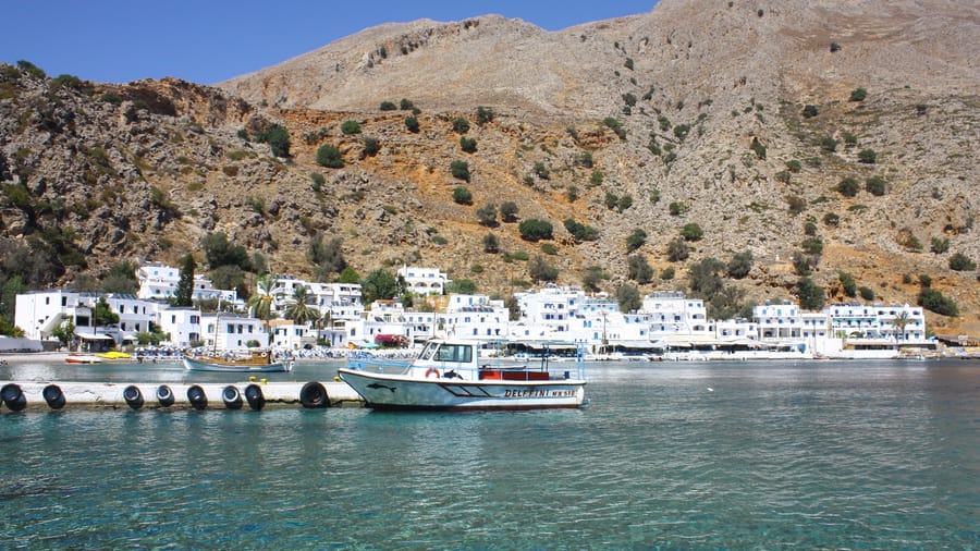
A Crete boat trip follows a long, deeply cut shoreline. The AKTAIA project put eastern Crete’s coast alone at about 757 km. Its teams visited over 100 beach zones.
Crete’s widest span runs from Cape Dion to Cape Lithino. Near the northeast shore lie the Dionysades, a group of four isolated islets. Researchers found 22 land snail species on them.
A Crete boat trip sails over deep water. The Libyan Sea, south of the island, averages 1,500 m in depth. Its floor holds the Hellenic Trench, a long seabed trough.
That trench makes a sharp bend south of Crete. East of the bend, it splits into three parallel trenches. They carry the names Ptolemy, Pliny and Strabo.
A Crete boat trip leaves from one of 12 ports listed on the island. In the third quarter of 2023, Heraklion handled 668 thousand ferry passengers. Souda Bay handled 303 thousand.
- South coast: That quarter, Agia Roumeli handled 80 thousand and Chora Sfakion 75 thousand.
- Coast guard: The Hellenic Coast Guard runs its 7th Regional Command from Heraklion.
- Network: Greece divides its coast guard into nine regional commands.
The Hellenic Coast Guard’s Greek name opens with Limeniko Soma, or Harbour Corps. Its Crete command covers Chania, Rethymno, Heraklion and Lasithi.


How did Minoans sail before a Crete boat trip?
A Crete boat trip follows sea lanes that Minoan crews sailed in the Bronze Age. Their ships carried masts, oars and steering oars. Harbour towns kept long sheds for their ships. Egyptian tomb paintings show Cretan envoys arriving with gifts.
A Crete boat trip crosses waters tied to a legend of sea power. Thucydides named Minos the first ruler known to build a navy. Minos ruled the Cyclades and fought piracy.
Ancient Greeks first called Minoan power a thalassocracy, or sea rule. In 1955, historian Chester Starr called it a myth. Nanno Marinatos later argued for a powerful Minoan navy.
A Crete boat trip retraces early trade routes. Between about 2650 and 2200 BC, Minoan ships began sailing to Egypt and Syria. Crete’s lack of metals is thought to have spurred this trade.
Cretan envoys bearing gifts appear in Egyptian tombs at Thebes. The earliest scenes are in the tomb of Senenmut, and more appear in Rekhmire’s tomb. In 1987, thousands of Minoan mural fragments turned up at Tell el-Dab’a, Egypt.
Seal carvers showed ships too. A black soapstone seal from central Crete has two steering oars and 15 oar lines. A gold ring from Poros shows a steersman and seven oarsmen.
- Ship sheds: At Kommos, Building P had six long galleries open toward the sea.
- Zakros: Diggers found copper ingots shaped like ox hides at this eastern harbour town.
- Uluburun wreck: This Bronze Age ship off Turkey carried 354 such copper ingots.
Kommos was the harbour town for Phaistos and Hagia Triada. Joseph and Maria Shaw dug it from 1976 to 1995. Hematite paint, used against sea growth on hulls, turned up there.
What did the earthquake of AD 365 do to the coast of a Crete boat trip?
A Crete boat trip along the west coast passes cliffs that a great quake raised from the sea. The shock struck at sunrise on 21 July. Its tsunami swept the eastern Mediterranean. Waves hurled ships onto roofs in Alexandria.
A Crete boat trip off the west coast sails above the quake’s source. Geologists rate it at magnitude 8.3 to 8.5. No modern quake in the region matches that size.
The fault dips about 30 degrees inside the upper plate. It runs 100 km and slipped 20 m. It surfaces near an undersea cliff 3,500 m deep, 25 km southwest of Crete.
A Crete boat trip passes cliffs that hold the proof. Scientists dated 13 uplifted corals and bryozoa, also called moss animals. Nine gave carbon dates that include the quake year.
At Phalasarna’s ancient harbour, the old shoreline mark sits 6.6 m above the sea. A fish basin carved into the shore rock cracked in half, apparently in the quake.
A Crete boat trip crosses the tsunami’s path. The Roman historian Ammianus Marcellinus described the sea drawing back first. He saw a wrecked ship nearly two miles from shore near Methone.
- Alexandria: A risk study cites about 5000 deaths and 50,000 homes destroyed there.
- Ionian Sea: The quake triggered a seabed mud layer 20-25 m thick.
- Tunisia: Near Sfax, a jumbled gravel and shell layer dates between 286 and 370 CE.
Alexandria marked each anniversary as a “day of horror” into the late sixth century. The same scientists estimate one such event every 800 years if the whole plate edge behaves alike.
Which whales and dolphins swim off a Crete boat trip?
A Crete boat trip sails near the Hellenic Trench, where ship strikes threaten sperm whales. Cuvier’s beaked whales live there too. Naval sonar tests have coincided with their beachings in Greece. Short-beaked common dolphins stay nearer the coast.
A Crete boat trip sails near an Endangered whale population. The IUCN, which ranks threatened species, gave Mediterranean sperm whales that status in 2012. The trench is their core eastern Mediterranean habitat.
Pelagos Cetacean Research Institute counted 30 sperm whale beachings in Greece from 1992 to 2017. Thirteen bore propeller cuts from ship strikes. Propeller wounds marked at least four of 181 photographed whales.
Sperm whales off a Crete boat trip coast keep to deep water. Of all encounters, 74% lie within 3 km of the 1000 metre depth line. The trench reaches 5 km deep.
The Hellenic Trench is the largest of five Mediterranean high-density areas for Cuvier’s beaked whales. Their sightings there, 63 in total, averaged 1066 metres of water.
A Crete boat trip crosses waters with a record of beaked whale losses. Four unusual mass beachings in the area involved at least 45 of these whales.
- NATO trial: In 1996, twelve beaked whales beached in Greece during sonar testing.
- Research base: The Pelagos Cetacean Research Institute works from Vouliagmeni, near Athens.
- Dolphin status: Mediterranean short-beaked common dolphins were listed as Endangered in 2003.
Striped and Risso’s dolphins live mainly in open water above the continental slope, where the shelf drops away. Short-beaked common dolphins keep to coastal waters instead.
Which new fish have reached the sea of a Crete boat trip?
A Crete boat trip now crosses waters holding Red Sea fish that entered through the Suez Canal. The canal was finished in 1869. Arrivals include the silver-cheeked toadfish, two rabbitfish species and the lionfish. Scientists call this spread Lessepsian migration.
The silver-cheeked toadfish reached the Mediterranean off Turkey in 2003. A Crete boat trip passes coasts where it was first recorded in 2005. Greek authorities sent out an alert about it.
The toadfish stores its toxin mainly in the ovaries, with less in the skin, muscles and liver. Tests on toadfish caught off Crete found a higher poisoning risk in the Libyan Sea.
From June 2020 to August 2021, small Cretan fishing boats averaged 858 kg of toadfish each. That was 13% of their whole catch. Trammel nets, made of layered mesh, took 744 kg.
Fishers in Crete boat trip waters lose gear to it. Per 10 kg of catch, nets showed 14 bite holes in summer. Longlines lost 32 hooks for the same catch in spring.
Two alien rabbitfish species graze seaweed. A survey of about 1000 km of coast found 65% less tall seaweed where they abound. Seabed life weighed 60% less, with 40% fewer species.
- Lionfish front: Replies from 216 dive centres placed lionfish as far as Corfu.
- Lionfish breeding: Eastern Mediterranean females average 20,743 eggs per batch.
- Greek count: A 2018 review listed 214 alien and 62 cryptogenic, or uncertain, species in Greek seas.
Francis Dov Por coined the term Lessepsian migration in a 1978 book. Eastern Crete is seen as the starting point for these species around the island. One rabbitfish, Siganus rivulatus, moves in schools of 50 to hundreds. Its barbed spines carry venom.
How clean is the water of a Crete boat trip?
A Crete boat trip passes beaches with top EU water ratings. In 2022, 176 of 177 Cretan bathing waters rated excellent. Crete topped Greek regions for Blue Flag beaches in 2022 and 2023. Plastic pellets and litter still reach its shores.
Bathing water checks along a Crete boat trip coast follow EU Directive 2006/7/EC. Officials sample each beach monthly from 1 June to 31 October. A rating needs at least 18 results.
Labs count two gut bacteria, intestinal enterococci and E. coli, in each sample. Results come as colonies per 100 millilitres. Ratings run from excellent through good and sufficient to poor.
European Environment Agency data cover the sites along a Crete boat trip coast. In 2019, 170 rated excellent, and 7 were not classified. The next year, only one rated good.
Blue Flag is an eco-label awarded to beaches and marinas. The Region of Crete held 128 flagged beaches in 2022. Lasithi alone rose from 41 to 48 the next year.
Late 2018 litter surveys covered three beaches on a Crete boat trip coast. Navarchou Klearchou held 0.33 items per square metre, rated moderately clean. Ammoudara scored 0.15 and Almyros 0.14, both clean.
- Smoking waste: Smoking-related items formed 40% of litter at two of those beaches.
- Pellet peak: In 2013, pellets on northern Cretan beaches peaked in summer.
- Europe-wide: In 2023, 85% of 22,081 European bathing sites rated excellent.
Greek Blue Flag records start in 1988, with 7 beaches and 8 marinas. The national beach total reached 617 in 2023, and the Region of Crete held 139 of them.
Which lighthouses watch over a Crete boat trip?
A Crete boat trip passes stone lighthouses on capes such as Drapano, Agios Ioannis and Sideros. Others stand on Gavdos, Elafonisi and Souda Island. French engineers built the bulk of the historic towers while Crete was under Ottoman rule.
Marius Michel, a French merchant navy officer, proposed a lighthouse network along Ottoman coasts. He later headed the Ottoman Lighthouse Authority. With Camille Collas, he founded the firm Collas and Michel.
The firm negotiated its first concession in 1860, a contract granting it lighthouse rights. Passing ships paid fees at offices across the empire. Almost a hundred lighthouses rose within twenty years.
The Greek network counts more than 1500 lighthouses and lights. Greece set up its first lighthouse service in 1852. A Crete boat trip passes only a small part of that network.
Drapano lighthouse stands near Kokkino Chorio. Its octagonal tower is 7 m tall, with the lamp 60 m above the sea. Three white flashes every 30 seconds reach 20 nautical miles.
Occupation troops removed its lamps, and it stayed dark until 1945. Electric power arrived in 1979. A Crete boat trip passes a tower that the Navy restored in 2007-2008.
- Agios Ioannis: Two white flashes every 12.8 seconds reach 11 nautical miles from a 9 m tower.
- Cape Sideros: Its light joined the Greek network in 1915.
- Gavdos: A German air raid in 1942 largely destroyed the island’s lighthouse.
A replica of the Gavdos lighthouse went up in 2002-03. Its rebuilt keeper’s house holds a café and a museum. Cape Tripiti carries a newer open-frame tower from 1990.
What do Cretan fishers catch on a Crete boat trip?
A Crete boat trip meets small boats that fish close to shore with nets and hook lines. Trawlers, boats that drag nets along the seabed, land red mullet and hake. Parrotfish, called skaros in Greek, carry Crete’s name in science.
A census listed 819 fishing vessels registered on Crete. Boats register at Coast Guard stations in Heraklion, Chania, Rethymno and Agios Nikolaos. Their fishing grounds lie within 6 nautical miles of shore.
On a Crete boat trip off Heraklion, the local fleet counts 206 active vessels. Small-scale boats, which fish with nets, lines and traps, make up 95% of them.
A Crete boat trip crosses a narrow continental shelf, the shallow seabed rim around the island. Its waters are poor in nutrients, so industrial fishing is not sustainable there.
Greek law bans trawling from 1 June to the end of September. Boat seines, nets hauled in by the boat itself, stop even earlier, in April. That pause spares picarel and bogue.
Adult female parrotfish are red with a yellow spot at the base of the tail. Adult males are greyish instead. Both feed mainly on algae that grow on rocks.
- Depth: The parrotfish lives on rocky shores down to 50 m.
- Fishers’ age: In a 2013 survey of Cretan crews, 72% were aged 45 or older.
- Fish farms: The Hellenic Centre for Marine Research studies fish farming at Gournes, near Heraklion.
Researchers interviewed crews from 101 boats in ports around Crete. Of the longer-serving fishers, 98% reported a smaller catch. Losses reached up to 90% within 5 to 10 years.
What lies on Koufonisi off a Crete boat trip?
A Crete boat trip off south-east Crete reaches Koufonisi, ancient Lefki. Sand covered its ancient town, with a stone theatre, baths, a villa and a temple. Today the islet is uninhabited and lies in a protected nature zone.
On a Crete boat trip, Koufonisi lies 3 nautical miles south of Cape Goudouras. Pliny preserved its ancient name. An inscription at Toplou Monastery records a dispute over it between Itanos and Ierapytna.
People lived on Lefki from the Early Minoan period, 3000-2200 BC. They left in the fourth century AD. English admiral Thomas Spratt described the ruins in the mid-19th century.
Systematic digging began in 1976 under Nikos Papadakis. Off a Crete boat trip, a stone theatre stands near the beach, opposite Marmara islet. Its twelve rows of seats held about 1000 people.
Roman public baths, used from the first century AD, keep walls 4 m high. Hypocausts, rooms heated from below the floor, survive inside. A nearby villa has eight rooms.
The ruined temple, 18 by 15.70 m, lies on the south side. Builders reused its stones for a lighthouse in 1925-1930. German bombs struck the lighthouse in the Second World War.
- Statue: Large fragments of a seated deity’s statue, once over 2.5 m tall, lie nearby.
- Cave chapels: West coast caves served as chapels, and one Latin inscription records the year 1638.
- Protected zone: Natura 2000 site GR4320008, part of the EU nature network, covers 804.94 hectares.
The islet rises only 79 m above the sea. Sand dunes with tamarisk trees dot its coast. Esparto grass, from a North African desert-like flora, grows on gypsum rock.
Which ancient wrecks lie off a Crete boat trip?
A Crete boat trip crosses waters that hold wrecks from the Bronze Age to the Venetian era. The first Minoan wreck ever documented lies off eastern Crete. Roman and Byzantine wrecks lie along other coasts and straits.
A Crete boat trip along the northeastern coast passes Pseira, where Elpida Hadjidaki began searching in 2003. Her team found a trading ship that sank around 1725/1700 BC.
Divers raised 209 clay vessels, about 80 nearly whole. One amphora, a two-handled storage jar, came up from 131 feet down. The debris trail runs about 100 feet.
The Pseira cargo is the largest known set of whole clay vessels from one Middle Minoan deposit. Her team mapped the site in 2004 and began large digs in 2005. The ship measured an estimated 32 to 50 feet.
A Crete boat trip into Elounda Bay crosses the site of a five-year underwater survey begun in 2017. Divers mapped drowned buildings in two coves of Kolokytha, Vathy and Melissos. They also found ancient quarries at three points.
Ancient Olous flourished until the early Byzantine period. People then left it, and the town began to sink. Divers there found signs of a Byzantine wreck and the remains of a 20th-century wreck.
- East Crete: A 2021 survey in Palaikastro Bay found a 2nd-century AD wreck.
- West Crete: A 2013 survey off Gramvousa and Rodopos found six ancient wrecks.
- Kythera: A wreck of the late 5th to mid-4th century BC lies 222 m down.
Sponge divers from Symi found the Antikythera wreck in 1900. Diver Elias Stadiatis first reached 45 m. The Roman ship sank in the second quarter of the first century BC.
Which months suit a Crete boat trip?
A Crete boat trip meets the driest weather from June to August. The lightest winds come in late spring and November. December and January bring the heaviest rain at Ierapetra. Early summer pairs warm air with calmer wind than July.
A Crete boat trip in July faces the strongest average wind of the year. The Ierapetra weather station logs 12.7 knots that month, the highest monthly average there.
The same station records its lightest average wind, 7.4 knots, in late spring and November. Late spring also brings an average temperature of 21.2 °C. Rain that month reaches only 10.4 mm.
A Crete boat trip in June meets an average temperature of 25.6 °C. The average wind holds at 9.0 knots. June rain totals 1.3 mm, spread over 0.7 rain days.
July rain averages just 0.2 mm, the lowest of the year. August nights stay warm, with an average low of 23.4 °C. The August average wind still reaches 11.7 knots.
A Crete boat trip in September keeps an average temperature of 25.0 °C. September rain totals 13.7 mm. October cools to an average of 21.3 °C. Rain that month climbs to 41.7 mm.
- Wettest month: December brings 108.3 mm of rain on 11.6 rain days.
- Midwinter: January rain at the same station averages 100.9 mm.
- Mid spring: April at Ierapetra has an average temperature of 17.1 °C.
Ierapetra lies on the south-east coast of Crete, facing the Libyan Sea. Its station shows rain almost vanishing from June to August. August averages only 0.7 mm, on 0.2 rain days.
What do visitors ask about a Crete boat trip?
A Crete boat trip raises practical questions about the sun, the wind and the weather data. Visitors ask how strongly water and foam reflect sunlight. Others ask what a knot means and where the weather figures come from. The islet of Pseira draws questions too.
How strongly does the sea reflect sunlight on a Crete boat trip?
The World Health Organization says calm water reflects under 10 per cent of UV. UV is the burning part of sunlight. Sea foam reflects about 25 per cent. White wave crests on a windy day therefore send back more UV than smooth water.
What does a knot mean on a Crete boat trip?
Wind and boat speeds at sea are given in knots. A knot is one nautical mile per hour, exactly 1.852 km/h. The 12.7-knot July wind at Ierapetra equals about 23.5 km/h. The lightest average, 7.4 knots, equals about 13.7 km/h.
Where do the weather figures for a Crete boat trip come from?
The figures come from HNMS, the Hellenic National Meteorological Service. Its Ierapetra station stands 18 m above sea level. Its averages cover the years from 1956 to 2010. The station records north as the main wind direction in every month.
What else lies on Pseira near a Crete boat trip?
Pseira kept a Minoan seaport town of about 60 buildings above its harbour. Cliffside stairs linked the town to the water. Philip Betancourt and Costis Davaras studied it closely from 1984 to 1992. Their team worked for Temple University. Halvor Bagge had earlier drawn its finds in ink and watercolour.
How did people farm on Pseira near a Crete boat trip?
Minoan Pseira lived by fishing and small farms. Its people terraced the thin limy soil and manured it with waste from the town. Dams caught seasonal run-off, because water was scarce. Pigs were not kept there.