
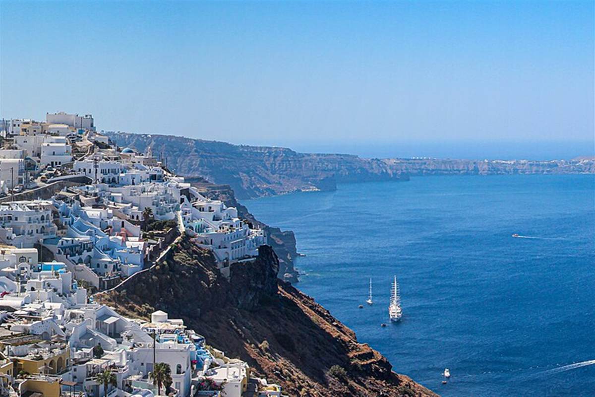
The Fira to Oia hike is the walk along the rim of the Santorini caldera from the capital, Fira, through Firostefani and Imerovigli to the village of Oia at the northern tip of the island. The hike is one of the Greece Tours on Greece Ville, listed with the other Santorini tours and Greece hiking tours.
This post follows the path stage by stage, then the caldera, the islets in view, plants, birds and cave houses, then the months, heat, gear, safety, sunset and the formats on sale. Common questions come last.
What is the Fira to Oia hike?
The Fira to Oia hike is a day hike along the rim of the Santorini caldera, linking the island capital Fira with the village of Oia, which lies 11 km away. A hike means a long, vigorous walk on trails or footpaths.
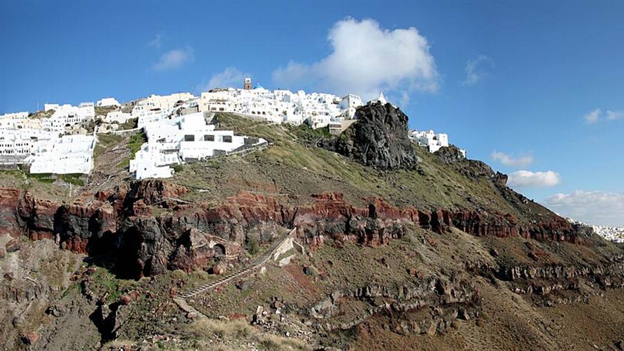
A day hike is a hike that can be completed in a single day. The Fira to Oia hike belongs to that group, because Oia lies 11 km from Fira along the caldera.
Fira is the transport terminus of the island, so the route begins at the hub that serves the whole of Santorini. Oia lies at the other end, on the north-western edge of the island.
The caldera measures about 12 by 7 km. The Fira to Oia hike keeps to its rim, where steep cliffs fall away to the water and the settlements stand along the edge.
In Oia the main street is the main trekking path. It is cobbled and winds round the caldera, so the Fira to Oia hike ends on a path named Nikolaou Nomikou.
- Hike: A hike is a long, vigorous walk on trails or footpaths in the countryside.
- Day hike: A day hike is a hike that can be completed in a single day.
- Distance: Oia lies 11 km from the island capital Fira.
- Caldera: The caldera measures about 12 by 7 km.
These facts frame the whole route. The sections below follow the Fira to Oia hike from the capital, past the churches and ruins on the rim, to the village at the northern end.


Where does the Fira to Oia hike start in Fira?
The Fira to Oia hike starts in Fira, the modern capital of the Greek island of Santorini, a whitewashed town built on the edge of a caldera 400 metres high on the western side of the semi-circular island.
In the early 1950s visitors came by yacht. The island’s children lit small lanterns along the steps from Fira to the port as a farewell, and the Fira to Oia hike begins in that town.
After the earthquake of 9 July 1956 there was no airport on Santorini. Aircraft of the Greek military dropped food, tents and other supplies by air, so relief reached the island from the sky.
Fira has a desalination plant with a capacity of 1,200 cubic metres per day. The island has no rivers, so the Fira to Oia hike starts in a town that relies on such plants.
The Santorini tours post covers the wider choice of tours on the island, from the capital in the centre to the villages that stand on the rim of the caldera.
- Height: Fira stands on the edge of a caldera 400 metres high.
- Lanterns: Children lit small lanterns along the steps from Fira to the port.
- Relief: Military aircraft dropped food, tents and other supplies over the island in 1956.
- Water: The desalination plant of Fira has a capacity of 1,200 cubic metres per day.
The capital therefore gives the Fira to Oia hike a start with a record of arrivals by sea and by air, and of water supplied by machines.
Which church above the cliffs does the Fira to Oia hike meet in Fira?
The Fira to Oia hike begins in the town of the Three Bells of Fira, officially the Catholic Church of the Dormition, an Eastern Catholic Greek Byzantine church known for its blue dome, its three bells and its views from the cliffs.
The church standing today was built in 1757. It was refurbished and expanded more than once over the centuries, and it stands directly above the cliffs that dominate western Santorini.
In the mid-17th century two modest cave churches were built into the then-solid cliff face. They were destroyed as the cliff receded during the expansion of Fira, and an infirmary was built on the spot.
Jesuits occupied that infirmary and lived on the site until the land was given to the Diocese of Santorini. The Fira to Oia hike therefore starts beside ground with a layered church history.
The 1956 Amorgos earthquake heavily damaged the building, and it was restored afterwards. Its feast day is 15 August, and the building took its official name from the Dormition.
- Name: The church is officially the Catholic Church of the Dormition.
- Rite: It is an Eastern Catholic Greek Byzantine church.
- Built: The present church dates from 1757.
- Cave churches: Two modest cave churches stood on the cliff in the mid-17th century.
A Fira to Oia hike that starts here leaves behind a church that was rebuilt, damaged and restored. The path then moves north along the same line of cliffs towards the next village on the rim.
Why does the Fira to Oia hike run through a village like Imerovigli?
The Fira to Oia hike reaches Imerovigli, a village north of Fira on the caldera rim, whose position fits the island pattern of the 15th and 16th centuries, when settlements stood at the highest points that were hardest to reach.
In the 15th and 16th centuries pirates threatened the Cyclades and the islanders. They plundered harvests and enslaved men and women, who were then sold in the slave markets.
The small bays of Santorini made good hideouts for the raiders. In response, islanders built their settlements very close to, or on top of, each other, at the highest and hardest-to-reach points of the island.
The external walls of the houses had no openings, and together they formed a protective perimeter around the village. The Fira to Oia hike follows the rim where such villages stand.
Casteli were large, fortified, permanent settlements. Every casteli had a church at its entrance, and the church honoured Agia Theodosia, patron saint among the castles, as part of the same defensive plan.
Goulas were multi-storey, rectangular towers, and the highest tower in a kastelli. There were four goulas on the island, and they served both as observatories and as places of refuge for the islanders.
- Threat: Pirates plundered harvests in the 15th and 16th centuries.
- Bays: The small bays of the island made ideal hideouts.
- Walls: Outer walls without openings formed a protective perimeter.
- Patron: Agia Theodosia was the Protector-Saint of castles.
The Fira to Oia hike thus passes through a landscape that was shaped by defence, with villages perched on the rim and walls turned towards the land.
What does the Fira to Oia hike show at the Skaros rock?
The Fira to Oia hike reaches the Skaros rock, a promontory above Imerovigli that formed in volcanic activity of the nearby caldera, carries the ruins of a Venetian fortress and is now a popular place for hiking and photography.
Skaros Rock is a large promontory formed by volcanic activity of the nearby caldera. One account dates that activity to 68,000 BC, and erosion and earthquakes have shaped the rock since.
In the early 13th century the Byzantine Empire fortified the site and employed a Venetian architect, Giacomo Barozzi. The first structure was known as La Roka, which means Upper Castle in Greek.
Marco I Sanudo had coerced the Byzantines into surrendering their claim to the Aegean islands and had named himself Duke of Naxos. When the fortress was complete, he gave Barozzi control of Santorini.
By 1336 the settlement held hundreds of inhabitants. In the mid-16th century Santorini signed a non-aggression treaty with the Ottomans, and the rise of the Tunisia-based Barbary pirates also threatened the island.
After the Ottoman takeover the Ottomans left a garrison in Skaros, and the threat of piracy faded. Skaros was then eclipsed by Fira and Oia, so the Fira to Oia hike meets ruins.
- Formation: One account dates the rock to an eruption of 68,000 BC.
- Architect: The Byzantine Empire employed Giacomo Barozzi.
- Name: La Roka means Upper Castle in Greek.
- Access: Walkers reach the promontory from the neighbouring village of Imerovigli.
The rock shows how a Fira to Oia hike crosses the site of a former capital that later lost its rank to the two towns at either end of the route.
What is the open ridge on the Fira to Oia hike made of?
The Fira to Oia hike follows the open ridge of a caldera that is cut by at least four overlapping calderas and reaches a maximum depth of 385 metres, so the path runs along the edge of a long volcanic history.
The present caldera is composed of overlapping shield volcanoes. They are cut by at least four partially overlapping calderas, and the Fira to Oia hike follows the edge of that structure.
The oldest southern caldera formed about 180,000 years ago. The next, the Skaros caldera, was created about 70,000 years ago, and it shares its name with the rock that the hike meets.
The caldera lies in the centre of the Christiana-Santorini-Kolumbo volcanic field. That field includes the extinct Christiana volcano, the polygenetic submarine Kolumbo volcano and the Kolumbo volcanic chain.
The International Union of Geological Sciences listed the Quaternary Santorini Caldera among 100 geological heritage sites in October 2022. It defines such a site as a key place of international scientific relevance.
The high walls, draped by whitewashed villages, combine with a sunny climate and good observation conditions. These traits have made the caldera a magnet for volcanologists, who study its layered cliffs.
- Depth: The caldera reaches a maximum depth of 385 metres.
- Southern caldera: The oldest caldera formed about 180,000 years ago.
- Skaros caldera: It was created about 70,000 years ago.
- Heritage: The caldera joined a list of 100 geological heritage sites in October 2022.
The ridge is thus a record in rock. The Fira to Oia hike reads that record from the top, with the flooded volcano on one side and the villages on the other.
Which chapels and churches stand along the Fira to Oia hike?
The Fira to Oia hike passes chapels and churches on the rim, and a chapel is a small place of worship, built as a satellite site by a church or monastery, in which clergy are not always resident.
The word chapel comes from the Latin cappella, a diminutive of cappa, which means little cape. The Fira to Oia hike is a walk through a landscape where the word has a precise meaning.
Tradition holds that Saint Martin of Tours cut his military cloak in half to give part to a beggar. The Frankish kings kept the cape as a relic, in a tent called the capella.
In Oia, narrow alleys run between blue-roofed churches with cupolas. The village is noted for its white and blue domed houses, which are painted with white lime water.
One account holds that the lime water lets rain run down the walls for collection. Another says that Greeks under Ottoman rule were not allowed to fly a white flag, so Oia painted its complex white.
On the fifth day of the fifth month of 1821, the island’s feast day for its patron saint, Kefalonians living on Santorini raised the flag of the Greek revolution and expelled Ottoman officials.
- Word: Chapel comes from the Latin cappella, meaning little cape.
- Saint Martin: Tradition holds that he cut his cloak in half for a beggar.
- Oia: Blue-roofed churches with cupolas stand between narrow alleys.
- Whitewash: The houses are painted with white lime water.
The buildings along a Fira to Oia hike are therefore small places of prayer in a village painted white, with more than one account of why the walls are that colour.
What does the Fira to Oia hike pass at Finikia?
The Fira to Oia hike reaches Finikia, the village immediately east of Oia, a place beside a settlement in the Cyclades that was previously known as Apano Meria, meaning upper side, and whose inhabitants are still called Apanomerites.
Finikia lies immediately to the east of Oia. About 500 m to the north of Oia lies the neighbouring settlement of Tholos, so the Fira to Oia hike enters a small group of villages.
The name Apano Meria still occurs locally as Pano Meria. Maps from the 16th to the 19th century designated the settlement Apanomeria, and the name changed to Oia in the second half of the 19th century.
From 1840 to 1851 Oia was an independent community. Under the Kapodistrias plan of 1997 it was combined with the whole island of Therasia to form the rural community of Oia.
Agricultural products are traded in Oia today. They include honey, wine, capers and fava beans, which links the Fira to Oia hike to the working land behind the village.
The residential keep of the old citadel, Goulas, stands in the oldest part of the town on its south-western edge. The citadel, Agios Nikolaos Kastell, was also called Apanomeria.
- Old name: Oia was previously known as Apano Meria.
- Neighbour: Tholos lies about 500 m north of Oia.
- Community: Oia was an independent community from 1840 to 1851.
- Products: Honey, wine, capers and fava beans are traded in the village.
The Fira to Oia hike thus approaches Oia through farmland and old names. The cobbled main street begins only after the walker has crossed the small group of villages on the edge of the caldera.
What waits at the end of the Fira to Oia hike in Oia?
The Fira to Oia hike ends in Oia, where watching the sunset from the Sunset Serenade point is a daily event, and the white houses and the caldera catch the colours of the setting sun for a moment.
The sunlight hours in Oia are much longer than in Fira town. The Fira to Oia hike therefore ends in the village that keeps the light of the evening.
The paths of the village are very narrow and get congested during the tourist season. A square stands at its centre, and the houses and restaurants are built into niches carved into the caldera.
An old windmill is a recognisable building of the village and appears on postcards. The Weaving Mill near the Maritime Museum has looms and produces fine textiles that are on sale.
The village also has a cultural centre, a bank, a bus station, a post office, a health clinic and a pharmacy, along with cafes, bars, restaurants and tavernas on the coastal path.
The museum occupies a restored 19th-century mansion. It displays figureheads, nautical charts with English labels and seamen’s chests, and the Santorini photo tour post covers photography in the village.
- Sunset: Sunset viewing is a special event every evening from the Sunset Serenade point.
- Windmill: An old windmill appears on postcards of Oia.
- Looms: The Weaving Mill produces textiles.
- Museum: The Maritime Museum shows figureheads and nautical charts with English labels.
The Fira to Oia hike ends where the village is shaped by trade at sea, by light on the caldera and by the paths that visitors share.
How does the Fira to Oia hike fit together as one route?
The Fira to Oia hike links a capital, a rim village, a Venetian rock, a farming area and a mariners’ town over 11 km, and each stage shows a different layer of Santorini history from the 13th century to the present.
The route starts at a church built in 1757, passes rim villages of the pirate age and reaches a fortress that was complete in the early 13th century.
It then crosses the former Apano Meria and ends in Oia, the centre of the story in the 1982 film Summer Lovers. A villa from the film was bought in 1987 and became a gift shop.
In 2004 Oia was the location for scenes in The Sisterhood of the Traveling Pants. Louise Candlish set her 2007 novel Since I Don’t Have You in Oia and London.
The level Apotos in the 2008 video game Sonic Unleashed is based on Oia, and the level Ilios in the 2016 video game Overwatch is closely based on the village.
- Start: The route begins at a church of 1757 in Fira.
- Middle: It passes Imerovigli, the Skaros rock and Finikia.
- End: It finishes in Oia, 11 km from Fira.
- Screen: Oia appears in a film of 1982 and a video game of 2016.
Taken as a whole, the Fira to Oia hike is a line through the history of one island. The village at its end also holds a place in film, in fiction and in video games.
What do the caldera wall layers show on the Fira to Oia hike?
The Fira to Oia hike follows a cliff top whose face records the volcano’s past in stacked bands of rock. Bands of lava, ash and pumice come from separate eruptions, so the walker reads a long geological sequence while moving along the rim.
The Santorini caldera lies in the southern Aegean Sea, 120 km north of Crete. The Fira to Oia hike covers only a short stretch of its ring, yet banded rock runs around the whole rim.
Geologists identify at least four partially overlapping calderas in the Santorini volcano. The oldest, the southern caldera, formed about 180,000 years ago, and the Skaros caldera followed about 70,000 years ago.
Tephra is the general word for fragments thrown out by an eruption. When ash and pumice fall and settle, they form layers, so the face beside the Fira to Oia hike holds a record of repeated eruptions.
Ignimbrite is a second rock type in such walls. It forms from the deposits of pyroclastic flows, which are hot suspensions of particles and gases. The geologist Patrick Marshall coined the term from Latin words for fire and rain.
- Southern caldera: It formed about 180,000 years ago and is the oldest of the overlapping set.
- Skaros caldera: It formed about 70,000 years ago, after the southern caldera.
- Tuff: This rock holds more than 75% volcanic ash.
- Ignimbrite: This rock is built from the deposits of pyroclastic flows.
The banded cliff is the first thing the Fira to Oia hike shows about the island. The next section turns from the wall to the small volcanic islands in the bay below.
Which volcanic islets does the Fira to Oia hike overlook?
The Fira to Oia hike overlooks the Kameni islands, two dark volcanic islets near the centre of the caldera, together with the pale islet of Aspronisi at the edge of the ring. Lava and ash built the Kameni pair.
Nea Kameni, the larger of the two Kameni islets, rises to a volcanic crater 130 metres high. The Fira to Oia hike gives a long view of that cone across the water.
Palea Kameni covers 0.5 km2, and Aspronisi covers 0.1 km2. Both are tiny beside Santorini itself, which has an area of 75.8 km2, yet each appears clearly from the rim.
Nea Kameni and Palea Kameni grew from dacite lava and ash. The word dacite comes from Dacia, a Roman province between the Danube and the Carpathian Mountains, where the rock was first described.
A lava dome is a mound-shaped protrusion made by the slow extrusion of viscous lava. High silica content gives lava that thickness, and about 6% of eruptions on Earth form domes.
The islets stand inside a ring where Santorini, Therasia and Aspronisi lie at the periphery and the Kameni islands lie at the centre. The Fira to Oia hike follows the northern part of that ring.
- Nea Kameni: Its crater stands 130 metres high.
- Palea Kameni: It covers only 0.5 km2.
- Aspronisi: It covers 0.1 km2 at the edge of the ring.
- Dacite: The rock takes its name from the Roman province of Dacia.
The Santorini volcano tour post covers a landing on the islets themselves. The Fira to Oia hike only watches them from the rim, and the next section turns to the large island beside them.
What does the Fira to Oia hike show of Thirasia?
The Fira to Oia hike shows Thirasia as the long island on the western side of the caldera, the outer arc of the ring. A submerged edge links it to Aspronisi and Santorini, so the three form one broken circle.
Thirasia is also spelled Therasia. The island forms the western arc of the ring, and walkers on the Fira to Oia hike see its cliffs facing their own across the bay.
Beneath the water, the outer edge of the Santorini caldera stays continuous. That submerged edge connects Aspronisi to Therasia and Santorini, which explains why the three look like pieces of one ring.
The writer George Cedrenus described an event in the summer of 727. He wrote that a vapour like an oven’s fire boiled up for days out of the middle of the islands of Thera and Therasia.
He added that the whole place burned like fire, little by little thickening and turning to stone. The Fira to Oia hike overlooks the same stretch of sea that his account describes.
Modern services also link the islands. A cable connects the electrical distribution systems of Thirasia and Santorini, and Therasia has a desalination plant with two TEMAK units and a capacity of 350 m3.
- Spelling: Both Thirasia and Therasia appear for the same island.
- Ring: The island forms the western arc of the caldera.
- Link to Aspronisi: A submerged outer edge joins the islands.
- Water: Two TEMAK units give the island a capacity of 350 m3.
Thirasia gives the Fira to Oia hike its western horizon and shows how the wall under the walker’s boots continues around the bay. The next section turns to the plants beside the path.
Which plants grow beside the Fira to Oia hike?
The Fira to Oia hike passes dry ground of the kind where Mediterranean scrub plants thrive. Low aromatic shrubs, grey-green leaves and bulbs that flower in autumn are the common answers to summer drought on such slopes.
The aromatic oils of scrub herbs leach from leaf litter into the soil. They are connected with allelopathy, in which one plant dominates its neighbours, and they help create the open spacing of the scrub.
Clear summer skies and intense solar radiation favour protective features. The grey-green colour of such landscapes comes from white hairs and light-diffusing, pebbled leaf surfaces, which the Fira to Oia hike shows at close range.
Sea squill grows a rosette of leaves in spring, and the leaves die away by autumn. The bulb then sends up a tall, narrow flower spike, a habit that suits the Mediterranean climate.
Thorny burnet is a spiny perennial bush that looks dead in the heat. Its fruits mature in autumn and then fall to earth, where they germinate with the rain water.
The wild scrub is a landscape shaped by people. Deforestation of the native oak forest since the Late Bronze Age, grazing by goats and charcoal making exposed the land to erosion and left low scrub in its place.
- Garrigue: The aromatic oils of its herbs restrict neighbouring plants.
- Sea squill: It carries leaves in spring and flowers in autumn.
- Thorny burnet: Its fruits mature in autumn.
- Caper: The bush bears thick, shiny leaves and large white to pinkish flowers.
Plants of this kind give the Fira to Oia hike its scent and its muted colours in summer. The next section turns from the ground to the birds that work the cliff face.
Which birds can walkers watch on the Fira to Oia hike?
The Fira to Oia hike passes cliffs that suit birds of the open sea and the rock face, such as Eleonora’s falcon, the crag martin, the alpine swift and the blue rock thrush. Each species uses the wall in its own way.
Eleonora’s falcon spends much time cruising along coastal cliffs with steady wingbeats, watching for tired incoming migrants. Its breeding season is delayed to late summer, because it specialises in hunting birds that cross the Mediterranean islands then.
Crag martins build neat mud nests under cliff overhangs or in crevices. The Eurasian crag martin has brown upperparts, paler underparts and a square tail with white patches, and it feeds on insects caught in flight.
The alpine swift has very short legs for clinging to vertical surfaces, and it never settles voluntarily on the ground. A white belly patch encircled by an olive-brown breast band separates it from swallows.
The blue rock thrush is a starling-sized bird with a long slim bill. The breeding male is blue-grey with darker wings, and it sings a clear, melodious call from rocky perches beside the Fira to Oia hike.
- Eleonora’s falcon: It breeds late, in step with the autumn migration of small birds.
- Crag martin: It builds mud nests under cliff overhangs.
- Alpine swift: It clings to vertical surfaces with very short legs.
- Yelkouan shearwater: It flies low, with the wingtips almost touching the water.
Birds on the Fira to Oia hike are easiest to spot where the path gives a clear view of the cliff face and the sky above the bay. The next section turns to the cave houses.
How do cave houses shape the Fira to Oia hike?
The Fira to Oia hike passes cave houses cut into the caldera face, a kind of dwelling that rests on soft volcanic rock. Tuff and pumice carve and build easily, and people have used both in construction for centuries.
A troglodyte is a human cave dweller, and the word comes from the Greek for a hole and the verb to go in. The cave houses beside the Fira to Oia hike belong to that long tradition.
In Oia, houses and restaurants stand in niches carved into the caldera on the seaward side. White-washed, blue-domed churches share the cliff top with cave houses cut into the rock face.
Despite its name, tuff is a relatively soft rock. People have used it for construction since ancient times, and the Romans used it widely, which shows why volcanic rock suits digging and building.
Pumice is widely used to make lightweight concrete and low-density cinder blocks. Roman engineers built the huge dome of the Pantheon with increasing amounts of pumice added to the concrete.
Oia receives far longer sunlight hours than Fira town, and cave fronts there face the evening light. That difference suits a path, such as the Fira to Oia hike, that ends in the village.
- Troglodyte: The word means a human cave dweller.
- Oia niches: Houses and restaurants stand in niches carved into the caldera.
- Tuff: It is relatively soft and has been used for construction since ancient times.
- Pumice: It goes into lightweight concrete and cinder blocks.
Cave houses show how island builders turned the volcanic cliff into rooms. The Fira to Oia hike passes them at close range before the next section turns to the old animal paths.
What do the old mule paths add to the Fira to Oia hike?
The Fira to Oia hike inherits the idea of the old island mule roads, called kalderimia in Greek. Cobbled paths built for hoofed traffic linked Greek villages and fields until motor roads replaced them in the 1960s and 1970s.
A kalderimi is a cobblestone-paved road built for hoofed traffic. Wikipedia reports widths from 1 to 4.5 m, and the Fira to Oia hike meets the same cobbled, stepped style near the villages.
Across rural Greece the kalderimia were the principal means of travel until the 1960s or 1970s. Modern roads then replaced them, and the villages came to face a different direction.
Part of the network follows earlier Roman and Venetian roads, with new paving. Kalderimia existed under the Ottoman Empire, though the date of the first ones is unclear.
Mules suit such paths. They inherit sure-footedness, toughness and endurance from donkeys and speed and agility from horses, and they live longer than either parent.
Initiatives now map and restore kalderimia for walking tourism, which suits a route such as the Fira to Oia hike. The donkey has served as a working animal for at least 5000 years.
- Width: Reported widths run from 1 to 4.5 m.
- Last era: The paths served as the principal means of travel until the 1960s or 1970s.
- Mules: They combine the endurance of the donkey with the agility of the horse.
- Donkeys: They have worked as pack animals for at least 5000 years.
Mule paths explain the shape of island routes, including the Fira to Oia hike, because their steps and turns were laid out for animals. The next section follows the stairs down to Amoudi.
Where does Amoudi below Oia fit into the Fira to Oia hike?
The Fira to Oia hike ends high above Amoudi, the harbour at the foot of the Oia cliff. The village stands on a hill that Wikipedia calls the Eagle’s Nest, so the harbour lies a steep descent below the last stretch of path.
Oia sits on a hill at about 150 m and is known as the Eagle’s Nest. From there the Fira to Oia hike looks down on Amoudi, with the Kameni islands and Thirasia in the same view.
Wikipedia gives the distance between Fira and Oia as 11 km. The island is reached from Fira, its transport terminus, so the Fira to Oia hike starts where the island’s travel begins.
Narrow paths in Oia become congested when tourist crowds arrive. The small fishing village of Ormos Armeni lies below the village to the south and is reached via steps.
Seabirds work the water around the harbour. The European shag nests on rocky ledges, in crevices or in small caves, and it dives as deep as 61 m to feed on the sea bottom.
- Height: Oia stands on a hill at about 150 m.
- Distance: Wikipedia gives 11 km between Fira and Oia.
- Armeni: The fishing village below Oia is reached via steps.
- Shag: It dives as deep as 61 m for fish.
Amoudi shows the other end of the cliff, where the village meets the sea. The final section of this part turns from the harbour to the whole bay that the Fira to Oia hike overlooks.
What does the caldera bay look like from the Fira to Oia hike?
The Fira to Oia hike looks over a flooded caldera about 12 by 7 km in size. Steep cliffs rise on three sides, and the Kameni islands stand near the middle, so the whole bay reads as one volcanic bowl.
Santorini, Therasia and Aspronisi sit at the periphery of the ring, while the Kameni islands sit at the centre. The main island has an area of 75.8 km2, and the Fira to Oia hike runs along its cliffs.
Santorini’s high walls, draped by whitewashed villages, together with a sunny climate and good observation conditions, have made the caldera a magnet for volcanologists. The Fira to Oia hike walks along those same walls.
The caldera lies in the middle of the Christiana-Santorini-Kolumbo volcanic field. The field takes in the extinct Christiana volcano, the Kolumbo volcano and the Kolumbo volcanic chain.
Tour boats depart from Skala for Nea Kameni, and caldera cruises are available from Oia or Fira. The Santorini boat tour post covers a sailing on the bay that the Fira to Oia hike overlooks.
- Size: The caldera measures about 12 by 7 km.
- Cliffs: Steep cliffs stand on three sides.
- Name: The term comes from words for a cooking pot.
- Field: The caldera lies within the Christiana-Santorini-Kolumbo volcanic field.
Wall, islets, Thirasia, plants, birds, houses and paths all face the same bay. The Fira to Oia hike ends with a last look at it from the village rim.
What are the best months for the Fira to Oia hike?
The Fira to Oia hike depends on the month, because the caldera edge is open to the weather: Oia has recorded 40 °C in June, 0 °C in December and wind speeds that peak in October and February at 98 km/h.
Heat sets the upper limit. The absolute maximum temperature on record at Oia is 40 °C, reached in June, and a summer walk on the open rim meets that heat directly.
Cold sets the lower limit. The absolute minimum at Oia is 0 °C, recorded in December. That figure marks the winter edge of the range for any walk along the caldera.
Wind adds a second variable. Wind speed at Oia varies between 56 km/h in August and 98 km/h in October and February, so August brings the calmest of those readings on the Fira to Oia hike.
Daylight changes the picture as well. Oia gets far longer sunlight hours than Fira town, which makes the Fira to Oia hike end in a village with more sun than its starting town.
Crowds follow the calendar. Oia gets crowded during the summer season, and its paths are very narrow, so the final approach to the village is busiest in the hot months.
- June: Oia holds the temperature record of 40 °C.
- December: Oia holds the minimum of 0 °C.
- August: Wind speed there falls to 56 km/h.
- October and February: Wind speed there reaches 98 km/h.
The Fira to Oia hike therefore sits between the extremes. A month with moderate heat and lower wind suits the open rim best, and the sections below cover water, footwear and safety for it.
How do heat and water shape the Fira to Oia hike?
The Fira to Oia hike crosses an island with no rivers and only one spring, so water travels with the walker. Heat and exertion raise the need, because dehydration follows when water loss exceeds intake, for instance through excessive sweating.
Santorini holds only one spring, named Zoodochos Pigi, the Life-giving Spring. Its soil is largely volcanic ash, and Santorini lacks rivers, so the walk from Fira to Oia crosses no natural stream.
Islanders met the shortage with cisterns that stored diverted rain. After the 1956 earthquake, cisterns fell out of use, and rising tourism demanded more water than rainwater harvesting supplied.
Desalination plants now provide the running water for residents, but that water is not potable. A walker on the Fira to Oia hike therefore carries drinking water from the start.
Dehydration is a lack of total body water that disrupts metabolic processes. Exerting oneself in hot and humid weather is a listed risk factor, and a summer walk meets the hot half of that description.
Hiking equipment lists treat water as a core item, with containers for carrying water and extra water as a standing entry. Sun protection, such as sunglasses and sunscreen, appears beside them.
- Rivers: Santorini has none, so no stream refills a bottle on the path.
- Spring: Zoodochos Pigi is the only one on record.
- Water gear: Hiking lists name containers for carrying water.
- Sun gear: Sunglasses and sunscreen sit on the sun-protection list.
Water and sun protection head the packing list for the Fira to Oia hike. A full bottle at the start of the path replaces the stream that the island does not have.
What footwear and gear suit the Fira to Oia hike?
The Fira to Oia hike suits trail shoes, which hiking sources describe as made for dry climates and for well-established, less rugged paths. A day pack, sun protection and water complete the kit for a day route of this kind.
Hiking sources state that footwear needs a fit that is neither too loose nor too tight. A snug fit helps prevent blisters and sore feet on a long path such as the Fira to Oia hike.
Hiking socks wick sweat from the feet, provide warmth and cushion the feet. A thin inner sock is a further option, and it adds one more layer between skin and shoe.
Shoes with traction reduce the chance of slipping. Hiking boots carry deep-lugged soles of tough rubber for friction, and trail shoes serve on paths that are less rugged or rocky.
Light trainers with thin soles appear in hiking sources as a less popular alternative to boots. Boots protect the feet and heel, and they are fairly stiff in build.
A day pack is a small to mid-sized backpack with two shoulder straps. Trekking poles add stability and balance, and cotton and linen clothing wicks moisture in hot weather.
- Shoes: Trail shoes suit dry climates and well-established paths.
- Socks: Wicking socks move sweat away from the feet.
- Pack: A day pack has two shoulder straps.
- Clothing: Apparel shades the body and protects it from UV rays.
The Fira to Oia hike asks for ordinary day-hike kit. Crampons, gaiters and overnight shelter belong to other routes, which hiking equipment lists treat as separate categories.
What safety rules apply on the Fira to Oia hike?
The Fira to Oia hike carries the hazards that hiking sources name for every route: terrain, weather, getting lost and pre-existing medical conditions. Sunburn, sunstroke, dehydration and ankle sprains appear among the physical problems that those sources list.
Lightning is named as a threat, especially on high ground. The rim path stands above the caldera, so a storm on the Fira to Oia hike is a reason to seek cover in a village.
Weather does not need to be very cold to be dangerous, because ordinary rain or mist has a strong cooling effect. Wind at the rim adds to that effect on the Fira to Oia hike.
The Mountaineers of Seattle developed a list of ten essentials in the 1930s. It covers navigation, sun protection, insulation, illumination, first-aid supplies, fire, a repair kit, nutrition, hydration and emergency shelter.
Services lie at both ends. Oia has a health clinic and a pharmacy, and the central square of Fira holds banks and pharmacies, so help sits close to each end of the route.
Hiking sources list getting lost as a hazard. Navigation comes first among the ten essentials, and a map and compass or a GPS navigation device meets that need.
- Terrain: Hiking sources name it first among the hazards.
- Weather: Rain or mist cools the body quickly.
- Lightning: The threat is greatest on high ground.
- Injury: Ankle sprains and broken bones appear on the injury list.
Safety on the Fira to Oia hike rests on kit, weather checks and services at both ends. The list of ten essentials gives a short test of what the day pack needs to hold.
What does sunset add to the Fira to Oia hike?
The Fira to Oia hike ends in a village that faces the sunset over the caldera. Oia stands on the north-west edge of Santorini, and its white houses and the caldera glow with sunset colours for a matter of seconds.
Sunset direction shifts with the season. In spring and summer the Sun sets towards the north-west, while in autumn and winter it sets towards the south-west, and the Fira to Oia hike therefore meets a different horizon.
Oia sits about 150 metres above the sea on a hill known as the Eagle’s Nest. From there the volcanoes of Palia and Nea Kameni appear, together with the island of Therasia.
The houses of Oia carry a coat of white lime water, so that rain falling on them runs down and can be collected. That white surface is the one that takes the evening colours.
After the 1956 earthquake, Oia redeveloped into a tourist town, and the village now gets crowded with people during the summer season. The Fira to Oia hike reaches that scene on foot.
The Santorini sunset tour post covers the evening tours built around the sunset. The Fira to Oia hike and those tours end in the same village.
- Position: Oia lies on the north-west edge of Santorini.
- View: The village looks across the caldera towards the sunset.
- Houses: White lime coats the walls and sheds the rain.
- Hill: The Eagle’s Nest gives views of two volcanoes and Therasia.
Sunset gives the Fira to Oia hike its natural end point. The season sets the direction of the setting sun, and the white houses of Oia hold the colour for a matter of seconds.
How do hikers get back to Fira after the Fira to Oia hike?
The Fira to Oia hike runs one way, so the return to Fira relies on the island’s roads. Oia has a bus station of its own, and Fira is the modern capital and the place where the island’s transport ends.
Access to Fira is mainly by roads on its eastern side, climbing from the port. Road traffic therefore reaches the town from the side away from the caldera.
Oia lists a bus station among its facilities, together with a bank, ATMs, a post office, a health clinic and a pharmacy. The village is a full stop on the island network.
Caldera boat cruise options are available from either Oia or Fira. Those cruises form a separate outing from the walk and do not replace the road back after the Fira to Oia hike.
Fira looks over a caldera 18 kilometres long, from Cape Akrotiri in the south to Cape Ag. Nikolaos in the north. Walkers who return to Fira see the whole sweep of it.
- Oia: The village has its own bus station.
- Fira: The town is the capital and the main transport hub.
- Roads: Access to Fira runs mainly along its eastern side.
- Cruises: Caldera boat options start from either village.
The return leg of the Fira to Oia hike uses the same road system as every other trip on the island. Transfer formats on sale handle that leg, as the formats section below lists.
Where else does a hike like the Fira to Oia hike lead in Greece?
The Fira to Oia hike is a day hike, a walk that can be finished in a single day, while longer mountain routes in Greece count as trekking. The Rhodope range in the north shows the span of Greek walking.
Hiking sources define a day hike as a hike completed in a single day. Trekking describes multi-day hiking in mountainous regions, and backpacking covers multi-day hikes with camping, mountain huts or other lodging.
The Roman Emperor Hadrian climbed Mount Etna during a return trip from Greece in 125 CE. Walking for pleasure then developed in Europe in the eighteenth century, long after such early climbs.
The Rhodopes spread over 14,735 square kilometres, and 12,233 of them lie in Bulgaria, with the remainder in Greece. To the south and east the range reaches the coastal plains of Greek Thrace.
In Greek myth, Queen Rhodope of Thrace offended the gods and Zeus and Hera changed her into a mountain. The range carries her name, which a walk in Greek Thrace recalls.
The Greece hiking tours post covers gorge, mountain and island routes across the country. The Fira to Oia hike is the caldera entry in that wider list.
- Day hike: The walk can be finished in a single day.
- Trekking: The term describes multi-day hiking in mountains.
- Backpacking: Multi-day hikes can involve camping or mountain huts.
- Thru-hiking: A long-distance trail is walked end to end in one direction.
The Fira to Oia hike belongs to the day-hike group. Other Greek routes stretch to trekking and thru-hiking, but the caldera rim fits into a single day.
Which Fira to Oia hike formats are on sale?
The Fira to Oia hike is on sale as a group caldera hike with an expert leader, a private hike with local stories and photos, an Imerovigli to Fira walk and a night hike that adds wine tasting and a Greek dinner.
Two listed titles describe the group caldera hike from Fira to Oia. One adds an expert leader, and the other lists the caldera hike alone. Both place the Fira to Oia hike at the centre of the outing.
A private format pairs the Fira to Oia hike with local stories and photos. The title calls the route a famous hike, and it sets the walk apart from the group listings.
Two further titles run the walk in the other direction, from Imerovigli to Fira. One calls the outing a hiking tour and the other a caldera walk, and both come with an expert leader on the Imerovigli stretch.
A night hike combines the walk with wine tasting and a Greek dinner. Day tours from Crete, minibus tours with an Oia sunset and a round-trip transfer to Oia sit beside these formats.
- Group hike: A caldera walk from Fira to Oia with an expert leader.
- Private hike: A Fira to Oia walk with local stories and photos.
- Imerovigli walk: A caldera route from Imerovigli to Fira.
- Night hike: A walk with wine tasting and a Greek dinner.
The tour cards and availability boxes on this page list live dates for every Fira to Oia hike format. Each card shows the current departures at the moment a booking opens.
What do travellers ask about the Fira to Oia hike?
The Fira to Oia hike raises questions about the season, the kit, the return and the night format. The answers below rest on the climate record of Oia, on hiking equipment lists and on the formats that the tour cards list.
Which months suit the Fira to Oia hike?
The Fira to Oia hike suits months between the extremes in the Oia record, which shows 40 °C in June and 0 °C in December. Wind peaks at 98 km/h in October and February, and August brings the calmest reading of 56 km/h.
What gear goes with the Fira to Oia hike?
Trail shoes, wicking socks, a day pack, sunglasses, sunscreen and a water container cover the Fira to Oia hike. Hiking sources describe trail shoes as made for dry climates and well-established paths, and a fit that is neither too loose nor too tight helps prevent blisters.
How does the Fira to Oia hike end?
The Fira to Oia hike ends in Oia, a village on the north-west edge of Santorini that faces the sunset over the caldera. Oia has its own bus station, and Fira is the island’s transport terminus, so the road leads back.
Is there a night format of the Fira to Oia hike?
Yes. One listed title describes a night hike that adds wine tasting and a Greek dinner. The Fira to Oia hike in that format keeps the caldera route, and the tour cards on this page show the live dates for it.
Featured photo: jokin.lacalle, CC BY 2.0, via Wikimedia Commons.