
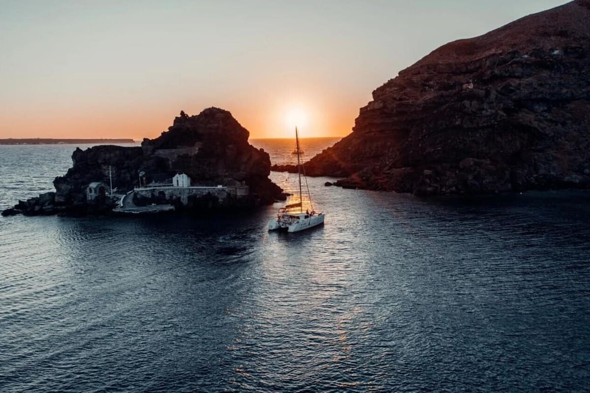
A Santorini boat tour is a trip by boat around the caldera and coasts of Santorini, in the Cyclades. The sea fills the old volcano between the cliffs and the small islands. The tour is one of the Greece Tours on Greece Ville, listed with the other Santorini tours and Greece boat tours.
This post covers what a Santorini boat tour includes, the harbours it leaves from and the island of Thirassia. It also covers Oia’s sea history, the colours of the cliffs and the sea life.
The vessels, the best months and common questions come last. The sections include Santorini boat tours and related caldera cruises that can be booked online.
What is a Santorini boat tour?
A Santorini boat tour is a short trip in a relatively small boat, taken for tourism. It crosses the caldera, a vast hollow formed when a volcano emptied its melted rock. Scientists list this caldera among the Decade Volcanoes, a group picked for close study.

Boat tours differ from river, yacht and ocean cruising. Those trips run on larger boats or cruise ships, with sleeping cabins on board. As a rule, a boat tour starts and ends in the same place.
IAVCEI, a world body of volcano scientists, picks the Decade Volcanoes. Each has a past of large, destructive eruptions near crowded areas. The project began in the 1990s, during a United Nations decade for disaster reduction.
A 2016 study of the seafloor puts the caldera at 10 by 7 km. Fira itself sits on the caldera edge, a cliff 400 m high. A Santorini boat tour passes below it.
A Santorini boat tour floats above deep water. In January 2023, the ocean drilling program IODP drilled the caldera’s northern basin, a deep hollow. At Site U1596, the seafloor lay 382 metres below sea level.
Strongyli, meaning round, was the first name of the island, after its shape. Aspronisi formed part of Strongyli until the Minoan eruption. Today, with Thira and Thirassia, it completes that round outline.
- Municipality: The municipality of Thira covers Santorini, Thirassia, Aspronisi, Anydros, Christiana and both Kameni islands.
- Units: The municipality has two municipal units, Thira and Oia.
- Shape: Eruptions turned the first round island into a horseshoe shape.
The caldera sits on the South Aegean Volcanic Arc, a volcano belt about 500 km long. Beneath it, Africa’s crustal plate slides under the Aegean at up to 5 cm a year.


Which harbours serve a Santorini boat tour?
A Santorini boat tour starts from a harbour on a coast about 36 nautical miles around. The Municipal Port Fund of Thira, a body of the municipality, runs these harbours. Its ports are Athinios, Fira and Ammoudi at Oia. It also manages the fishing shelter at Vlychada.
The coast seen on a Santorini boat tour holds six bays. They are Ammoudi, Armeni, Mouzaki, Fira, Athinios and Balos at Akrotiri. Ammoudi and Armeni lie in Pano Meria, an old name for Oia.
Athinios falls within the local district of Pyrgos Kallistis. It was listed among 16 ports in a Greek plan of ports of refuge. Such ports take in ships that face an emergency or danger.
Above Fira’s old port, a cable car climbs about 220 metres. Shipowner Evangelos Nomikos set the project going in 1979. His foundation’s charter backs development works in the communities. It opened to riders in 1982.
At Ammoudi, the 1956 earthquake destroyed buildings and the harbour. From 1978 to 1980, the Greek National Tourism Organisation restored 6 buildings. A Santorini boat tour there crosses water used for Lara Croft film scenes.
The Vlychada fishing shelter has 700 metres of usable pier. It lies 10 km from Fira, the island’s capital. One small-boat shelter sits at Exo Gialos, on the east coast about 3 km from Fira.
- Capacity: The cable car carries 1,200 passengers an hour, 600 each way.
- Cabins: Each gondola, or hanging cabin, seats two rows of three passengers.
- Revenue: Cable car income funds public works in the communities of Santorini and Thirassia.
In the 2021 census, the Old Port of Gialos below Fira had no permanent residents. Across the water, the fund also runs two shelters on Thirassia, at Korfos and Riva.
Why is Thirassia worth a stop on a Santorini boat tour?
A Santorini boat tour that stops at Thirassia lands on an island west of Santorini. The 2011 census counted 319 residents there. Its highest peak, Profitis Ilias, rises to 294 m. The island keeps Bronze Age remains and two harbours.
The historian Pliny wrote that Thirassia split from Thira after an earthquake in 237 BC. Ptolemy, an ancient writer, called Thirassia a city. In every historical period, it shared Thira’s fate.
In 1866, mines on Thirassia and Thira sent local earth to Egypt for the Suez Canal. Digging in one of these mines, workers found an ancient building, clay pots and a human skeleton.
The French volcano expert Ferdinand Fouqué dug on Thirassia in 1867. He studied the building remains and other finds. The settlement dates from the Late Bronze Age. Its finds spurred the digs at Akrotiri.
A Santorini boat tour that rounds the south end passes Kimisi hill. Pottery on its south side points to about 2000 to 1700 BC. In 2018, diggers found straight walls there, one about 7 metres long.
A Santorini boat tour that lands at Korfos, the old harbour, meets a winding path. Its 270 steps climb to Manolas, the capital, on the eastern side. Donkeys can also carry riders along it.
- Potamos: Its name, meaning river, comes from the stream bed where the village stands.
- Agrilia: Until 1928, it was the largest and oldest settlement on the island.
- Monastery: Panagia Kimisis, honouring the Virgin Mary’s falling asleep, stands on Cape Trypiti at the southern tip.
Riva, the harbour of Agia Eirini, lies at the northern tip, opposite Oia. Passenger and car ferries reach it from Athinios. The village itself stands about 3.5 km north of Manolas.
What does Oia’s sea history add to a Santorini boat tour?
A Santorini boat tour below Oia faces a village of shipowners and sailors. Its churches include ones built in memory of seafarers. Sea captains’ mansions climb the slope, one above the other. A museum there now keeps their seafaring story.
A Santorini boat tour passes a shore that once built ships. In 1890, Oia had a small shipyard. The farmland behind the village made excellent wine. That wine was exported to France, among other places.
Oia keeps two kinds of traditional home. The kapetanospita, or captains’ houses, belonged to the shipowners. Another local name for them is karavokyraiika. The cave houses have narrow fronts but run far back.
The 1956 earthquake, centred south of Amorgos island, reached magnitude 7.7. It was the largest earthquake in Greece in the 20th century. A magnitude 7.2 shock near Santorini followed 13 minutes later.
A Santorini boat tour looks at a village that faded and recovered. Farming shrank as people emigrated, especially to Laurium. By 1977, Oia had only 306 inhabitants. In 1976, a state programme began restoring its houses.
A restored 19th-century mansion houses a museum of the island’s maritime history. It shows rare figureheads, the carved figures on old ships’ bows. Old maritime drawings and patterns complete the display.
- Pause: The museum stopped its work after the earthquake.
- Gift: In 1988, Dina A. Manolessou-Birbili gave her father’s house in Oia to the museum.
- Rebuild: Shipowners Nikolaos and Dimitrios L. Nomikos rebuilt the house, and the museum reopened in 1992.
In 2022, museum president Nicoletta Nomikou led its renovation. Its displays highlight the role of Santorini shipowners and captains in Greek maritime history. A Santorini boat tour below Oia sees the mansions those captains built.
Which rock colours line a Santorini boat tour?
A Santorini boat tour passes cliffs striped red, black, pink and white. Red and black bands come from older lava and scoria, a frothy lava rock. Pale pumice, a light rock full of gas holes, caps the cliff top.
Below Oia, a Santorini boat tour faces a red scoria bed of andesite, a volcanic rock. Its ragged blocks suggest they were molten when they landed. A thicker lava layer lies on top.
Low on the Oia cliff lies a lava flow five or six metres thick. Geologists think it erupted on land before the sunken crater formed. Pumice on top erodes into white scree, or loose stones.
Under Fira, a Santorini boat tour passes a black and pink layer 79,000 years old. Its base holds blocks of andesite scoria. Dark rock above it is rhyolite, another kind of lava, from 18,000 years ago.
Skaros, west of Fira, is a cliff 250 metres high. A thick andesite flow sits at its base. About thirty eruptions piled lava above it. Red bands of rusted rubble mark each flow’s edge.
The Minoan eruption left a white layer up to 60 metres thick. Three distinct bands in it mark separate phases. Its pumice and ash were thrown 36 km into the air.
- Old quarries: Diggers cut caves 2–5 m wide into Minoan ash from soon after the eruption.
- Pozzolana: Santorin earth, a volcanic ash that sets with lime, was used from 500–400 BC.
- Export: In 1852, Santorini exported Theran earth, a volcanic ash, to Austria and Greek ports.
Black basalt, a lava rock, from the earliest eruptions lies at sea level near the Faros lighthouse. Gentle eruptions built the dark lava of Nea and Palea Kameni. They round off a Santorini boat tour’s colours.
What sea life can a Santorini boat tour meet?
A Santorini boat tour crosses waters with dolphins, whales and the rare Mediterranean monk seal. Meadows of Neptune grass support diverse animal life. Offshore, the Kolumbo underwater volcano feeds microbes at its vents. Parrotfish feed on algae over rocky reefs.
Greek seas hold twelve recorded kinds of cetacean, the group of whales and dolphins. Seven live there all year. They include striped, bottlenose and common dolphins, plus sperm and fin whales.
A Santorini boat tour crosses the range of Mediterranean striped dolphins. They feed mainly on hake, sardines and cephalopods, the octopus and squid group. Estimates put common dolphins in the Mediterranean at more than 19,400.
A Santorini boat tour shares the Aegean with the Mediterranean monk seal. Only 800 to 1,000 survive. It is thought to be the world’s rarest pinniped, the seal and walrus group. Adults average 2.4 metres long.
Posidonia oceanica, or Neptune grass, grows only in the Mediterranean. Its name honours Poseidon, the Greek god of the seas. The meadows grow 1 to 35 metres deep, depending on water clarity.
Kolumbo, an underwater volcano, lies about 8 km north-east of Santorini’s Cape Kolumbo. Its cone climbs from at least 504 metres deep to just 18 metres below the surface.
- Monk seal diet: It eats octopus, squid, lobsters and fish, up to 3 kg a day.
- Parrotfish: Called skaros in Greek, it lives down to 50 metres along rocky coasts.
- Lionfish: This venomous fish reached the Mediterranean through the Suez Canal and was first recorded in 1991.
Kolumbo’s 1650 eruption killed about seventy people on Santorini. Vent water there reaches 224 °C. White microbial mats, thin living films of microbes, streak the crater’s northern wall near 490 metres.
What kinds of vessels run a Santorini boat tour?
A Santorini boat tour can sail on a caique, a catamaran or a monohull. A caique is a Greek wooden boat, traditionally built from pine wood. Monohulls are the commonest vessels afloat, while catamarans range up to large car ferries.
On a Santorini boat tour, the caique goes by its Greek name, kaiki, from Ottoman Turkish kayık. Builders paint its frame with orange primer to seal the timber. White paint on the hull counters the strong sun.
Besides timber, Greek boatbuilders use iron, copper, tar, resin, hemp and linen sailcloth. Parts of this craft date back to the Byzantine and medieval era. A new builder trains beside a master for three to five years.
Greek boatyards still build two classic wooden hull types, the trechantiri and the liberty, in their older form. In the late 1980s, a European Community rule to shrink fishing fleets cost Greece fine old boats.
A catamaran on a Santorini boat tour can meet less water drag than a monohull of similar length. It then needs less power from sails or motors. Its wide stance can also leave smaller waves behind it.
- Planing hull: At speed, this kind of monohull lifts up and rides on top of the water.
- Safety authority: The Hellenic Coast Guard oversees the safety of navigation in Greek waters.
- Wood choice: Builders pick ship timber in the forest before cutting.
Greece founded the Hellenic Coast Guard in 1919 by an act of parliament. It works under the Ministry of Maritime Affairs and Insular Policy. Its members count as military personnel under the Greek Military Penal Code.
Which months suit a Santorini boat tour?
A Santorini boat tour sails on Aegean water that is warmest in July and coldest in February. August brings Santorini 2.8 mm of rain on average. A buoy off the island recorded an average wind speed of 6.49 metres per second.
From 1982 to 2012, Aegean surface water warmed by 0.038 °C a year. For a Santorini boat tour, South Aegean coastal water averages above 20 °C. Farther south, mean coastal values top 22 °C off south-eastern Crete.
The etesian, a summer wind from the north, shapes air flow over the eastern Mediterranean. High pressure over the Balkans and low pressure over Cyprus drive it. Similar winds blow in the Adriatic and Ionian.
From 2000 to 2011, a POSEIDON monitoring buoy off Santorini logged a typical wave height of 0.89 m. It sat over water 320 m deep, 8.60 km from shore. Crete blocks southern waves from reaching it.
For a Santorini boat tour on 6 June, sunset comes at 20:35 local time. By 8 September, the sun goes down at 19:38 local time. The shortest day, 21 December, holds 9 hours and 40 minutes of daylight.
- Buoy rhythm: POSEIDON buoys take readings about every 3 hours, or 8 times a day.
- Sample length: Each wave reading lasts 17 minutes, while each wind reading lasts 10 minutes.
- Heat waves: Marine heat waves in Greek seas grew longer and more frequent from 2018 to 2021.
Unlike a true monsoon, the etesian brings no opposite wind in winter. Its summer pattern still links distantly to the monsoons of India. Philip II of Macedon even timed his military campaigns around the etesian.
What do first-time sailors ask about a Santorini boat tour?
A Santorini boat tour sails in Greece, a country where the Beaufort wind scale is widely used. Children under 2 years old rarely suffer from motion sickness. The risk of motion sickness peaks between the ages of 7 and 12.
What is the Beaufort scale on a Santorini boat tour?
The Beaufort scale relates wind speed to what people observe at sea or on land. It has 13 levels, from 0 for calm up to 12 for hurricane force. It was first used on the 1831 to 1836 voyage of HMS Beagle, under Robert FitzRoy. In 1916, it switched to describing the sea, not sails.
How does a caldera like the one on a Santorini boat tour form?
A caldera is a large, cauldron-like hollow. It forms soon after an eruption empties a magma chamber, a pool of liquid rock under the ground. The ground above then sinks into the empty space. That makes a caldera a type of sinkhole, not a crater blown out by an explosion.
How deep is the sea below a Santorini boat tour?
Scientists on Expedition 398 of the International Ocean Discovery Program drilled into the caldera floor. Cores from one northern site held loose volcanic sediment, with a little mud near the top. The northern basin sits 100 m deeper than the basin to the south.
How can passengers avoid seasickness on a Santorini boat tour?
Lab trials show breathing at a regular, resting pace works about half as well as anti-sickness drugs. Lack of sleep also makes the symptoms of motion sickness worse. The NHS, England’s public health service, warns against heavy meals, spicy food and alcohol before or during travel.
Which number calls the Coast Guard during a Santorini boat tour?
In Greece, the emergency phone number for the Coast Guard is 108. The European emergency line, 112, also works there. The Coast Guard employs 8,000 people, and a volunteer auxiliary arm joined in 2011. It also runs an emergency radio station, called SXE, at Aspropyrgos.
What is the official name of the island on a Santorini boat tour?
The island’s official name is Thira, which is also written as Thera. It was revived as the official name in the nineteenth century, while Santorini stays in popular use. A modern tradition also gives the island the name Strongyle, meaning the circular one.