
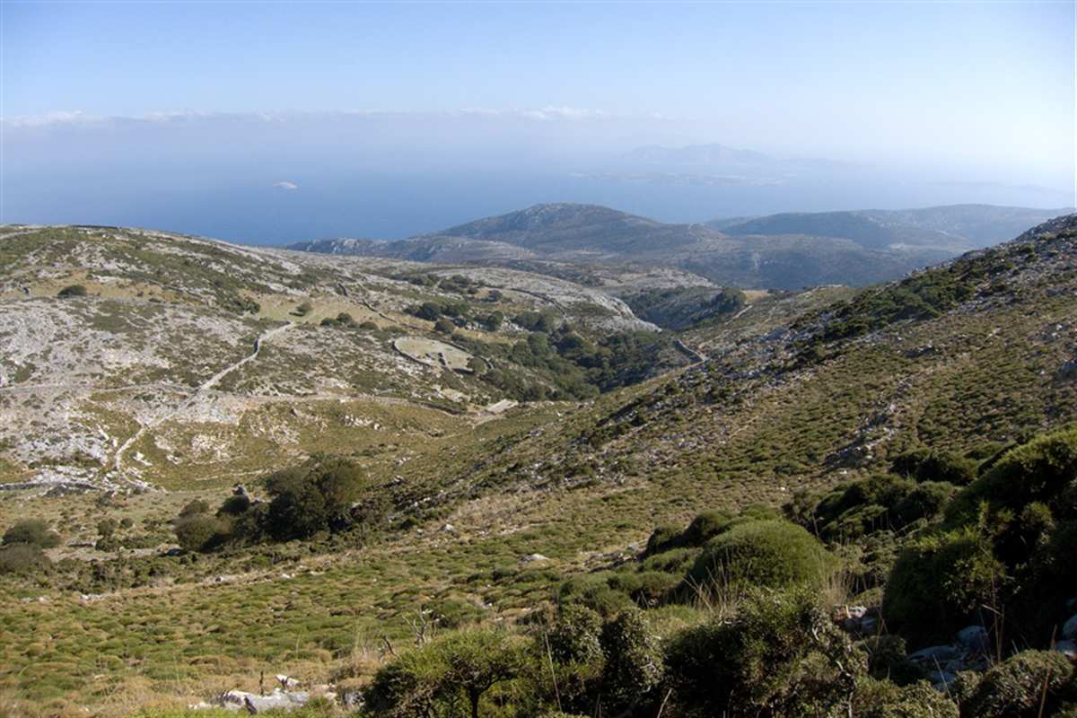
Naxos hiking tour climbs Mount Zas and crosses the plateau of Tragaea, passing Byzantine chapels, Venetian towers, the villages from Apiranthos to Koronos, the Apollonas kouros and the quarries of Flerio. The hike is one of the Greece Tours on Greece Ville, listed with the other Cyclades tours and Greece hiking tours.
This post covers what the tour is, Mount Zas and its cave, Tragaea, Byzantine chapels, Venetian towers, the villages, the kouros and the quarries, marble and emery and the formats on sale. Common questions come last.
What is a Naxos hiking tour?
A Naxos hiking tour is a day on foot across Naxos, an island of the Cyclades, on village paths, mountain slopes and old quarry tracks. It links the highest ground of the island with farm villages, chapels and marble sites.
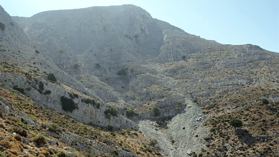
The word hiking has no single meaning in English. The United Kingdom pairs it with rambling, hillwalking and fell walking, Australia says bushwalking and New Zealand says tramping. A Naxos hiking tour joins that family.
Walking for pleasure is a young habit. In earlier times walking suggested poverty and was linked with vagrancy, and long walks were mostly pilgrimages. Walking tours became popular only in the nineteenth century.
Naxos offers plenty of material for such walking. The main villages are Filoti, Apiranthos, Vivlos, Agios Arsenios, Koronos and Glynado, and a Naxos hiking tour links a number of them by path.
Reference works also call Naxos the island of the Cyclades that feeds itself best. A Naxos hiking tour therefore passes working land, with flocks, orchards and stone farm buildings, in place of bare hillsides.
- Terms: English speakers say hiking, rambling, bushwalking or tramping for the same country walk.
- Pilgrimage: Long walks in earlier centuries were mostly religious journeys.
- Villages: Six main villages of Naxos are named in reference works, from Filoti to Glynado.
- Farming: The island is the one in the Cyclades that feeds itself best.
The Naxos tour post covers the island as a whole, with its towns and sights. The sections below keep to the paths, peaks, chapels, towers and quarries of the interior.
What is Mount Zas on a Naxos hiking tour?
A Naxos hiking tour climbs Mount Zas, also called Mount Zeus, the mountain that overlooks the village of Filoti. Its modern name is a cognate of Zeus, and the peak ties the island to the Greek god in name, myth and cave.
Mount Zas stands on the Greek island of Naxos. Filoti lies north of the peak, and the town of Naxos lies to the west. The walk therefore begins inland, away from the beaches.
Myth explains the name. Tradition holds that Zeus spent his childhood on the mountain, after he was taken from the Ideon Antron cave on Crete. A Naxos hiking tour climbs to the home of a god.
Climate shapes the walk. Inland Naxos is much wetter and cooler in winter than the coast, because the ground stands higher. A Naxos hiking tour on Zas meets cooler, damper air in the cold months.
Weather experts class the island in two ways, since the island has a Mediterranean climate in one area and hot semi-arid conditions in another. The interior and the coast feel different on a Naxos hiking tour.
- Name: The modern name Zas is a cognate of Zeus.
- Alias: The same mountain is also known as Mount Zeus.
- Village: The mountain overlooks Filoti, which lies to the north.
- Myth: Zeus came to Naxos from the Ideon Antron cave on Crete.
Mount Zas anchors every mountain format on sale below. The next section turns to the cave on its slope and to a lost settlement from the same district.
What does a Naxos hiking tour find at the Zas cave?
A Naxos hiking tour reaches the Cave of Zas, a site that people used from the Late Neolithic to the Early Cycladic III period. The cave lies southeast of Filoti and holds large stalactites and stalagmites inside its chambers.
Archaeologists dug in the cave in 1985 and 1986 and again in 1994. They found no crop-processing residue, which suggests that nobody lived there all year. The site served as a seasonal base.
The same suggestion links the cave with herders, who used it during the driest period of the year. A Naxos hiking tour therefore walks through old pastoral country, where flocks shaped the use of the slopes.
Myth adds a second reason for the cave. In the telling of Agathosthenes about the history of Naxos, Zeus spent his childhood inside it, hiding from his father Cronus. Tradition, not proof, carries this story.
Raiders also marked the district. Around 1344 Turkish pirates destroyed the settlement of Aria near Filoti, and the survivors moved into Filoti. Before the raid, Filoti had 200 residents and Aria 300.
- Digs: Excavations ran in 1985 and 1986 and again in 1994.
- Use: Herders used the cave in the driest part of the year.
- Interior: Large stalactites and stalagmites have been found inside.
- Location: The cave lies southeast of Filoti, the village at the foot of the mountain.
The cave links the oldest layer of the island with its myths. A Naxos hiking tour then moves on across the central uplands, where the village of Filoti sits among fertile land.
What does a Naxos hiking tour cross on the plateau of Tragaea?
A Naxos hiking tour crosses the central uplands around Filoti, where mountains ring fertile land with running water. The district feeds free-range sheep and goats, and the farms behind the dairy products of Naxos lie along the way.
Mountain ranges surround Filoti and gave its early inhabitants a natural fortress. From the heights they watched the district and had time to drive their flocks into the hills. The walker sees the same ground.
The land was fertile in antiquity and carried abundant running waters. The municipal community of Filoti extends over 92.79 square kilometres and has the largest acreage in Naxos, so there is space to roam.
Dairy products lead the local output of the district: kefalotyri, anthotyro, xinotyro, touloumotiri, arsenico and mizithra. Arsenico kefalotyri comes only from sheep and goat milk and is gathered in sheepfolds called mitatos.
Carnival brings a village custom. On Tsiknopempti every family once killed a pig bred through the year, in a rite called Chirosfagia. Mountain villages keep it, and a Naxos hiking tour in carnival time meets it.
- Defence: Surrounding ranges made Filoti a natural fortification.
- Water: The district had abundant running waters in antiquity.
- Area: The community of Filoti covers 92.79 square kilometres.
- Dairy: Arsenico kefalotyri comes from sheep and goat milk alone.
The Naxos ATV tour post covers the same inland roads by quad bike. A Naxos hiking tour covers them on foot, village by village, on the way towards the Byzantine chapels of the next section.
Why do Byzantine chapels shape a Naxos hiking tour?
A Naxos hiking tour passes Byzantine chapels because the early Byzantine age filled Naxos with churches. Builders raised them in the early Christian basilica style between 500 and 650 AD, and settlers moved inland as pirate raids emptied the coast.
Piracy drove people uphill. The Filoti article records a rising population between the seventh and tenth centuries, as people left coastal settlements for fear of raiders based on Crete. A Naxos hiking tour leads inland.
In that age the first small church of Panagia Filotitissa is estimated to have been built. The large church of today replaced an older Byzantine building, so the village shows a long chain of rebuilding.
Byzantine builders developed the Greek cross plan for churches over time. Round arches and domes carried the roof, grand buildings had gold mosaics, and frescoes served as a cheaper cover for the walls of smaller chapels.
Naxos shows a further detail in its frescoes. Traces of Muslim artistic influence are visible in paintings from the tenth century, so a painted chapel on a Naxos hiking tour can show mixed influences.
- Period: A wave of churches rose across Naxos between 500 and 650 AD.
- Piracy: Raiders from Crete pushed settlers away from the coast.
- Plan: The Greek cross plan became the standard Byzantine church plan.
- Klefaros: The church of St Nicholas turned Catholic in 1207 and returned to the Filotians in 1917.
Chapels mark the Orthodox side of the island past, and towers mark the Venetian side. The next section turns from one to the other, with the stone towers of the feudal lords.
What do Venetian towers add to a Naxos hiking tour?
A Naxos hiking tour meets the Venetian towers that followed the conquest of the island by Marco Sanudo, who divided Naxos into 56 fiefs. A tower house served both for defence and as a home, and it suited hill country.
Sanudo ruled for twenty years, from 1207 to 1227, and made Naxos the seat of the Duchy of the Archipelago. His men received fiefs, and a Naxos hiking tour crosses land those lords held.
In Filoti, Zorzeto Barozzi bought a tower-like mansion in the centre of the village from a certain Tzuane Tagari in 1620. The building became known as the Barozzi Tower, a stop for a Naxos hiking tour.
Zorzeto was an heir of Giacomo IV Crispo, the last Venetian duke of Naxos. His son Jacob held the fief of Filoti from 1648 to 1676 and gathered documents from 1372 to 1667.
Tower houses are a wider type. They are stone structures built for defence and as homes, and they appear first in mountain areas. In the Balkans they spread in the seventeenth century.
- Fiefs: Sanudo divided the island into 56 fiefs, and one of them was Filotis.
- Tower: The Barozzi Tower stands in the centre of Filoti.
- Land: Jacob Barozzi came to hold 71 percent of the land of Filoti.
- Type: A tower house served for defence as well as for habitation.
The towers show how feudal lords held the hills. The next section follows a path in the opposite direction, to two mountain villages of the north-east that lived by the mines.
Which villages link Apiranthos to Koronos on a Naxos hiking tour?
A Naxos hiking tour from Apiranthos to Koronos joins two mountain villages of the north-east, both among the Smiridohoria, the emery-producing villages. Koronos lies on the slopes of the Koronion Oros, the second tallest mountain of Naxos.
Koronos sits in the north-east of Naxos, on the north-eastern slopes of the Koronion Oros. The village lies 630 metres above sea level, and the route reaches it from the high ground around Apiranthos.
Apiranthos is also written Apeiranthos or Aperathos. In 1835 the new Municipality of Apeiranthos took in Filoti, then a place of 1,130 inhabitants in 291 families, so the village was an old centre of local rule.
Along with Keramoti, the two villages form the Smiridohoria. The name marks them as the emery-producing villages of Naxos. A Naxos hiking tour on this route thus follows the mining belt of the north-east.
Apiranthos also gave Naxos the army officer Michalis Vardanis, who lived from 1936 to 2014. Such names show how a Naxos hiking tour passes villages with a record far beyond their size.
- Mountain: The Koronion Oros is the second tallest mountain of the island.
- Altitude: Koronos sits 630 metres above sea level.
- Group: Apeiranthos, Koronos and Keramoti form the Smiridohoria.
- Municipality: The Municipality of Apeiranthos was created in 1835.
The Fira to Oia hike post covers a day hike on another Cyclades island, Santorini. The next section stays on Naxos and turns to its unfinished statues and the quarries that produced them.
What does a Naxos hiking tour find at the Apollonas kouros and the quarries of Flerio?
A Naxos hiking tour reaches the Kouros of Apollonas, an unfinished statue in one of the oldest quarries in Greece. Writers once took the figure for Apollo, and a later reading names it as Dionysus. Two smaller kouroi lie near Flerio.
In the fifteenth century a traveller called the figure a statue of Apollo, as a sanctuary of Apollo lay close by. Ross used the label in 1840, and von Massow named it Dionysos in 1932.
The cracks are not new. A sketch of 1835 by Schaubert for a copper etching already shows them, and nobody can tell which date from the carving. A Naxos hiking tour sees the stone unfinished.
The statue was to show an older bearded man with the right arm stretched forward. The sculptors cut the arms as rough rectangles and began the feet on a plinth 50 centimetres high.
Near Melanes lie two more unfinished kouroi, one in a village garden and one halfway up a marble outcrop 300 metres high. The quarry figure is also the Kouros of Potamia or of Faranga.
- Colossus: The Colossus of the Naxians on Delos, 9 metres high, came from the same quarry as the Flerio pair.
- Athens: Ludwig Ross moved a smaller kouros from Apollonas to the Museum at Athens in 1834.
- Museum: Another small kouros from Flerio is set on a terrace at the Museum of Naxos.
- Method: Sculptors worked layer by layer, so that the whole figure stayed at one stage.
The kouroi show the quarry work in mid-process. A Naxos hiking tour reads the stone here, before it turns to the marble and emery that made the island rich.
What do the marble quarries and emery add to a Naxos hiking tour?
A Naxos hiking tour passes the marble quarries and emery workings that gave Naxos its stone wealth. Naxian marble has crystals up to 15 millimetres wide, and emery from the east of the island was mined for over two thousand years.
Marble quarrying on Naxos goes back to before 550 BCE. Ancient quarries lie in the north near Apollonas and in the centre near Melanes, while the modern quarries stand near the village of Kinidaros.
Naxian marble is a white stone whose layers reach a thickness of 30 metres in old fissures. Its large crystals are transparent, which gives the stone depth and a blue-grey shimmer that shifts with the light.
Emery is a black or dark grey granular rock crushed to make abrasive powder. Pliny the Elder recorded its mining on the eastern side of Naxos, where a Naxos hiking tour enters emery country.
Demand fell once sintered carbide and oxide abrasives arrived. Turkey and Greece are the main suppliers of emery, and in 2010 Greece produced 2,000 tonnes against 6,000 tonnes from Turkey.
- Start: Marble was already quarried on Naxos before 550 BCE.
- Layers: Marble layers reach 30 metres in old fissures.
- Smell: Worked marble gives off a faint smell of bitumen that disappears afterwards.
- Temple: The remains of the Temple of Demeter at Sangri are built of Naxian marble.
Stone, more than any other material, explains the island. The final sections list the formats on sale and answer the questions that travellers ask about a Naxos hiking tour.
Which formats of a Naxos hiking tour are on sale?
A Naxos hiking tour is on sale as ten formats, from summit walks on Mount Zas to village and chapel routes, a gorge and waterfall walk, a tree walk and a mix of mountain biking and hiking across the countryside.
Three formats go to the top of Mount Zas, also listed as Mount Zeus. One is a walk with a local, one an experience led by a local, and one a private loop or out-and-back route.
Two formats stay in the countryside. One passes Byzantine churches and olive groves, and the other crosses villages and Byzantine churches. Each suits travellers who want the chapels more than the summit.
Water and trees have their own formats. A private hike follows a gorge to a waterfall, a private tour crosses green valleys, and a tree walk through the Cyclades is led by a local.
The last two formats widen the range. One mixes e-mountain biking with hiking in a private adventure, and the other crosses the eastern mountains with a local. The second Naxos hiking tour covers the emery country.
- Summit: Three formats climb Mount Zas or Mount Zeus.
- Chapels: Two formats join Byzantine churches to olive groves and villages.
- Water and trees: A gorge, a valley and a tree walk fill three more formats.
- Mix: One format joins e-mountain biking to hiking, and one covers the eastern mountains.
The tour cards and availability boxes on the page list live dates for each format. A Naxos hiking tour needs a check of those boxes before any day is chosen.
What do travellers ask about this Naxos hiking tour?
A Naxos hiking tour raises questions about the history of walking, the marble of the island, the Venetian lords of Filoti and the hardness of emery. The answers below repeat the facts of each stop in short form.
How old is the habit behind a Naxos hiking tour?
Petrarch climbed Mont Ventoux, 1,912 metres tall, on 26 April 1336 with his brother and two servants, and that climb is cited as an early recreational ascent. Later research found older ascents, so a Naxos hiking tour belongs to a very old habit.
Which monuments used the marble met on a Naxos hiking tour?
Richard Lepsius suggested in 1890 that Naxian marble was used for ancient roof tiles at Olympia and on the Athenian Acropolis, and later research affirmed it. In Roman times the stone lost importance, and Pliny the Elder never mentions it.
When did villagers near a Naxos hiking tour first rebel against their lords?
The first known rebellion of Naxos villagers against the seigniors, over excessive taxation, is reported in 1641. The privileges of the feudal lords ended in 1721, when they were counted as equal to the Naxians, as a Naxos hiking tour in Filoti recalls.
How hard is the emery seen on a Naxos hiking tour?
Emery is a mixed rock, so it has no single Mohs hardness. Corundum rates 9 and spinel-group minerals stand near 8, while magnetite stands near 6. A Naxos hiking tour across emery country therefore crosses stone of very different hardness.
Featured photo: Zde, CC BY-SA 4.0, via Wikimedia Commons.