
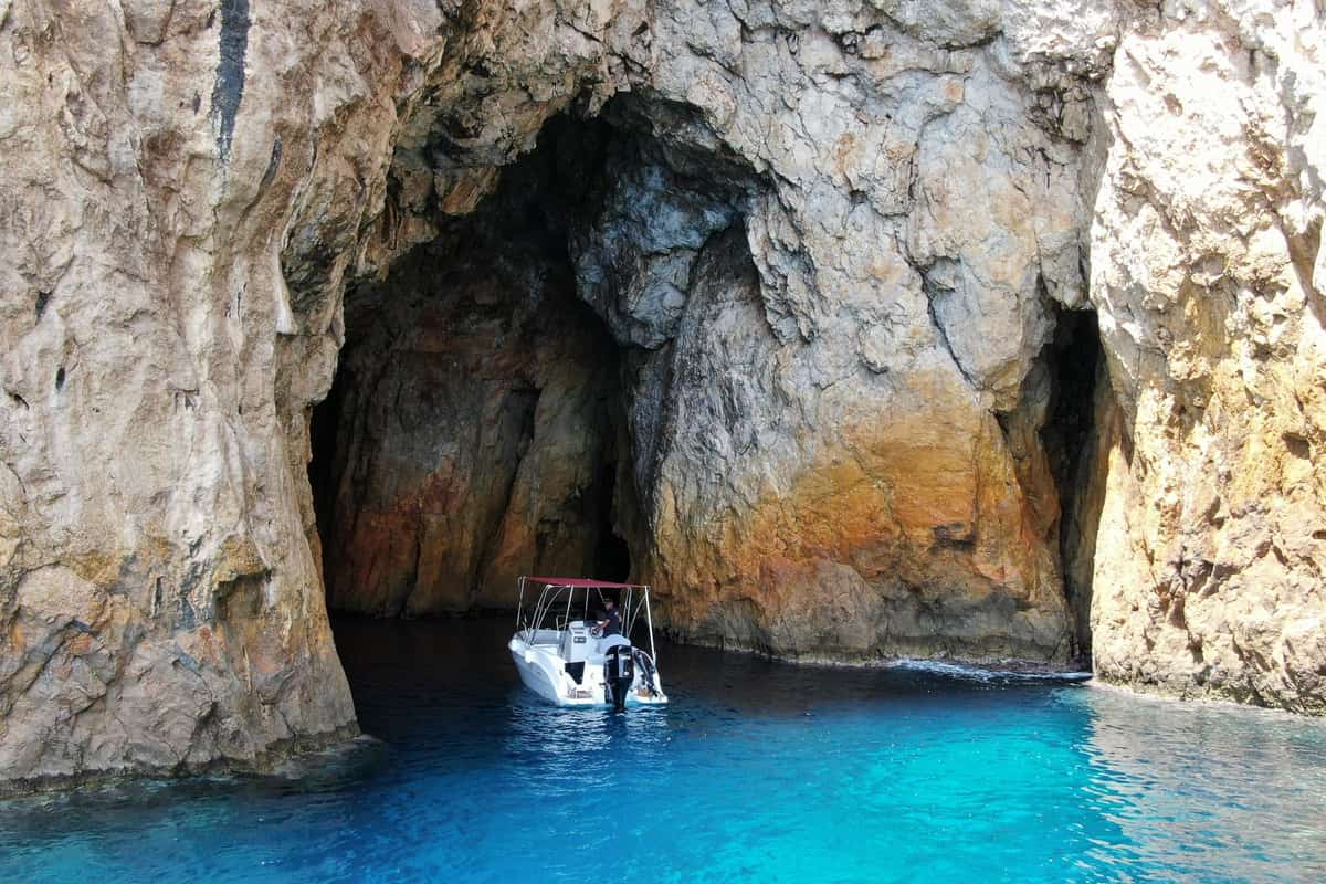
A Corfu boat trip follows the coasts of Corfu, an island of the Ionian Sea close to Albania. Routes pass cliffs, sea caves and the small islands off its shores. The trip is one of the Greece Tours on Greece Ville.
This post covers the harbours, the sea distances, the small islands, the coves and sea caves, and the sea life.
Sea battles, the best months and common questions come last. The sections include Corfu boat trips that can be booked online.
What is a Corfu boat trip?
A Corfu boat trip sails along the coasts of Corfu and out to its small islands. Its waters link the western and eastern Mediterranean basins. Sailing directions, official books for sailors, call Corfu the second largest Ionian island.
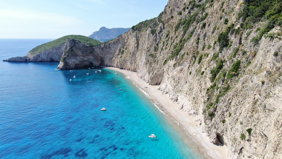
The Corfu Channel carries shipping bound for Albanian and Greek ports. Local boats, tourist boats and Adriatic traffic use it too. Its narrowest point lies near Cape Skales in Albania.
A Corfu boat trip sees high white cliffs at Cape Asprokavos, the southeast tip. Cape Arilla, 91 metres high, ends a northwest peninsula.
The islands around a Corfu boat trip belong to the Corfu regional unit, an administrative district. Since 2019 it has had four municipalities, or local councils. The 2021 census counted 101,600 residents there.
- Cycle: Northern Ionian currents reverse their spin each decade.
- Clockwise phase: A weak current runs west to east.
- Anticlockwise phase: An intense current crosses the basin’s centre.
Ionian sea level tracks these phases too. Its trend rises during anticlockwise phases and falls during clockwise ones.


Which harbours serve a Corfu boat trip?
A Corfu boat trip leaves from Corfu port, Gouvia marina or a village harbour. These stand at Kassiopi, Petriti, Lefkimmi and, on the west coast, Alypa. The marina’s shallow bay takes only small craft and small coastal ships.
The town port offers 1,090 metres of commercial berths, 3.6 to 8.8 metres deep. A Corfu boat trip with over 50 passengers must report to Kerkyra Traffic, the port’s radio control.
The Corfu Port Authority SA runs both the town port and the southern port of Lefkimmi. Full ownership of the company passed to TAIPED, the Greek state’s asset development fund.
Small boats also moor at Bouka, where the Lefkimmi river meets the sea. The port authority says no official port exists there. Yet the mouth shelters boats in all weathers.
- Gouvia entrance: Banks at both points leave a narrow channel.
- Alypa: This Paleokastritsa boat shelter holds 103 mooring places.
- River pier: Its red light flashes from 8 metres up.
An iron fence separates Gouvia marina from the ruins of a Venetian arsenal, or naval shipyard. Venice’s Senate limited work there to basic upkeep like cleaning and caulking, or sealing seams.
How far does a Corfu boat trip sail?
A Corfu boat trip can follow the west coast for 31 nautical miles between capes. Each nautical mile measures exactly 1,852 metres. Eastward, the mainland lies across a strait. Depths there run from shallow banks to deep water.
A Corfu boat trip on the west coast passes rocks and shoals, or shallow patches. All lie within 1.5 miles of shore. Only small craft with local knowledge anchor there.
Southward, the strait’s entrance spans from Corfu’s southeast tip to Sivota island. Hazards reach 2 miles off the Corfu side. The mainland side is clear, 55 to 73 metres deep.
Igoumenitsa bay gives the best shelter on the facing mainland coast. A bar, or seabed ridge, blocks its entrance. Its buoyed channel measured 7.9 metres at its shallowest in 1993.
- Approaches: Depths off the town harbour exceed 35 metres.
- Roadstead: This outer anchorage runs 18 to 30 metres deep.
- Ipsos Bay: A bank under 9 metres deep reaches 0.4 mile out.
Inside the bar, the bay is mainly 16 to 26 metres deep. A 5.5-metre shallow patch lies 0.3 mile west of the channel entrance. Ships cannot pass each other inside it.
Which small islands can a Corfu boat trip reach?
A Corfu boat trip reaches Othonoi, Ereikoussa and Mathraki in the Diapontia group, northwest of Corfu. Near Corfu town, it passes the islets of Vido and Lazaretto. The group and its islets cover 17.65 square kilometres of land.
A Corfu boat trip to Othonoi reaches an island once called Fidonisi, meaning Snake Island. Tradition says snakes once drove people out. Othonians in Corfu call it Pera, meaning beyond.
Ereikoussa is green with forests of cypress and olive trees. Its older name, Merlera, is Italian. It has six settlements. Over 300 families from the island live in New York.
A Corfu boat trip passes Vido, once called Agios Stefanos, or Saint Stephen. Early Christians fleeing persecution built him an altar there. Its present name comes from a Venetian owner.
- Youth prison: Vido held young prisoners from 1949 to 1976.
- Lazaretto: One view links its name to a Nazareth church.
- Islets: Karavi, Kastrino, Leipso, Ostrako and Plaka lie in the group.
Mathraki was once called Samathraki. Tradition links its name to anthrakia, meaning embers, after the island burned. In 2021, its primary school reopened after 21 years. It had one pupil.
Which coves and sea caves does a Corfu boat trip pass?
A Corfu boat trip passes a cove near Sidari on the north coast. In the northwest, a cave on the Afionas headland holds a chapel. On the west coast, Chomi beach near Liapades is open only to boats.
Near Sidari lies the Canal d’Amour, or Love Channel. Sidari holds the only Middle Stone Age site studied in the Ionian Islands. Its bowls date from the 6th millennium BC.
On a Corfu boat trip, the Afionas headland ends at ancient Cape Arilla. A chapel to Saint Stylianos sits in a cave there. The village church above dates from 1636.
A Corfu boat trip off Liapades, on the west coast, passes Chomi beach, which only boats reach. Nearby Liniodoro beach takes its name from Heliou doron, ancient Greek for Gift from the Sun.
- Othonoi: A coastal cave there stands 20 metres high.
- Reefs: Rocks and boulders cover 3,065 hectares of Diapontia seabed.
- Rims: Ledges built by sea life edge exposed rocky shores.
Peroulades, a northwest village, is listed as a traditional settlement. The ruins of poet Andreas Kalvos’s house lie among its Venetian mansions. Finds point to people there 12,000 years ago.
What sea life lives along a Corfu boat trip?
A Corfu boat trip crosses waters home to dolphins, monk seals, loggerhead turtles, sharks and nesting seabirds. Seagrass meadows grow on the seabed near shore. Field studies and European Union records of protected sites map where they live.
Tethys researchers tracked common dolphins in the Inner Ionian archipelago. Encounters fell from 2.2 animals per 100 km in 1997 to 0.1 in 2004. Overfishing of prey drove the fall.
Diet studies showed Ionian common and striped dolphins overlap 77% in what they eat. That points to competition for food. Purse seiners, which net whole shoals, take the largest catch.
The same project used underwater sound recorders in the archipelago. They captured the full range of monk seal calls. It was the first published record of the species calling underwater.
- Turtles: A loggerhead hatchling headed seaward on Corfu, 9 August 2022.
- Sharks: White sharks have been seen off Othonoi.
- Seabirds: At least 15 shag pairs nest on Diapontia rocks.
South of town, a Corfu boat trip passes Posidonia seagrass that grows thicker toward Mesongi. Cystoseira seaweed shapes these coastal waters. EU records also list green turtles and otters there.
Which sea battles took place along a Corfu boat trip?
A Corfu boat trip crosses waters where fleets fought. Corcyra, the old name of Corfu, battled Corinth here in 433 BC. Ottoman, Venetian, Russian and French forces later fought sieges by sea. Mines and a court case followed.
A Corfu boat trip recalls Sybota, where Corcyra had 110 ships and Athens 10. Corinth brought 150. Thucydides, an ancient Greek historian, said no earlier Greek battle had more ships.
The 1716 siege a Corfu boat trip recalls ran from 8 July to 21 August. Ottoman troops first landed at Ypsos. Andrea Pisani’s Venetian fleet held 26 big sailing warships.
A new siege of the French garrison began on 4 November 1798. On 28 February 1799, warships shelled Vido for four hours. The French gave up on 3 March.
- 1923: An Italian bombardment killed 16 civilians.
- 1946: Mines in the Corfu Channel killed 44 British sailors on 22 October.
- 1949: The International Court of Justice held Albania responsible.
The court ruled on 9 April 1949 that Albania must have known about the minefield. It also upheld innocent passage, the right of ships to cross an international strait in peace.
Which months suit a Corfu boat trip?
A Corfu boat trip suits the summer months. Then the maistro, a north-west wind, blows mostly at force 3 to 5 on the Beaufort wind scale. Storm risk rises from September. Warm autumn water can feed tropical-like storms.
Greeks also call the maistro the maistrali. That name pushed aside Skiron, the ancient Greek name for this wind. The maistro reaches force 6 to 8 only in rare cases.
On a Corfu boat trip, force 4 means waves of 1 to 2 m. Force 5 means waves of 2 to 3 m and winds of 29 to 38 km/h.
Satellite data from 2008 to 2021 cover the coasts of the Ionian. North of 39.5° N, a line of latitude, the mean coastal sea temperature was 19 to 20 °C.
- September 2020: The western Ionian reached 27 to 28 °C.
- Storm limit: Tropical storms need water above 26.5 °C.
- Ianos: The storm cooled the sea by 4 °C.
Medicanes, Mediterranean tropical-like storms, peak from September to January. A Corfu boat trip in June or July meets the lowest counts. The Ionian is one of their two main birth areas.
What do sailors new to Corfu ask about a Corfu boat trip?
A Corfu boat trip can pass a lighthouse that joined the Greek network in 1864. The Hellenic Coast Guard, formed in 1919, oversees sea safety. Greece has widened its territorial waters, the sea it rules, in the Ionian.
Which old lighthouse can a Corfu boat trip see?
Peristeres islet, called Pythaea in ancient times, has a white stone tower 17 m tall. Its first light reached 13 nautical miles, a sea distance unit. The building now stands in ruins. Today an automatic beacon there shines 5 miles.
Who keeps a Corfu boat trip safe at sea?
The Hellenic Coast Guard runs a maritime rescue coordination centre in Piraeus. Corfu port has its own traffic monitoring centre, which gives ships information. Safe speed limits for ships there come from a 1978 port regulation and a 2016 decision.
Which warship sank in the waters of a Corfu boat trip?
The Greek torpedo boat Proussa, a small warship, sank off Corfu on 4 April 1941. Italian dive bombers hit her. She began as an Austro-Hungarian boat, launched in 1916. Greece received her in 1919 as payment after the First World War.
How wide are the sea limits on a Corfu boat trip?
Territorial waters give a country full control of the airspace above and partial control of shipping. Their standard width grew from 3 nautical miles to 6 last century. It now stands at 12, under a UN sea treaty of 1982.