

A Hydra boat trip sails to Hydra and along its rocky coasts, where the Argolic Gulf meets the open Aegean. Stops can include islets, quiet coves and the old harbour. The trip is one of the Greece Tours on Greece Ville.
This post covers what a Hydra boat trip includes, the ports it uses and the distances it sails. It also covers the islets on the route, the coves and the sea life.
Hydra’s old sailing ships, the best months and common questions come last. The sections include Hydra boat trips and related Saronic cruises that can be booked online.
What is a Hydra boat trip?
A Hydra boat trip sails the waters around Hydra, off the south-east end of the Argolid peninsula. Its routes cross the Gulf of Hydra and the Hydra Strait. The Myrtoan Sea opens to the south, and the Argolic Gulf lies to the west.

The Myrtoan Sea runs south from the Argo-Saronic area to Kythira. The eastern Peloponnese forms its west side, and the western Cyclades its east. Legend ties its name to Myrtilus, thrown in by Pelops.
Islets and strong currents, even without wind, made this sea risky in the past. The Argolic Gulf is the easternmost of three big gulfs in the southern Peloponnese. It reaches 30 nautical miles, or sea miles, inland.
On a Hydra boat trip, Hydra and Dokos form the south side of the Gulf of Hydra. Boats enter from the east through the Hydra Strait. Its mouth spans 5 nautical miles, from Cape Zourvas to Cape Skillaion.
- Width: The municipality describes Hydra as a rocky mountain range 1.5 to 6 km wide.
- Coves: Apart from three coves, the rocky shore is unfriendly to ships, which once helped defend Hydra.
- Islets: The municipality holds 22 more islands, islets and rocks, including Pontikos and Strongylo.
Part of the Black Sea’s water flows through the Aegean and into the Myrtoan Sea. In the Pliocene and early Pleistocene, two old geological ages, the Argolic Gulf reached the Corinthian Gulf.


Which ports does a Hydra boat trip use?
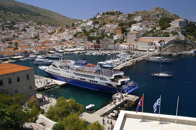
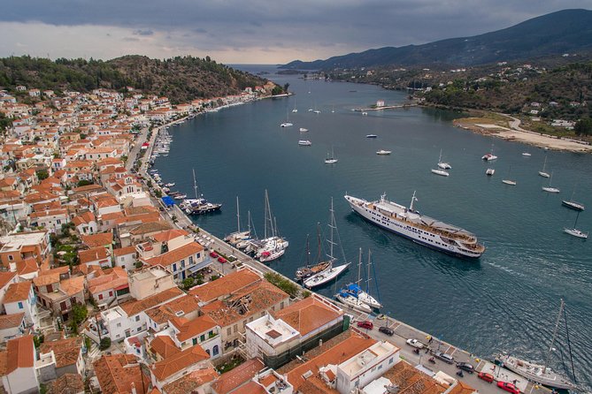
A Hydra boat trip calls at Hydra harbour, a small port protected by breakwaters, walls that block waves. The municipal port fund of Hydra also runs Kamini, Mandraki and Metochi. Ermioni, on the mainland, offers another landing across the water.
On a Hydra boat trip, the harbour entrance is 8 metres deep. Inside, depths drop to 3 metres or less. The quays have up to 4.5 metres of water alongside them.
The Hellenic Coast Guard lists Hydra’s office as a Limenarcheio, a port authority. The port fund, founded in 2002, is a non-profit public body. Its seven-member board includes the mayor and the head of the port authority.
A Hydra boat trip can reach Mandraki by sea. From the 16th to the 18th century, it was the Venetians’ naval base. Metochi, also called Agios Dimitrios, had 36 permanent residents in 2021.
- Harbour light: A light shines from the east entrance of Hydra’s bay.
- Cables: Undersea cables mean no anchoring or fishing between Cape Metokhion and Hydra’s north coast.
- Chart: Greek chart XEE-135 is the harbour plan for both Hydra and Ermioni.
Ermioni’s white buildings line a low tongue of land. Its inlet, Kastri, holds 5 to 15 metres of water. A quay and two piers there have 1 to 3.5 metres alongside.
How far does a Hydra boat trip sail?
A Hydra boat trip reaches an island 6 nautical miles, or sea miles, off the south-east Argolida coast. A yacht race from Faliro to Hydra covers 36 nautical miles each way. Cape Metokhion lies 7.4 nautical miles east-north-east of Ermioni’s Cape Kastri.
The Greek shipping ministry sorts 572 passenger sea routes into safety classes A to D. Poros to Hydra and Spetses to Hydra are Class D routes. So are Ermioni to Hydra and Hydra to Metochi.
A Hydra boat trip from Zea Marina in Piraeus follows a Class C route. Cape Skillaion lies 5.6 nautical miles east-north-east of Cape Metokhion. Off that cape, a passage between two islets is 16 metres deep.
A Hydra boat trip finds 30 to 60 metres of water just outside the harbour. Boats can briefly anchor there in good weather. The Petasi channel, between Hydra and Dokos, is deep and clear of dangers.
- Basin depth: The Myrtoan basin is roughly 1,000 metres deep.
- Sill: A ridge roughly 500 metres deep west of Milos separates the basin from the West Cretan Sea.
- Shoal: A shallow patch of 14.9 metres lies about 0.6 nautical miles north-west of Palamidas islet.
Halfway between Hydra’s east end and Stavronisi, two currents meet and raise a ripple. It was once taken for shallow water. In the Petasi channel, the current runs east as a rule.
Which islets lie on a Hydra boat trip route?
A Hydra boat trip west of the island passes Dokos and a chain of islets. Smaller ones include Petasi, Trikeri and Alexandros. Bare rocks such as Drapi and Strongylo lie east of Trikeri. Off Dokos, only the cargo of a prehistoric ship survives.
A Hydra boat trip finds Dokos at the Argolic Gulf’s mouth. Its name comes from its owners in the late 18th century, the Dokos shipping family of Hydra. Its ancient name, Aperopia, possibly meant “the mountain island”.
Dokos counted 18 residents at the 2011 census, all Orthodox monks or sheep herders. Olive trees grow almost everywhere on it. Its finds have made the entire island an archaeological site where building is banned.
A Hydra boat trip passes the wreck site off the south shore of Cape Kommeni. Nikos Tsouchlos ran the technical side of two surveys, in 1975 and 1977. The full excavation lasted four seasons.
- Petasi: This islet covers 0.334 square kilometres, with Bisti beach to its south.
- Trikeri: It spans 0.923 square kilometres and had no residents at the 2021 census.
- Alexandros: Also called Lexandri, it covers 0.331 square kilometres and rises 14 metres.
The finds went to the Spetses Museum for study and conservation. Nearer Hydra, the islet of Agios Ioannis, named after its chapel, has its own protected wreck. That ship sank in early Byzantine times.
Which coves can a Hydra boat trip reach?
A Hydra boat trip along the west and south coasts reaches quiet pebble coves. Molos, Bisti and Agios Nikolaos line the western end. Karali sits beside Limnioniza on the south side. Seagrass, rock and sand share the seabed below.
Molos is a closed, rocky bay with a large pebble beach. Bali, also called Pigadakia, has small pebbles, warm water and a tiny harbour. An early Bronze Age settlement lies just metres from its shore.
A Hydra boat trip reaches Bisti, a bay ringed by high rocks. It suits diving from the rocks and spearfishing, as the municipality notes. Another early Bronze Age site lies in the pine forest beside it.
Near Cape Bisti, Agios Georgios beach lies between two pine-covered hills. Past the areas of Paouki and Fichthi comes the bay of Agios Nikolaos. Pines cover its slopes, and one spot has a little sand.
A Hydra boat trip floats over a mixed seabed. A seagrass study checked 676 points around the island. Seagrass covered 349 of them, or 51.62 percent. Rock covered 218 points and sand 83.
- Agios Kyprianos: Past the sheer rock of Zastani, this empty beach has a chapel of the saint.
- Anchoring: Seagrass off Agios Nikolaos and Agios Georgios grows in patches, possibly from uncontrolled anchoring.
- Molos: A pier there draws boat traffic, a suspected cause of sparse seagrass in the bay.
Past Cape Agios Konstantinos, below Mount Gerakina, steep shores run to Cape Agios Ioannis. Seagrass grows thickest off Klimaki and in the bay facing Nisiza islet. Limnioniza, past Cape Tsigkari, draws tourist boats.
What sea life lives along a Hydra boat trip?
A Hydra boat trip crosses waters where Mediterranean monk seals breed again. Seagrass meadows grow off parts of the shore. Dolphins and even whales have been recorded in the surrounding seas. Loggerhead sea turtles nest on Greek beaches and feed in the Mediterranean.
From 2006 to 2013, the monk seal society MOm logged 296 sightings in the Saronic and Argolic gulfs. Of these, 19 involved newborn pups. Its rescue team stepped in 6 times.
A Hydra boat trip crosses the area of a MOm seal project begun in late spring 2014. Its team checked about 1,300 kilometres of coastline. It mapped 27 sea caves and rated 10 fit for breeding.
A Hydra boat trip passes meadows of Posidonia oceanica, a seagrass found only in the Mediterranean. A 2023 survey mapped 77.12 hectares of it around Hydra. Their lower edge averages 20.63 metres deep.
Greece holds Europe’s largest monk seal population, an estimated 250 to 350 animals. Twelve species of whales and dolphins are on record in Greek seas. Seven of them are present all year.
- Risso’s dolphins: The largest dolphins in Greek seas live in the Myrtoan Sea, south-west of Hydra.
- Humpback whale: In spring 2001, one spent a month feeding near Tolo, in the Argolic Gulf.
- Turtles: Greece holds the Mediterranean’s busiest loggerhead nesting beaches, with more than 3,000 nests a year.
Monk seals eat octopus, squid and mullet, up to 3 kilograms a day. Pregnant females give birth in hard-to-reach sea caves. Old accounts show they once gave birth on open beaches.
What do Hydra’s old sailing ships add to a Hydra boat trip?
A Hydra boat trip sails the sea where the island’s brigs and fireships fought. Brigs, two-masted sailing ships, were the favourite ships of the Greek fighters. Their sailing qualities won them that place. Fireships were old ships packed with flammable material.
A Hydra boat trip crosses the home sea of the polacca, a three-masted ship. Mediterranean crews sailed it from the 16th to the 19th century. Its one-piece masts let crews lower the sail poles fully. A schooner had square sails on its front mast and triangular ones behind.
Even Ottoman fleet commanders sought out Hydriot crews before the war. Small fights with pirates had already armed the brigs by 1821. A war brig carried 12 to 18 cannons on deck and a crew of 100 men.
A Hydra boat trip passes waters where fireships, called volcanoes in official papers, once sailed. Barrels of explosives sat under deck holes, and tar soaked the sails. Hooks called ravens locked each fireship onto its target.
- Brig Aris: This 350-ton Hydra brig carried 16 cannons.
- Gerontas: On 29 August 1824, Hydriot fireships blew up a Tunisian frigate with 44 cannons.
- Patras: On 20 February 1822, the fleet’s only death fell on Miaoulis’s own ship.
Fireship crews made 59 attacks during the war. Of these, 39 succeeded. Another 19 failed, and 1 remains disputed. Each crew escaped in a towed boat, with the captain lighting the fire last. Later, French-trained Egyptian crews made attacks harder.
Which months suit a Hydra boat trip?
A Hydra boat trip suits the warm sea season, which runs from spring into autumn. In summer, the meltemi, a yearly north wind, raises the waves. Winter brings a sea blessing at the harbour. Marine forecasts describe the sea by its wave height.
Hellenic Navy records from 1965 to 1995 show a yearly warm sea period. The water then stays above its annual average. The period starts between 28 April and late spring. It ends between 27 October and 19 November.
A Hydra boat trip in summer meets the meltemi wind. It brings a clear sky and a wavy sea. Between 1979 and 2009, the summer lost about 4.6 meltemi days. Its air starts over southern Russia and dries out as it crosses Europe.
A Hydra boat trip on 6 January meets Theophany, the feast of Christ’s baptism. At the harbour, the bishop threw a cross on a ribbon into the sea. Islanders dived to catch it.
- Winter rest: Old advice kept boats in port from 14 September to the third Sunday of Lent.
- Near gale: At Beaufort wind force 7, open-ocean waves reach 4 to 5.5 metres.
- Shore waves: Beaufort wave heights describe the open ocean, not waters along the shore.
- Doves: The bishop also released doves to bless the waters.
Marine forecasts give significant wave height, the average of the highest third of waves. On a Hydra boat trip, the highest single waves can reach double that figure. Gusts can blow 40 percent stronger than the stated wind.
What do sea travellers ask about a Hydra boat trip?
A Hydra boat trip passes a lighthouse on a main open-sea shipping route. A national weather service forecasts its waters every day. Yearly sailing races arrive in spring and autumn. The sea around the island is also getting warmer.
Which lighthouse watches over a Hydra boat trip?
Hydra’s lighthouse is an open-sea light for ships sailing from the Ionian Sea to Piraeus. On that route it follows the light of Cape Maleas. Psyttaleia’s light comes next. Such lights have the strongest beams and longest range. The next one shows before the last fades.
Which marine forecasts cover a Hydra boat trip?
The national weather service, HNMS, issues marine forecasts four times a day. Each covers the next 24 hours, plus a half-day outlook. The forecasts cover 36 of the 53 sub-areas of METAREA III, a marine forecast zone. Gale warnings are reissued when conditions change sharply.
Which sailing races meet a Hydra boat trip?
Yearly sailing races link Faliro and Hydra. The spring race, named after the Greek Revolution, sails in late March. POIATH, an offshore sailing club, has run it since 1973. It opens the island’s summer season. A second race, run by the Nautical Club of Greece, sails each autumn.
Is the sea warming on a Hydra boat trip?
Yes. Satellite records from 1982 to 2023 show the Mediterranean warming 0.41 °C per decade on average. The eastern basin warmed fastest, locally about 0.6 °C per decade. The Aegean is among the seas at greatest risk from marine heatwaves, spells of unusually warm sea.