

A Samos boat trip cruises the coast of Samos in the eastern Aegean, with swimming and barbecue stops on beaches and on the islet of Samiopoula, past the island of Pythagoras, the Heraion and the Tunnel of Eupalinos. The trip is one of the Greece Tours on Greece Ville.
This post covers the formats on sale, the island and its towns, Kokkari and Mount Kerkis, Samiopoula, Pythagoreion, the Heraion, the Tunnel of Eupalinos, Polycrates, the Battle of Mycale, the later history, Pythagoras, Aristarchus, Epicurus, 1821, the wine and the questions that come up before booking.
What is a Samos boat trip and where does it sail?
A Samos boat trip is a sea excursion along the coast of Samos, a Greek island in the eastern Aegean Sea. The island sits off the coast of western Turkey. Formats on sale add swimming stops, beach time and a barbecue lunch.
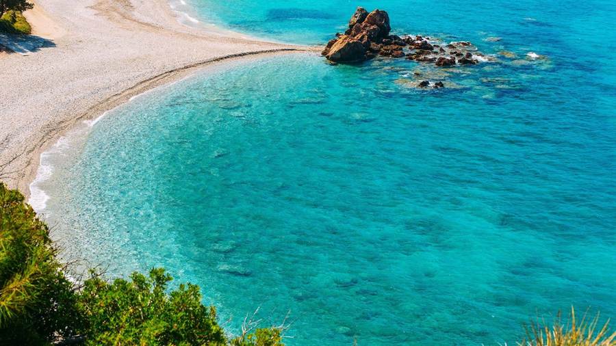
Samos lies south of Chios and north of Patmos and the Dodecanese archipelago. It forms a separate regional unit of the North Aegean region. A Samos boat trip runs in the eastern Aegean, close to Turkey.
Access to the island runs by sea and air. Samos International Airport provides seasonal flights to Europe, and the two main ferry terminals sit at Samos town and Karlovasi. Boat excursions start from the island harbours.
The sea season follows the island climate. Samos has a hot-summer Mediterranean climate, with mild, rainy winters and hot, dry summers. July is the hottest and driest month, followed by August.
Two boat formats appear in the current listings. One cruises the east coast and ends with a barbecue on a beach. The other sails to the islet of Samiopoula with a barbecue lunch.
- Location: Samos is a Greek island in the eastern Aegean Sea, off the coast of western Turkey.
- Region: The island forms a separate regional unit of the North Aegean region.
- Neighbours: Chios lies to the north, while Patmos and the Dodecanese lie to the south.
- Wildlife: Samos is home to the monk seal, flamingos, the golden jackal and the wild boar.
Each Samos boat trip on this page is set out by format, coast and stops, from the east coast beaches to the islet of Samiopoula.
Which Samos boat trip formats and land tours are on sale?
A Samos boat trip on sale today comes in two sea formats: an east coast cruise with a beachside barbecue and a boat tour with a barbecue lunch to Samiopoula. Three land formats complete the list of tours offered for the island.
The east coast Samos boat trip follows the shore of the island by boat. Its listing names a beachside barbecue, so the meal takes place on a beach rather than on deck.
The second Samos boat trip heads for Samiopoula, an islet off the south of Samos. Its title pairs the boat tour with a barbecue lunch as part of the outing.
On land, a private sightseeing tour covers Samos by road for a single party. The listing title names private sightseeing only and gives no fixed list of stops.
Two further land formats complete the list. An accompanied full-day island bus tour moves around Samos by coach, and a winery tour pairs an accompanied visit with a wine tasting. Other pages cover Samian wine.
- East coast cruise: A boat follows the east coast and stops for a barbecue on a beach.
- Samiopoula cruise: A boat tour sails to the islet of Samiopoula with a barbecue lunch.
- Private tour: A sightseeing tour by road serves a single private party.
- Bus and winery: A full-day bus tour and a winery tasting complete the land list.
Readers planning more sea days can compare the Patmos day trip, since Patmos lies south of Samos. The tour cards and availability boxes on this page list live dates for each format.
How large is the island seen on a Samos boat trip?
A Samos boat trip runs along an island of 477.395 square kilometres. Samos measures 43 kilometres in length and 13 kilometres in width. Two mountains, Ampelos and Kerkis, dominate its relief, and a narrow strait divides it from Anatolia.
The Mycale Strait, also known as the Samos Strait, separates the island from Anatolia. At its narrowest point it is only 1.6 kilometres wide, the narrowest gap between any Aegean island and Turkey.
The strait takes its name from Mount Mycale on the Turkish mainland. The Dilek Peninsula-Büyük Menderes Delta National Park, in the Kuşadası district of Aydın Province, lies along the strait.
Ampelos, known locally as Karvounis, is the larger massif and occupies the centre of the island, rising to 1,095 metres. Kerkis is smaller in area but taller, and its summit reaches 1,434 metres.
Both mountains continue the Mycale range of the Anatolian mainland. The island also holds large and fertile plains, and vineyards cover a great portion of it. A Samos boat trip shows these ridges from the water.
With 33,814 residents, Samos ranks 9th by population among the Greek islands. Since the 2019 reform, the island has consisted of two municipalities, East Samos and West Samos.
- Area: Samos covers 477.395 square kilometres.
- Length and width: The island runs 43 kilometres long and 13 kilometres wide.
- Highest point: The summit of Kerkis stands at 1,434 metres.
- Strait: The Mycale Strait measures 1.6 kilometres at its narrowest point.
A Samos boat trip along the north or east coast keeps these mountains in view, with the Turkish mainland across the strait to the east.
Which two main towns anchor a Samos boat trip on the island?
A Samos boat trip sets out from an island with two main towns and two main ferry terminals: Samos town, also called Vathy, in the north-east, and Karlovasi in the north-west. The EO62 national road links them along the northern coast.
Samos town is the capital of the regional unit and of East Samos. It carried the name Limin Vatheos before 1958, and the old name Vathy now refers to the hillside suburb of Ano Vathy.
The town was built in the middle of the 18th century as the port of Vathy. Its houses form an amphitheatre around the bay, and a wharf of more than 150 metres fronts the port.
The 2021 census counted just over 9,700 people in the port and Ano Vathy together. Landmarks include the churches of Agios Nikolaos and Agios Spiridon and a big lion statue on the central square.
Karlovasi sits on the north-west side of Samos and is the seat of West Samos. It is the commercial centre of the island, and its municipal unit counted 10,220 inhabitants in the 2021 census.
- Samos town: The capital spreads from the port of Vathy up to Ano Vathy on the hillside.
- Karlovasi: The School of Sciences of the University of the Aegean is based in the town.
- Sea link: Beyond a Samos boat trip, Karlovasi Port connects with Sığacık in Seferihisar, Turkey.
- Nearby sights: The waterfalls of Potami and the beaches of Mikro and Megalo Seitani lie near Karlovasi.
For a Samos boat trip, both towns hold the main ferry terminals of the island, while the excursions to Samiopoula leave from the southern ports.
What do Kokkari and Mount Kerkis add to a Samos boat trip?
A Samos boat trip gains two landmarks to look for from the water: Kokkari, a fishing harbour about 10 kilometres from the capital, and Mount Kerkis, a marble mountain with whitish exposed cliffs in the western part of the island.
Kokkari began as a fishing harbour and has developed into a tourist centre. It keeps a traditional face, with small houses and lanes full of flowers, and green mountains surround it.
The village sits on a small peninsula, with houses climbing to the top of a hill. A Samos boat trip shows its small harbour on one side and its pebble beach on the other.
Pebble beaches lie close to Kokkari, including Tsamadou, Tsambou and Lemonakia. Tsamadou takes its name from the Greek national hero Anastasios Tsamados. Streets and small paths connect nearby villages such as Platanakia and Valeodates.
Kerkis, called Kerketeus in antiquity, forms the bulk of the western part of Samos. Its highest peak, Vigla, is the second-highest peak in the East Aegean, after Fengari on Samothrace.
Kerkis belongs to the Natura 2000 network and shelters plants and animals, including endangered species. Small monasteries and caves sit on its slopes, and its name means roughly belonging to Circe.
- Kokkari: The former fishing harbour stands on a small peninsula with a pebble beach.
- Beaches: Tsamadou, Tsambou and Lemonakia are pebble beaches close to the village.
- Kerkis: The mountain is composed of marble, with whitish exposed cliffs.
- Protection: Kerkis is part of the Natura 2000 network of protected sites.
Kokkari near the capital and Kerkis in the west give a Samos boat trip two clear landmarks along the northern shore.
What is Samiopoula, the islet on the barbecue Samos boat trip?
A Samos boat trip with a barbecue lunch reaches Samiopoula, a Greek islet 0.85 kilometres off the south of Samos. The name means small Samos. The islet falls under the municipal unit of Pythagoreio and had five inhabitants in 2001.
The islet reached on this Samos boat trip measures about 2.15 kilometres in length and 0.7 kilometres in width. The terrain is mainly rocky, with sparse trees, wild bushes, shrubs and wildflowers.
Buildings on the islet are limited. They include the small parish churches of Agia Pelagia and of the Ascension of Christ, a small tavern, and a handful of small houses and shelters.
Psalida is the only beach on Samiopoula. It is quite small and can be crowded in peak summer, and it has white sand and turquoise water. Wild goats outnumber the human residents by far.
Sailing boats approach the islet through the small bay of Katsakas, which is sheltered from the prevailing north-westerly winds. Daily excursions reach Samiopoula in the tourist season from Pythagoreio and Ormos Marathokampou.
Basic services on the islet arrive from Samos. Electricity and telephone lines run through underwater cables, photovoltaic systems add extra power, and cisterns store rainwater through the winter.
- Distance: Samiopoula lies 0.85 kilometres off the south of Samos.
- Size: The islet measures about 2.15 kilometres long and 0.7 kilometres wide.
- Beach: Psalida is the only beach on the islet.
- Anchorage: Sailing boats enter through the small bay of Katsakas.
Readers comparing a Samos boat trip with other island sea days in the Aegean can also see the Kos boat trip page.
Where is Pythagoreio, the harbour town of a Samos boat trip?
A Samos boat trip to Samiopoula can start at Pythagoreio, the harbour town in the south-east of the island. The town gave its modern name to the Pythagoreion, the archaeological site of the ancient town of Samos, listed by UNESCO in 1992.
Pythagoreio ranks among the main towns of Samos besides the capital, Vathy. It sits in the south-east, while Karlovasi lies in the north-west and Marathokampos in the south-west.
The town carried the name Tigani until 1955. Pythagoreio is also a municipal unit of East Samos, alongside Vathy, and the islet of Samiopoula falls under its local jurisdiction.
The archaeological site lies within the area of the modern town. Fortifications from the 5th and 4th centuries BC surround the ancient town, and excavations have uncovered its street plan and a sewage system.
Roman remains stand on the site as well, including an agora, public baths, a stadium and town houses. A museum in the modern centre displays over 3000 objects from the ancient city.
The settlement began around the 16th century BC, when the Minoans colonised Samos. The town remained an influential trading centre until the 3rd century AD. Separate pages cover the Heraion and the Tunnel of Eupalinos.
- Position: Pythagoreio sits in the south-east and serves as a port for the Samos boat trip to Samiopoula.
- Former name: The town was called Tigani until 1955.
- World Heritage: The Pythagoreion and the Heraion of Samos joined the UNESCO list in 1992.
- Museum: The town museum displays objects from the 4th millennium BC to the 7th century AD.
For a Samos boat trip south to Samiopoula, Pythagoreio is one of the two ports for daily excursions, together with Ormos Marathokampou.
Which sanctuary of Hera lies on the coast a Samos boat trip passes?
A Samos boat trip along the shore passes the coast near the Heraion of Samos, a large sanctuary of the goddess Hera. It lay 6 km southwest of the ancient city, in the marshy basin of the Imbrasos river near the sea.
Cult activity at the site reaches back to c. 1700 BC. The area held a settlement in the Early Bronze Age. The first temple of Hera rose there in the eighth century BC.
Local tradition held that Hera was born under a lygos tree. At the annual Toneia festival, the cult image was bound with lygos branches and carried down to the sea for washing.
Monumental building began in the late seventh century BC. That phase produced the Hekatompedos II temple, the South Stoa, two colossal kouroi and the Sacred Way, which linked the sanctuary to the city by land.
Before the Sacred Way, the sanctuary was reached by sea, and its main entrance stood on the southeastern side. That old approach lay on the coast a Samos boat trip follows today.
- Altar: The first altar, built in the ninth century BC, was rebuilt seven times.
- End of worship: Worship of Hera ceased in AD 391 under the Theodosian edicts.
- First Westerner: Joseph Pitton de Tournefort visited Samos in 1704 on a commission from Louis XIV.
- World Heritage: UNESCO listed the temple ruins in 1992 for their architecture and Samian naval power.
Herodotus counted the temple among the three engineering feats of Samos. The other two, the Tunnel of Eupalinos and the harbour mole, belonged to the ancient city on the coast of a Samos boat trip.
Which architects built the temple of Hera near the route of a Samos boat trip?
A Samos boat trip near the Heraion passes the site of the Rhoikos temple, the work of the architects Rhoikos and Theodoros. It measured about 100 metres long and 50 metres wide and was the first of the massive Ionian temples.
Work on the Rhoikos temple began between 600 and 570 BC and ended around 560 BC. It stood for only about a decade. Later research ties its fall around 550 BC to subsidence under the foundations.
The Great Temple, or Polycrates Temple, rose about 40 metres further west. It measured 55.2 by 108.6 metres, one of the largest floor plans of any Greek temple, and was never wholly finished.
In Byzantine times the temple served as a quarry. One surviving column shaft seems to have served as a navigation point for ships on the waters a Samos boat trip crosses.
The Kouros of Samos, about three times life size, stood near the sanctuary entrance around 580 BC. An inscription on its thigh names Isches son of Rhesus as the dedicator.
- Cheramyes group: One of its korai is now in the Louvre as the Hera of Samos.
- Boat votives: About 40 carved wooden objects from the site are read as abstract depictions of boats.
- Ship’s hull: Waterlogged soil preserved a full-size hull of about 20 metres from the late seventh century BC.
- Earliest writing: The Hazael horse frontlet bears the earliest alphabetic writing found anywhere in Greece.
Votives from Egypt and the Near East trace Samian trade across the sea of a Samos boat trip. A Delos tour reaches the key religious centre of the Aegean.
Who built the Tunnel of Eupalinos behind the coast of a Samos boat trip?
A Samos boat trip off the ancient capital passes the city once fed by the Tunnel of Eupalinos. The engineer Eupalinos from Megara directed two groups who dug it through Mount Kastro in the mid-6th century BC as an aqueduct.
The tunnel runs 1,036 metres through Mount Kastro. The ancient city on the coast of a Samos boat trip had outgrown its wells and cisterns. The main source of fresh water lay beyond the mountain.
The aqueduct also served defence. Running underground, it stayed hidden from any enemy bent on cutting the water supply. Fifteen stone pillars held up the roof of the reservoir that concealed the spring.
The date remains unclear. Herodotus mentions the tunnel in his account of Polycrates, who ruled c. 540 to 522 BC, but he does not say that the tyrant ordered the work.
Aideen Carty links the project to the regime that overthrew the Geomori in the early sixth century BC. That regime granted citizenship to a large number of Megarians, possibly including Eupalinos.
- Builder’s name: Herodotus calls him a Megarian named Eupalinus, son of Naustrophus.
- Working life: The aqueduct carried water for 1100 years before it began to silt up.
- Later refuge: In the seventh century AD the south end served as a defensive refuge.
- First name: Eupalinos counts as the first hydraulic engineer in history whose name has been passed down.
The tunnel shares a UNESCO listing with the Heraion of Samos, and a Samos boat trip passes the shore between the ancient city and the sanctuary.
How did two teams meet inside the hill seen from a Samos boat trip?
A Samos boat trip near the old harbour passes below Mount Kastro, where two teams met underground. Eupalinos set a mountain line over the summit, had the tunnel dug from both ends at once and joined the halves at a dog-leg.
Only two diggers fitted at the tunnel face at a time. To speed the work, crews cut from both ends together. H. J. Kienast calculates that the whole tunnel took at least eight years.
After 273 metres from the north end, water, weak rock and mud forced a turn to the west. Eupalinos planned this diversion as an isosceles triangle with angles of 22.5, 45 and 22.5 degrees.
The south cut ran straight but stopped after 390 metres. Eupalinos then turned both tunnels, widening the catching width by 17 metres, so the halves meet at nearly a right angle.
In the north tunnel he raised the roof by 2.5 metres. In the south tunnel he lowered the floor by 0.6 metres. The halves met deep under the hill a Samos boat trip passes.
- Distance unit: Letters on the west wall mark a regular interval of 20.59 metres.
- Angle unit: Directions were set out in steps of 7.5 degrees, one twelfth of a right angle.
- Water channel: A separate channel below the tunnel deepens from 4 metres to 8.5 metres.
- Pipe: Terracotta sections 72 centimetres long, joined with lime mortar, carried the water.
Hermann J. Kienast carried out a full survey with detailed geodetic measurements. Portions of the tunnel are open to the public, inland from the coast of a Samos boat trip.
Which tyrant ruled the sea lanes of a Samos boat trip?
A Samos boat trip crosses waters once ruled by Polycrates, son of Aeaces, the tyrant of Samos from the 540s BC to 522 BC. He recruited an army of 1,000 archers and assembled a navy of 100 penteconters.
Herodotus reports that Polycrates took power with his brothers Pantagnotus and Syloson and only fifteen men. The coup seems to date to 540 BC or slightly earlier. He soon had Pantagnotus killed and exiled Syloson.
Herodotus calls Polycrates the first Greek ruler to grasp the importance of sea power. Thucydides lists him among the thalassocracies of the Aegean. He set out to rule all the Greek islands and Ionian cities.
Polycrates also commissioned the Samaina, a decked ship with two banks of oars. It was apparently a merchant galley for the rapid transport of goods or troops across the waters of a Samos boat trip.
Herodotus adds a fleet of 40 triremes sent to the Persian king Cambyses. The crews turned back, beat Polycrates at sea but failed to take the island. Sparta and Corinth then besieged Samos for 40 days.
- Ally: Polycrates formed an alliance with King Amasis of Egypt.
- Court: He was a patron of the poets Anacreon and Ibycus.
- Ring: Herodotus tells how a fish returned the jewelled ring Polycrates had thrown into the sea.
- Death: The satrap Oroetes invited him to Magnesia around 522 BC, where he was assassinated.
His plan reached across the Greek islands of the Aegean. A Naxos tour visits another of those islands, beyond the waters of a Samos boat trip.
What battle took place across the strait from a Samos boat trip?
A Samos boat trip faces Mount Mycale, on the coast of Ionia opposite the island. There, on 27 or 28 August 479 BC, an alliance of Greek city-states defeated the Persian Empire of Xerxes and burned the Persian fleet.
In July a Samian delegation under Hegesistratos reached the Greek fleet at Delos. The Spartan king Leotychides took the name, meaning Army Leader, as a good omen and sailed for Samos with 110 ships.
The Persians withdrew from Samos across the channel a Samos boat trip faces and beached their ships below Mycale. Behind a palisade of stakes they waited for a siege, at a spot later called Skolopoeis.
The Greeks camped at Kalamoi, beside the Heraion of Samos, on the shore a Samos boat trip passes. Their marines then landed out of sight of the Persian camp on the mainland.
The Greek right broke the Persian shield wall by shoving. The disarmed Samians joined the Greeks, and other Ionian contingents turned on the Persians. The Greeks burned the Persian fleet after taking the loot ashore.
- Commanders lost: The Persian admiral Mardontes and general Tigranes both died.
- Captives freed: The Samians freed 500 Athenian captives during the Persian retreat.
- Narrow channel: The channel was just about 1 kilometre wide at its thinnest point.
- Beach battle: Richard Evans calls Mycale the first battle in recorded history fought on a beach.
Together with Plataea, Mycale ended the second Persian invasion of Greece. Samos then joined the Hellenic alliance, and its Persian garrison was eliminated.
Which rulers held the island of a Samos boat trip from Byzantine times to 1913?
A Samos boat trip follows the shores of an island that passed from Byzantine rule to the Genoese Giustiniani family and then to the Ottomans. It became the autonomous Principality of Samos in 1834 and joined Greece in March 1913.
As part of the Byzantine Empire, Samos belonged to the theme that bore its name. Tzachas ruled the island between 1081 and 1091. The Genoese Giustiniani family held it from 1346.
Ottoman rule began in 1475 or c. 1479/80, when piracy and plague had left the island practically abandoned. It stayed desolate for almost a full century before the authorities moved to repopulate it.
The population recovered to about 10,000 in the 17th century, concentrated in the interior. Dense settlement of the coast a Samos boat trip passes began only in the mid-18th century.
From 1834 the Principality of Samos was an autonomous tributary state of the Ottoman Empire. A Christian prince of Greek descent, nominated by the Sublime Porte, governed with a senate of 4 members.
- Russian interlude: The island came under Russian control in 1771 to 1774, during the Russo-Turkish War.
- Assembly: A chamber of 36 deputies held legislative power, presided over by the Greek Orthodox Metropolitan.
- Prince: Ion Ghica, a prime minister of Romania, also served as prince of Samos.
- Enosis: On 24 November 1912 the island’s parliament declared union with Greece.
Themistoklis Sofoulis landed with exiled Samians during the First Balkan War. Union took effect on 2 March 1913, and the island of a Samos boat trip was securely in Greek hands by 16 March.
Who was Pythagoras, born on the island of a Samos boat trip?
A Samos boat trip circles the island where Pythagoras was born around 570 BC. He was the son of Mnesarchus. He left Samos at about forty years of age, settled in Croton in southern Italy and founded a school there.
Herodotus and Isocrates name Mnesarchus as his father. Mnesarchus is said to have been a gem-engraver or a wealthy merchant. Apollonius of Tyana names his mother Pythaïs, a descendant of Ancaeus, the mythical founder of Samos.
During his youth, Samos was a thriving cultural hub and a major centre of trade in the Aegean. Traders brought goods from the Near East to the island that a Samos boat trip now follows.
His early life coincided with the flowering of early Ionian natural philosophy. He was a contemporary of Anaximander, Anaximenes and the historian Hecataeus. All three lived in Miletus, across the sea from Samos.
Porphyry repeats an account from Antiphon about a school on Samos called the semicircle. Samians debated matters of public concern there. Pythagoras is also said to have studied in private in a secret cave.
- Children: The Suda names four children, called Telauges, Mnesarchus, Myia and Arignote.
- Brothers: Diogenes Laertius records two brothers, Eunomus the elder and Tyrrhenus the second.
- Writings: No authentic writings by Pythagoras have survived.
- Biographies: Three late antique biographies by Diogenes Laërtius, Porphyry and Iamblichus form the major sources on his life.
Accounts of his death disagree. Dicaearchus describes an escape to Metapontum and a final refuge in the temple of the Muses. His story begins on the island that a Samos boat trip explores.
What did Pythagoras teach, as background for a Samos boat trip?
A Samos boat trip leaves from the home island of a teacher whose best-attested doctrine was metempsychosis. He held that every soul is immortal and enters a new body after death. His followers formed a communal school at Croton with strict rules.
Heraclides Ponticus reported that Pythagoras remembered four previous lives. The account lists Aethalides, son of Hermes, then Euphorbus from the Trojan War, then the philosopher Hermotimus, and finally Pyrrhus, a fisherman from Delos.
Another belief attributed to him was the harmony of the spheres. Planets and stars move by mathematical equations that match musical notes. Porphyry wrote that Pythagoras called the seven Muses the seven planets singing together.
The school at Croton resembled a monastery. Members shared all possessions in common and ate meals together after the manner of the Spartans. One maxim ran: all things in common among friends.
Two groups existed within early Pythagoreanism. The mathematikoi, or learners, formed a more rationalist and scientific faction. The akousmatikoi, or listeners, are identified with mysticism, numerology and religious teachings.
- Diet: He reportedly forbade fava beans and the meat of non-sacrificial animals such as fish and poultry.
- Tetractys: Later Pythagoreans credited him with the tetractys, a triangular figure of four rows that add up to ten.
- Women: Iamblichus lists 235 famous Pythagoreans, and seventeen of them are women.
- Theorem: Pythagoras has received credit for the Pythagorean theorem since at least the first century BC, a claim Walter Burkert rejects.
Plato’s dialogues, especially the Timaeus, show Pythagorean ideas. Until the 1840s, English speakers called vegetarians Pythagoreans. These ideas trace back to a teacher from the island a Samos boat trip explores.
How do Aristarchus and the first sun-centred model link to a Samos boat trip?
A Samos boat trip sets out from the birthplace of Aristarchus, born around 310 BC. He presented the first known heliocentric model. It placed the Sun at the centre of the universe, with the Earth revolving around it once a year.
Aristarchus lived from about 310 to about 230 BC. He is thought to have moved to Alexandria and studied under Strato of Lampsacus. Strato later became head of the Peripatetic school.
According to Ptolemy, Aristarchus observed the summer solstice of 280 BC. Vitruvius writes that he built two sundials. One was a flat disc, and the other was hemispherical.
He estimated that the Sun was 7 times larger than Earth. The true figure is 109 times in diameter. The Sun’s greater size led him to treat it as the natural centre of the universe.
At half moon, he put the angle between the Sun and the Moon at 87 degrees. From this he concluded that the Sun lay between 18 and 20 times farther from Earth than the Moon.
- Lost text: The original text is lost, but Archimedes describes the heliocentric model in The Sand Reckoner.
- Stars: Aristarchus held that the stars were other suns, far enough away that no parallax showed.
- Surviving work: His only known work, On the Sizes and Distances of the Sun and Moon, rests on a geocentric worldview.
- Legacy: The lunar crater Aristarchus, the minor planet 3999 Aristarchus and the telescope Aristarchos carry his name.
Copernicus later revived the heliocentric theory. He knew that Aristarchus had proposed a moving Earth. A Samos boat trip departs from the island of his birth.
Who was Epicurus, the philosopher born on the island of a Samos boat trip?
A Samos boat trip starts on the island where Epicurus was born in February 341 BC, in the Athenian settlement. His parents, Neocles and Chaerestrate, were Athenian-born. He later founded Epicureanism and taught at The Garden, his school in Athens.
He grew up during the final years of the Greek Classical Period. He studied under a Samian Platonist named Pamphilus, reportedly for about four years. His surviving writings point to extensive training in rhetoric.
After the death of Alexander the Great, Perdiccas expelled the Athenian settlers from the island a Samos boat trip explores. They went to Colophon. Epicurus joined his family there after his military service.
At Colophon he studied under Nausiphanes, a follower of Democritus. Around 311 BC, at about thirty, he began teaching in Mytilene. His teachings caused strife there, and he was forced to leave.
He then founded a school in Lampsacus. Around 306 BC he returned to Athens and founded The Garden, named for a garden he owned. He remained in Athens until his death.
- Happiness: He taught that managing desires, removing unnecessary fears, friendship and virtuous living lead to a pleasant life.
- Gods: He held that the gods exist but have no involvement in human affairs.
- Atoms: Like Democritus, he traced all natural events to tiny, invisible atoms moving in empty space.
- Swerve: His atomic swerve lets atoms deviate from their expected course and so permits free will.
Epicurus died in 270 BC, aged seventy-two. Colophon, his family’s place of exile, lay on the coast of what is now Turkey. That coast also features on the Kos to Bodrum day trip.
How did Samos join the Greek War of Independence, as told on a Samos boat trip?
A Samos boat trip explores an island that joined the Greek War of Independence on 18 April 1821. Lykourgos Logothetis led the uprising with the Karmanioloi. A revolutionary government with its own constitution then took charge of the island.
Lykourgos Logothetis was born Georgios Paplomatas on 10 February 1772. When the war broke out, he returned to Samos. The islanders quickly elected him their political and military leader.
Logothetis founded the Military-Political System of Samos and led it until 1833. The exception was 1828 to 1830, when Samos was administered as part of the nascent Greek state.
The Samians repulsed three Ottoman attempts to recapture the island, in summer 1821, in July 1824 and in summer 1826. Greek naval victories off Samos and at Gerontas averted the 1824 threat.
Logothetis also headed the Greek forces in the unsuccessful campaign to Chios in 1822. The campaign led to the massacre and destruction of Chios. His actions drew heavy criticism.
- Party name: The Karmanioloi took their name from the French Revolutionary song Carmagnole.
- Kapodistrias: In 1828 Samos was formally incorporated into the Hellenic State under Governor Ioannis Kapodistrias.
- London Protocol: The London Protocol of 1830 excluded Samos from the borders of the independent Greek state.
- Exile: In 1834 an Ottoman fleet enforced the decision of the Great Powers, and the revolutionary leaders fled to settle near Chalkis.
Logothetis died in 1850. His tower on the island of a Samos boat trip was damaged in the earthquake of 30 October 2020.
What wine and grape belong to the island of a Samos boat trip?
A Samos boat trip visits an island known in ancient times for its vineyards and wine production. The Muscat grape is the main crop used for wine on Samos. Samian wine was well known in antiquity and is still produced there.
Vineyards cover a great portion of the island a Samos boat trip explores. Muscat wine is made from them. Other main farm products include honey, olives, olive oil, citrus fruit, dried figs and almonds.
Muscat Blanc à Petits Grains is a white wine grape of Greek origin. Its name comes from its small berries and tight clusters. In Greece it is known as White Muscat, or Aspro Moschato.
In Greece, this grape matters above all on Samos and near Patras. On Samos it produces a Vin Doux Naturel, aromatic dry white wines and a Liastos, or straw wine.
The quality wines come from vineyards between 500 and 1000 metres above sea level. Samos is reinventing itself as a winemaking region. New independent producers focus more on dry, or even sparkling, styles.
- Antiquity: In classical antiquity, Samos was renowned for its Samian wines and its red pottery, which the Romans called Samian ware.
- Ancient grape: Ampelographers identify the variety with the Anathelicon moschaton grape of the Ancient Greeks.
- Exports: Samian wine also leaves the island under other appellations.
- Appellation: Samos appears among the main wine growing regions of the Aegean Islands, with Lemnos, Paros, Rhodes and Santorini.
Muscat of Samos sits on the island’s list of local specialities. Readers comparing island wines across the Aegean can also look at the Mykonos wine tour.
What do travellers ask about a Samos boat trip?
A Samos boat trip prompts four questions from travellers. They ask about the barbecue, the route to Samiopoula, the land tours on sale and the famous people born on the island. The answers below draw on tour listings and on history.
Does a Samos boat trip include a barbecue?
Yes. Both boat trips in the listing include a barbecue. The east coast trip has a beachside barbecue, and the trip to Samiopoula has a barbecue lunch. Both titles name the BBQ, so the meal forms part of each Samos boat trip on sale.
Does a Samos boat trip reach Samiopoula?
Yes. One listed Samos boat trip carries the title Boat Tour with BBQ Lunch to Samiopoula. The barbecue lunch is part of that trip. The other boat trip in the listing follows the east coast of Samos instead, with a beachside barbecue.
Are land tours sold alongside a Samos boat trip?
Yes. The listing that carries each Samos boat trip also sells three land tours. One is a private sightseeing tour of Samos. Another is an island bus tour. The third is a winery tour with a wine tasting experience. Together with the two boat trips, the listing holds five options.
Which famous people came from the island of a Samos boat trip?
Three ancient thinkers came from Samos. Pythagoras, born around 570 BC, founded Pythagoreanism. Aristarchus, born around 310 BC, presented the first known heliocentric model. Epicurus, born in 341 BC, founded the philosophical school of Epicureanism. Each Samos boat trip leaves from their home island.