
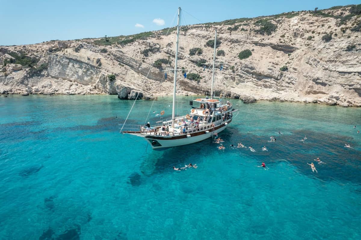
A Kos boat trip takes visitors by sea from Kos to nearby islands such as Kalymnos, Pserimos, Plati and Nisyros. The trip is one of the Greece Tours on Greece Ville.
This post covers what the trip is, the harbours it leaves from, the island’s history at sea, Kalymnos, Pserimos, Plati, the Nisyros volcano, the crossing to Bodrum and the life in the sea.
The distances between the islands, the sea temperature, the beaches, the 2017 earthquake, the best months and common questions come last. The sections include Kos boat trips that can be booked online.
What is a Kos boat trip?
A Kos boat trip sets out from an island shaped like a long sickle with a thick handle. The island runs from north-east to south-west. Its north-east end faces the Gulf of Kos and the coast of Asia Minor.
The gulf is named after Kos town, the capital, at its inner end. It measures about 5.8 km across, from Cape Ammoudia to Cape Louros. It covers about 7 square kilometres of water.
On a Kos boat trip, the gulf holds the sea entrance to Kos town. Its shores carry the harbour, the Neratzia castle, a yacht marina and beach resorts. Opposite lies the Gulf of Gökova, Kerme Körfezi in Turkish.
Public boat links across the gulf also reach Turgutreis, Samos, Tilos and Symi. The waters between the two gulfs are a popular sailing area.
Pliny the Elder called Kos the best known island in its gulf. He wrote that writers gave it a circumference of 100 miles. Strabo put its size at about five hundred and fifty stadia.
The Kos regional unit covers Kos, Nisyros and smaller islands, and Kos town is its seat. It was created in 2011 from part of the former Dodecanese Prefecture.
- Power: Since 1994, an oil-fired power station near Mastichari has served the island.
- Undersea cable: A cable links this 100 MW plant with Tilos, Nisyros, Kalymnos and Pserimos.
- Cape Laceter: Strabo placed this cape on the south coast, sixty stadia from Nisyros.
- Greek name: Greeks call the opposite Turkish gulf Kerameikos Kolpos.
A Kos boat trip therefore crosses waters shared by Greek islands and the Turkish coast.


Which harbours does a Kos boat trip leave from?
A Kos boat trip from Kos town leaves a harbour for shipping, fishing, leisure boats, tourism and cargo. It also holds a small naval base. Its entrance faces north-east, and boats reach the inner basin through a funnel-shaped gap.
The inner basin, walled with stone and concrete quays, holds the smaller boats. With its entrance, it covers about 9 hectares. Its edge runs for about 1.6 km. It measures up to about 330 m long and 250 m wide.
The funnel entrance is up to about 90 m wide. Its narrowest built gap is about 70 m. Ferries berth near the entrance with their sterns to the quay. That sometimes narrows the way in.
On a Kos boat trip, outer moles and piers take seagoing ships and act as breakwaters. The cargo area in front of Neratzia covers about 1.5 hectares. Its pier can carry heavy lorries.
Palm trees line the inner quays, which are open to walkers and cyclists. At the fishermen’s berths, fresh fish and seafood are sold straight to buyers.
Kardamena harbour sits beside the village’s central square and serves sea links with Nisyros and Tilos. The town hall of Kardamena holds a permanent show on the area’s sea tradition.
- Kefalos: The harbour on Kefalos Bay mainly serves as a fishing shelter, with fish tavernas around it.
- Limnionas: This small cove, about 5 km from Kefalos on the north side, has a little harbour.
- Mastichari: It is the port settlement of the village of Antimachia.
- Kamari: It stands 3 m above sea level and lies 3 km from Kefalos.
Kamari was first counted as a separate settlement in the 1951 census. On a Kos boat trip, the west-end harbours of Kamari and Kefalos lie close together.
How did the sea shape the history of a Kos boat trip?
A Kos boat trip sails past a harbour with a 4,000-year past. Between 2000 and 1600 BC, a Bronze Age settlement called Seraglio grew on a low hill near it. It covered at least 7.5 hectares. It ranked among the leading Minoan settlements outside Crete.
Stone blades from the Aspri Petra cave near Kefalos were made of obsidian. It came from Gyali, an islet near Nisyros. In Homer’s Catalogue of Ships, Kos and its neighbours sent 30 ships.
From 411 to 407 BC, Kos was the chief Athenian station in the south-eastern Aegean. Strabo wrote that Kos town was a pleasing sight when sailing in from the high sea.
On a Kos boat trip, the sea battle of Cos is part of the story. There, Antigonus II beat the fleet of Ptolemy II, although he was outnumbered. That battle and the Chremonidean War ended absolute Ptolemaic rule of the Aegean.
Under Rome, Kos joined the province of Asia and became a port of the empire. From the 11th century, Byzantine emperors handed Kos to Genoese captains. Their private fleets controlled the sea for the emperors.
In return, the Genoese clans won rights over raw materials, trade and customs duties. Builders of Neratzia castle reused carved pieces from the ancient city and the Asklepieion.
- Genoese admiral: From 1272, Kos passed through Giovanni De lo Cavo, admiral of Constantinople.
- Loggia Mosque: The Ottoman admiral Gazi Hasan Pasha paid for it beside the Plane Tree of Hippocrates.
- Italian era: Florestano Di Fausto designed the Palazzo del Governo, built from 1927 to 1929.
- 1943: The town’s harbour was sheltered but shallow, with little equipment and only one berth.
On 1 October 1943, a German convoy slipped past British destroyers that lacked fuel to stop it. The British command on Kos expected it to head for Rhodes.
What does a Kos boat trip see on Kalymnos?
A Kos boat trip reaches Kalymnos, an island of treeless mountains. Profitis Ilias rises to 760 m and Kyra Psili, in the south-east, to 700 m. The coast of Asia Minor, now Turkey, lies about 14 miles to the east.
Pothia, the main port, climbs a rocky hill like an amphitheatre, topped by the Castle of Chora. In the early 1930s, two large Fascist-style buildings rose on its seafront. They were the Eparcheio and the Town Hall.
On a Kos boat trip, sponge diving is the story Kalymnos tells. The Naval Museum, founded in 1994, fills four rooms. Its displays include diving stones, old suits called skafandra and the air pumps that fed them.
A private Museum of Sea Finds shows the suits Kalymnian divers used from 1872 to today. It also keeps about 2,000 photographs of the sponge divers’ history.
Early suits were deadly. In 1867, suppliers reported that 10 of 24 divers using 12 suits died in one season. In 1868, of 30 suited divers at Kalymnos, two died and two were paralysed.
That year, three divers shared each suit. The shorter daily diving time lowered the death rate. In 1995, a fisherman pulled the bronze Lady of Kalymnos from the sea in his nets.
- Diapori: The narrow strait between Kalymnos and Leros also goes by this name.
- Argos: Diodorus wrote that four of Agamemnon’s ships wrecked off Kalymnos and their crews founded this village.
- Easter: Kalymnians set off dynamite blasts that can be heard as far as Kos.
- War: German forces held Kalymnos from 1943 to 1945.
Telendos, the islet off the west coast, stretches about 4 km from east to west. Its plateau, Rachi, reaches 460 m, and 66 people lived there in 2021.
Why does a Kos boat trip stop at Pserimos?
A Kos boat trip stops at Pserimos, a car-free island of 14.8 square kilometres. It is the largest of the small islands that belong to Kalymnos. It lies 6 miles from Pothia. The 2011 census counted 80 residents.
The channel between Pserimos and Kos, the Kapari channel, is about 1.7 miles wide. A shoal only about 2.5 m deep lies mid-channel, 0.6 miles from the shore.
The island’s northern tip is Akra Vasiliki and its southern tip is Akra Roussa. Vasiliki bay opens on the east side between them. Akra Koraki, the north-west tip, lies about 2 miles north of Pserimos bay.
On a Kos boat trip, a small Panagia chapel stands by the little harbour. A cave is listed among the island’s sights. Low hills and small valleys full of olive trees cover the land.
Homer’s Catalogue of Ships counts Pserimos among the Kalydnai islands around Kalymnos. Pliny the Elder named it Pserema, one of the islands of the Ceramic Gulf. In 1888, W. R. Paton saw an inscription naming Psērimos in the village church.
The inscription is lost today. It listed officials of Kos, such as monarchs, a gerephoros and hieropoioi. Those titles show that Pserimos depended on Kos in the 3rd century AD.
- Recognised: Pserimos has been a recognised settlement since 1948, when the Dodecanese joined Greece.
- Cape Sfyri: Pserimos bay lies about 3.5 to 5.5 stadia north-north-west of this cape.
- Vasiliki islet: A rock of 0.0026 square kilometres lies 750 m north-east of Pserimos.
- Gyalo: This tiny rock of 0.0004 square kilometres sits just metres off the south coast.
Krevatio, also called the Erinyes, lies a short way north-west of Gyalo. Boats take care around these rocks on a Kos boat trip.
What is Plati island on a Kos boat trip?
A Kos boat trip calls at Plati, also called Platy, a small islet near Pserimos. It lies about six tenths of a mile south-west of Akra Koraki. Plati was a listed settlement in 2001, but the 2021 census found no residents.
Nekrothiki, a rock of just 0.01 square kilometres, is the northern continuation of Plati. It lies west of Cape Korakia on Pserimos. On a Kos boat trip, Plati and Nekrothiki mark the waters west of Pserimos.
Agia Kyriaki, an islet of 0.147 square kilometres, lies off the west coast of Kalymnos, south of Telendos. It takes its name from the monastery of Saint Kyriaki on the islet.
Further north, Pitta is an uninhabited rock islet of 0.024 square kilometres. It lies 9 km north-north-east of Kalymnos and 2 km north-west of Kalolimnos.
A Greek film comedy, Loufa kai Parallagi: Seirines sto Aigaio, is set on Pitta. It was actually filmed on Fonias islet off Evia. The name Kalolimnos is thought to come from the calm water in its lee, still like a lake.
Dangerous reefs and rocks line the south coast of Kalolimnos and block a safe approach by boat. The rock islet of Plevro lies 0.3 miles off that coast. Kalolimnos is steep and rocky, with wild goats.
- Eagles: Kalolimnos hosts species of global concern, such as the white-tailed eagle.
- Imia: The two Imia rock islets lie 5 km east of Kalolimnos.
- Land area: The Municipality of Kalymnos, with all its islets, covers 134.544 square kilometres.
- Kalavros: It covers 0.296 square kilometres and had no residents in 2011.
A Kos boat trip that stops at Plati sees one small part of this scattered group of islets.
Which volcano does a Kos boat trip reach on Nisyros?
A Kos boat trip can reach Nisyros and its main crater, Stefanos. The crater is about 300 m across and 25 m deep. It is described as the largest hydrothermal crater in the world. It is one of five small explosion craters on the caldera floor.
The floor of the Lakki and Rammos depression lies about 100 m above sea level. Two dacite domes, St. Elias and Nifios, form its west wall. St. John mountain rises on its east side.
Alexandros, an explosive vent, sits on the south-east edge of the St. Elias dome, just beyond Stefanos. The 1871 eruption came with earthquakes, loud blasts and red and yellow flames.
On a Kos boat trip, the crater floor shows the marks of later blasts. Ash and small stones from 1871 covered Rammos and destroyed its fruit gardens. A three-day eruption in 1873 opened a crater 6 to 7 m wide.
In 1873, hot salty water overflowed the crater. It turned the floors of Lakki and Rammos into a lake. The strong 1888 eruption threw out a column of material at least 25 m wide. It also threw out mud and steam.
Nisyros was one of the first volcanoes where scientists measured carbon dioxide seeping from the soil. Nine zones of gas release on the caldera floor follow its cracks and craters.
- 1956: Fumaroles were seen along the west and south sides of Rammos.
- Plinian eruptions: Two eruption phases sent columns of ash 15 to 20 km into the sky.
- Strongyli: This volcanic islet north of Nisyros rises 125 m from a seabed 600 to 650 m deep.
- Avyssos: A sunken caldera of 3 by 4 km lies 600 to 700 m deep, north-east of Strongyli.
Avyssos is thought to be the source of the great eruption that laid down the ignimbrite of Kos. That Kos Plateau Tuff eruption rates 7 on the Volcanic Explosivity Index, with 110 cubic km of material.
Can a Kos boat trip cross to Bodrum?
A Kos boat trip can cross to Bodrum, home of the Knights’ Castle of St Peter. A papal decree of 1409 promised its builders a place in heaven. For over a century, it ranked second among the Knights’ castles and sheltered Christians in Asia Minor.
Fourteen cisterns cut into the rock under the castle collected rainwater. In 1482, Prince Cem Sultan sheltered there after his revolt against his brother failed.
The castle became a prison in 1895. A French warship’s shells destroyed its minaret in 1915. It was rebuilt in its original shape in 1997. An Italian garrison left in 1921, and the castle then stood empty for 40 years.
On a Kos boat trip, Bodrum shows where Halicarnassus stood. In 1846, Lord Canning won permission to remove twelve marble reliefs of Greeks fighting Amazons from the castle.
Halicarnassus kept its kings long after other Greek cities dropped theirs. While its Ionian neighbours rebelled against Persia, it stayed loyal. One linguist links the end of its name to a Luwian word meaning fortress.
Mausolus’s workmen used sand dredged from the harbour to build breakwaters before its channel. The Mausoleum had thirty-six Ionic columns, topped by a pyramid of 24 steps. The city never fully recovered from Alexander’s siege.
- Musgebi: More than forty Mycenaean burial places were found at Musgebi, now Ortakent, near Bodrum.
- Passport: Non-EU visitors need a passport issued within the previous 10 years to enter the Schengen area.
- Entry/Exit System: It replaces passport stamps and detects travellers who overstay.
- ETIAS: This EU travel permit covers visa-free travellers visiting 30 European countries for short stays.
EU citizens coming back from Bodrum need a travel document valid on the day of travel.
What lives in the sea on a Kos boat trip?
A Kos boat trip crosses waters where damselfish lead the fish counts. At Kalymnos, damselfish made up 17.43% of fish counted, ahead of the alien marbled spinefoot at 10.63%. At Nisyros, the damselfish Chromis chromis scored 21.32% in diver counts.
At Nisyros, the alien dusky and marbled spinefoot rabbitfish each scored 8.06%. Divers found large numbers of young ornate wrasse there. That fish signals the warming of the Mediterranean.
A diving study found the south and east Aegean hit hardest by non-native fish. Mediterranean lionfish come mainly from the Red Sea, in separate waves. Off Rhodes, fish made up 94.7% of their prey by weight.
The Indo-Pacific sea urchin Diadema setosum turned up at 21 of 34 dive stations across 16 Dodecanese islands. On a Kos boat trip, dense patches live at Kalymnos and Pserimos. In seven islands with dense patches, they averaged 2.5 animals per square metre.
Where the urchin was dense, it was the only sea urchin present. The native Arbacia lixula and Paracentrotus lividus were missing. Diadema setosum invaded the Mediterranean in 2006 and lives for about 3.5 years.
- Monk seals: An EU LIFE project named Kalymnos and Karpathos among seven monk seal hot spots.
- 1993: Greece held 200 to 250 monk seals, 90% of the European population.
- Threats: In 29 dead monk seals, deliberate killing caused 44% of adult deaths.
- Turtles: About 18% of loggerhead turtle nesting in Greece takes place around the Aegean.
Net entanglement killed 56% of the younger seals in that study.
How far apart are the islands of a Kos boat trip?
A Kos boat trip crosses short gaps between islands, but deep water lies beneath. South of Kos, the seabed drops into basins 550 to 630 m deep. Gyali, a volcanic islet, sits between Kos and Nisyros.
Gyali covers 4.558 km² and measures up to 4 km across, narrowing to 500 m in places. It rises to 180 m above the sea.
Its volcano has a partly sunken caldera, with its floor about 300 m below the sea. An underwater rise about 400 m deep, between Gyali and Kos, splits the seabed into two basins.
South of Kos, the Eastern Kos basin is the largest and deepest around Nisyros, averaging 630 m. A small crater with about 70 m of relief lies on its floor, 600 to 670 m down.
The Western Nisyros basin, about 550 m deep, lies between the Kandelioussa rise and the western Kos platform. Kandelioussa islet is made of Mesozoic limestone, while the ridge east of it is young volcanic rock.
South of Nisyros, the seabed forms the northern end of the Karpathos basin, which drops below 2,000 m. The Tilos basin, about 600 m deep, lies south-east of Nisyros behind a shallower rise.
- Survey: In 2000, the research ship Aegaeo mapped the seabed around Kos and Nisyros down to 2,200 m.
- Relief: Volcanic activity has built 1,400 m of relief in the Nisyros volcanic field.
- Fault block: The sea between Kos and Tilos fills a block that dropped about 2.5 km along faults.
- Pachia: This islet near Nisyros had the ancient name Nisyreion.
Off Cavo Paradiso, the westernmost tip of Kos, the nearest island is Astypalaia. Therma beach, at the south-east tip, looks across to Nisyros.
How warm is the sea on a Kos boat trip?
A Kos boat trip crosses coastal water that averaged above 22 °C in the southern Dodecanese over 2008-2021. Its lowest readings stayed above 16 °C. Satellite data show the south-east Aegean warming by 0.51 °C per decade.
In summer, Etesian winds lift cold deep water along east Aegean coasts. That keeps their peak sea temperatures below 28 °C. East Aegean coasts warmed more slowly than northern Aegean coasts in recent satellite records.
Upwelling builds in late spring, peaks in August and fades in September. It always starts in the same spots along the east Aegean coast. Over the summers of 2003 to 2015, the biggest events came from 2003 to 2009.
The lifted cold water spreads into the south-east Aegean and leaves through the Kassos and Karpathos straits.
On a Kos boat trip, the warmest water of all comes from the land. At Therma beach, 13 km from Kos town, a hot spring flows into the sea. It runs at 45 to 50 °C, and rocks ring a small sea pool.
The pool is warmest near the spring and cooler where seawater mixes in. Volcanic gas bubbles rise from its seabed. The spring water carries calcium, potassium, sodium, sulphur and magnesium.
- Gas: Of four gas-venting areas on Kos, Therma released the highest carbon dioxide per square metre.
- Kamari: The Kos tourism site rates the water at Kamari, in Kefalos bay, among the island’s coldest.
- Karnagio: This beach, 6 km from Kos town, has warm, shallow water facing Pserimos.
- Alykes: Beside the Tigaki salt lake, it has shallow and fairly warm water.
Agios Stefanos beach has clear, shallow water that feels crisp. Aegean surface water turns anticlockwise, carrying very salty water north along the coast of Turkey.
Which beaches does a Kos boat trip reach?
A Kos boat trip reaches Kefalos bay, where Paradise beach sits about 35 km from Kos town. The water there is still only about half a metre deep 40 m out. Kos had 13 Blue Flag beaches in 2023.
From Agios Stefanos beach, people swim, pedal or paddle out to Kastri’s chapel of Agios Nikolaos. He is the protector of sailors. Two early Christian basilicas there date from AD 469 and 554.
Italian archaeologist Luciano Laurenzi found the basilicas in 1932. They are the largest and best-preserved early Christian basilicas on Kos. The ruins lie about 3 km north-east of Kefalos village.
The great basilica had a rectangular courtyard with granite columns on three sides. White marble columns split its interior into three aisles, with carved relief slabs between them.
On a Kos boat trip, the Kefalos peninsula shows its volcanic side. Volcania beach, on its north side, is named after its volcanic soil and crater. Helium there and at Paradise beach gives the strongest sign of mantle gas on Kos.
Carbon dioxide makes up almost all of the gas escaping from the island’s natural vents. The bulk of those vents lie underwater along the south coast. Lagada beach in Kefalos bay has golden dunes and an all-sand seabed.
- Camel beach: It comes in two parts, and their camel-back shape possibly explains its name.
- Tigaki: Palm trees and tamarisks line this north coast beach.
- Alykes: Kitesurfers ride off this beach beside the dunes just past Tigaki.
- Blue Flags: Kos had 10 Blue Flag beaches in 2019, and Kos Marina flew one in 2023.
The red-breasted goose is listed among the notable birds of the Psalidi–Alyki protected site. Urban growth, road building, tourism and hunting are the main threats to those wetlands.
How did the 2017 earthquake hit the harbour of a Kos boat trip?
A Kos boat trip leaves a harbour where the 2017 tsunami ran up 1.5 m. The quake struck inside the Gulf of Gökova, 11 km east-north-east of Kos. Its tsunami ranks among the largest recorded in the Mediterranean since 426 BC.
This sunken block of crust is 120 km long and 5 to 30 km wide. The fault broke along a stretch about 16 km long and 11 km wide. The main shock lasted 17 seconds.
Kandilli Observatory first rated the quake at 6.2, then raised it to 6.5 minutes later. It placed the focus only 5 km below the ground. More than 825 aftershocks followed by 08:00 on 23 July. The largest reached magnitude 4.9.
On a Kos boat trip, the harbour shows where the sea rose. A tide gauge in Bodrum picked up the tsunami first, at 0.11 m. Elsewhere along the east coast of Kos, the run-up stayed at 1 m or less.
The highest run-up hit the mouth of a small dry streambed at Gümbet Bay, Bodrum. There, the sea first drew back about 2 to 3 m. In Bodrum, water flooded shops and hotels and swept away about 60 vehicles.
Two people died on Kos, a Turk and a Swede. The upper front of a bar fell on them. Seven badly hurt people were flown from Kos to hospitals in Athens and Heraklion.
- Mosque: The minaret of the Defterdar Mosque collapsed in the quake.
- Church: The sanctuary of the Metropolitan Church of Agios Nikolaos collapsed.
- Castle: The quake badly damaged the Italian stoa of Neratzia, which was later taken down.
- Bodrum: About 360 people were hurt there, a large share after jumping from windows in panic.
Diagonal cracks run south from the centre of the Gate of Foros. It was once the largest of the walled town’s five gates. Until the quake, shops filled the ground floor of the Gazi Hassan Mosque at the Loggia.
Which months suit a Kos boat trip?
A Kos boat trip suits the warm months from June to September. Greek weather service normals for 1991-2020 give August a daily mean of 26.7°C. August is the warmest month. July is almost the same, at 26.6°C.
June’s daily mean is 24.6°C, and September’s 23.9°C. August air averages 70% humidity, the lowest from June to September.
October has a daily mean of 20.3°C and a mean daily low of 17.5°C. April and November share a daily mean of 16.1°C.
March and April each average 5 hours of sunshine and 8 rain days. March averages 13.2°C, against 11.3°C in February. Its mean daily high is 16°C.
December averages 4 hours of sunshine a day. February brings 10 rain days.
In late spring and early June, light north winds called forerunners cross the Aegean. They blow for 2 to 3 weeks. These winds stop for a while in June, when only weak north winds blow on and off.
- June: 8 hours of sunshine a day and just 1 rain day.
- October: 7 hours of sunshine a day and 5 rain days.
- November: 6 hours of sunshine a day and 9 rain days.
- January: 3 hours of sunshine a day and 11 rain days.
A Kos boat trip in high summer meets the island’s driest, sunniest weeks.
What do visitors ask about a Kos boat trip?
A Kos boat trip raises questions about weever stings, sea glare, heat, alcohol, tides and Blue Flag beaches. Water reflects UV and can raise the level above its surface by about 10%. Severe weever pain starts 2 to 3 minutes after a sting.
How do swimmers avoid weever stings on a Kos boat trip?
A weever spine can pierce a thin rubber sole, so hard-soled water shoes help. Once the pain eases, check the wound for broken bits of spine and remove them. Swelling that spreads, for example from hand to arm, needs medical help.
How much sun reflects off the water on a Kos boat trip?
In a boat’s shade, people still get about 10% UV reflected from the water. Another 10% reflects off the boat itself. Dry sand can raise exposure by 20%, even in shade. Summer UV index values in the tens are common where water reflects sunlight.
What are the signs of heat exhaustion on a Kos boat trip?
Skin tingling, irritability and low blood pressure are common signs. A person can lose 1 to 2 litres of sweat an hour. Blood flow to the skin can climb to 8 litres a minute. Diuretics, blood-pressure drugs and antidepressants raise the risk.
Can a skipper drink alcohol on a Kos boat trip?
Greek Port Regulation 20 bans anyone under the influence of alcohol or drugs from operating leisure craft. The Coast Guard applies the road-driving alcohol limits. A test is compulsory after any fatal accident. A breath reading above 0.60 mg/L is a crime under those rules. It can bring up to two years in prison.
Why are the tides so small on a Kos boat trip?
The Mediterranean tide is small, and headwinds or high air pressure can hide it almost completely. Near amphidromic points, such as in the Adriatic, the tidal range drops to zero. The Gulf of Gabès off Tunisia is the exception, at nearly two metres.
What makes a Blue Flag beach on a Kos boat trip?
Blue Flag beaches must ban driving, except in special cases, plus rubbish dumping and free camping. Each needs a water sampling point where pollution pressure is highest. In each municipal unit, at least one Blue Flag beach must have ramps and toilets for disabled visitors.