

A Lousios gorge hike follows the Lousios river through its gorge in Arcadia, in the central Peloponnese, past cliff monasteries, the ruins of ancient Gortys and the villages of Dimitsana and Stemnitsa. The hike is one of the Greece Tours on Greece Ville, listed with the other Peloponnese tours.
This post covers the formats on sale, the river and the gorge, the monasteries, ancient Gortys, Dimitsana and Stemnitsa and the questions that come up before booking.
What is a Lousios gorge hike?
A Lousios gorge hike is a walk through the deep, narrow ravine of the Lousios river in western Arcadia, in the central Peloponnese, where the gorge runs about 15 km from north to south between Karytaina and the village of Dimitsana.
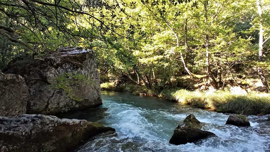
The ravine measures about 2 km across, and steep cliffs frame both sides. Thick forest covers much of the ground, and the gorge holds a strong place among hikers who walk in the Peloponnese.
In antiquity the river also went by the name Gortynius. Its Latin form was Lusius. The ancient town of Gortys stood beside the water near the southern end of the gorge.
Tradition holds that the river took its name from Zeus. In Greek myth the newborn god washed at its springs, and the ancient writer Pausanias called it the coldest river in the known world.
A Lousios gorge hike reaches the river from villages set high above it. Dimitsana sits at the northern end, while Stemnitsa lies on the eastern side, above the left bank of the stream.
On foot the route links stone villages, monasteries built into the rock and the ruins of Gortys. Each of these sites appears in its own section below, from the river course to the mills.
- Source: The Lousios rises near the village of Lykochori.
- Current: The river flows fast and is treacherous.
- Waterfall: The Vrontou waterfall lies within the gorge.
- Village heights: Dimitsana stands at 950 metres and Stemnitsa at about 1050 metres.
A Lousios gorge hike therefore combines river scenery, forest and religious buildings in one compact valley of the central Peloponnese, between two mountain villages and an ancient site.
Which Lousios gorge hike formats are on sale?
A Lousios gorge hike is on sale in four formats: a hike with a local from Dimitsana to ancient Gortyna, a private Dimitsana outing to two monasteries, a private Stemnitsa trip with ancient Thyrea, and a private village trip from Athens.
The first format is a gorge walk with a local, based in Dimitsana. It heads through the ravine to the ruins of ancient Gortyna, which lie at the southern end of the gorge.
The second format is a private outing in Arcadia, also based in Dimitsana. It visits Agia Theodora and Philosophou, where the Old and the New monastery both stand inside the Lousios gorge.
The third format is a private trip based in Stemnitsa, on the eastern side of the gorge. It pairs the Lousios with ancient Thyrea, and its listing presents both as stops on one private Peloponnese excursion.
The fourth format starts from Athens rather than from a village in the gorge. It is a private trip to the villages of Arcadia, with a monastery on a cliff face as its listed highlight.
Three of the four formats are private. Two are based in Dimitsana, one in Stemnitsa, and one sets out from Athens, so the start of each Lousios gorge hike differs.
- Walk with a local: A Dimitsana-based hike runs through the gorge to ancient Gortyna.
- Monastery outing: A private Dimitsana trip covers Agia Theodora and the Philosophou monasteries.
- Stemnitsa excursion: A private trip from Stemnitsa links ancient Thyrea with the Lousios.
- Athens start: A private trip from Athens covers Arcadian villages and a cliffside monastery.
The tour cards and availability boxes on this page list live dates for each Lousios gorge hike format, so the four options can be compared side by side before a booking.
Where is the river on a Lousios gorge hike?
The Lousios gorge hike follows a river in western Arcadia that rises near Lykochori, runs south past Dimitsana and Stemnitsa, and joins the larger Alfeios river 2.5 kilometres northwest of the hill village of Karytaina, south of Atsicholos.
Arcadia is a region of the central Peloponnese that takes its name from Arcas, a figure of Greek myth. Mountains cover the bulk of it, apart from plains and the valleys of the Alfeios and Ladon.
The gorge lies in the west of that region. Its upper part falls inside the municipality of Gortynia, formed in 2011 from eight former municipalities, among them Dimitsana and Trikolonoi, the unit that holds Stemnitsa.
The Alfeios, which receives the Lousios, starts on the north slopes of Mount Taygetus and flows to the northwest. Its basin lies 60% in Arcadia, 30% in Elis and 10% in Achaea.
Below the meeting point the Alfeios passes north of Andritsaina. Near Tripotamia it takes in the Ladon and the Erymanthos, then flows west past Olympia to the Ionian Sea south of Pyrgos.
Karytaina, the village nearest the confluence, stands on a hill on the right bank of the Alfeios. Its 13th-century Frankish castle and a five-arch bridge mark the southern approach to a Lousios gorge hike.
- West bank: Gortyna and Atsicholos lie west of the river.
- East bank: Dimitsana, Stemnitsa and Elliniko lie east of the river.
- Highest peak: Mainalo, the highest mountain in Arcadia, reaches 1,981 metres at Ostrakina.
- Old highway: In antiquity the road between Patras and Kalamata ran beside the Alfeios for much of its course east of Olympia.
Karytaina itself fell in 1320 to the Byzantine Greeks of Mystras, the former capital of the Despotate of the Morea in Laconia that a Mystras tour covers.
Which monasteries does a Lousios gorge hike pass?
A Lousios gorge hike passes the Timiou Prodromou, Philosophou, Aimyalon and Panagias Kalamiou monasteries, plus the Church of St Andrew at Gortys, a cluster on the cliff walls that has earned the whole gorge the name Mount Athos of the Peloponnese.
Philosophou Monastery was founded in 963 inside the gorge, 2.5 km from Dimitsana. A Patriarchate document of 967 tied to the monastery holds the earliest written record of the name Dimitsana.
Two sites carry the Philosophou name, the Old and the New monastery. Both lie inside the gorge, and so does Prodromou Monastery, which stands seven kilometres from Stemnitsa.
Prodromou Monastery is dedicated to St John the Baptist. One account dates its founding to around 1167, and its buildings sit on the side of a rock face above the ravine.
On a Lousios gorge hike the river runs about 200 yards below the Prodromou buildings. During Ottoman rule the monastery served as a centre of faith and learning for the Greek population.
At the southern end of the gorge the Church of St Andrew stands at Gortys. Aimyalon and Panagias Kalamiou complete the list of four monasteries on the walls of the ravine.
- Greek name: Prodromos, the Greek title of St John the Baptist, gives the Prodromou house its name.
- Village name: A settlement in the Dimitsana community carries the name Moni Aimyalon i Filosofou.
- Nearby sights: Dimitsana counts the Philosophou and Prodromou monasteries among the sights in its surroundings.
- Village churches: In Stemnitsa the church of Bafero dates from 1185 and the Zoodochos from 1433.
A Lousios gorge hike thus links houses of worship from the 10th century onwards, all set on the same steep walls above the river and its forest.
What is ancient Gortys on a Lousios gorge hike?
The Lousios gorge hike reaches ancient Gortys, also called Gortyna, at the southern end of the ravine, where an Arcadian town once stood beside the river and later shrank to the village that Pausanias described in the 2nd century AD.
Tradition names Gortys, a son of Stymphalus, as the founder of the town. In the district of Cynuria it stood beside the river then called Gortynius, whose waters were known for their cold.
In 371 BCE, when Megalopolis was founded, the bulk of the people of Gortys moved to the new city. The town still kept a measure of importance, since Polybius records its capture in 219 BCE.
That capture came during the Social War, at the hands of Euripidas, the general of the Eleians. At that point Gortys was subject to the city of Thelpusa.
The town held a temple of Asclepius built of Pentelic marble. Statues of Asclepius and Hygieia by Scopas stood inside, and Cicero refers to a tomb of one of the Aesclepii near the Lusius.
On a Lousios gorge hike the ruins lie near the modern village of Atsicholos, by the road to Elliniko. Excavations ran from 1940 to 1956 and exposed fortifications, temples and baths.
- Municipal name: The modern municipality of Gortynia takes its name from the ancient town.
- Old province: Gortynia was one of the four provinces of Arcadia until its abolition in 2006.
- Megalopolis: The Theban general Epaminondas founded the city that absorbed the people of Gortys.
- Ancient hospital: Near Prodromou Monastery lie excavations of an ancient hospital built in honour of Asclepius.
Gortys thus marks the ancient end of the gorge, while Olympia, reached on an Ancient Olympia tour, stands downstream on the Alfeios, the river that receives the Lousios.
What are Dimitsana and Stemnitsa on a Lousios gorge hike?
A Lousios gorge hike links Dimitsana and Stemnitsa, two mountain villages east of the river that rank as traditional settlements, known for gunpowder mills, old libraries, metal crafts and their part in the Greek War of Independence in 1821.
Dimitsana stands on a mountain slope, on the ruins of the ancient town of Teuthis. It lies 31 km northwest of Tripoli and serves as the seat of Gortynia.
In the mid-18th century Bishop Ananias Lakedaimonias built the first gunpowder mills of Dimitsana, presented as a home industry. The movement came to light in 1764, and he and his partners were killed.
During the War of Independence 14 gunpowder mills in Dimitsana worked day and night for the Greek fighters, who fed paper from the town library into them. The town earned the name the Nation’s powder keg.
Near the village, the Open-air Water Power Museum of 1997 occupies restored pre-industrial works. It contains a flour mill, a cauldron, a tannery, a tanner’s house and a gunpowder mill.
Stemnitsa lies 6 km southeast of Dimitsana. In 1821 it became the first seat of the Peloponnesian Gerousia, the temporary government of the freed Peloponnese, which met at the monastery of Zoodochos Pigi.
- Smiths: Stemnitsa was known for its gold- and silversmiths, and a public school for the craft has run there since the 1970s.
- Refuge: The village sheltered the Kolokotronis clan and other fighters of the War of Independence.
- Folklore museum: Stemnitsa’s museum shows candle making, a jeweller’s workshop, a shoe repair shop and copper tinning.
- Seminary: Patriarch Gregory V studied at the Dimitsana school, and his statue stands in the central square.
Beyond a Lousios gorge hike, the call to revolt in 1821 was first heard at Agia Lavra, a monastery near Kalavryta in Achaea, on the route of a Kalavryta tour.
What do travellers ask about a Lousios gorge hike?
A Lousios gorge hike raises recurring questions about the starting village, the monasteries on the route, the ancient site at the southern end and the history of the mills, and the answers below draw on the sections above.
Where does a Lousios gorge hike start?
Two of the four formats on sale are based in Dimitsana, at the northern end of the gorge, and one is based in Stemnitsa on the eastern side. A fourth format sets out from Athens and heads for the villages of Arcadia. Karytaina marks the southern end, near the meeting with the Alfeios.
Does a Lousios gorge hike pass through forest?
Yes. Dense forest covers much of the gorge, and steep cliffs line its sides. Stemnitsa, above the left bank, sits at the western edge of the Mainalo mountains, whose Greek fir and Crimean pine forests Natura 2000 cites as the best examples of their kind in the Peloponnese.
Why is a Lousios gorge hike linked with Mount Athos?
The gorge carries the name Mount Athos of the Peloponnese because monasteries dot its walls. The list covers Timiou Prodromou, Philosophou, Aimyalon and Panagias Kalamiou, plus the Church of St Andrew at Gortys. Philosophou dates from 963 and Prodromou, by one account, from around 1167.
What links a Lousios gorge hike to the 1821 revolution?
Dimitsana ran 14 gunpowder mills for the Greek fighters, Stemnitsa housed the first seat of the Peloponnesian Gerousia, and Karytaina became one of the first strongholds of the revolt, with the nickname Bastion of 1821. In 1826 Theodoros Kolokotronis used Karytaina as a base against Ibrahim Pasha of Egypt.