
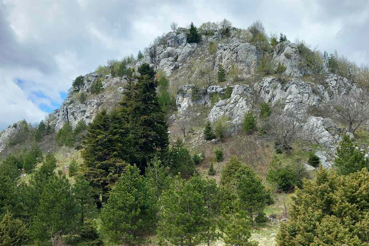
A Grevena tour explores Grevena in West Macedonia, the mountain town and region between the Pindus range and the Haliacmon river, with its peaks, canyons, forests, stone bridges and mountain villages. The tour is one of the Greece Tours on Greece Ville, listed with the other Northern Greece tours.
This post covers the formats on sale, where Grevena lies, Mount Orliakas and the Portitsa canyon, Valia Calda, the mountain villages, the history and finds of the area and the questions that come up before booking.
What is a Grevena tour?
A Grevena tour is a trip based in Grevena, the capital of the Grevena regional unit in Western Macedonia, northern Greece. It reaches the Pindus mountains, Aromanian villages, the Valia Calda forests, the Haliacmon river and a mastodon museum at Milea.

Grevena is a town and a municipality in Western Macedonia, in the north of Greece. Its Aromanian name is Grebini. The town serves as the seat of the regional unit that shares its name.
The 2021 census counted 12,515 people in the town and 25,905 in the whole municipality. A Grevena tour therefore starts in a small regional capital, not in a large city or a coastal resort.
The municipality took its present shape in 2011, when 13 former municipalities merged. Samarina, Smixi, Ventzio and Theodoros Ziakas are among them, and each now forms a municipal unit of Grevena.
Mountains surround the municipality, and the town stands beside the Greveniotikos, a river that flows into the Aliakmon. Wheat and legumes, chickpeas above all, fill the farmland of the wider regional unit.
Two departments of the University of Western Macedonia are based in the town: Statistics and Insurance Science, and Business Administration. The long jumper Miltiadis Tentoglou, an Olympic and European champion, comes from Grevena.
- Region: Western Macedonia groups Grevena with the regional units of Florina, Kastoria and Kozani.
- Units: The Grevena regional unit holds two municipalities, Grevena and Deskati.
- Income: Ecotourism, the forest industry and the Vasilitsa ski resort add to farm income across the unit.
- Award: Grevena won an EDEN European Destinations of Excellence award in 2008 as a non-traditional destination.
The sections below move from the hike on sale to the park, the villages and the old finds that give a Grevena tour its range of subjects.
Which Grevena tour formats are on sale?
A Grevena tour on sale comes in a single format: a hike based in Grevena that names Mount Orliakas and the Portitsa canyon in its title. No other listed product in the catalogues checked names Grevena as a base or a stop.
The catalogues hold one bookable format for the town. It is a walking route, and its title pairs a mountain, Orliakas, with a canyon, Portitsa. No coach, river or ski format appears beside it.
A Grevena tour in this form is therefore a hike, not a sightseeing drive. The base is the town itself, and the route heads into the mountain country that surrounds the municipality on every side.
The second catalogue checked lists no product that names Grevena. The hike thus stands alone, and visits to Valia Calda, Samarina or Vasilitsa fall outside the formats on sale at present.
Weather frames any walking plan in this area. Grevena has a Mediterranean continental climate, with a great gap between day and night temperatures, cold winters and frequent snowfall in the town.
Summer days in Grevena are hot, while the nights stay cool. Walkers on a Grevena tour in the warm months meet that daily swing between hot afternoons and cool evenings in the hills.
- Format: A single hike based in Grevena is on sale.
- Features: The title names Mount Orliakas and the Portitsa canyon.
- Base: The town of Grevena serves as the capital of the regional unit.
- Other listings: The second catalogue checked holds no product that names Grevena.
The tour cards and availability boxes on this page list live dates for each format, so the Orliakas and Portitsa hike shows its open departures there.
Where is Grevena on a Grevena tour?
A Grevena tour takes place in the Grevena regional unit of Western Macedonia. The Pindus mountains cover its western part, and the Haliacmon, the longest river flowing wholly on Greek soil, runs through the north and the east of the unit.
A Grevena tour crosses a unit that borders Ioannina in Epirus to the west, Kastoria to the northwest and Kozani to the north and east. Larissa lies to the southeast and Trikala to the south.
Grevena became a prefecture in 1964, carved from parts of the Kozani and Larissa prefectures. At the 2001 census, it was the least densely populated prefecture in Greece, a mark of its mountain terrain.
The Chasia range, a forested eastern extension of the Pindus, rises in the south. Its highest peak, Kratsovo, reaches 1,564 metres, and the range stretches about 35 kilometres from Korydallos to Kerasoula.
Vourinos closes the northeast, with a top elevation of 1,866 metres and a length of about 30 kilometres. The Aliakmon and its tributaries drain the range, and Grevena lies to its west.
The Haliacmon rises in the Gramos mountains near the Albanian border and runs for 297 kilometres. It curves around Vourinos, turns northeast near Paliouria and feeds the artificial Lake Polyfyto in Kozani.
- Tributaries: The Grevenitikos and the Venetikos are among the streams that join the Haliacmon.
- Name: The name comes from Greek words for salt or sea and for anvil, and in Greek myth Haliacmon was a river god.
- Old belief: Pliny the Elder recorded that sheep drinking from the Haliacmon turned white.
- Fish: The river holds 33 kinds of fish, including the endemic mavrotsironi.
The Haliacmon turns southeast near Kastoria before it reaches the Grevena area, so a Kastoria tour follows the same river through the next regional unit upstream.
What are Mount Orliakas and the Portitsa canyon on a Grevena tour?
A Grevena tour in hike form takes its name from Mount Orliakas and the Portitsa canyon. The title is the main record of both features, so this account extends to Spilaio and the former Theodoros Ziakas municipality within Grevena municipality.
The hike title pairs a mountain with a canyon. Orliakas is the mountain, and Portitsa is the canyon. The tour cards on this page carry the route details that belong to each listed date.
Spilaio is a village and a community of the Grevena municipality. Before the 2011 reform, it formed a municipal district of Theodoros Ziakas. The 2021 census recorded 194 residents in the village.
The community of Spilaio covers 39.504 square kilometres. Its former municipality carried the name of Theodoros Ziakas, a chieftain in Macedonia during the Greek War of Independence of 1821.
Ziakas was born in Mavronoros in 1798 to a family of Armatoloi. With his brother Yiannoulas, he freed the Grevena region until an Ottoman force destroyed their headquarters in 1826.
Two years later Ziakas returned and set up a new base in the Valia Kalda area of the Pindus. He was again a chieftain in the Grevena region during the 1854 Macedonian Rebellion.
- Mavranaioi: The village served as the seat of the Theodoros Ziakas municipality before 2011.
- Mavronoros: The birthplace of Ziakas is now a settlement of the Mavranaioi community, with 83 residents in 2021.
- Ziakas village: Known as Tista before 1927, it recorded 136 residents in its community in 2021.
- Mesolouri: The village borders the former Theodoros Ziakas municipality and sits at 1080 metres on the northern Pindus.
A Grevena tour on the Orliakas and Portitsa route starts in a district whose villages keep the Ziakas name alive, from Mavronoros to the community of Ziakas.
What does Valia Calda add to a Grevena tour?
A Grevena tour that reaches Valia Calda enters the Pindus National Park, founded in 1966 on the border of the Grevena and Ioannina units. The name means the Warm Valley in Aromanian, and the forests hold brown bears, wolves and chamois.
The park covers 6,927 hectares in the northeastern part of the Pindus range. Its core zone of 3,360 hectares takes in the greater part of the Valia Calda valley and the slopes around it.
A Grevena tour into the park meets heights from 1,076 to 2,177 metres. Avgo is the top peak, while Kakoplevri, Flegga, Aftia and Tria Sinora also pass 2,000 metres along its ridges.
European black pine and common beech cover the lower and middle slopes, with individual trees more than 700 years old. Bosnian pine takes over higher up, and alpine meadows without trees crown the top.
The park is one of three areas in Greece with a population of Eurasian brown bears, and the region also carries the name bear park. Lynxes, roe deer, wildcats and wild boars live there too.
The park belongs to the Natura 2000 network, and the Northern Pindus Management Body has run it since 2003. No settlements or facilities stand inside its borders, and no signs point to it from main roads.
- Plants: Records list 415 types of plants and 86 species of mushrooms inside the park.
- Birds: More than 80 bird species find shelter there, including the golden eagle and eight types of woodpeckers.
- Rivers: Three small rivers with very clear water give a home to the Eurasian otter.
- Access: The best approach is from the north, via the village of Perivoli.
Valia Calda lies north of the town of Metsovo, on the edge of Epirus, so a Metsovo tour covers the southern approach to the same mountain country.
Which villages does a Grevena tour reach?
A Grevena tour reaches Aromanian mountain villages such as Samarina, Smixi, Perivoli and Avdella. It also reaches the Vasilitsa ski resort in the middle of the Pindus and the mountain municipality of Deskati on the southern slopes of Kamvounia.
Samarina stands on an eastern spur of Mount Smolikas, the highest mountain of the Pindus. At 1420 metres, it ranks among the highest villages in Greece and the Balkans, with 253 residents in 2021.
The people of Samarina tended sheep and goats and wove a woollen fabric called flokati for regional fairs. As muleteers, they led long caravans across the Balkans, and the village flourished through the 19th century.
Smixi, Zmixi in Aromanian, is a Vlach village of 247 people. Perivoli sits at 1250 to 1370 metres and holds only 10 to 20 people in winter, yet its summer population rises to 4,000.
Avdella, a seasonal Aromanian village at 1250 to 1350 metres, has a transhumant community and a summer population of about 3,000. It is the birthplace of the Manaki brothers, pioneers of photography and cinema.
Vasilitsa, the winter stop on a Grevena tour, lies about 42 kilometres from the town, with five lifts and 16 trails. Its summit stands at 2113 metres, and two trails carry FIS homologation as Olympic trails.
- Deskati: The municipality lies on the southern slopes of Kamvounia, among forests of fir, pine and oak.
- Andromana: At the end of spring, men in Deskati stand on each other’s shoulders to build a large human structure.
- Kranea: The traveller François Pouqueville recorded that the village formed in 1507 from Turia and Paleohori.
- Song: The folk song Children of Samarina recalls village fighters at Messolonghi in 1826.
Vovousa, an Aromanian village of Zagori in Epirus, lies near the Valia Calda park, so Zagori tours meet the same mountain culture across the regional border.
What history and finds belong to a Grevena tour?
A Grevena tour meets a town history that runs from Ottoman rule to union with Greece in 1913, and a fossil site at Milea, where the tusks of a Mammut borsoni mastodon came to light after heavy rain in 1997.
Under Ottoman rule Grevena was a small administrative and military centre. It held the seat of a kaza in the Sanjak of Serfiğe, within the Vilayet of Manastir, and kept barracks until the Second World War.
Vasil Kanchov counted 600 Greek Christians, 500 Turks, 200 Greek Muslims known as Vallahades, 150 Aromanians and 100 Romani in the town in 1900. The Treaty of Bucharest passed Grevena to Greece in 1913.
The Ottoman buildings of the town vanished during the 20th century. A mosque became a church in 1927 and was later pulled down, and the church of Agios Achillios now stands on the site.
At Milea, also spelt Milia, Athanasios Delivos found a first pair of tusks in 1997 after heavy rain. They measured 4.39 metres, and Dr Evaggelia Tsoukala of Aristotle University of Thessaloniki led the excavations.
In 2007 the team found longer tusks of 5.02 metres, which won a Guinness record award. The mastodon dates to about three million years ago, and the Natural History Museum of Milia shows the finds.
- Size: Milia specimens of Mammut borsoni reached an estimated 14 tonnes and a shoulder height of 3.9 metres.
- Diet: Isotope study of the Milia bones points to a browser on the leaves and twigs of woody plants.
- Palia Milea: The old village, left in the early 1970s because of soil instability, keeps its original stone architecture.
- Mylos: Ruins of old watermills and the foundations of a bridge lie south of Mesolouri.
A Grevena tour to the Ventzia area recalls the 1995 earthquake, when two foreshocks sent people outdoors before the main shock brought houses down in its villages.
What do travellers ask about a Grevena tour?
A Grevena tour raises four common questions: the winter conditions, the park rules in Valia Calda, the local food, and the road links to the town. The answers below draw on records for the town, the Pindus park, and the region.
Does a Grevena tour work in winter?
A Grevena tour in winter meets cold weather and frequent snowfall. The dirt roads of Valia Calda stay in good condition in every season except winter. Western Macedonia counts two large ski centres, Vigla in Florina and Vasilitsa in Grevena, and the second ranks as a popular winter holiday destination.
Can a Grevena tour include camping in Valia Calda?
A Grevena tour into Valia Calda follows strict park rules. Camping and staying in the core after sunset are prohibited, and the collection of any organism is not allowed. Fires are banned, and kayaking or rafting needs special clearance from the local forestry service before any trip on the water.
What local food belongs to a Grevena tour?
A Grevena tour passes through a large mushroom area, with the crop collected around Valia Calda. Grevena is also home to Anevato cheese, which it shares with Kozani, while kefalograviera and manouri appear on the cheese list of the region. Goat and lamb production stays strong across the unit.
How does a Grevena tour reach the town by road?
A Grevena tour starts about 420 kilometres from Athens and about 180 kilometres from Thessaloniki. The A2 motorway, Egnatia Odos, gives the town direct access, and National Road 15 runs from Kalambaka through Grevena to Kastoria. The regional unit has no railway line at all.