
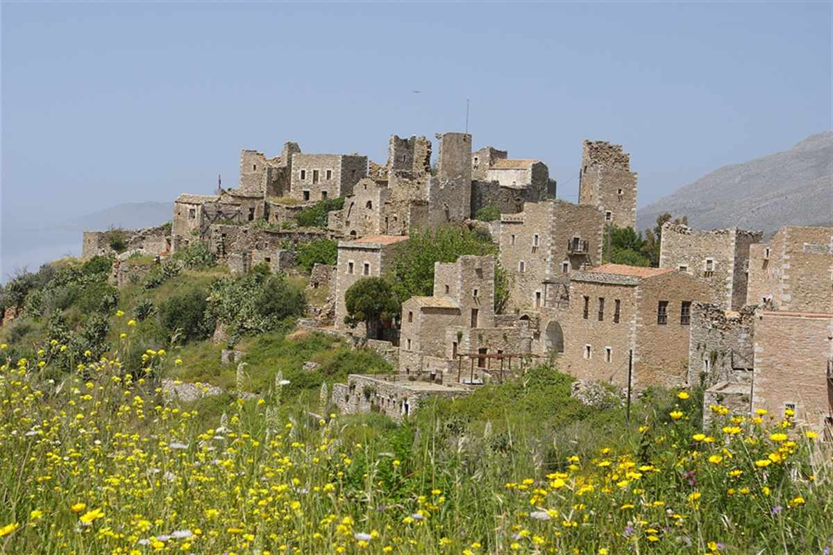
Mani tour crosses the Mani Peninsula from Gytheio, with its tower houses, Byzantine churches, Areopoli, Limeni, Vathia, Porto Kagio, Cape Tainaron, the Diros caves, Kardamyli, Stoupa and Mount Taygetus. The tour is one of the Greece Tours on Greece Ville, listed with the other Peloponnese tours and Greece historical tours.
This post covers what the tour is, Outer and Inner Mani, the tower houses and feuds, Gytheio, the south to Cape Tainaron, the Diros caves, Kardamyli, the castles, the cuisine and the formats on sale. Common questions come last.
What is a Mani tour?
A Mani tour crosses the Mani Peninsula in the southern Peloponnese, the home region of the Maniots. It links tower villages, rocky coast and mountain slopes, and it follows the history of a land that Sparta, Byzantium, Venice and the Ottomans all claimed.
The name Mani is written Maina in older sources, and Greek speakers add the article and say the Mani. The people of the region are called Maniots, or Maniates in Greek.
In ancient times the Mani counted as part of Laconia, the region dominated by the city-state of Sparta. A Mani tour therefore passes through country that once answered to Spartan power.
The modern administration is split between two municipalities, East Mani and West Mani. Both were established in 2011 by the Kallikratis Programme, a reform that merged regional and local governments across Greece.
Tourism started to develop in the early 1960s, long before the modern Mani tour existed. At that time hotels stood only in Gytheio, and inns served travellers in Gerolimenas and Kotronas.
The peninsula stayed remote until the 1970s, when the government began to build roads that made it more accessible by car. A Mani tour today runs on those roads along the coast and across the interior.
- Region: The Mani lies in the southern Peloponnese and is home to the Maniots.
- Ancient link: The peninsula counted as part of Laconia and fell under Spartan influence.
- Administration: East Mani and West Mani were created in 2011 under the Kallikratis reform.
- Economy: Agriculture, maritime activity and tourism shape the modern economy.
The sections below cover the land, the two halves of the peninsula, the tower houses, the feuds, the revolt of 1821 and the towns that a Mani tour reaches.
How does the geography of the Mani Peninsula shape a Mani tour?
The Mani tour runs over limestone country where thin soils, hot dry summers and long exposed coasts set the pattern of settlement. Roads loop around the peninsula, so every Mani tour follows the bends that shaped village life.
Shallow lithosols and rendzina soils cover the limestone bedrock and hold little water. Terra rossa, a deeper red clay, appears in cultivated areas, and alluvial soils fill the river valleys.
Erosion places the soils of the Mani at high risk of desertification. The dry lower slopes carry maquis, a dense evergreen scrub that grows between 1.5 and 3 m tall.
The peninsula has a hot-summer Mediterranean climate, with mild to cool wet winters and hot dry summers. Köppen classification places it in the Csa type, the same label that covers much of southern Greece.
On a Mani tour, a road leaves Oitylo for the south and later loops back north along the east coast through Kokkala, Kotronas and Skoutari. Another cross-peninsular road runs southeast from Areopoli to Kotronas.
Wildfires have scarred the landscape. Fires in 2007 caused damage and loss of life, particularly around Areopoli, and fires in 2021 burnt 105 square kilometres of East Mani.
- Soils: Lithosols, rendzina, terra rossa and alluvial soils form a patchwork across the peninsula.
- Climate: A hot-summer Mediterranean pattern brings wet winters and dry summers.
- Roads: Cross-peninsular roads join Oitylo to Gytheio and Areopoli to Kotronas.
- Fire: The fires of 2007 and 2021 hit Areopoli and East Mani.
A Mani tour reads the land as well as the villages, and the geography comes first on any Mani tour. The soils, the fires and the road loops explain why settlements cluster where they do.
What does a Mani tour show in Outer Mani?
A Mani tour in Outer Mani covers the north-western part of the peninsula, which matches West Mani in Messenia. The area receives more rain than the rest of the Mani, so terraced olive groves and green slopes mark this side of the route.
The Greek name Exo Mani means Outer Mani. The region matches the municipality of West Mani and lies in the north-west, on the Messenian side of the peninsula, beside the Messenian Gulf.
Olive groves cover the lower slopes, built on terraces, and fill the coastal plain of Messenian Mani. Growers mainly work the groves without herbicides, so annual plants flower between the trees in spring.
Family names in Outer Mani end in -eas, while names in Inner Mani end in -akis, -akos or -oggonas. A Mani tour reads a surname as a hint to the side of the peninsula.
Large quantities of olive oil were produced north of Oitylo in the early nineteenth century. Cultivation spread further south only decades later, so the north led the oil trade.
In June 1826 the Battle of Verga took place just southeast of Kalamata. Between 2,000 and 4,000 Maniots defended a fortified wall over three days against the Egyptian advance.
- Name: Exo Mani is the Greek name of the north-western region.
- Groves: Terraced olive groves grow on the lower slopes and the coastal plain.
- Surnames: Family names end in -eas in Outer Mani.
- Battle: The Maniots held the wall at Verga in the summer of 1826.
Outer Mani gives a Mani tour its greener first impression. The olive terraces and the Verga wall show the farming and the fighting of the north-west.
What does a Mani tour show in Inner Mani?
A Mani tour in Inner Mani covers the south-western region, known in Greek as Mesa Mani, which corresponds to southern East Mani. The ground is drier and more rugged here, and the tower villages of the deep Mani stand in this part.
The Greek name Mesa Mani means Inner Mani. Lower Mani, called Kato Mani, lies in the east and matches northern East Mani, so the peninsula has three traditional regions.
Surnames in Inner Mani end in -akis, -akos or, less frequently, -oggonas. These endings differ from the -eas ending of Outer Mani and mark the Laconian side of the peninsula.
On a Mani tour of the south, the municipal unit of Oitylo holds 91 villages. The largest are Areopoli, Pyrgos Dirou and Oitylo, and the unit also includes Gerolimenas and Vatheia on the road south.
Genetic research found little Slavic ancestry among Maniots from East Mani, between 0.7 and 1.6 per cent. Maniots from West and Lower Mani show higher but still low shares.
Petros Mavromichalis became bey in 1815 and was the first bey from Inner Mani. The Ottomans had appointed beys to rule the Mani since the late seventeenth century.
- Name: Mesa Mani is the Greek name of the south-western region.
- Lower Mani: Kato Mani lies in the east and completes the three traditional regions.
- Villages: Oitylo municipal unit includes 91 villages.
- Bey: The first bey from Inner Mani took office in 1815.
Inner Mani shows a Mani tour its starkest scenery. The villages here carry the clan history, from the tower houses to the feuds and the revolt of 1821.
Why do tower houses define a Mani tour?
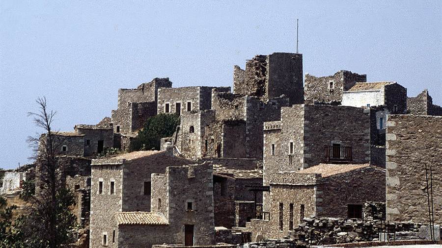
The Mani tour is known for its stone tower houses, which clans built as defences and which still stand in abandoned and inhabited villages. The towers are the clearest record of how Maniot families lived, fought and protected themselves for centuries.
Over 170 settlements on the peninsula contain architecture from the middle of the Byzantine period. Greek speakers call them palaiomaniatika, which means old Maniot settlements, or palaiochores, meaning old villages.
These settlements are small, with between 10 and 50 houses each. About half are still inhabited, and the rest stand abandoned, so a Mani tour passes both living villages and empty ones.
Builders used very thick dry-stone walls made of large blocks of quarried limestone or limestone boulders. Scholars describe the style as megalithic or cyclopean and suspect a tradition reaching back to the late Hellenistic period.
Maniots built the tower houses as defences against Frankish and Ottoman invaders. Historical documents show that people lived in the old settlements well into the Ottoman era, long after construction.
After 1833 the Council of Regency of King Otto took action to subdue the Maniots and to dismantle their defensive towers. The order explains why not every tower survives.
- Old villages: Over 170 settlements keep Byzantine-era architecture.
- Size: Each settlement holds between 10 and 50 houses.
- Walls: Thick dry-stone masonry forms the towers and cisterns.
- Dismantling: The regency of King Otto ordered defensive towers taken down.
The towers give a Mani tour its visual identity. Each tower marks a family that held land and prepares the ground for the story of the feuds.
What were the blood feuds that a Mani tour recalls?
A Mani tour recalls the vendettas that plagued the peninsula, in which rival families fought one another from their towers. The feuds were a defining feature of Maniot life, and they continued in the decades after Greek independence.
The decision to start a vendetta was made at a family gathering. The main aim was to wipe out the opposing family, whose members were killed whenever the chance arose.
Vendettas went on for months and sometimes for years. They ended only when one family was exterminated or left the town, and the cause of the feud no longer mattered by then.
Other feuds ended in peace, with terms agreed between the families, or through an exchange of property. A killing also closed a feud when the guilty person had been put to death.
Feuds continued after independence. In 1870 a regular army with artillery support halted a Maniot vendetta, and one of the last large-scale feuds required the Greek police, 1,000 army soldiers and 200 navy sailors.
The Mavromichalis family moved from Alika to Tsimova partly because of blood feuds and conflicts. After the revolt of 1770 the young Petros Mavromichalis gained a reputation for mediating disputes between warring families.
- Decision: A family gathering decided to open a vendetta.
- Aim: The goal was to wipe out the rival family.
- End: Feuds ended through extermination, departure, peace terms or property exchange.
- Army: A regular army with artillery halted a feud in 1870.
The feuds explain the height of the towers. A Mani tour presents them as history that the villages remember in sober terms.
How do the Mavromichalis family and 1821 connect to a Mani tour?
A Mani tour passes through the home country of the Mavromichalis family, the clan that led the peninsula into the Greek War of Independence. On 17 March 1821, 12,000 Maniots gathered in Areopoli and declared war on the Ottoman Empire.
According to tradition, the name Mavromichalis comes from an orphan called Michalis. Orphans were called mavros, meaning black, because of the dark clothing worn in mourning, and the family name grew from mavros Michalis.
Georgios Mavromichalis led a Peloponnesian rebellion backed by Count Orlov during the Russo-Turkish War of 1768 to 1774. His sons Ilias-Pierros and Ioannis took part, and Maniot soldiers defeated Turkish and Albanian forces.
Petros Mavromichalis, known as Petrobey, was born on 6 August 1765. On 17 March 1821 he hoisted a war flag at Areopoli, and his declaration preceded the rest of Greece by about a week.
Maniot fighters joined the forces of Theodoros Kolokotronis that captured and sacked the Ottoman regional capital Tripolitsa on 23 September 1821. Petrobey styled himself Commander in Chief of the Spartan Forces.
Petrobey died in Athens on 17 January 1848. The Mani flag carries the Spartan phrase meaning with your shield or on it, which appears at the annual commemoration on 17 March.
- Name: Tradition derives Mavromichalis from the orphan mavros Michalis.
- Father line: Georgios Mavromichalis led the uprising backed by Count Orlov.
- Declaration: On 17 March 1821, 12,000 Maniots gathered at Areopoli.
- Capital: Maniot fighters helped take Tripolitsa on 23 September 1821.
The revolt of 1821 gives a Mani tour its central date. Every town on the route recalls the week in which the peninsula rose.
What does a Mani tour show in Areopoli?
A Mani tour stops in Areopoli, the largest settlement of the peninsula, where the first flag of the Greek War of Independence was raised in Taxiarchon Square on 17 March 1821. The town is the base of the deep Mani.
Areopoli lies near the west coast of the peninsula, 20 km southwest of Gytheio. It served as the seat of the Oitylo municipality before the reform of 2011.
A market takes place in the main square each Saturday, and local producers attend it. The market gives a Mani tour a view of everyday trade in the town.
By 1829 Areopoli was home to 290 families. Through the nineteenth century and into the mid-twentieth century the population moved between 1,100 and 2,000 inhabitants, rising and falling with the years.
After the war both population and commercial activity fell, yet Areopoli remained the largest settlement in the peninsula. The town expanded eastward along the main road, where the market was established.
Stylianos Pierrakos, born Stylianos Mavromichalis, was born in Areopoli in 1902 and became prime minister of Greece. He died in 1981, and the town counts him among its notable people.
- Flag: The first flag of the war was raised in Taxiarchon Square.
- Market: A Saturday market fills the main square.
- Families: The town had 290 families by 1829.
- Distance: Gytheio lies 20 km northeast of the town.
Areopoli is the natural centre of a Mani tour, and the Mani tour route gathers around its square. Its market and its tower houses stand close together in the old centre.
Why does a Mani tour stop at Limeni?
A Mani tour stops at Limeni, the small port of Areopoli, where the Mavromichalis family built the stronghold from which it governed the region. The harbour village also saw the landing of an Egyptian army in June 1826.
On a Mani tour, Limeni lies 1.5 km from Areopoli. The Mavromichalis family moved there from Tsimova, the older name of Areopoli, after first living in Alika, and fortified the village to hold the port.
Under Venetian rule the family took advantage of port taxation. According to the family history, the income helped arrange a virtual autocephaly, a self-governing status, for the land around the harbour.
In June 1826 an Egyptian fleet landed an army at the Bay of Diros near Areopoli. The aim of the joint Ottoman and Egyptian invasion was to capture the town and disrupt Maniot communications.
Local women and elderly men, armed with sickles and stones, first contained the troops. About 1,000 Maniot fighters then attacked, inflicted heavy losses and forced the landing force to retreat.
Maniots also produced sea salt in the nineteenth and early twentieth centuries, mostly on the west coast. Salt was traded for barley, wheat, maize, cheese and dried figs.
- Distance: Limeni lies 1.5 km from Areopoli.
- Stronghold: The Mavromichalis family fortified the village.
- Landing: An Egyptian army landed in the Bay of Diros in 1826.
- Salt: Salt works on the west coast supplied the Maniot trade.
Limeni shows a Mani tour the sea side of Maniot power. The port, the bay and the old salt trade explain how the clan paid for its towers.
Which Byzantine churches does a Mani tour reach?
A Mani tour reaches Byzantine churches that stand in the old villages and among the fields, and the oldest date to the middle Byzantine centuries. Recent research suggests that church building began on the peninsula far earlier than older studies assumed.
The earliest record of the name is a bishop of Maina in a list of dioceses dated 907. Around 950 Emperor Constantine VII wrote that the Maniots had stayed pagan until the reign of Basil I.
Early archaeological studies took that statement at face value and dated the first churches to the tenth century. Research since the 1960s has tentatively dated churches in southern Mani to the Early Byzantine period.
The scholar Seifried considers that Christianization can be pushed back as far as the fifth century. Seifried notes that church building rose between the tenth and fifteenth centuries to an average of 35 a century.
In the Early Byzantine years the average had been only two churches a century. The rise runs from the tenth century to the fifteenth, a span that covers Byzantine, Frankish and Despotate rule.
By the middle of the sixth century nearly 60 episcopal sees existed in mainland Greece, concentrated in the province of Achaia, which included the Mani. The church network therefore predates the clans.
- Bishop: A bishop of Maina is recorded in 907.
- Earliest dates: Research places the earliest churches in the Early Byzantine period.
- Rate: Building rose to an average of 35 churches a century.
- Province: The Mani belonged to the province of Achaia.
Churches give a Mani tour its oldest layer. The Mystras tour post covers the Byzantine hill town above Sparta, which lies beyond Mount Taygetus.
Why does a Mani tour start in Gytheio?
A Mani tour starts in Gytheio, a town on the eastern shore of the Mani Peninsula in Laconia. It is the largest town in the Mani, the seat of the municipality of East Mani, and a port on the Laconian Gulf.
Gytheio was built on a hill called Koumaros, or Laryssio, near the mouth of the Gythium River. The river is dry for long periods, and its nickname Xerias means dry river.
Ermou Avenue now covers the greater part of the old riverbed. Pine trees grow to the west of the town, rocky mountains rise to the north, and the peak of Profitis Ilias shows from the harbour.
In myth, Heracles and Apollo founded ancient Gythium, and Castor and Pollux also appear in its legends. In classical times it was a community of the Perioeci caste, politically dependent on Sparta.
In 370 BC the Thebans under Epaminondas besieged Gytheio for three days, and the Spartans recaptured it three days later. In 219 BC Philip V of Macedon failed to take the city.
The town grew again when Tzannetos Grigorakis built his tower, and refugees made it a major town during the Greek War of Independence. A Mani tour therefore starts in a place shaped by war.
- Ferries: Boats link Gytheio with Kythira, Antikythera, Crete and Piraeus.
- Road: National Road 39 links the town with Sparta.
- Port: The modern port opened in the 1960s.
- People: Two prime ministers of Greece, Alexandros Othonaios and Tzannis Tzannetakis, were born here.
A Mani tour that begins here crosses a working port first. The road then runs south-west towards Areopoli and the tower villages of the deep Mani.
Why does a Mani tour visit Marathonisi and the tale of Paris and Helen?
A Mani tour visits Marathonisi, also called Cranae, the small island off the harbour of Gytheio. The ancient writer Pausanias recorded that Paris celebrated his marriage to Helen of Troy there, and a museum now occupies the tower.
A Mani tour learns that Marathonisi means fennel island, because the herb grew wild there. One reading derives Kranai from the legendary Athenian king Kranaos, and another from a Homeric word for rocky.
Tradition holds that Paris took Helen from Sparta and that the pair spent their first night on Cranae. Once Gythium became the major port of Sparta, the island served as a resting place for traders.
Under Ottoman rule the Beys of Mani fortified the island with a tower house. The tower of the Tzannetakis family, built in 1829, now houses the Historical and Cultural Museum of Mani.
A lighthouse 23 metres high stands on the island. It was built in 1873 from high-quality marble of the Tainaro area, in the far south of the peninsula.
In 1803 the Ottomans learned that Grigorakis had received arms from the French. The Kapudan Pasha based his army at Gytheio, facing the fortified home of Grigorakis on Marathonisi.
- Pausanias: His account of Roman Gythium lists the agora, the acropolis and Cranae.
- Hill: Pausanias names the hill Larysium, now Koumaro, above the town.
- Oath: On 15 August 1806 clan representatives gathered there to swear fealty to Andonis Grigorakis, Bey of Mani.
- Chapel: A chapel of Saint Peter on the island is used for weddings.
The island joins myth, clan politics and navigation on one small rock. A Mani tour that stops on Marathonisi reads all three from the shore.
What does a Mani tour show at Mavrovouni beach?
A Mani tour passes Mavrovouni, the district south of Gytheio on the Laconian Gulf. The same coast holds Valtaki beach, where walls of ancient Gythium appear on the sand and in the shallows beside a stranded shipwreck on the shore.
Mavrovouni appears on the list of places nearest to Gytheio. Castle Passava lies to the south-west, Rachi to the west, Stefania to the north, and the island of Cranae to the east.
Loggerhead sea turtles lay over 3,000 nests each year in Greece, the leading nesting site in the Mediterranean. A Mani tour on the gulf shore follows the habits of that species.
A female digs her nest above the high-tide line, close enough to the water for the hatchlings to return. The temperature of the sand under the nest decides the sex of the young.
After an incubation of around 80 days, the hatchlings dig to the surface, mainly at night. They head for the brighter horizon that the moon and starlight create over the water.
- Size: Hatchlings measure about 4.6 cm and weigh about 20 g.
- Light: Artificial lighting discourages nesting and confuses hatchlings as they search for the sea.
- Navigation: A magnetite compound in the brain lets the turtles sense the magnetic field of the Earth.
- Raft: Young turtles shelter in floating mats of Sargassum algae until they reach 45 cm.
A Mani tour along this coast therefore links two records, the submerged walls of the ancient port and the nesting cycle of a sea turtle, on one stretch of sand.
Why is Vathia a stop on a Mani tour?
A Mani tour stops at Vatheia, also spelled Vathia, a largely abandoned village near the town of Oitylo. Its hillside tower houses overlook the surrounding landscape, and the village shows the southern Maniot architecture of the 18th and 19th centuries.
A road links Vatheia to Areopoli and Kalamata in the north and to Cape Matapan in the south. Farmland and maquis shrubland cover the hillsides, and the Sangias range rises to the north-east.
Clusters of abandoned houses, towers and chapels stand on the hills around the village. They are called the perichora. The nearest villages are Kyparissos, Alika and Gerolimenas in the north-west and Lagia in the north-east.
An unofficial census of 1618 recorded the village as vatia with 20 hearths. The Grimani census of 1700, taken for the newly established Kingdom of the Morea, counted 212 people in 54 families.
On 13 April 1805 William Martin Leake passed through on the coastal road, and a band of armed local men briefly stopped him. A Mani tour still follows that road.
- Seasons: Wildflowers cover the hills, and the village is popular in spring and summer.
- Oath: The 1806 oath of fealty to the Bey of Mani lists the Michalakiani, Gerandoniani and Karabatiani of Vatheia.
- Clan war: A local clan war that began in 1764 led to the clans that ruled the area from the 19th century.
- Megaliths: Kostakianika Kalyvia stands on a hillside, and Pachia stands on the mountainside opposite the village hill.
A Mani tour that climbs through Vatheia reads a clan landscape in stone. The village was nearly abandoned after the Second World War, and the towers and chapels remain.
Why does a Mani tour reach Porto Kagio?
A Mani tour reaches Porto Kagio, a seaside village on the eastern side of the peninsula. It faces a small bay on the Laconian Gulf, about three miles north of Cape Matapan, the southernmost tip of mainland Greece.
The village lies near the site of the ancient port of Psamathous. Its name comes from the Venetian Porto Quaglio and the French Port des Cailles, and both mean Quail Port.
Around 1568 the Ottomans built a castle to protect the harbour, which was vital in their long wars with Venice. They used it as a base for galleys that patrolled the Kythera Channel.
In 1670 the Ottomans returned and built a new fortress. They were driven out in 1770 during the Orlov Revolt. A Mani tour therefore passes a harbour that changed hands more than once.
In the late 18th century the harbour was the base of the pirate fleet of Lambros Katsonis. In 1792 the Ottomans destroyed that fleet in the Battle of Porto Kagio.
Maps of the 17th and 18th centuries label the village Maina, the historical name of the peninsula. The village has belonged to the municipality of East Mani since 2011.
- Evacuation: British soldiers left from Porto Kagio for Egypt in the Second World War.
- Attack: The Venetians attacked the first castle in 1570, and the Ottomans surrendered it.
- Economy: The main economic activity of the village is tourism.
- Rooms: Four small hotels serve the village.
A Mani tour that stops here sees a harbour shaped by galleys, pirates and evacuations. Cape Matapan lies about three miles to the south, at the end of the road.
Why does a Mani tour end at Cape Tainaron?
A Mani tour ends at Cape Tainaron, also called Cape Matapan, Taenarum or Cape Tenaro. The cape is the southernmost point of mainland Greece and the second southernmost point of mainland Europe, and ruins of an ancient city lie on it.
In classical antiquity the cape held the city of Taenarum. Cape Matapan was also a place where mercenaries waited to be employed, and Taenarum was a mercenary headquarters in the late 4th century BC.
In 218 BC Philip V of Macedon laid waste the east coast of the peninsula as far south as Taenarum. According to Procopius, the Vandals under Gaiseric later assaulted Taenarum without success.
In Greek mythology the hero Taenarus gave his name to the cape, to a mountain and to a city with its harbour. One account makes him a son of Elatus, himself a son of Icarius.
A Mani tour that reaches the headland stands at the end of the peninsula, and warships fought off this cape in 1717 and again in 1941, as the list below shows.
- Lighthouse: A lighthouse was built on the cape in 1892, but it is now disused.
- Venice: On 19 July 1717 a Venetian fleet with allied ships fought the Ottoman fleet there, with no clear result.
- Royal Navy: In March 1941 the British won a one-sided battle off the cape against the Italian Regia Marina.
- Effect: That battle sharply reduced Italian naval activity in the Eastern Mediterranean.
A Mani tour that ends at the cape closes a long road with the open sea on two sides. The ruins, the lighthouse and the sea battles all lie within one headland.
What does a Mani tour tell of the Temple of Poseidon at Tainaron and the entrance to Hades?
A Mani tour tells of the Temple of Poseidon at Tainaron, whose remnants lie on a hill above a cave. Greek legend named that cave as the home of Hades, and tradition treated the cape as a gateway to the underworld.
The ancient Spartans built temples at Taenarum for their gods. The cave lies near the city, and the remains of the temple of Poseidon, the sea god, lie on the hill above it.
Under the Byzantine Empire the temple was converted into a Christian church. Christian rites are conducted there to this day, on the hill that lies above the cave.
A Mani tour hears one account of the founder, in which Taenarus, a son of Zeus, sailed to the Peloponnese with his brothers Calabrus and Geraestus. There he founded a sanctuary of Poseidon called Taenarum.
In Greek myth, the final labour of Heracles was to capture Cerberus. He first went to Eleusis to be initiated into the Eleusinian Mysteries, and he then found the entrance to the underworld at Taenarum.
- Parentage: Another account makes Taenarus a son of Poseidon.
- Suppliants: The Spartans killed Helots who had fled into the temple, and the Greeks called the crime the Tainarian evil.
- Helpers: Athena and Hermes helped Heracles to go down and to come back, in the myth.
- Condition: Hades agreed that Heracles was free to take Cerberus, provided that the dog was not harmed.
A Mani tour keeps the myth separate from the stones. The ruin belongs to Poseidon and to a later church, while tradition ties the cave below to the road to Hades.
What does a Mani tour show in Kita?
A Mani tour shows Kita, written Koita in Greek, a village built on top of a hill that overlooks the sea. It is known for its Maniot war towers and counts among the oldest villages in the Mani, since the Iliad mentions it.
Koita belongs to the municipal unit of Oitylo. Before 1940 the name was spelled Kitta. The village is partially abandoned, because much of its population left between the Second World War and today.
The Iliad names the village as Messes, a settlement in the kingdom of Menelaus. The Catalogue of Ships also lists Oetylus, Kardamyli, Gerenia, Teuthrone and Las among the towns of the Mani Peninsula.
The community of Koita consists of the main village and eight smaller ones. These smaller villages are Agios Georgios, Ano Gardenitsa, Archia, Kalonioi, Kato Gardenitsa, Kechrianika, Nomia and Psi.
The war towers are called pyrgoi in Greek. A Mani tour sees them on the hilltop above the sea. The census of 2021 counted 290 residents, and the tower age ended as the population left.
- Unit: The village forms part of the municipal unit of Oitylo.
- Site: The village stands on a hill with a view of the sea.
- Old name: The spelling Kitta was in use before 1940.
- Hamlets: Eight smaller villages belong to the community of Koita, among them Psi and Nomia.
A Mani tour through Kita therefore meets the Homeric past and the tower age in one village. Its empty houses record the departure of the population from the peninsula, and a Mani tour passes them.
Why do the Maniot laments belong on a Mani tour?
A Mani tour meets the Maniot laments, funeral songs that Greeks call moirologia, which belong to the long Greek tradition of ritual lament. A recorded moiroloi from Mani is performed at a funeral, and ancient lament was a feminine form.
Ritual lament in ancient Greece began as part of funerary rites. Tradition regarded it as a musical and feminine form of expression, and the singers used it to appease the deceased.
Women performed it during the prothesis, the stage of the burial when the body lay in state. The lament joined singing and wailing with the tearing of clothes and the beating of the breast.
A Mani tour meets one of the oldest forms of writing in the lament. In classical and Hellenistic Greece it was sung in elegiac verse with the aulos, and the Iliad and the Odyssey contain laments.
Solon placed limits on the role of women at funerals. His laws forbade the laceration of the flesh by mourners, the bewailing of the dead and the use of set lamentations.
- Goos: This was the spontaneous grief of the close female relatives of the dead person.
- Threnos: This was a set dirge sung by hired musicians, and it included praise of the deceased.
- Adonia: Athenian women held a festival to mourn Adonis, the lover of the goddess Aphrodite.
- Ailinon: The Suda describes it as a lament and song named after Ailinos, a son of the Muse Calliope.
A Mani tour that includes a moiroloi listens to a custom with ancient roots. The song belongs beside the towers and churches as part of the burial customs of the peninsula.
What does a Mani tour show at the Diros caves?
A Mani tour reaches the Diros caves on the shore of Dirou Bay, where karst limestone formed a cave system that Neolithic people used for thousands of years. Alepotrypa Cave holds the clearest record of that prehistoric life on the peninsula.
Alepotrypa is a karst cave, a hollow dissolved from the Mesozoic carbonate rock that forms the peninsula. The cavity stretches roughly 300 metres in length and 50 metres in width, and it runs from east to west.
A Mani tour learns that people divided the cave by purpose. Areas near the entrance served everyday activities, with traces of structures, burials and worn tools, while the deeper areas were mainly used for ritual.
In the deep chambers, worshippers deliberately broke decorated vessels, tools and jewellery that were rarely used. Archaeologists read the breakage as a sign of ritual, and the head of a marble idol shaped like a stalagmite supports that reading.
A later layer came from the Bronze Age. A Mycenaean ossuary dating from 1300 BC was found at the site, and archaeologists think the bones were carried there for reburial in the late Bronze Age.
- Rock: The Mani is largely Mesozoic carbonate rock, including limestone, which erodes into karst caves.
- Size: The main cavity runs roughly 300 metres long and 50 metres wide.
- Threat: Private construction work threatened the site between 1958 and 1970.
- Idol: Excavators found the head of a stalagmite-type marble idol, a sign of cult practice.
The Diros caves tour post covers the visit through the water caves, while a Mani tour adds the wider story of the peninsula around them.
Why does a Mani tour stop at Pyrgos Dirou?
A Mani tour stops at Pyrgos Dirou because the town is the base for the Diros caves and holds a layered record of settlement. Documents name the place in 1336, and Byzantine churches and a preserved school still stand there.
The earliest known mention of the place dates to 1336, when a document wrote the name as Iro. It was then a property of Nikolaos Atsagioli near Tzimova, the old name of Areopoli.
The name has Slavic origins and means stagnant water. The village of Pyrgos itself is mentioned in 1571.
The Byzantine churches of Agios Petros Glezos and Taxiarchon Glezos stand in the village. The single-aisle church of Agioi Theodoroi in Kalos dates to the 12th century, which makes it the oldest of the group.
The single-aisle church of Agios Nikolaos has a built-in iconostasis and frescoes from 1868. A Mani tour sees paintings that place the church art well into the nineteenth century.
The old school of the village is a protected historic monument. Its walls incorporate materials from earlier buildings, and that method of construction is the reason given for the designation.
- Distance: The town lies around 26 km from Areopoli.
- Bay: Dirou Bay lies between the town and Areopoli.
- Earliest record: The name first appears in 1336 as Iro.
- School: The old school is a preserved monument built partly from older materials.
On a Mani tour, the town works as a hinge between the caves and the tower villages to the south, and its churches add a medieval layer to the visit.
What does a Mani tour see in Kardamyli?
A Mani tour sees in Kardamyli an old coastal town with a medieval castle, Venetian-built houses and Maniot tower houses. The village also sits on a prehistoric lava flow, and the chimney of an old soap factory marks its skyline.
The houses of Old Kardamyli, called Pano Kardamyli or Upper Kardamyli, include buildings raised by the Venetians. They mix traditional Greek and Venetian design.
The Church of Saint Spyridon stands in the fortified compound of the Mourtzinoi-Troupakis clan. Builders put it up in the 18th century and reused material of ancient and Byzantine origin.
A Mani tour sees tower houses dominate the skyline here as in other Maniot towns. Scions of the Nikliani clans, the medieval aristocracy of the Mani, built a number of them.
Much of the town sits on the remnants of a prehistoric lava flow. Igneous rock formations from that flow extend to the beaches, so the shore differs from the limestone found across the rest of the Mani.
Two buildings recall trade. The smokestack of the old soap factory dominates the skyline, and the old customs house stands in the harbour of St John.
- Beaches: Ritsa, Belogianni, Salio, Tikla, Megalo Amoni, Mikro Amoni and Masklimitsa line the coast.
- Ashes: The ashes of the writer Bruce Chatwin were scattered near a Byzantine chapel above the village in 1989.
- Descent: Local families trace their lineage to the Mourtzinos and Troupakis clans or to a descendant of Constantine Palaiologos.
- Castle: The older town includes a medieval castle and its outworks.
A Mani tour in Kardamyli therefore covers a lava shore, Venetian lanes and Maniot towers within one village.
How does a Mani tour connect with Patrick Leigh Fermor?
A Mani tour connects with Patrick Leigh Fermor through Kardamyli, where the English travel writer kept a house in an olive grove. His wife Joan died in the village, and the house later appeared in the film Before Midnight.
Patrick Michael Leigh Fermor was born in London on 11 February 1915 and died on 10 June 2011. He was a writer, scholar, soldier and polyglot, widely seen as Britain’s greatest living travel writer.
At the age of 18 he set off on 8 December 1933 to walk from the Hook of Holland to Constantinople. He arrived in Istanbul on 1 January 1935.
In 1968 he married the Honourable Joan Elizabeth Rayner. She travelled with him until her death in Kardamyli in June 2003, at the age of 91.
On a Mani tour the village shows where they lived part of the year, in a house in an olive grove, and part in Gloucestershire. He opened it to villagers on 8 November, the feast of Michael, a name he took while fighting with the Greek resistance.
- Book: A Time of Gifts appeared in 1977 and tells the first part of the walk across Europe.
- Film: His house in Kardamyli features in the 2013 film Before Midnight.
- Last volume: The Broken Road was edited from his diary and an early draft and published in September 2013.
- Influence: He influenced travel writers including Bruce Chatwin, Colin Thubron, Philip Marsden, Nicholas Crane and Rory Stewart.
Readers who open his work before a Mani tour find the peninsula described by a writer who lived beside it, and the village explains why he chose this coast.
Where does a Mani tour meet the Viros gorge?
A Mani tour meets the Viros gorge at Kardamyli, where the riverbed reaches the Messenian Gulf. The gorge runs down from the foot of Mount Taygetus, and winter floods carry tree branches and rocks down to its mouth at the village shore.
The name appears as Viros and as Vyros. Both spellings describe the same deep river gorge in the Taygetus Mountains on the Mani Peninsula in the southern Peloponnese.
The gorge runs from the foot of Mount Taygetus, known locally as Profitis Ilias, to Kardamyli on the Messenian Gulf. A Mani tour on the coast road passes the village where it ends.
After winter rain, the river carries tree branches and rocks down to its mouth in Kardamyli. The debris shows how much material the mountain sends toward the sea.
A Mani tour notes that walking paths in the gorge lead to nearby monasteries. The gorge therefore serves as a drainage line for the slopes and as a route into the mountain for walkers.
Heavy winter rainfall falls over the area. The summit above the gorge remains snow capped until early June, which sets the mountain apart from the warm coast below.
- Mouth: The gorge ends at Kardamyli on the Messenian Gulf.
- Setting: It is a deep river gorge in the Taygetus Mountains.
- Cargo: Floodwater moves tree branches and rocks to the mouth.
- Hail: Hailstorms strike the area in early spring and mid autumn and sometimes damage the olive crop.
A Mani tour reaches the lower end of the gorge at the village, and the mouth shows why the mountain and the village are tied together.
What does a Mani tour show in Stoupa?
A Mani tour in Stoupa reaches a tourist village of Outer Mani on the western coast with a Frankish castle on its hill and beaches fed by freshwater springs. A bust of the author Nikos Kazantzakis looks over Kalogria beach.
A Mani tour places Stoupa in the region traditionally known as Outer Mani, in the municipal unit of Lefktro within West Mani. Its economy is oriented toward tourism.
Leuktron Castle stands on a hill in Stoupa. Builders raised it in 1248 and 1249, when Stoupa belonged to the Principality of Achaea, to subdue the Melingoi tribes of nearby Mount Taygetus.
Stoupa and Kalogria beaches both feature underground freshwater springs. Points of submarine groundwater discharge show on the sea surface around the bay, which makes the sea itself a sign of water below.
The largest groundwater source lies about 100 metres offshore. Two strong discharges emerge from fissures in the bedrock at a depth of roughly 25 metres, so the springs rise from deep rock.
The bust of Nikos Kazantzakis, who lived from 1883 to 1957, stands on a cliff above Kalogria beach. The protagonist of his 1946 novel Zorba the Greek was based on a real acquaintance from Stoupa.
- Agios Nikolaos: A working fishing village lies about 4 km from Stoupa.
- Oitylo: The village of Oitylo is 32 km away.
- Limeni: Limeni is 36 km away.
- Areopoli: Areopoli is 40 km away, and the caves of Pirgos Dirou lie below it.
A Mani tour that stops in Stoupa joins a castle, a spring-fed bay and a literary link in one village, and the road south then leads on toward the inner peninsula.
How does a Mani tour relate to Mount Taygetus?
A Mani tour runs along the southern end of the Taygetus range, which forms the spine of the peninsula and divides its western shore from its eastern shore. The mountain also touches Messenia and Laconia, and its slopes shape every road.
The range belongs to the folded mountains of southern Europe, created by the collision of the northward-moving African Plate with the Eurasian Plate. A second process of fault-block uplift adds to the folding.
North to south extension of the crust pulls the region apart. It creates normal faults and a parallel sequence of horsts and grabens, or rift valleys, that run in a north to south direction.
Normal faults at the base of the range cause earthquakes. Single earthquakes leave scarps of 1 to 12 m, and the slip rate of about 1 mm per year suggests an average interval of 3000 years.
The summit is an ultra-prominent peak. The Isthmus of Corinth, which separates the Peloponnese from mainland Greece, rises only to about 60 m, so the massif stands high above its surroundings.
On the festival of the Prophet Elias, a Mani tour in Kardamyli finds a local gathering point for people who wish to view the fire on the summit without climbing the mountain.
- Plates: The African Plate moves north against the Eurasian Plate.
- Prefectures: The range lies within Arcadia, Laconia and Messenia.
- Rivers: Creeks wash down from the slopes, and the northern part holds headwaters of the Eurotas.
- Peak: Profitis Ilias is classed as an ultra-prominent peak.
A Mani tour sees the range as a wall beside the road, and its geology explains the sharp relief between the coast and the high summit.
Which plants and birds does a Mani tour meet in the mountains?
A Mani tour meets low alpine plants above the tree line of the Taygetus, such as rock thyme and a milkvetch, and Greek fir trees on the slopes below. Migrating raptors cross the southern peninsula, which is a protected bird area.
A Mani tour finds low-growing alpine plants above the tree line of the Taygetus range. Rock thyme, known botanically as Clinopodium alpinum, grows beside a milkvetch, Astragalus angustifolius.
Greek fir is an evergreen conifer that grows 25 to 35 metres tall, and rarely reaches 40 metres. Its trunk is up to one metre across, and the flat needles are glossy dark green above.
The tree grows at elevations of 900 to 1,700 metres on mountains with rainfall above 1,000 millimetres. Its cones, 10 to 20 cm long, disintegrate when mature and release winged seeds.
The southern part of the Mani is an important habitat for migrating raptors. The short-toed snake eagle, the lanner falcon and the rare eastern imperial eagle all appear in the list of birds.
Bonelli’s eagle favours hilly or mountainous country with rocky walls and crags, from sea level to 1,500 metres. It is a specialist predator of the European rabbit, galliform birds and pigeons.
- Name: Bonelli’s eagle commemorates the Italian ornithologist Franco Andrea Bonelli.
- Description: Louis Pierre Vieillot described the species in 1822.
- Decline: Habitat destruction, electrocution on pylons and persecution have reduced its numbers in Europe.
- Needles: Greek fir needles carry two blue-white bands of stomata on the underside.
A Mani tour that climbs toward the tree line therefore finds botany at the top and birds of prey in the sky above the rocky coast.
Why is Kalamata the gateway to a Mani tour?
A Mani tour from the north begins in Kalamata, the port city beside West Mani, where the Greek revolution of 1821 saw its first liberated city. The city also keeps a Frankish castle and a cathedral restored after a modern earthquake.
One hypothesis derives the modern name from the church of Panagia i Kalamata. Another links it to an older name, Kalamai, which means reeds.
In 1292 or 1293 two Melingoi Slavic captains took the castle of Kalamata by a ruse. Aided by 600 villagers, they seized the lower town in the name of the Byzantine emperor Andronikos II Palaiologos.
The Venetian commander Francesco Morosini captured Kalamata in 1659. His fleet took the town without effort, and the able-bodied men were carried off to serve as rowers in the Venetian galleys.
On 23 March 1821 Greek revolutionary forces under Theodoros Kolokotronis, Petros Mavromichalis and Papaflessas took the city. The Church of the Holy Apostles is where Mavromichalis declared the revolt against Ottoman rule.
A Mani tour reads Kalamata through the cathedral of Ypapanti, which stands beneath the Frankish castle. Its foundation stone was laid on 25 January 1860, and the building was consecrated on 19 August 1873.
- Earthquake: On 13 September 1986 a quake of magnitude 6.2 killed 20 people and injured 330.
- Silk: The Kalograion monastery runs a silk-weaving workshop where the Kalamata scarves are made.
- Museum: The Benakeion Archaeological Museum stands in the historic centre.
- Festival: The Kalamata International Dance Festival is among the cultural events of the city.
The Kalamata food tour post covers the olives, oil and sweets of the city, a natural pairing for travellers who start a Mani tour here.
What do the Frankish castles add to a Mani tour?
A Mani tour reaches a peninsula that Frankish crusaders absorbed into the Principality of Achaea after the Sack of Constantinople in 1204. The mountains still gave the Maniots a degree of autonomy, and the castle of Passavas watched the route towards Areopoli.
The Principality of Achaea lasted from 1205 to 1432 and counted as a Crusader state. The Mani belonged to it on paper, yet the inaccessible mountain terrain kept a degree of local independence.
Around 1220 a French knight, Jean de Nully, received the Barony of Passavant, the last of the baronies of Achaea to be established. His castle of Passavas overlooked the route from Gytheio to Tsimova, the modern Areopoli.
In the 1250s the Pope appointed a Latin bishop, meaning a Roman Catholic one, to the Mani. The Orthodox Greeks resented the appointment and soon removed him. A Mani tour passes country that tested Frankish rule.
By the middle of the thirteenth century the Byzantine Empire had revived under the Palaiologos dynasty, and the balance of power in Greece had shifted. Frankish influence on the peninsula faded after that turn.
From the middle of the fourteenth century to the middle of the fifteenth, control passed gradually to the Despotate of the Morea. Successive despotes governed this semi-autonomous Byzantine province, and the Maniots kept their autonomy under it.
- Principality: Achaea ran from 1205 to 1432 as a Crusader state.
- Baron: Jean de Nully held the Barony of Passavant from about 1220.
- Bishop: Orthodox Greeks removed the Latin bishop of the 1250s.
- Despotate: The Despotate of the Morea ran from 1349 to 1460.
The Frankish layer is thin on the ground but clear in the record. A Mani tour reads it as one of a series of outside powers. The Monemvasia tour post covers the fortified rock town that belongs to the same chapter of history.
How did Ottoman rule and piracy shape a Mani tour?
The Mani tour follows a peninsula that the Ottomans ruled only in name until the revolt of 1821. Limited imperial control left the Maniots free to shape their own order, and piracy at sea lasted into the nineteenth century.
The Ottomans completed the conquest of the Morea by 1460 and stayed nominal rulers of the Mani until 1821, apart from a brief Venetian interlude. The rugged terrain and the remote position limited imperial control.
In 1612 an Ottoman force of 20,000 soldiers and 70 ships invaded after the Maniots allied with Charles Gonzaga, who claimed descent from the Palaiologos dynasty. The expedition devastated the peninsula and imposed punishing taxes.
In the late seventeenth century the Ottomans began to appoint Maniot chieftains as beys. The first, Limberakis Gerakaris, took office around 1669. He was a former Venetian galley oarsman turned pirate, condemned to death and then pardoned.
Piracy formed part of the Maniot economy from at least the thirteenth century until well into the nineteenth. The Turkish traveller Evliya Celebi said the Maniots seized a Frank and sold him to the Ottomans, then seized an Ottoman and sold him to the Franks.
Priests blessed the raiding ships before they sailed, and sometimes joined the crews. The larger share of the pirates came from Inner Mani, the drier and more rugged south-west of the peninsula.
- Conquest: The Ottomans completed the conquest of the Morea by 1460.
- Expedition: A force of 20,000 soldiers and 70 ships invaded in 1612.
- Bey: Limberakis Gerakaris was captured by Ottoman forces in 1682.
- Interlude: Venice held the Mani after the Morean War of 1684 to 1699 and lost it in 1718.
A Mani tour treats the Ottoman centuries as a story of limited control and sea raiding. The war of 1684 to 1699 shows how the peninsula changed hands between two empires.
What does Maniot cuisine add to a Mani tour?
A Mani tour tastes a cuisine built on a stony peninsula, where cheese, pies, fried dough and honey sweets sit beside pasta and pork dishes. Maniot cooks use sfela cheese, savoury pies, lalangia and diples, and the table follows the farm.
Sfela is a white, semi-hard cheese of the Mani. Cheese pies and other savoury pies sit beside it, and these dishes put the cheese of the peninsula into pastry.
Lalangia are strips of fried dough, and diples are honey rolls. Both belong to the sweet side of the Maniot table, and both appear on lists of local specialities.
The same lists name hilopites, kolokythokorfades, paspalas and dakos. Tsouchti is a pasta dish with egg, so a Mani tour tastes more than cheese and sweets.
Travellers who visited between about 1680 and about 1840 recorded wheat, barley and sorghum as crops, with maize in soils that hold water. Lupins grew in rotation with barley and wheat.
Beans and chickpeas were grown in quantities that supported exports to Italy in abundant years. Citrus later became widely grown, and garden vegetables spread through communities that served the tourist trade.
- Cheese: Sfela is a white, semi-hard cheese of the peninsula.
- Sweets: Lalangia are fried dough strips and diples are honey rolls.
- Pasta: Tsouchti is a pasta dish with egg.
- Crops: Lupins grew in rotation with barley and wheat.
The cuisine shows how a rocky land fed its families. A Mani tour that stops for food meets the same crops that travellers recorded long ago.
Why does olive oil matter on a Mani tour?
The Mani tour passes olive groves because olive cultivation grew until it dominated the agricultural labour of the peninsula. The Kalamata name for olives and olive oil belongs to the region around the city, which includes Messenia and nearby Laconia.
Tourism started to develop in the early 1960s, and over the next three decades the economy changed. Olive cultivation increased and came to dominate the labour needs of agriculture.
Kalamata is renowned as the land of the Kalamatianos dance, Kalamata olives and Kalamata olive oil. Its exports include raisins, olives and olive oil, so the city sits at the edge of the olive country.
Kalamata olives take their name from the region around the city. That region includes Messenia and nearby Laconia, the two provinces that share the Mani, so a Mani tour crosses the home ground of the variety.
In places in Greece the terrain is too mountainous for machines, and growers harvest olives by hand. Olive groves on steep slopes seen on a Mani tour belong to that pattern.
The English word olive comes from the Greek elaia. The oldest attested forms are Mycenaean, written as e-ra-wa in the Linear B script, so the name of the tree is as old as that script.
- Labour: Olive cultivation came to dominate agricultural work on the peninsula.
- Name: The Kalamata name belongs to the region of Messenia and nearby Laconia.
- Harvest: Growers pick by hand where the terrain is too mountainous for machines.
- Word: The oldest attested forms of olive are Mycenaean.
Olive oil links the farm, the table and the history of the Mani. A Mani tour that includes the groves shows why the tree still shapes the landscape.
How do the dialect and folklore of the Maniots colour a Mani tour?
A Mani tour crosses country where the Greek spoken has its own sound. The Maniot variety keeps an old vowel that Standard Modern Greek lost, so the word for wood is pronounced xulo in Maniot and xilo in the standard language.
The historical sound /y/, written upsilon, became /i/ in Standard Modern Greek but stayed /u/ in Maniot. Tsakonian and the dialects spoken around Athens until the nineteenth century share this feature.
Scholars regard these varieties as relics of a larger dialect area. Arvanitika spread across much of that area in the late Middle Ages and divided it into separate patches.
Maniot also softens velar consonants before the vowels i and e. Southern dialects of Greek share this feature, and Cretan is the best known of them. Scholars call the Maniot variety either a dialect or an idiom.
Folklore adds another layer. Maniot stories revolve around witches, demons, vampires and ghosts, and the Maniots thought that certain areas were haunted by demons.
In 1839 the Earl of Carnarvon toured the Mani and offered a fresh egg from the roadside to a Maniot soldier. The soldier declined, saying that if a hag had enchanted the egg, marriage to her followed.
- Vowel: The sound /y/ stayed /u/ in Maniot, as in xulo.
- Relic: Maniot belongs to a once larger dialect area.
- Softening: Velar consonants soften before i and e.
- Stories: Witches, demons, vampires and ghosts fill Maniot folklore.
The dialect and the stories belong to the same isolated world as the towers. A Mani tour with a local hears both in the names of places and in the tales told about them.
Which months suit a Mani tour?
The Mani tour follows a hot-summer Mediterranean climate, with mild, wet winters and hot, dry summers. The record heat at Kalamata, 45.0 °C on 24 June 2007, shows why the dry months call for sun protection and water.
The Mani peninsula shares the Csa climate type of the Köppen classification with much of southern Greece. Winters are mild to cool and wet, and summers are hot and dry.
The weather station at Kalamata airport recorded the highest maximum temperature there, 45.0 °C, on 24 June 2007. The lowest minimum, minus 5 °C, followed on 14 February 2004.
A reading of 45.1 °C came from the city station, which the National Observatory of Athens runs, on 23 July 2023. The record shows that midsummer heat reaches the Messenian side of the Mani.
Kalamata receives plenty of precipitation in winter, while summers bring plenty of sunshine. A Mani tour in the wet season therefore suits visits that focus on villages, churches and museums rather than beaches.
The southern part of the peninsula covers about 317 km2 and forms a Special Protection Area. Migrating raptors use it, among them the rare eastern imperial eagle, the lanner falcon and Bonelli's eagle.
- Winter: Mild to cool weather comes with wet conditions.
- Summer: Hot, dry weather and plenty of sunshine dominate.
- Record: Kalamata airport recorded 45.0 °C on 24 June 2007.
- Birds: Migrating raptors use the Special Protection Area in the south.
The choice of month depends on the aim of the visit. A Mani tour in the dry season needs shade and water, while the wet season suits indoor stops.
How does the road from Athens reach a Mani tour?
The Mani tour can be reached from Athens by bus, by air and by sea. A bus service runs through Tripoli and Corinth to Kalamata, a scheduled flight links Kalamata to Athens, and ferries connect Gytheio with Piraeus, the port of Athens.
The motorway to Kalamata from Tripoli is complete. A Mani tour on the east side can reach Gytheio from Kalamata by the toll motorways A7 and A71, and the A7 connects with National Road 39.
National Road 39, which carries the European route E961, runs north from Gytheio to Sparta. A Mani tour that begins in Laconia can follow it between the peninsula and the Evrotas valley.
A bus link operated by KTEL connects Kalamata with Tripoli, Corinth and Athens. In December 2010 train services from Kalamata and the rest of the Peloponnese south of Corinth stopped, and the Kalamata station is now closed.
A scheduled service by Aegean Airlines between Kalamata and Athens International Airport began in 2010. Ferries link Gytheio to Kythera, Antikythera, Crete and Piraeus, so the sea route joins the peninsula to the capital.
- Bus: KTEL links Kalamata with Tripoli, Corinth and Athens.
- Air: Aegean Airlines flies between Kalamata and Athens International Airport.
- Rail: Train services south of Corinth ended in December 2010.
- Sea: Ferries run from Gytheio to Piraeus, Kythera, Antikythera and Crete.
The roads, the ferries and the airport give a Mani tour more than one way in. The choice depends on whether the visit starts in Messenia or in Laconia.
Which Mani tour formats are on sale?
The Mani tour formats on sale start from Kalamata and range from private day trips to a longer Mani Peninsula tour with an airport transfer. Others pair the Mani with Sparta, Pylos, Olympia, Messene and the olive country.
One format is a Kalamata shore excursion that discovers the Mani Peninsula, and another is a Mani Peninsula tour with an airport transfer that runs longer than a day.
A third format, Into the Wild Mani, combines Oitylo, the Diros caves and Limeni. A fourth format from Kalamata pairs a full day at the Diros caves with a dinner at Limeni.
A fifth format goes from Kalamata to Kardamyli, Stoupa and Agios Nikolaos. Each of these formats keeps to the peninsula, and each stays within reach of the Kalamata coast.
Other formats leave the Mani for neighbours. They cover a private day trip from Kalamata to Sparta, a private day trip to Ancient Olympia, a private trip to Ancient Messene, and a tour of Nestor's Palace and Pylos.
Further formats suit travellers with narrower interests. One is a private tour that visits St Theodora and the Apollo Temple, another is an olive oil routes tour, and a third covers Kalamata Old Town and Kastraki.
- Peninsula: Shore excursions and a longer tour with an airport transfer.
- Caves and coast: Oitylo, Diros caves, Limeni, Kardamyli and Stoupa.
- Neighbours: Sparta, Olympia, Messene, Pylos and Voidokilia Beach.
- Food and town: Olive oil routes and Kalamata Old Town.
The tour cards and availability boxes on this page list live dates for every format. A Mani tour can be picked there by start town and by theme.
What do travellers ask about a Mani tour?
A Mani tour raises four recurring questions in the southern Peloponnese. Travellers ask where the route begins, which Ottoman castle belongs to it, what the peninsula sold in earlier centuries, and why Corsica enters the long story of the Maniots.
Where does a Mani tour begin?
The formats on sale start from Kalamata, and Kalamata International Airport lies near the city. A bus operated by KTEL links Kalamata with Tripoli, Corinth and Athens, and ferries run from Gytheio to Piraeus.
Which Ottoman castle belongs to a Mani tour?
Around 1568 the Ottomans built a small castle to defend the harbour of Porto Kagio. Galleys that patrolled the Kythira Strait used it as a base, and the occupants abandoned it in 1570 after a Venetian attack.
What did the Mani sell before a Mani tour existed?
Early exports included honey and beeswax, quails and olive oil. Growers also sold valonea, a tanning substance from holm-oak acorn-cups, and prinokoki, a scarlet dye from the galls. Mulberry plantations near Skoutari supported a silk industry.
Why does a Mani tour mention Corsica?
In October 1675 about 730 Maniots fled Ottoman rule and sailed from Oitylo on a Genoese ship. They reached Corsica in March 1676 and settled near Paomia, today Cargese. The Stephanopoulos family led them, with clergy alongside.
Featured photo: jacme31, CC BY-SA 2.0, via Wikimedia Commons.