
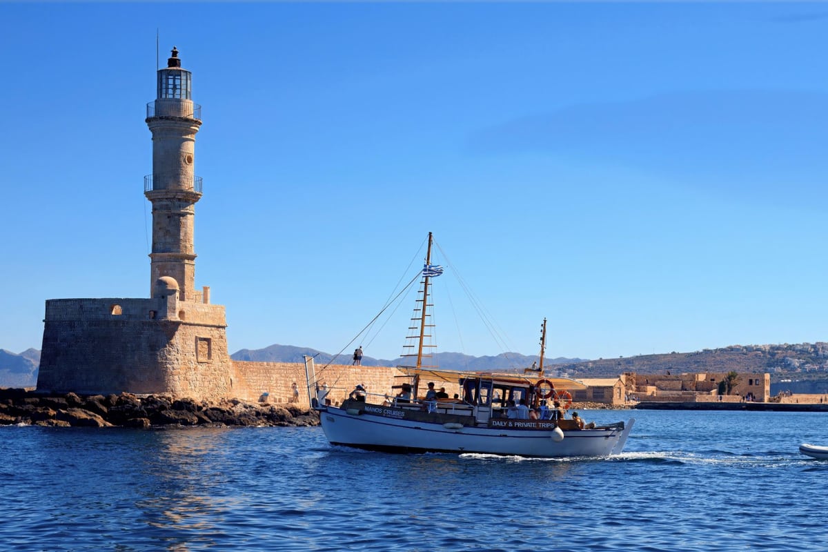
A Chania boat trip sails out of Chania, in western Crete, along the Gulf of Chania and the coast around it. The trip is one of the Greece Tours on Greece Ville, listed with the other Crete tours and Greece boat tours.
This post covers the gulf, the winds, the sea floor, how temperature and salt change the sea, the fish below the boats and the Battle of Crete at sea.
The ancient harbours of the coast, the best months and common questions come last. The sections include Chania boat trips that can be booked online.
What is a Chania boat trip?
A Chania boat trip sails the Gulf of Chania, between the Rodopou and Akrotiri peninsulas. The coastal zone of the Chania region holds 415 km of shoreline. In prehistory, the powerful city of Kydonia commanded this gulf.
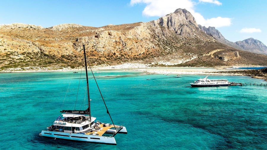
The Rodopos peninsula juts into the Cretan Sea like an outstretched finger. At its widest point, it measures about 5 km across. In ancient times, it was called Tityros.
Faults shaped Rodopos and built steep coastal mountains, mainly on its western side. Its limestone helped form hollows, small gorges and marine terraces in front of the coast. The Kladissos, Delfinos and Mouselas rivers run from the White Mountains to this north coast.
A Chania boat trip passes a Rodopos coast covered in low phrygana scrub of thorny burnet and thyme. Its gorges end in small coves, where narrow strips of sea reach into the rocky shore.
- Cape Spatha: The cape where the Rodopou peninsula ends is also known as Psakon.
- Akrotiri: The Akrotiri peninsula was Kiamon in ancient times and Charaka under the Byzantines.
- Maleme: The Maleme shore runs over three kilometres, from Tavronitis to Kondomari.


How do the winds shape a Chania boat trip?
A Chania boat trip meets winds that change with the season. On the hottest days at Souda, the average wind blows from the west-northwest at 8.1 mph. On the coldest days, it comes from the north at only 3.6 mph.
Ancient Greeks told apart three south winds. Notos brought winter rain and cut visibility. Leukonotos, the “white notus”, was milder and cleared the sky. The third, a hot dust-bringer, is identified with the sirocco.
A Chania boat trip uses the Beaufort scale, which first had 13 classes, from 0 to 12. In 1916, its descriptions changed to show how the sea behaved, not the sails. Anemometer readings were matched to Beaufort numbers only in 1923.
Souda records from 1973 to 1996 show calm air in 21.46% of autumn observations. Spring was the least calm season, with calm air in only 15.06% of observations.
- Height: On the modern Beaufort scale, wind speed is measured 10 metres above the sea.
- Harbour: The Venetian harbour of Chania gave weak shelter from north winds.
- Cyclone: A satellite image caught a tropical-like cyclone near Crete on 15 December 2005.
What lies on the sea floor under a Chania boat trip?
A Chania boat trip crosses a seabed that drops from a coastal shelf into deep water. Crete is ringed by a shelf full of reefs and shallows. South of Crete, the Hellenic Trench lies between 2000 and 4000 m deep.
North of eastern Crete, the Sea of Crete has two main deeps, about 2200 m and 2500 m. The Kithera–Antikithera deep of the Hellenic Trench reaches 4,615 m.
A Chania boat trip lies east of the west Cretan straits. The Kythira strait is 35 km wide and 160 m deep. The Elaphonisus strait is 10 km wide and 180 m deep.
Below 500 to 1000 m, Aegean bottom water keeps an even temperature of 13 to 14 °C.
- Earthquakes: Earthquakes in the Kythira Strait have reached surface-wave magnitudes of up to 8.0.
- Gulf site: Natura 2000 site GR4340003 covers Rodopou, Maleme beach and the Gulf of Chania, 160.47 km².
- North Rodopou: Natura 2000 site GR4340021 covers the northern Rodopou peninsula, 28.64 km².
How do temperature and salt change the sea of a Chania boat trip?
A Chania boat trip crosses waters shaped by heat loss and salt. From 1988 to 1995, the Eastern Mediterranean Transient took place in the Aegean Sea. After 1987, the Aegean supplied new eastern Mediterranean deep water, warmer than 13.3 °C and saltier than 38.7.
From the early 20th century to the mid-80s, eastern Mediterranean deep water barely changed. In 1995, Cretan Deep Water formed a dome-shaped layer centred on the Cretan Passage, south of Crete.
A south Aegean survey measured 15.09 to 24.65 °C and 37.84 to 39.18 psu within 100 m. Below 100 m, readings were 14.24 to 15.67 °C and salinity 38.86 to 39.04 psu.
During winter, temperature and salinity changed together through the water column at a Cretan Sea mooring. In spring, warm and cool layers separated the upper 300 m from deeper water.
- Deep-water flood: Cretan water lifted the older deep water to 800-2,500 m in the Levantine basin.
- Transitional layer: It lies 500 to 700 m deep, oxygen-poor and nutrient-rich.
- Antikythera Strait: Cretan water flowed up to 1.5 Sv there in 1992 and 1993.
What fish live below a Chania boat trip?
A Chania boat trip sails over dusky, gold-blotch and mottled groupers. The dusky grouper eats molluscs, crustaceans and octopuses, then takes more fish as it grows. The brown meagre makes sounds beside its swim bladder to communicate.
Young gold-blotch groupers are striped and look very different. Scientists counted them as another species until 1882. The fish lives shallower than 80 m but can go down to 200 m.
The IUCN lists the brown meagre as Vulnerable in the Mediterranean. Fishers catch it with spearfishing, trammel nets and gill nets. Gold-blotch groupers grow up to 1.4 m in length.
The sand steenbras below a Chania boat trip starts adult life as a male. It turns female between the ages of four and seven. Mediterranean cardinalfish hide in caves by day, at depths of 2 to 20 m.
- Black seabream: Kantharos, an Ancient Greek name for this fish, dates to Aristotle.
- Pearly razorfish: It buries fast in sand, wintering 90 to 150 m deep.
- Red mullet: It becomes adult at 10 to 14 cm during its first year.
How did the Battle of Crete reach the sea of a Chania boat trip?
A Chania boat trip crosses waters where British warships fought in 1941. In Souda Bay, Italian explosive boats crossed three boom defences to reach HMS York. Boom defences are net barriers stretched across a harbour. Later, HMS Kipling survived 83 bombs west of Crete.
To pass the inner net, Lieutenant Luigi Faggioni led the boats close to the shore. The two attacking pilots left their boats about 80 m from York.
A Chania boat trip passes the bay where, at 05:11, York’s officer of the watch heard an engine. He took it for an aircraft. The destroyer HMS Hasty towed York into water 27 feet deep.
All six Italian pilots were captured, and the British recovered one boat undamaged. An Italian shipbreaker raised York’s wreck in February 1952 and towed it to Bari.
- HMS Gloucester: Of 807 men aboard, only 85 reached shore, and Germans took them to Kythira.
- Fiji’s chaplain: Kit Tanner kept entering the sea to rescue men and won the Albert Medal after death.
- HMS Greyhound: Three Stuka bombs hit her, and six officers and 74 sailors died.
What ancient harbours lined the coast of a Chania boat trip?
A Chania boat trip passes a coast of old harbour towns. Phalasarna was a walled harbour town on the far west coast. Cisamus served Aptera as its naval arsenal, Strabo wrote. Minoa stood on the Akrotiri peninsula, near modern Marathi.
Kydonia fought off a Roman attack in a naval battle in the Gulf of Chania by 74 BC. In 69 BC, the Roman Metellus defeated the Cretan general Lasthenes at Kydonia.
A Chania boat trip can sail toward Phalasarna, which Kydonia captured in 184 BC. An artificial channel joined its military harbour to the sea, and a chain was able to close it.
A second basin at Phalasarna had a 30 m quay with a slipway at one end. A winery and warehouses dug up between 2008 and 2012 show that the town made goods for export.
- Aptera: Linear B tablets of the 14th and 13th centuries BC name Aptera as A-pa-ta-wa.
- Kalami: The site of Cisamus, the port of Aptera, is tentatively placed at Kalami.
- Lissos: Lissos, a harbour town on the south coast, had strong trading and fishing fleets.
Which months suit a Chania boat trip?
A Chania boat trip suits the warm sea of summer and early autumn. In July, sea readings off Chania run from 23.9 °C to 27.4 °C. October sea water still averages 23.1 °C. In late spring, rain falls on only 3.9 days at Souda.
The sea off Chania averages 16.7 °C in January and 16.1 °C in March. In late spring it averages 19.1 °C, and in December 18.1 °C.
March brings 81.2 mm of rain at Souda, while April drops to 26.9 mm. A Chania boat trip in November meets 86.7 mm of rain over 10.8 rain days. November still logs 138.0 hours of sunshine.
- Phota: In Greece, the feast of Theophany on 6 January is also called Phota, “Lights”.
- Blessing: On the feast day, the Great Blessing of Waters takes place at a beach, harbour or quay.
- Rank: Theophany is the third Great Feast of the Orthodox year, behind Easter and Pentecost.
What do visitors ask about a Chania boat trip?
A Chania boat trip raises questions on lifejackets, sun, passenger rights and the harbour light. EU rules put drowning in Category III, the group of risks that can cause death. WHO says that below a UV index of 2, even very fair skin needs no protection.
Which lifejackets suit a Chania boat trip?
EN ISO 12402-3 covers level 150 lifejackets for adults, children and infants in offshore or rough water. The level 100 standard, EN ISO 12402-4, also covers infants. Under EU rules, inflatable gear that prevents drowning must inflate rapidly and fully.
How strong is the sun on a Chania boat trip?
Four bodies, including WHO and the World Meteorological Organization, developed the UV index together. Environment Canada first forecast next-day UV levels in 1992. In the EU, sunscreen carries the UVA seal only with strong UVA protection. That protection must reach one third of its SPF.
What rights cover passengers on a Chania boat trip?
EU ship passenger rights do not cover ships with no more than 3 crew. On a cancelled sailing, passengers are owed snacks or meals in proportion to the wait.
When did the harbour light of a Chania boat trip become official?
A fixed white light was installed in the Chania lighthouse in late spring 1915. That made it an official Greek lighthouse. The lighthouse was damaged in the Second World War and refurbished in 2006.