
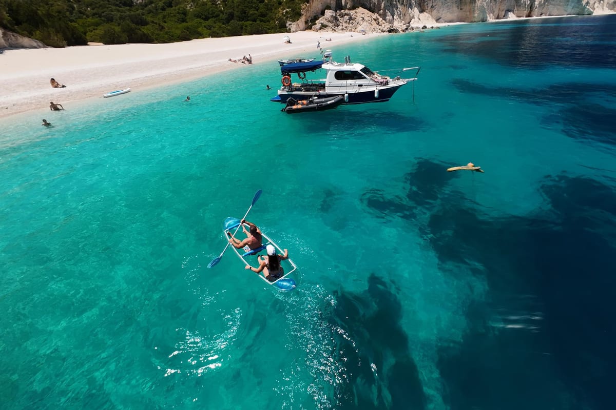
A Kefalonia boat tour sails along the coasts of Kefalonia, the island west of the Gulf of Patras in the Ionian Sea. The tour is one of the Greece Tours on Greece Ville, listed with the other Ionian Islands tours and Greece boat tours.
This post covers the island from the sea, the coast raised by earthquakes, the sea that flows into the land, lighthouses, seafarers and the deep sea offshore.
Wrecks, the best months and common questions come last. The sections include Kefalonia boat tours that can be booked online.
What is a Kefalonia boat tour?
A Kefalonia boat tour sails around the hilliest of the Ionian Islands. Kefalonia ranks third in population among them, after Corfu and Zakynthos. It sits opposite the mouth of the Gulf of Patras. Its Ionian coast is rocky and steep.

The main gulfs are those of Sami, Myrtos, Lourdas, Atheras, Fiskardo, Livadi and Argostoli.
On a Kefalonia boat tour, the Gulf of Argostoli is the central stretch. It runs 13 km from north to south and is 2 to 3 km wide. Its mouth is 3 km wide, between the cape of Platys Gialos and the south-west cape of Paliki.
Lixouri, Agios Dimitrios, Kouvalata, Kontogourata, Farsa, Drapano and Argostoli line its shores. The shores are mountainous, above all on the east side. The gulf sits in a graben, a block of land that sank between faults.
On a Kefalonia boat tour, the gulf’s past is surprising. In the Ice Ages it was possibly a karst plain, drained by the Argostoli sinkholes.
Livadi lagoon, about 800 acres, is Kefalonia’s key wetland, 8 km from Lixouri. A sand bar separates it from the gulf, and a man-made inlet lets floodwater out. More than 50 bird species have been recorded there.
- Northern capes: Dafnoudi, Atheras, Ortholithia, Skiza and Gerogombos mark the north and west.
- Harbouris: Livadi is also called Harbouris’ swamp, after a man who grew sugar cane, indigo and cotton there.
- Sea route: The geopark’s sea route starts at Argostoli port and crosses to Lixouri.
- Paliki: The same route then sails around the Paliki peninsula.


How did earthquakes lift the coast on a Kefalonia boat tour?
A Kefalonia boat tour passes a coast raised and lowered by earthquakes. The main 1953 shock began about 10 km below the surface. No shorelines lifted in 1953 were found on the Fiskardo peninsula.
Two quakes came first. A magnitude 6.3 shock hit on 9 August and a 6.5 shock on 11 August. A magnitude 6.2 aftershock struck at 12:05 on 12 August, the day of the main shock.
On a Kefalonia boat tour, look for tidal notches. These grooves are worn into limestone cliffs at sea level, chiefly by living things eating into the rock. One notch, formed between the 4th to 6th century AD and 1953, deepened by 0.64 mm a year.
An older raised shoreline sits 1.2 m above the sea in southern Kefalonia. It was lifted between AD 350 and 710. On Fiskardo’s east coast, ancient quakes left raised shorelines about 18 and 44 cm above the sea.
The same coast hides seven drowned shorelines, the deepest about 230 cm below the surface. Researchers mapped them by snorkelling and diving, using a boat to reach every site.
On a Kefalonia boat tour, the 2014 quakes are recent history. The sequence had two main shocks: Mw 6.1 on 26 January and Mw 6.0 on 3 February. The second struck about 7 km north-west of Lixouri, at a depth of 10 km.
- Paliki: The bulk of the 2014 ground movement was on the Paliki peninsula.
- Rise and fall: Central-eastern Paliki rose highest, while its eastern coastal zone sank lowest.
- Fiskardo: A June 2014 survey found no height change there.
- Lixouri: Satellite radar from 2016 to 2022 shows the town still rising by millimetres each year.
Why does the sea vanish into the land on a Kefalonia boat tour?
A Kefalonia boat tour near Argostoli passes sinkholes where the sea pours into the land without a break. They are Geosite No 14 of the Kefalonia-Ithaca UNESCO Global Geopark. Their riddle kept geoscientists busy for about 150 years.
Their channels run through Upper Cretaceous limestone, about 100.5 to 66 million years old. Tides and wind cannot explain the flow. The water table at the sinkholes lies 1.70 m below sea level, against 0.73 m below at Karavomylos.
On a Kefalonia boat tour, the physics is simple. Seawater is heavier than brackish water. It sinks in at Argostoli and pushes lighter water out near Sami. The inflow speeds up after heavy rain and slows when rain is scarce.
The main underground channel first formed about 7 million years ago, when the Messinian sea level fell. Faults running north to south later broke it, which helps explain the slow trip of the dye.
The 1963 test used 160 kg of uranine, a tracing dye. The Austrians Zötl and Maurin poured it in.
On a Kefalonia boat tour, the sea mills tell a business story. An Englishman named Stevens built the first one to earn money from the flow. Miliaressis built a second mill in 1857 and later bought Stevens’ mill too.
- Trombetas: From 1917 to 1922, Angelos Trombetas owned both mills and ground wheat and barley for beer.
- Power: The sea mills also powered a power plant and an ice factory until the Second World War.
- Schliemann: Heinrich Schliemann visited in 1868 and saw two large grain mills working day and night.
- Karavomylos: The name means boat mill, after a mill turned by an iron boat wheel.
Which lighthouses mark a Kefalonia boat tour?
A Kefalonia boat tour passes the Agioi Theodoroi lighthouse near Argostoli. It is a round building on twenty white Doric columns. It takes its name from the small church beside it. Its light shines from 11 m above the sea.
Kefalonian architect Takis Pavlatos rebuilt it in 1964, after the 1953 earthquakes destroyed it. The light gives one white flash every 3 seconds.
On a Kefalonia boat tour, British rule left its mark on these lights. Irish Royal Engineer John Pitt Kennedy built lighthouses, roads and quays on the island under Sir Charles Napier. The Argostoli light joined the Greek network in 1863.
Fiskardo’s lighthouse dates from 1892, with a 14.2 m tower and a light 27 m above the sea. It was built near the old Venetian lighthouse and took over its job. The 1953 earthquakes damaged it badly, and it was almost completely rebuilt.
On a Kefalonia boat tour, Cape Gerogompos marks the far west. It sits at the south-west end of the Paliki peninsula, the westernmost point of the island. A rotating lighthouse has stood on the steep cape since 1906, and its light reaches 30 nautical miles.
- Twelve Islands: This dangerous cluster of reefs lies about 5 miles north of the Gerogompos light.
- Vardiani: Under British rule, a large lighthouse went up on this islet between Argostoli and Lixouri.
- 1942: Italian bombing flattened the Vardiani lighthouse, and a modern light stands there today.
- Range: Ships can see the Argostoli light from about 5 nautical miles away.
Which Kefalonian seafarers does a Kefalonia boat tour recall?
A Kefalonia boat tour recalls the sailor Juan de Fuca. He was born Ioannis Fokas in Valerianos on Kefalonia on 10 June 1536. British captain Charles William Barkley named the Strait of Juan de Fuca after him in 1787.
In 1587, the English privateer Thomas Cavendish seized his galleon Santa Ana off Cabo San Lucas. In 1592 he claimed to have found a strait at about 47° north. The real strait lies near 48° north.
On a Kefalonia boat tour past Assos, another life story fits. Constantine Phaulkon was born in 1647 at Assos Castle. His Greek surname, Gerakis, comes from geraki, the word for falcon. At 13 he left on an English ship and spent ten years in London.
In 1669 he sailed to Bantam on the English ship Hopewell as assistant gunner. He rose to chief minister of King Narai of Ayutthaya, in Siam. He was executed at Lopburi on 5 June 1688.
On a Kefalonia boat tour, shipping wealth is part of the story. Panagis Vallianos is called the father of modern Greek shipping. Born in Kerameies in 1814, he began as a sailor. Around 1840 he and his brothers traded and shipped grain from Taganrog in Russia.
Vallianos moved his firm to London in 1858 and joined the Baltic Exchange. From 1815 to 1864, chiefly Kefalonian captains and shipowners built an Ionian ocean-going fleet for bulk grain.
- Lykiardopoulos: This Kefalonian family worked in shipping from the middle of the 18th century.
- Pylaros: In the 19th century, a large share of its men were sailors, shipowners and merchants.
- Danzig: From the 16th to the 18th centuries, Kefalonia owned a large fleet and ordered ships from Danzig.
- Academy: The Merchant Marine Academy in Argostoli has trained ship captains since 1975.
What lies under the sea on a Kefalonia boat tour?
A Kefalonia boat tour sails over the Kefalonia Transform Fault Zone. It shows the fastest relative plate motion in the Mediterranean. It has five main segments, nearly 120 km long in total. The Kefalonia segments slip about 25 mm a year.
The Lefkada segments slip about 15 mm a year. Under Kefalonia, the fault’s earthquakes break rock between 3 and 17 km below the surface. The fault runs parallel to the west coast of the Paliki peninsula.
On a Kefalonia boat tour, the plate border changes character offshore. An ocean plate sinking under another gives way to two continents pushing together. A gap of about 100 km separates the Adriatic and Aegean subduction lines. The fault lies in that gap.
GPS surveys in 1989 and 1991 told a clear story. A deep trough along the north-west coast controls how the ground moves. Seabed shallower than 125 m near the shore has not been studied in detail.
On a Kefalonia boat tour near Lixouri, the Kounopetra rock is a local legend. Visitors once wedged small sticks between it and the shore and watched them shift or snap. Its motion faded after the 1953 earthquake and stopped for good in 1974.
- New Kounopetra: A smaller rock beside it still moves now and then.
- Sperm whale: A male tagged south-west of Kefalonia was followed for 57 days.
- Route: It swam from the Ionian Sea along the Hellenic Trench into the southern and north-eastern Aegean.
- Codas: Sperm whales in the trench make click patterns never recorded in the western Mediterranean.
Which wrecks lie off a Kefalonia boat tour?
A Kefalonia boat tour passes the waters off Argostoli where the steamer Ardena hit a mine. It happened on 28 September 1943. She was carrying 840 Italian prisoners of war, and 720 of them died. She began life in 1915 as HMS Peony, a British minesweeping sloop.
As HMS Peony, she served as General Julian Byng’s headquarters ship. That was during the Suvla Bay evacuation of December 1915. In 1920 she was rebuilt as a passenger ferry and renamed Ardena.
On a Kefalonia boat tour, the war of 1943 left more wrecks. The German transport Elsi, built in 1891, hit a mine south of Kefalonia that September. She was sailing to Argostoli for Italian prisoners, and nobody died.
On 13 September 1943, Italian gun batteries fired on a German convoy of five ships near Argostoli. They sank two German landing craft.
In the late spring of 1941, two German cargo ships struck mines off Kefalonia. The Kybfels and the Marburg both sank. On 30 December 1941, HMS Proteus torpedoed the Italian cargo ship Città di Marsala. It was hit 10 nautical miles south-west of Argostoli.
On a Kefalonia boat tour near Fiskardo, the sea holds an older wreck. A Roman merchant ship found there was 34 m long and 13 m wide. It carried about 6,000 amphorae. A University of Patras team found it in 2013 with sonar, about 2 km from the bay entrance.
- Date: The Fiskardo wreck dates to the 1st century BCE or 1st century CE.
- Size: It is the largest such wreck yet found in the eastern Mediterranean.
- MAS boats: Italian torpedo boats MAS 512 and 513 were wrecked at Kefalonia on 24 January 1942.
- Perseus: John Capes, the only survivor of the submarine HMS Perseus, later received the British Empire Medal.
Which months suit a Kefalonia boat tour?
A Kefalonia boat tour suits summer, when Argostoli gets 12.6 hours of sunshine a day in July. June averages 11.7 hours and August 11.8. July is also the windiest summer month, with a mean of 6.6 m/s.
December and January get only 4.6 hours of sunshine a day. April averages 8.5 hours. September averages 9.4 hours, and October 7.3 hours.
On a Kefalonia boat tour in autumn, the wind drops. The mean wind speed is lowest in September and October, at 5.6 m/s. February has the highest mean of the year, 6.9 m/s.
The strongest wind in the October record reached 38.7 m/s, the top figure of any month. August has the lowest top wind speed of the year, 21.7 m/s.
On a Kefalonia boat tour in high summer, heat builds. In the 1991 to 2020 averages, August is the warmest month, with a mean of 27.4 °C. The mean daily high reaches 31.1 °C in August and 30.5 °C in July.
The August mean rose from 26.1 °C in 1971 to 2000 to 27.4 °C in 1991 to 2020. June averages 24.5 °C, with nights falling to 18.4 °C.
- September rain: The wettest single September day on record brought 125.2 mm.
- August rain: Even August has seen 37.8 mm fall in one day.
- South storms: Storms from the south can reach the Gulf of Argostoli across open water.
- Beaufort: Calm air, force 0, makes up 7.1 percent of the yearly wind record.
What do visitors ask about a Kefalonia boat tour?
A Kefalonia boat tour raises questions about the gulf, the De Bosset Bridge and the ferries. Others ask about the Ionian name and dolphins. The Gulf of Argostoli is over 20 m deep. The inner bay is under 10 m, and Koutavos under 1 m.
How sheltered is the gulf on a Kefalonia boat tour?
For its size, the Gulf of Argostoli is shallow. The Bays of Argostoli and Koutavos are sealed off from open-sea waves. They form one of the best storm-sheltered natural harbours in the Mediterranean.
Did tsunamis hit the coast on a Kefalonia boat tour?
Sediment cores at Koutavos record four tsunami waves. They date to about 4150 BC, 3200 BC, 650 BC and AD 930. Researchers concluded that the Koutavos lagoon served as the harbour of ancient Krane. The Argostoli Fault makes Koutavos a dead-end arm of the gulf.
What is the De Bosset Bridge on a Kefalonia boat tour?
In 1812 the island council feared the planned bridge gave robbers an escape route. Its northern end had no houses. Parts collapsed in the 1953 earthquake, and the repairs still show from the side.
Which ferries serve a Kefalonia boat tour?
In summer, Lixouri has a ferry service to Patras and Killini on the mainland. KTEL buses from Lixouri run to Patras and Athens by way of Sami. Poros, the port for the Kyllini ferry, had 884 residents in 2021.
Where does the sea name come from on a Kefalonia boat tour?
The Oxford Classical Dictionary says the name Ionian possibly comes from Ionians who sailed west. The Greek word for Ionians uses an omega, but the sea’s name uses an omicron. One legend names it after Ionius, a son of Adrias.
Which dolphins swim on a Kefalonia boat tour?
Common dolphins breed in the protected sea along the west coast and in the Kefalonia–Ithaca strait. The same site lists striped dolphins as resident and Risso’s dolphins as occasional visitors. Bottlenose dolphins are listed from Argostoli to Mounta Bay.