

A Kos island tour crosses the long island in the Dodecanese, from Kos town to Kefalos. The tour is one of the Greece Tours on Greece Ville, listed with the other Dodecanese tours and Greece shore excursions.
This post covers the villages, churches and mosques, castles, famous people and old crafts of the island.
Earthquakes, Italian buildings, ports, roads, islets, festivals, wetlands, the best months and common questions follow. The sections include Kos island tours that can be booked online.
What is a Kos island tour?
A Kos island tour is a trip across the island of Kos and its villages. The Kos regional unit, which also holds Nisyros, covers 337.2 square kilometres. The Kos municipal unit, the area around the main town, covers just 67.2 square kilometres.
The island’s population grew a lot over the years. In 1905, the whole island of Kos had 13,052 inhabitants. By 1947, the population had reached 18,545. Kos counted 26,379 residents in 1991 and 30,949 in 2001.
On a Kos island tour, the Dikaios municipal unit covers 62.575 square kilometres of land. At the 2011 census, it counted 7,130 residents. At the same census, the Irakleides municipal unit in the west counted 6,826 residents.
Kos has a narrow neck of land, known as an isthmus. It is just 1.6 kilometres wide. West of it lies the Kefalos peninsula. This isthmus joins the peninsula to the rest of Kos.
On a Kos island tour, the ground is far from flat. The hilly parts of Kos rise 200 to 300 metres above sea level. Volcanic ash also forms a tuff plateau about 100 metres high around Antimachia.
Birds have their own space on Kos as well. The island has a protected EU Natura bird site. This site joins two wetlands. One is Psalidi lake, and the other is the Alyki salt lake.
On a Kos island tour, the main town has a mixed past. In the late 1920s, about 3,700 Turks lived in Kos town. That was slightly under half of all the people in the town.
- Datça: Turkey’s Datça peninsula lies just 15 kilometres south of Kos, across the water.
- Nisyros: The island of Nisyros lies 12 kilometres south of Kos, even closer than Datça.
- Astypalea: The island of Astypalea lies about 43 kilometres west of Kos, much farther away.
- Tilos: The island of Tilos lies midway between Kos and the island of Rhodes.
A Turkish community still lives on the island of Kos today. Together with the one on Rhodes, it is estimated at fewer than 5,000 people.


Which villages does a Kos island tour cross?
A Kos island tour can pass through villages such as Zipari, Antimachia, Pyli, Platani, Kefalos and Kardamena. The village of Zipari sits 30 metres above sea level. It lies right on the main road that runs from Kos town to Kefalos.
Zipari counted 3,467 residents at the 2021 census. In 2011, it held about 80 percent of the 4,094 people of the Asfendiou district. That makes Zipari by far the largest village of the district.
On a Kos island tour, Antimachia stands about 116 metres above sea level. It sits on a low plateau right in the centre of Kos. Back in 1947, the village counted 1,870 inhabitants.
This farming area once had about 100 windmills. The windmill of Antimachia is the last of them still standing. The community of Antimachia was founded on 28 September 1948, after the Dodecanese joined Greece.
On a Kos island tour, a local myth tells of the shipwrecked Heracles. He wrestled Antagoras, a shepherd near Antimachia, to win a ram. Fleeing the angry locals, he reached the fort of Old Pyli in women’s clothes.
Muslims first settled in Pyli during the Ottoman period. After the 1821 revolution, Ottoman officials drove the Greeks out of the castle village. The Greeks then built the new village of Lower Pyli nearby.
On a Kos island tour, Platani sits 2 kilometres from Kos town centre and from the Asklepieion. The village also carries the Turkish name Kermentes. About 1,800 of its roughly 3,000 residents are of Turkish origin.
- Linopotis: The small settlement of Linopotis counted just 413 residents at the census of 2021.
- Kamari: Kamari, the beach settlement below the village of Kefalos, counted 156 residents at the same census.
- Kefalos and Kardamena: Kefalos had 1,405 inhabitants in 1905, while Kardamena had only 600 that year.
- Pyli: The population of Pyli fell from 2,049 in 1951 to 1,508 in 1971.
Halasarna, the ancient town near Kardamena, is thought to have been abandoned around the seventh century. The cause is thought to be an earthquake and fear of Arab raids.
Which churches and mosques mark a Kos island tour?
A Kos island tour explores the home of one of the four Orthodox cathedrals of the Dodecanese. Only two of the five Ottoman mosques on Kos are still open for prayer. These are the Defterdar Mosque and the Gazi Hasan Pasha Mosque in Platani.
Certain accounts say the Defterdar Mosque was once an Orthodox church of Saint Paraskevi. Its dome rests on twelve arches. An eastern staircase topped by a small two-domed porch was the entrance kept for officials.
On a Kos island tour, an eight-sided marble fountain stands beyond the Defterdar minaret. Six arches and short columns hold up its vaulted roof. That minaret needed a second restoration between 2004 and 2005.
The Loggia Mosque measures 23 by 17 metres and has two storeys. Local tradition says it began as a church of Saint George. An old description says Gazi Hasan Pasha built it in 1786.
On a Kos island tour, the Loggia Mosque reuses marble and stone from a three-aisled harbour basilica. Its builders took more from the Baptistery of Saint John, called the Seven Steps.
The Municipality of Kos bought the empty synagogue in the 1980s and uses it for lectures and exhibitions. In 2022 architect Elias Messinas was asked to restore its interior for services and cultural events.
On a Kos island tour, the Metropolis of Kos answers directly to the Patriarchate of Constantinople. It is not under the Church of Greece. In 325, Bishop Meliphron of Kos attended the First Council of Nicaea.
- Loggia fountain: North of the mosque stands a fourteen-sided white marble fountain under a dome on seven arches.
- Agios Stefanos: East of its two basilicas, a large cross-shaped baptistery had a channel draining into the sea.
- North basilica: The smaller of the two keeps its apse niche, clergy bench (synthronon) and sanctuary foundations.
- Panagia Palatiani: Known for its view, this church stands among the ruins at Palatia, south of Kefalos.
The Church of Agios Nikolaos in Kos fared worse. The 1933 earthquake damaged it so badly that it had to be torn down.
Which castles and towers guard a Kos island tour?
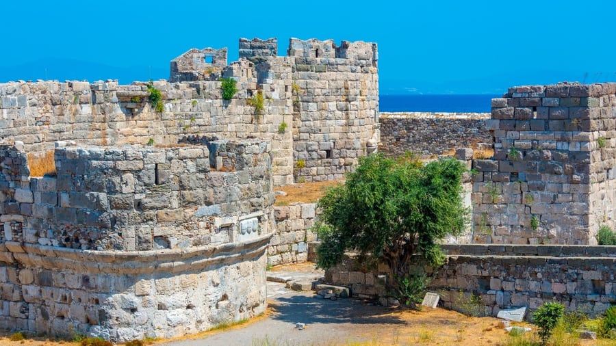
A Kos island tour reaches Neratzia castle, where a wide moat separates two baileys. A ramp resting on arches crosses it. The inner bailey’s south-east corner tower was later built into the outer bailey wall. Besides the main gate, Neratzia has the Carmadino Gate.
Neratzia’s oldest tower bears the arms of Jean de Lastic and Jacques de Milly. De Lastic was the first head of the Knights to actually use the title Grand Master. De Milly was the 37th Grand Master.
On a Kos island tour, the outer bailey recalls Pierre d’Aubusson, who began it. He was wounded three times defending Rhodes in the 1480 siege. Emery d’Amboise, born in 1434 at Chaumont-sur-Loire castle in France, carried it on.
Fabrizio del Carretto completed the outer bailey. He was born in Finale Ligure, Italy, in 1455. As Grand Master from 1513 to 1521, he stocked the Dodecanese fortresses with food and artillery.
On a Kos island tour, Antimachia castle’s first record is a Knights’ document of 1358. The Malta Archives keep it. Knights’ documents call the castle de Landemachi or Lindemachii. 18th-century travellers called it Andimesia.
About 25,000 people sheltered inside Antimachia castle during the Ottoman siege of 1457. In 1462, 18,000 men took part in another assault. A circular yard inside leads to galleries of Ottoman-period gun batteries.
On a Kos island tour, cyclopean masonry remains suggest the Pyli castle hill was fortified in Mycenaean times. Peripatos castle, inside modern Pyli, appears in a codicil to Saint Christodoulos’s will dated 10 March 1093.
- Pyli castle: A flat-roofed building of about 5 by 6 metres is its only complete structure.
- Pyli cistern: A large underground water cistern lies in the centre of the upper bailey.
- Fortezza di Chiffalo: In 1461 the Knights thought of leaving this Kefalos castle. They planned to move the islanders to Rhodes.
- Kefalos ruins: A 20-metre stretch of wall and a water cistern still survive there.
In 1526 the Ottoman admiral Piri Reis called Kefalos the third castle of Kos. It stands on a hill on the south-west side.
Which famous people come from a Kos island tour?
A Kos island tour covers an island linked to poets, doctors, painters and leaders. Ptolemy II was born on Kos and studied with the philosopher Strato of Lampsacus. He funded the expansion of the Library of Alexandria and paid for scientific research.
Diogenes Laërtius says Epicharmus was born at Astypalea on Kos, near today’s Kefalos. Epicharmus is thought to have lived from about 550 to 460 BC. One of the first comedy writers, he wrote thirty-five to fifty-two comedies.
On a Kos island tour, Philitas of Cos is a key name. Born about 340 BC, he is seen as founder of the Hellenistic school of poetry. His word list, Disorderly Words, explained rare words, including Homer’s.
The Roman writer Aelian passed on a story. Philitas wore lead weights in his shoes to stop the wind blowing him away. His pupil Hermesianax wrote that islanders raised a statue of Philitas under a plane tree.
On a Kos island tour, it helps to know the poem Demeter by Philitas. It told how the goddess came to Cos and was welcomed by the Meropids. These humans were twice normal size.
Apelles painted Aphrodite Rising from the Sea for Kos’s temple of Asclepius. Augustus took it to Rome as part payment of tribute. Apelles died painting an Aphrodite of Kos. No one had the skill to finish it.
On a Kos island tour, Idyll 7 by Theocritus is worth knowing. This poem, the Harvest Feast, is set on Kos. In it, Theocritus praises Philitas, the veteran poet of the island.
- Herodas: His fourth mime shows two poor women at the temple of Asclepius on Kos.
- Praxagoras: Born on Kos about 340 BC, he told arteries apart from veins and taught Herophilos.
- Gaius Stertinius Xenophon: This Kos-born physician is suspected of helping to poison the Emperor Claudius.
- Berossus: Vitruvius wrote that this Babylonian priest moved to Kos and founded an astronomy school.
Al Campanis, born on Kos in 1916, was Major League Baseball’s first Greek player. Ioannis Sarmas, born there in 1957, was caretaker Prime Minister of Greece in 2023.
Which silk and crafts made a Kos island tour famous?
A Kos island tour explores the island that gave its name to Coan silk. This cloth was woven from the wild silk of Pachypasa otus. It is a Mediterranean moth of the family Lasiocampidae. Dru Drury first described it in 1773.
Pachypasa otus has a wingspan of 36 to 45 mm. Adult moths of this kind fly from June to September. Its recorded food plants include cypress, juniper, thuja and the oak Quercus pubescens.
On a Kos island tour, Pliny’s record of the Coan silkworm is worth knowing. He said it lived on cypress, terebinth, ash and oak. Collectors kept the cocoons in earthen pots in a warm place.
The worms were fed on bran. The cocoons were softened in water and drawn into thread with a reed spindle. This silk was so light that even Roman men wore it in summer, Pliny complained.
On a Kos island tour, it helps to understand wild silk. Wild silk is collected after the moth leaves the cocoon. That cuts the thread, so there is no single long thread.
Pliny names Pamphile of Kos, daughter of Plateas, as the first person to weave silk. Boccaccio’s book On Famous Women includes her as Panphyle. On ancient Kos, female slaves made silk garments in large factories.
On a Kos island tour, Augustan poets give clues about Coan cloth. Tibullus, Propertius, Horace and Ovid all mention it in their verses. Their lines show it was at times dyed purple, with stripes of gold.
- Tibullus, elegy 2.3: His mistress wants costly gifts, including Coan silk clothes woven with gold thread.
- Chinese silk: After the 1st century AD, Coan silk slowly gave way to this better-quality silk.
- Sarikol kingdom: Romans did not at first link Coan wild silk with silk from the Pamirs.
- Unguents: Pliny says Kos became famous for a marjoram unguent, later replaced by a quince-blossom one.
The Cleopatra Papyrus, a Ptolemaic royal order, let one Roman import 5,000 Coan amphorae of wine a year. He paid no tax on them.
Which earthquakes shook a Kos island tour?
A Kos island tour crosses towns that big earthquakes have shaped over the ages. The 1933 quake struck on a Sunday morning. Kos town then had about 7,500 inhabitants. Estimates of the quake’s magnitude range from 6.43 to 6.70.
Greece’s quake protection agency, OASP, lists 200 dead and 600 injured. The bulk of residents were left homeless. Shaking reached intensity IX to X, “violent” to “extreme”, in Antimachia, Kardamena and Kos town.
On a Kos island tour, Antimachia stands out in the 1933 story. Almost every home there fell, and Kardamena was nearly wiped out. In the newer part of Kos town, 50 percent of homes were wrecked.
Only 122 victims were ever named. The Kos town toll was later revised to 178, with three more deaths at Pyli. The local historian Zarraftis was among the people killed in 1933.
On a Kos island tour, the walled old town recalls a hidden weakness. In 1933, a large share of its houses had no foundations. They simply rested on top of ancient walls.
Islanders and the media still describe a 2–3 m tsunami in 1933. Yet no reports of one exist. Relief measures were announced on 21 June 1933. They were backdated to the quake and valid for three years.
On a Kos island tour, the 2017 Bodrum–Kos quake is recent history. Liquefaction hit Cape Louros and the waterfront, wrecking the main pier and customs building. At Kos Marina, a 0.8 m tsunami reached 33 m inland.
- AD 141 to 142: A quake shook Lycia, Caria, Rhodes, Kos, Symi and Serifos. It set off a severe tsunami.
- Altar of Dionysus: The 142 quake damaged it and its Doric temple, and both were later partly restored.
- AD 469: The municipality calls it decisive; it ended the ancient city and opened the early Christian period.
- 15 August 554: NOAA lists this quake at magnitude 7. It also badly damaged Tralles, today’s Aydın, and Kalymnos.
The historian Agathias visited Kos soon after the 554 quake. He saw that its tsunami had flattened the buildings still standing.
Which Italian buildings line a Kos island tour?
A Kos island tour moves through a town shaped by Italian buildings. Eleftherias Square took its present layout after the 1933 quake. So did the buildings around it. Florestano Di Fausto’s Governor’s Palace now holds the police headquarters, court and regional administration offices.
Rodolfo Petracco, born in Trieste in 1889, studied under the local architect Lodovico Braidotti. In 1927, he and Di Fausto built the Catholic church of Agnus Dei. He also designed the Hotel Gelsomino, built in 1928–1929.
On a Kos island tour, the church of Agnus Dei has a central plan. A tapering bell tower rises on its front. It counts as Di Fausto’s best work in the Dodecanese.
A 1928 town plan had banned modern buildings in the walled old town. The ban also covered Halvagià, the Turkish quarter. A governor’s decree of 25 August 1933 scrapped it after the quake.
On a Kos island tour, archaeologist Luciano Laurenzi is part of the town’s story. He dug test pits across the town through the summer of 1933. This came before the new plan was drawn.
The 1934 plan kept eight large zones free of building. Each was set aside for a future archaeological park. Governor Mario Lago wrote a note by hand telling Petracco to mark these zones in the plan.
On a Kos island tour, Armando Bernabiti’s Casa del Fascio dates from 1934–1935. This Fascist party house held a cinema and a workers’ club. The town’s former Hall of Fascism is known today as the “Egli” building.
- Casa del Balilla: Built in 1934–1936, it is another Bernabiti work, like a kindergarten and the Villa Brunetti.
- Archaeological Museum: Its first drawings date from 1934, the year after the quake.
- Museum style: Architect A. K. Antoniades called its style “fascist monumentality” with International Style details.
- Ancient stadium: A 1941 decree protected the block over it, between Via d’Italia and Via dell’Impero.
The Archaeological Museum stands on part of the Hellenistic wall of the ancient city. That wall can be seen in its basement.
Which harbours and ferries serve a Kos island tour?
A Kos island tour depends on the Kos town harbour, the main port for passengers and goods. Today it serves chiefly regional traffic. The small port of Mastichari links Kos with Kalymnos and Pserimos. Daily catamarans reach Symi, Leipsoi, Rhodes, Leros, Kalymnos and Patmos.
In Greek, the main harbour of Kos town is called Limani Mandraki. The port authority, the port police, the town hall and the court all stand around it. Nisyros has a harbour with the same name.
On a Kos island tour, the Turkish mainland is close. Its nearest point lies about 7 km from the harbour in a straight line. North of Kos town, the Bodrum peninsula lies less than five kilometres away.
In 1935, the Italian archaeologist L. Morricone found two Hellenistic shipsheds near the port. They stood in Bozuktà, the old Turkish quarter. At first, experts wrongly took them for part of the harbour’s defence walls.
On a Kos island tour, more shipsheds lie further south on the same harbour inlet. The Greek Archaeological Service found them in 1986–87. In the 2nd century AD, the Harbour Baths reused shipshed walls for bathing rooms.
In 1915, the French battleship Suffren hit the British freighter Saint Oswald. The Suffren was returning to its anchorage off Kamari. The Saint Oswald carried horses evacuated from Gallipoli and sank. The Suffren was badly damaged.
On a Kos island tour, Kos port handled about 617 thousand sea passengers in 2023, by Eurostat’s count. That figure leaves out cruise passengers. About 309 thousand landed, and about 308 thousand sailed away.
- Kardamena: Ships from Kardamena to Nisyros run only part of the time in winter.
- Record year: Port traffic peaked at about 639 thousand passengers in 2006, the highest count up to 2023.
- First count: In 1997, the first year in the series, the port counted about 338 thousand passengers.
- Sharp drop: In 2020, traffic fell to about 283 thousand passengers, under half the 627 thousand of 2019.
Two nearby ports see less traffic. In 2023, Eurostat counted about 386 thousand sea passengers at Kalymnos port. Nisyros port counted only about 31 thousand.
Which roads, bikes and buses serve a Kos island tour?
A Kos island tour on land relies on public buses, the main road and bicycles. Buses run up to eleven times a day between the airport and Kos town, by way of Mastichari. Kos also has 6,500 bicycles for rent.
Kos airport opened in 1964 with a 1,200-metre runway. The single runway is now 2,390 metres long and 45 metres wide. The runway’s name changed from 15/33 to 14/32 in 2005–2006, as Earth’s magnetic north had shifted.
On a Kos island tour, flights land without an instrument landing system. Pilots land by sight or with a VOR/DME radio beacon. With no parallel taxiway, planes turn around at the runway’s end before take-off.
In 1997, a new arrivals hall was built beside the departures hall. Before that, queues at busy times reached the car park. A new terminal, finished in spring 2021, has 28 check-in desks and nine security lanes.
On a Kos island tour, the airport has more than doubled its traffic since 1994. That year it handled 1,255,267 passengers. In 2023, it handled 2,954,719 passengers, and 305,775 flew on domestic routes.
Cycling on Kos took root under Italian rule. Locals copied the Italian soldiers’ steady use of bicycles. Classic Greek films of the 1960s show stars cycling on Kos town’s Palm Tree Avenue, Phoinikon Street.
On a Kos island tour, cyclists find about 5 km of separate lanes in Kos town. An EU LIFE project of the Municipality of Kos rebuilt them for cyclists and walkers.
- Kardamena road: A spur road links Kardamena with Antimachia and with the main road.
- Antimachia stop: Buses heading to Kardamena and Kefalos stop at the edge of Antimachia.
- Mastichari link: Mastichari lies six kilometres by road from the main road between Kos and Kefalos.
- City buses: All city buses running inside Kos town carry GPS sensors on board.
Riders can cycle a completely flat 60 km route one day. The next day brings a 110 km route with 1,000 m of climbing.
Which islets and beaches ring a Kos island tour?
A Kos island tour meets beaches, small and large, along about two-thirds of the coast. In 2023, Lambi alone flew three Blue Flags on three separate stretches. Kastri, the rocky islet facing Agios Stefanos beach, measures about 50 metres across. It is also called Palaiokastro.
Lambi beach has deep water and thick sand mixed with gravel and pebbles. It sits over a seabed of smooth rocks. The Nautical Club of Kos, based at Lambi, gives swimming and sailing lessons for all ages.
On a Kos island tour, Marmari beach stretches for nearly 2 km and is known for water sports. Wooden boardwalks cross soft dunes and tamarisk trees to reach the sand. Endangered sea turtles nest on its sandy beachfront.
Blue Flags also flew in 2023 at Psalidi, Troulos, Bamialiki, Gourniatis, Kritika, Vouno, Akro Chelonas, Marmari and Kefalos. Psilos Gremos beach in Kefalos bay is known to locals by the name Markos.
On a Kos island tour, Paradise beach stays only about half a metre deep 40 metres from shore. Cavo Paradiso is reached by the dusty road to Agios Mamas. Its sand runs on into the so-called Mystic beach.
Faros beach is named after a nearby lighthouse, faros in Greek. It is windy and wavy at times. The Psalidi coast is chiefly shingle. A bike lane of about 4 km leads there from Kos town.
On a Kos island tour, Pserimos ends in Cape Vasiliki to the north. To the south, it ends in Cape Roussa. Low hills and small valleys full of olive trees cover it.
- Kapari: Pserimos also goes by this name, linked to an aromatic plant that grows thickly there.
- Tigaki: This beach runs for around 10 km, partly organised and partly left wild.
- Agios Fokas: Its chiefly pebbly shores have deep water for snorkelling and views across to Turkey’s coast.
- Tripiti: This sheltered cove of soft white sand, 47 km from Kos town, has a gate-shaped rock.
In the Second World War, two German ships carrying ammunition sank off the north end of Plati. Both went down towards the rock of Nekrothiki.
Which festivals and customs fill a Kos island tour?
A Kos island tour reaches the home of the Hippocratia festival, named after Hippocrates. It has run every year for over 30 years. It comes in winter and summer editions. The summer one runs from early June to about the end of October.
Hippocratia events include art shows, concerts, theatre, traditional dancing, athletic races, religious feasts and book presentations. The main event takes place at the Asklepieion. There, medical graduates take the Hippocratic Oath.
On a Kos island tour, the story of the Hippocratic Oath re-enactment starts in 1952. Pupils of the Hippocratic High School of Kos held the first one, for visiting European doctors.
A crowned young man walks down from the third terrace, holding the Oath on parchment. Two maidens in white, symbolising Hygeia and Panacea, walk beside him. Three flute players in chitons lead the procession.
On a Kos island tour, Pyli keeps the customs of Fanos and Klidonas on 23 June. For Fanos, villagers burn the wreaths made in early spring in bonfires called boubounes. Then they jump over the flames.
Kefalos holds village feasts for Agia Paraskevi on 26 July and Agios Ioannis on 29 August. On 15 August, people from across Kos meet there at Panagia Stilioti for food and traditional dances.
On a Kos island tour, the traditional violin, lute and lyra are still played at weddings and fairs. Shepherds made their own tsabouna, a kind of bagpipe, and pinauli, a flute of reeds and oleander.
- Klidonas: This custom has roots in antiquity, with a first written description from Byzantine times.
- Kardamena: It celebrates the Virgin Mary on 8 September at its church of the same name.
- Anna Sarri-Karabesini: Nicknamed “the thirteenth of the twelve islands”, this Antimachia folk singer wrote over 150 songs.
- Hellenistic Kos: The island produced up to 20 singers and players, nearly half the Dodecanese total.
In ancient Kos, the priest of Heracles at Antimacheia dressed as a woman before the sacrifice. Coan bridegrooms also wore women’s clothes to welcome their brides.
Which salt lakes and wetlands lie on a Kos island tour?
A Kos island tour crosses an island with two protected wetlands. Greece classified the Psalidi–Alyki wetlands as an EU Special Protection Area for birds on 1 October 2002. The site’s perimeter is 11.8 km, and its highest ground rises only 27 m.
Lake Psalidi lies in the island’s north, at Cape Louros. The Alyki salt marsh lies in the west, at Tigaki. Chaste trees grow at Psalidi. Planted eucalyptus, poplars and palm trees line its edges.
On a Kos island tour, Psalidi sits among only a handful of Aegean wetlands with officially marked boundaries. Lake Koukounaries on Skiathos is another one. A fence guards Psalidi against encroachment and land reclamation.
Two torrents and seawater from a pipe feed the Alyki lagoon with salty to brackish water. In recent years, summer seawater inflow has kept water in Alyki all year. This made a seasonal wetland permanent.
On a Kos island tour, the Psalidi wetland has a working past. During the Italian occupation, it was used as a salt pan. Today it is also protected as the Agios Fokas Wildlife Sanctuary.
Coastal lagoons, a priority EU habitat, cover 4.6843 hectares of the wider Kos Natura site. Embryonic shifting dunes cover 10.4243 hectares there. White dunes with marram grass cover a further 7.8251 hectares.
On a Kos island tour, rare migrants turn up at Psalidi. They include purple herons, night herons, glossy ibises and marsh harriers. Hundreds of wild ducks, coots and flamingos also spend the winter there.
- Breeding birds: Masked shrikes, pied wheatears, sand martins, alpine swifts, nightjars and turtle doves breed inside the site.
- Winter visitors: Spotted and common redshanks, greenshanks and green sandpipers winter here; Kentish plovers winter and migrate through.
- Smaller wetlands: Small, unprotected wetlands in the wider site matter for migrating herons, raptors and breeding birds.
- Other wildlife: The wider site lists South European toothcarp, European pond turtle, Balkan terrapin and Levant water frog.
Marsh sandpipers, wood sandpipers, Temminck’s stints and black-tailed godwits stop at the site on migration. Corncrakes, red-footed falcons and lesser grey shrikes pass through too.
Which months suit a Kos island tour?
A Kos island tour in the month after April sees 7 hours of sunshine a day on average. The same month also averages just 4 days with rain. Across an average year, the island receives about 940 mm of rain.
Greek weather service normals show the August mean temperature on Kos rising from 26 °C to 26.7 °C. The first figure covers the years 1981-2010. The second figure covers the years 1991-2020.
On a Kos island tour, the cooler months have warmed as well. Only January kept its mean of 11.2 °C in both periods.
On 13 March 2022, the Kos station dropped to 1.4 °C. On 10 April 2021, its low was 7.1 °C. In April 2023, the station’s warmest reading was only 22 °C, on 17 April.
On a Kos island tour, winter days have topped 20 °C. On 7 January 2016, the Kos station reached 20.5 °C. On 16 February 2016, it reached 23.3 °C. On 4 December 2014, it hit 22.2 °C.
Rain records at the Kos station show how wet single months can get. November 2019 brought 151.8 mm of rain. November 2022 brought 151 mm. January 2022 brought even more, with 234.4 mm.
On a Kos island tour, summer brings the Etesian, or meltemi, winds. From 1979 to 2009, wind days from June to September fell by about 4.6 days. Their monthly peak daily speed also dropped by nearly 1 m/s.
- February nights: In the 1991-2020 normals, February has the coldest nights, with a mean low of 8.9 °C.
- Spring humidity: From March to the end of spring, the air averages 77 to 78 percent humidity.
- Autumn lows: Readings fell to 11.6 °C on 26 October 2018 and 7.3 °C on 27 November 2023.
- Dry September: The Kos station recorded no rain at all during the whole of September 2017.
The Etesian decline has a wider meaning. Researchers say weaker Etesians point to less summer cooling in the eastern Mediterranean as the climate changes.
What do visitors ask about a Kos island tour?
A Kos island tour brings up questions about the island’s past and present. Visitors ask who runs the area and where the name Kos comes from. They also ask about tourism and the union with Greece. Other questions cover the Gyali islet and Kos Marina.
Which municipality covers the setting of a Kos island tour?
The Municipality of Kos was first formed on 28 September 1948. Its seat was the settlement of Kos. The Kos regional unit covers Kos, Nisyros and smaller islands, with 38,137 people in 2021. Before 2006, the same area formed the Province of Kos, part of the old Dodecanese Prefecture.
Before a Kos island tour, where does the name Kos come from?
In myth, Merops was the founder-king of Kos. So the archaic Homeric hymn to Delian Apollo lists “Meropian Kos”. One Greek explanation says the name Kos comes from koion, a word for sheep. The island bred sheep with rich wool. Under Italian rule, the island was called Coo.
How busy is tourism around a Kos island tour?
At the 2011 census, the town of Kos had 19,432 residents. Counting hotels and short-term rentals, Kos has 232.5 tourist beds per square kilometre. From 2014 to 2023, beds in five-star hotels on Kos rose by 103.32%. Four-star hotel beds rose by 8.5% in the same years.
When did the area of a Kos island tour become part of Greece?
The Paris peace treaty handed Italy’s Aegean islands to Greece. It came into general effect on 15 September 1947. Charles Henry Gormley, then Arthur Stanley Parker, led the British military administration of the islands. After joining Greece, the islands were run as the Governorate-General of the Dodecanese. This became the Dodecanese Prefecture after 1955.
What is worth knowing about Gyali before a Kos island tour?
Gyali is a volcanic islet halfway between Kos and Nisyros. Its name comes from the Greek word for glass. Its northeast is nearly all obsidian, and its southwest is pumice, mined in huge quantities. Two crucibles with copper stuck to them show metalworking there in the mid-4th millennium BC.
What is Kos Marina like for visitors on a Kos island tour?
Kos Marina has been in operation since 2001. In 2023, it was one of 18 Greek marinas that won a Blue Flag. People at the marina can stop at one of its two cafés or browse its shops. Boats can take on fuel at its modern fuel station.