
Dodecanese tours are trips through the island group in the south-east Aegean, from Rhodes and Kos to Patmos, Symi, Karpathos, Kastellorizo and Astypalaia. The page is part of the Greece Tours on Greece Ville.
This page covers what Dodecanese tours are, the history of the group, Kos and its neighbours, and the islands from Patmos in the north to Kastellorizo in the east. Ferries, the months and common questions come last. Each section links to the Greece Ville posts on single tours.
What are Dodecanese tours and which islands do they cover?
Dodecanese tours are trips around the Greek island group in the south-eastern Aegean, set between Turkey, Crete and the Cyclades, and they link Rhodes, Kos, Patmos and the smaller islands by ferry, by boat and by road.
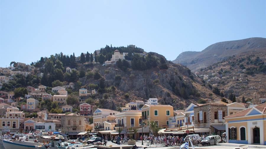
The group counts twenty-six inhabited islands, so Dodecanese tours reach a long list of harbours, villages and ruins. Each island keeps its own landscape and its own set of old stories, and Dodecanese tours link them into one route.
Since antiquity the islands have formed part of the Southern Sporades. The name Dodecanese came into common use later, and it reached the whole group only in the early twentieth century, after the Italian occupation.
Turkey lies to the east of the group, Crete to the south-west and the Cyclades to the west. That position put the islands on sea routes between three seas, and it shaped every period of their history.
Rhodes has been the leading island of the area since antiquity. The Rhodes tours post covers the largest island, its old city and its coast in full.
- Greek name: The Greek form of the name is Dodekanisa, and it means the twelve islands.
- Radio prefix: Amateur radio call signs in the group begin with SV5 instead of the SV used for the rest of Greece.
- Local bakes: Island specialities include koulouria, pitaroudia and a pastry known as avranies.
- Sweets: Desserts of the group include fanouropita, melekouni and katimeria.
Dodecanese tours therefore combine ancient sites, Byzantine churches, medieval castles and working harbours in one region. The sections below take the main islands in turn, starting with the long history of the group.


Why does history matter on Dodecanese tours?
Dodecanese tours cross layers of Mycenaean, Dorian, Roman, Byzantine, Ottoman and Italian history, because the islands lay on a busy sea route and every regional power tried to hold them, from the Bronze Age to the twentieth century.
Mycenaean Greeks ruled the islands from circa 1400 BC, until the Dorians arrived around 1100 BC. The Dorians then built an independent economy, and Rhodes and Kos emerged as the leading islands of the group.
In 408 BC the three cities of Rhodes united into one state and built a new capital at the northern end of the island. The Colossus of Rhodes followed in 304 BC.
The Romans were later allies of Rhodes, but those privileges ended in 42 BC, when Cassius invaded and sacked the islands. Saint Paul visited the islands twice, and tradition holds that Saint John came to live among them.
On Dodecanese tours the fortifications of the Knights of Saint John stand out, because they repelled the Sultan of Egypt in 1444 and Mehmed II in 1480. Suleiman the Magnificent then took Rhodes, and the other islands fell soon after.
Ottoman rule gave the islanders a special tax and a form of autonomy. The London Protocol of 1830 then left the islands outside the new Greek kingdom, and Dodecanese tours still pass mansions built in that prosperous century.
- Treaty plan: The Tittoni-Venizelos agreement of 29 July 1919 called for the smaller islands to join Greece, but it never took effect.
- Census: The Italian census of 1936 counted 129,135 people in the group, of whom 7,015 were Italians.
- Citizenship: Italy created a special Italian Aegean citizenship for the local population.
- Occupation: Nearly the entire Jewish population of 6,000 was deported during the German occupation, and 1,200 survived.
Dodecanese tours handle these chapters soberly. Fortresses, churches, mansions and Italian buildings stand side by side, and each marks a different period of rule.
What do Dodecanese tours show on the island of Kos?
Dodecanese tours reach Kos, the third largest island of the group after Rhodes and Karpathos, which has a population of 37,089 at the 2021 census and so ranks second to Rhodes in population among the islands of the group.
The island measures 42.1 by 11.5 kilometres, and its coastline runs for 112 kilometres. Kos town, the principal port, is also the seat of the municipality and the centre of island life.
In 366 BC a democracy was set up on Kos, and the capital moved to a newly built town laid out in a Hippodamian grid. That planned grid still shapes the ancient core of the modern town, and Dodecanese tours walk through it.
Farming is the second occupation after tourism, and the main crops are grapes, almonds, figs, watermelons, olives and tomatoes. Cos lettuce, the romaine of the shops, takes its name from the island.
On the night of 5 August 1773 a Russian landing party tried to take the castle and suffered heavy casualties. The ships left two days later. The Kos island tour post covers the island on land.
- Name: A person from the island is called a Koan, and the word also serves as an adjective.
- Ancient names: Other ancient names include Meropis, Cea and Nymphaea.
- Ancient market: The ancient market place of Kos was organised around a rectangular yard 50 metres wide and 300 metres long.
- Bar street: Kos town has whitewashed buildings and a lively quarter known as the bar street.
Dodecanese tours use Kos as a base because the island has an airport, a large harbour and clear routes to the neighbouring islands.
What is the Asklepieion in Dodecanese tours, and who was Hippocrates?
Dodecanese tours visit the ruins of the Asklepieion on Kos, where tradition says that Herodicus taught the young Hippocrates, the physician later known as the father of medicine and the best-known ancient son of the island of Kos.
Dorians invaded Kos in the eleventh century BC, and a large group of settlers came from Epidaurus. They brought the cult of Asclepius, and that cult made their new home famous across the ancient world.
Soranus of Ephesus, a physician of the second century, was the first biographer of Hippocrates. He wrote that the father of Hippocrates was Heraclides, also a physician, and that his mother was Praxitela.
The two sons of Hippocrates, Thessalus and Draco, and his son-in-law Polybus all became students of his. Plato calls him Hippocrates of Kos, the Asclepiad, in the dialogue Protagoras.
Ancient schools of medicine split into the Knidian and the Koan, and the Koan school of Kos concentrated on care and prognosis. In the town centre stands the Plane Tree of Hippocrates.
- Teacher: Herodicus of Selymbria was a Thracian physician who gave lessons to Hippocrates.
- Museum: A Hippocratic Museum on the island is dedicated to him.
- Foundation: The International Hippocratic Foundation of Kos is based in the same small city.
- Library: A provincial library stood on Kos in Roman times, funded by donors in the first century AD.
Dodecanese tours treat Hippocrates as a historical figure, because little is known for certain about what he himself wrote and did.
How do Dodecanese tours use boats around Kos?
Dodecanese tours by boat take advantage of the position of Kos, which lies south of Kalymnos and Pserimos and north of Nisyros, so one harbour gives access to a chain of islands that once belonged to a single mountain range.
The island has three named capes from antiquity. Cape Skandari lies in the north-east, Cape Lacter in the south and Cape Drekanon in the west, and each marks a turn in the coastline.
Earthquakes and subsidence in ancient times separated Kos from a chain of mountains. The remnants include Kalymnos and Kappari, which now lie apart across an underwater chasm about 70 metres deep.
The same chain also includes the volcano of Nisyros and the islands around it. That shared geology explains why Dodecanese tours so easily link volcanic craters with limestone coasts.
At the entrance to the harbour stands a fortress that the Knights Hospitaller erected in 1315. The Kos boat trip post covers the sea routes from the port.
- North-east: Cape Skandari, or Skandarion, marks the north-eastern headland.
- South: Cape Lacter, or Lakter, marks the southern headland.
- West: Cape Drecanum, or Drekanon, marks the western headland.
- Shared range: Kalymnos, Kappari and Nisyros once formed part of the same mountain chain as Kos.
Dodecanese tours by boat therefore show the same island group from the water, where the old geography is easiest to read.
Which inland places do Dodecanese tours reach on Kos by ATV?
Dodecanese tours by ATV leave the coast of Kos for the farmland and villages of the interior, where grapes, olives and tomatoes grow, and where the rocks hold fossils of animals that are long extinct on the island.
Kos has a wide variety of rocks, linked to its geological formation. The Quaternary layers hold fossil remains of horses, hippopotami and elephants, and Dodecanese tours can follow roads that cross these layers.
A fossilised molar of an elephant of gigantic proportions was presented to the Paleontology Museum of the University of Athens. The find shows how much the island has changed.
The smaller villages of the island include Zia, Lagoudi and Asfendiou. These settlements sit away from the beaches, and they show the quieter farming side of the island.
The same fields grow wheat, corn and figs as well. Dodecanese tours also pass the other fortress of the island, a Byzantine one, which stands well away from the harbour. The Kos ATV tour post covers the inland routes.
- Fossils: Horses, hippopotami and elephants left remains in the Quaternary layers.
- Crops: Wheat and corn grow alongside the grapes, almonds and olives.
- Byzantine fortress: A fortress from the Byzantine period stands inland on the island.
- Hotels: Five-star hotels nearly doubled in number between 2014 and 2023.
Dodecanese tours by ATV therefore add farmland, geology and village life to the coastal picture of Kos.
Why do Dodecanese tours cross from Kos to Bodrum?
Dodecanese tours cross from Kos to Bodrum, the Turkish port town that was once the ancient Greek city of Halicarnassus, because the two places share a Dorian past, a Hospitaller castle and a coast that faces across a narrow strait.
Alexander the Great laid siege to the city and captured it in 334 BC, together with his ally Queen Ada of Caria. The city then passed through a series of Hellenistic hands until 129 BC, when Rome took it, and Dodecanese tours across the strait follow that chain of rulers.
The modern name of the town comes from its medieval name Petronium. Scholars propose that the ancient name Halicarnassus borrows from a Luwian word meaning fortress, so the place was a stronghold in words as well.
The town sits at the entrance to the Gulf of Gokova, and the writer Cevat Sakir Kabaagacli came here in exile. He adopted the pen name the Fisherman of Halicarnassus.
The record high temperature in Bodrum reached 46.8 degrees in July 2017. Dodecanese tours that cross the strait therefore meet a hot, dry coast. The Kos to Bodrum day trip post covers the crossing.
- Climate: Winter averages 15 degrees in Bodrum and summer averages 34 degrees.
- Government: The town has run as a single municipality for the whole peninsula since 30 March 2014.
- Museum: The Bodrum Maritime Museum keeps historical documents and objects from the maritime history of the town.
- Ferries: The port has ferries to nearby Greek and Turkish islands, with Kos the key link.
Dodecanese tours that add Bodrum show how closely the Greek islands and the Anatolian coast are tied together.
What do Dodecanese tours find on the volcanic island of Nisyros?
Dodecanese tours visit Nisyros, a round volcanic island between Kos and Tilos, where a caldera three to four kilometres wide fills the interior and where villages of fewer than seven hundred residents sit on the rim and the coast.
Greek myth explains the island with a giant. Poseidon cut off a piece of Kos and threw it on Polybotes to stop him escaping, and tradition holds that this piece became Nisyros.
The island measures about 8 kilometres across and covers 41.6 square kilometres. The 2021 census counted 1,048 people in the municipality, and Mandraki, the main town and port, held 660.
The latest eruptive activity was a steam explosion in 1888. Fumaroles still sit at the craters, and Dodecanese tours walk beside them on marked ground. The Nisyros volcano tour post covers the volcano itself.
In 1997 the municipality held a referendum on a geothermal plan, and 87% of voters opposed the plans of the power company. The island has kept its quiet character.
- Paloi: The village of Paloi had 239 inhabitants.
- Soumada: A traditional product is soumada, a non-alcoholic almond-flavoured drink.
- Millstones: Antipater of Thessalonica refers to the island as a source of millstones in the first century BC.
- Gyali: The nearby islet of Gyali has deposits of perlite and pumice.
Dodecanese tours to Nisyros show the volcanic side of the group, set against the limestone of the neighbouring islands.
What makes Kalymnos and sponge diving part of Dodecanese tours?
Dodecanese tours include Kalymnos, known as the island of the sponge divers, where sponge fishing once brought wealth and fame across the Mediterranean, and where a rock-climbing boom has since drawn a different kind of visitor each season.
Only 18% of the steep, volcanic land of Kalymnos can be cultivated, so the islanders turned to trade, boat building and sponge fishing. Early divers worked without equipment, and used a harpoon.
A freediver carried a rounded stone of 15 kilograms, called a skandalopetra, to reach the bottom quickly. When divers began using surface-supplied suits in 1865, injury from decompression sickness rose sharply.
Sponge Week takes place a week after Easter to honour the sponge, called Kalymnian gold. The local dance Mihanikos depicts the crippling effects of decompression sickness, and men perform it.
More than 4,600 climbing routes now cover the limestone, and the boom began in 1997 when the Italian Andrea di Bari set the first routes. Three museums about sponge diving sit on the island.
- Emigration: The population fell from 24,000 in 1925 to 16,500 in 2012, as emigrants moved to the United States and Australia.
- Tarpon Springs: Tarpon Springs in Florida is home to a large Greek community of Kalymnian descent.
- Temple: Charles Newton excavated the Hellenistic Temple of Apollo in the nineteenth century.
- Citrus: The valley of Vathy is known for its citrus fruits.
Dodecanese tours therefore treat Kalymnos as a working island, where sea trades shaped a whole way of life.
What does Leros offer on Dodecanese tours?
Dodecanese tours reach Leros, an island with a coastline of 71 kilometres, a castle possibly built on a Byzantine fortress and Lakki, a deepwater harbour so large that the Italians chose it for a naval base in the Aegean.
The municipality had 7,992 residents at the 2021 census, but the figure swells to over 15,000 at the summer peak. Agia Marina is the administrative centre, with 2,380 inhabitants.
In ancient times the island was linked to Parthenos Iokallis. In 1505 the Ottoman admiral Kemal Reis besieged the castle with three galleys and seventeen other warships, and he failed to take it.
Legend says the only surviving knight, aged barely eighteen, dressed women and children in the armour of the dead. The Ottomans believed the garrison was still strong and withdrew, a story that Dodecanese tours retell at the castle.
Mussolini called Leros the Corregidor of the Mediterranean. On 26 November 1940 Swordfish aircraft of the Fleet Air Arm bombed Port Laki, and the coves of Leros gave warships excellent anchorage.
- Julius Caesar: Local pirates held Julius Caesar for forty days on Farmakonisi.
- Cheese: Mizithra is a hard, salty local cheese, cured in the sediment of red wine.
- Mackerel: Kolios Pastos is mackerel cured in sea salt.
- Music: A special genre called Havas, with famous examples such as Prouzos, belongs to the island.
Dodecanese tours to Leros mix defences, naval harbours and local food on an island that is smaller than its history suggests.
Why is Patmos a stop on Dodecanese tours?
Dodecanese tours stop at Patmos, one of the northernmost islands of the group, famous as the place where John of Patmos received the vision recorded in the Book of Revelation, and a destination for Christian pilgrimage since early times.
The island has 3,283 inhabitants, and Dodecanese tours climb the same slopes that pilgrims use.
According to Greek myth, the island was first called Letois, after Artemis, daughter of Leto. Tradition holds that the moon goddess Selene persuaded Artemis to bring the sunken island to the surface.
Muslim raids from the seventh to the ninth century nearly ended early Christian life. Cretan refugees came after the fall of Candia in 1669, and Venetians held the island from 1659 to 1669.
Russian forces occupied Patmos during the Orlov Revolt, from 1770 to 1774, and Dodecanese tours recall that period at the monastery. The Patmos day trip post covers the monastery, the cave and the town.
- Forbes: In 2009 Forbes magazine named Patmos Europe’s idyllic place to live.
- School: The island is home to the Patmian School, a notable Greek seminary.
- Villages: Grikou and Kampos are settlements near the main communities of Chora and Skala.
- Poet: The American poet Robert Lax is among the notable people linked to Patmos.
Dodecanese tours that end on Patmos close the northern run of the group at its main pilgrim site, and the island also suits a quiet end to a longer journey.
What do Dodecanese tours cover in Lipsi, Agathonisi and the northern islets?
Dodecanese tours reach the northern edge of the island group through Lipsi, Arkoi and Agathonisi, three small islands where tavernas, harbours and sea views replace large monuments, and where the route runs between Patmos and the coast of Turkey.
Agathonisi lies at the northernmost point of the Dodecanese. The island covers 13.5 square kilometres, and its highest point stands 209 metres above the sea, close to the village of Mikro Chorio.
The ancient name of the island was Psetoussa. Near its waters, Pericles defeated the Samians in a naval engagement in 440 BCE, and the island passed from Italy to Greece in 1947 under the peace treaty.
Dodecanese tours find springs at Fountani on Lipsi, and the Cave of Ontas dominates the settlement. The island covers 15.95 square kilometres, which makes it the largest island of its small archipelago.
Arkoi has no real capital, because households cluster around the main harbour. The land is dry and rocky, with olive trees and hardy shrubs, while the bays around the island hold grouper and nudibranch.
- Villages: Megalo Chorio means Big Village, and Mikro Chorio means Small Village.
- Harbour: Agios Georgios, between the two villages, forms the only harbour of Agathonisi.
- Nickname: Locals also call Agathonisi by the name Gaidaro, which means donkey.
- Beach: Tiganakia, the best beach on Arkoi, lies at the end of the island that faces Lipsi.
Dodecanese tours that include these northern islands trade large sights for small harbours and plain tavernas. Ruins of an acropolis crown the hill above the harbour on Arkoi.
Where do Dodecanese tours stop at Pserimos and the small islets near Kalymnos?
Dodecanese tours also stop at Pserimos, Telendos and a scatter of small islets between Kos and Kalymnos, places where cars are rare or absent, residents number in the dozens and the sea shapes daily life more than roads do.
Pserimos lies between Kalymnos and Kos, near the coast of Turkey. The island had 84 inhabitants in the 2021 census, and tourism is now its main industry, drawing visitors with remote beaches.
Dodecanese tours also pass Telendos, which stands about one kilometre off the coast of Kalymnos. The island is a single steep, flat-topped mountain whose sides plunge directly into the sea.
No cars run on Telendos, and its population stood at 66 in 2021. Earthquakes in the 6th century AD separated the island from Kalymnos, to which it had been joined.
Kalolimnos rises 80 metres above the sea and covers 1.95 square kilometres. Fifteen people lived there in 2021 beside a permanent garrison, and an old lighthouse built in 1864 stands on the steep rock.
- Ferry: A daily ferry links Pserimos with Pothia, on the island of Kalymnos.
- Kinaros: The island takes its name from the artichoke and covers 4.5 square kilometres.
- Levitha: Ovid names the island, then called Lebinthus, in the saga of Daedalus and Icarus.
- Shipwrecks: In June 2019, archaeologists found five 2000-year-old shipwrecks near Levitha.
Dodecanese tours that call at these islets work best as add-ons to a larger route, since the landings are short and the settlements are tiny.
Why do Dodecanese tours visit Symi?
Dodecanese tours visit Symi because the island joins a mountainous interior, a harbour town of neoclassical mansions and a famous monastery, all within a short sea distance of Rhodes, which makes it a natural second island on any route.
Symi lies about 24 kilometres north of Rhodes and covers 58.1 square kilometres of mountainous ground. Its coast alternates between rocky cliffs, beaches and isolated coves, and the nearest land across the water belongs to Turkey.
Dodecanese tours reach Panormitis, which holds the island monastery and draws visitors from around the world. Greek pilgrims honour St Michael of Panormitis each year, and the tourist season runs from Easter until early November.
The population peaked at about 22,500 in the 19th century, when Symi had the largest sponge fishing fleet in the world. Mansions on the slopes near the main town date from that period.
In Greek myth, Symi is the birthplace of the Charites and takes its name from the nymph Syme. Homer names King Nireus as its ruler, and Thucydides records a Spartan naval victory off the island.
- Towns: Yialos is the harbour town, and Horio, also called Ano Symi, is the upper town.
- Residents: The 2021 census counted 2,603 permanent residents on the island.
- Festival: The Symi Festival has run from July to September every year since 1995.
- Museum: The Historical Museum of Symi reopened after renovation in late 2020.
The Symi day trip from Rhodes post covers the crossing from Rhodes. Dodecanese tours that include Symi pair the harbour town with the monastery.
What do Dodecanese tours show on Tilos?
Dodecanese tours show on Tilos a quiet island of abandoned villages, medieval castles and a cave that yielded the bones of dwarf elephants, an island whose electricity now comes entirely from renewable sources, with settlements spread across a mountainous limestone interior.
Tilos had 746 residents in 2021. Together with the uninhabited islets of Antitilos and Gaidaros, it forms a municipality in the Aegean Sea whose land area is 64.525 square kilometres.
Charkadio cave, near the centre of the island, has yielded the remains of a dwarf elephant from about 45,000 years ago. One group of authors thinks the animals survived until about 1500 BC.
Mikro Chorio, first settled in the 15th century by the Knights of the Order of St John, has been abandoned since 1960. Dodecanese tours treat its empty houses above the bay as an attraction.
The Monastery of Agios Panteleimon sits on the slopes of Mount Profitis Ilias, which rises 654 metres. The monastery has cold springs and an enormous loquat tree known in Greek as Musmulla.
- Energy: Solar power, wind turbines and a battery farm make Tilos self-sufficient in renewable electricity.
- Harbour: Livadia, at the southern end, is the major harbour and economic centre.
- Colonists: Settlers from Tilos and Lindos founded the city of Gelas in Sicily in the 7th century BC.
- Poet: Tilos claims the poet Erinna as a native, and her poems were ranked beside those of Homer.
Dodecanese tours that stop on Tilos meet castles built to resist pirate raids and a mountainous limestone interior, all within a compact island.
How do Dodecanese tours handle the small island of Halki?
Dodecanese tours handle Halki as a short western stop from Rhodes, a small, dry island with one working village, a chapel that keeps original frescoes and a long habit of living without a natural supply of fresh water.
Halki lies about 9 kilometres west of Rhodes and covers 28 square kilometres. The 2021 census showed 475 inhabitants, concentrated in the village of Emporio, while Chorio above it was almost completely abandoned.
Emigration in the mid-20th century emptied the island. A sizable group of residents moved to Tarpon Springs in Florida, where they established the Greek-American community that continues to this day.
Dodecanese tours meet an island with virtually no natural water, where rainfall is collected in large cisterns. Drinking water arrives from Rhodes, and a desalination plant has operated since 2014.
The chapel in the old town keeps original frescoes. The municipality adds uninhabited offshore islands, the largest being Alimia to the northeast, and its total land area is 37.043 square kilometres.
- Solar: A solar park on Halki generates 1.8 gigawatt hours of electricity each year and cuts CO2 emissions by an estimated 2,576 tonnes.
- Alimia: The island covers 7.4 square kilometres and has a coastline of 21 kilometres.
- Dockyards: Hellenistic dockyards carved into the rock at Alimia confirm ancient use of its two bays.
- Casualty: Alexandros Diakos, who lived from 1911 to 1940, is listed among the people of Halki as the first Greek casualty of the Second World War.
Dodecanese tours that include Halki also pass Alimia, whose settlement has been abandoned since the 1940s and has been declared a traditional settlement since 1978.
What do Dodecanese tours offer on Karpathos?
Dodecanese tours offer on Karpathos a large mountainous island in the southeastern Aegean Sea, with ancient cities, beaches sorted by their exposure to the wind and villages that have kept their own customs because of a remote location.
The municipality of Karpathos covers 324.8 square kilometres and had 6,567 residents in 2021. Summer visitors and returning expatriates lift the figure to as high as 20,000 people.
Karpathos Island National Airport opened in 1970 in a small building of 500 square metres. Its current terminal was inaugurated on 25 July 2009, and a bus links it directly with the town of Pigadia.
Dodecanese tours sort the beaches into four groups. The east coast has gravelly beaches without wind, the south has fine white sand, the west is exposed to the Meltemi, and the north needs a boat.
Genoese corsairs received Karpathos as a fief in 1304. Two years later it passed to Andrea Cornaro of Venice, and the Cornaro family held it until 1538, when the Ottomans took it.
- Excavation: Theodore and Mabel Bent excavated at Vroukounta in the spring of 1885, and part of their finds rests in the British Museum.
- Football: Poseidon Karpathos F.C. represents the island in Greek regional championships.
- Names: Other names of the island include Tetrapolis and Anemoessa.
- Tax: In 1835, Sultan Mahmud II granted the island the lump-sum maktu tax system.
The Karpathos boat trip post covers the coast by sea. Dodecanese tours that stop here also use the municipal roads that join the port, the airport and the main villages.
Why do Dodecanese tours include the small island of Kasos?
Dodecanese tours include Kasos as the quiet southern outpost of the group, a mountainous island of five villages that built wooden sailing ships, backed the Greek Revolution with its fleet and later lost a large share of its population to emigration.
Kasos covers 49 square kilometres, stretching 17 kilometres in length and 6 kilometres across at its widest. Mount Prionas, the highest peak, rises 550 metres, and the island has fresh water.
Dodecanese tours reach five villages. Fri, the capital, had 357 residents, and Agia Marina, the largest village, had 444. Panagia, Poli and Arvanitochori are the other three, and Panagia keeps a group of early chapels.
In 1824, the Egyptian fleet plundered the island, killing 500 people and enslaving 2000. From the later half of the 19th century, about 5,000 islanders emigrated to Egypt.
By the 1920s, only 400 of the island’s 2,300 houses were permanently inhabited. In 1935 the warship Averof evacuated Eleftherios Venizelos from Helatros beach after his failed coup attempt.
- Traveller: Claude-Etienne Savary stayed on the island for days in late 1779 because of bad weather.
- Honey: The naturalist Charles Sigisbert Sonnini praised the very good wine and the abundant honey.
- Wrecks: Archaeologists revealed four wrecks in January 2021, including a Roman ship with amphorae.
- Museum: The Kasos Archaeological Museum sits in the original demarcheion of Fri.
Dodecanese tours that include Kasos suit travellers who want a small, remote community whose economy grew from shipping and whose central plain once held olive trees and vineyards.
What do Dodecanese tours reach at Kastellorizo?
Dodecanese tours reach Kastellorizo as the far eastern end of the group, a very small island in the Levantine Sea, with a horseshoe harbour, a medieval castle and a history of occupation by a long string of powers.
Kastellorizo lies about 570 kilometres southeast of Athens and 125 kilometres east of Rhodes. At 11.98 square kilometres, it is the smallest of the Dodecanese, and its triangular shape runs from northeast to southwest.
Around 1440, Sultan Jaqmaq of Egypt destroyed the castle. Alfonso V of Aragon rebuilt it in 1461, and the Crown of Aragon kept the island until the Ottoman sultan Suleiman I conquered it.
Ottoman shore batteries shelled the island in 1917 in answer to a French occupation led by the cruiser Jeanne d’Arc. The shelling led to the sinking of the British seaplane carrier HMS Ben-my-Chree.
In the late 1920s the population dropped to 3,000, while about 8,000 islanders lived abroad. Dodecanese tours now meet a town of 594 residents, counted in the 2021 census.
- Eclipse: The island was the only European Union territory where the solar eclipse of 29 March 2006 appeared in totality.
- Diaspora: Emigrants in Perth and Sydney are known in Australia as Kazzies.
- Ro: On nearby Ro, Despina Achladioti raised a Greek flag every day until her death in 1982.
- Airport: Kastellorizo Island Public Airport, which opened in 1986, is the eastmost airport of Greece.
The Kastellorizo day trip post covers the crossing and the harbour town. Dodecanese tours reach this far east because the island lies almost halfway between Rhodes and Antalya.
What do Dodecanese tours show on Astypalaia?
Dodecanese tours show on Astypalaia an island at the western edge of the group, where a hilltop Chora, a very old cemetery and a treaty with Rome sit beside a modern plan to make the island run on electric transport.
Pliny the Elder records that Rome accorded Astypalaia the status of a free state. Along with its islets, the largest of which are Syrna and Ofidoussa, it forms a municipality of 114.077 square kilometres.
Dodecanese tours see worked stones from ancient monuments reused in the older houses of Chora and in the castle. The 2021 census counted 1,084 people in Chora, 159 in Livadia and 111 in Analipsi.
The island appears in records in 1334, during a devastating raid by the Turkish ruler Umur of Aydin. The Ottoman Empire conquered it in 1522, and Venice held it from 1648 until 1668.
Kylindra, a graveyard excavated by the Greek archaeological service, holds the largest child and infant cemetery in the world. At least 2,700 infants were buried there in ceramic pots starting around 750 BC.
- Treaty: A treaty with Rome, made in 105 BC, survives in an inscription and treats both sides as sovereign equals.
- Boxer: Kleomedes of Astypalaia, an ancient Greek boxer, was active around 496 to 492 BC.
- Historian: Onesicritus, a historian and traveller, lived from about 360 to about 290 BC and is counted among its notable people.
- Electric island: A 3.5 megawatt photovoltaic power station with battery storage supports a plan for climate-neutral mobility.
The Astypalaia boat trip post covers the coast and the islets by sea. Dodecanese tours that call here also pass the mosaic floor under the chapel of Agia Varvara.
How do ferries and flights shape Dodecanese tours?
Dodecanese tours depend on a web of ferries and small airports, with long lines running from Piraeus through the group and short local boats linking neighbouring islands, so each island needs its own check of the sea and air schedule.
Lipsi is well served by ferries passing between Patmos and Leros, and it lies on the main route for ferries from Piraeus. Arkoi is called at by the ferry between Samos, Patmos and Lipsi.
Ferries connect Karpathos with Piraeus by way of Crete and Rhodes. During the summer months, small private boats leave Pigadia each day for Olympos by way of Diafani and for beaches that roads do not reach.
Dodecanese tours land at Kastellorizo Island Public Airport, about 2.5 kilometres southwest of the town. A single bus links them only in summer, and the terminal covers 150 square metres.
Kasos has an airport near Fri that is big enough for an ATR 42 to land. The airport of Astypalaia, called Panaghia, stands near Analipsi and about 12 kilometres northeast of Chora.
- Arkoi: Occasional small ferries also run from Arkoi to nearby islands such as Marathi.
- Karpathos: Karpathos is connected to neighbouring islands and to the mainland by both ferries and aeroplanes.
- Kastellorizo: In winter, one weekly ferry links Kastellorizo with the Turkish town of Kas.
- Taxis: Taxis wait at the Kastellorizo airport, and buses serve the Karpathos airport.
Dodecanese tours therefore work best when each island is booked separately, because a ferry line that serves one harbour can skip its neighbour, and flights fill the gaps between them.
When are the best months for Dodecanese tours?
Dodecanese tours follow a hot dry summer and a very mild winter, with the strong northern Etesian winds shaping the sea from the middle of the fifth month to mid-September and deciding which boats leave harbour on a given day.
The Etesian winds, called meltemia in Greek, blow strong and dry from the north. Dodecanese tours meet them at full strength in the afternoon, since they die down at night, though they sometimes last for days.
Philip II of Macedon timed his campaigns around the winds, which can blow at force 7 to 8 on the Beaufort scale. Yachts and inter-island ferries cannot all sail under such conditions.
In the southern Aegean, near the Carpathian Sea, the Etesians blow as northwesterlies. The northerly breeze also tempers the fierce summer heat, and weather under it is ordinarily fine and clear.
Kastellorizo recorded a coastal low of 4.5 °C on 25 January 2022. Kasos has a record low of 2.7 °C in an observatory series that starts in 1989.
- Kastellorizo winter: Average lows do not drop below 12.0 °C during the coldest months on Kastellorizo.
- Tropical nights: Kastellorizo records on average 158 tropical nights each year.
- Sea: Summer temperatures in the surface water of the Aegean reach 19 to 24 °C.
- Flights: Charter flights from European cities reach Karpathos between April and October.
Dodecanese tours in summer need flexible plans, because the wind can keep boats in port, and the exposed western beaches of Karpathos are available only in low wind conditions.
What do travellers ask about Dodecanese tours?
Dodecanese tours raise a handful of practical questions about distance, wind, small islands and winter service, and the answers below draw on the island facts above to help readers match each stop to the season and the route.
Which Dodecanese tours islands have no cars?
Telendos has no cars, and its population stood at 66 in 2021. Pserimos is also tiny, with 84 inhabitants, and Kinaros had only two residents in 2011. Dodecanese tours to these places rely on walking from the landing, as the settlements are compact.
Do Dodecanese tours reach islands near the Turkish coast?
Yes. The nearest land neighbours of Symi are the Datca and Bozburun peninsulas. Pserimos lies near the coast of Turkey, and Kalolimnos sits opposite it with a permanent garrison on its rock and a lighthouse. Dodecanese tours to these islands stay close to the Turkish shore.
How windy are Dodecanese tours in summer?
The Etesian winds blow from the middle of the fifth month to mid-September and are strongest in the afternoon. They can reach force 7 to 8 on the Beaufort scale, and yachts and inter-island ferries cannot all sail then, so Dodecanese tours plan around the forecast.
What runs to Kastellorizo in winter on Dodecanese tours?
In the winter period, the ferry chain from Kastellorizo to Piraeus makes two trips a week, calling at Rhodes, Symi, Tilos, Nisyros and Kalymnos. One weekly ferry links Kastellorizo with Kas, and flights run four times a week, so winter routes need early planning.