

The meltemi wind is the strong, dry north wind of the Aegean summer, and it shapes ferry crossings, boat trips and beach days across the Greek islands. The post is part of the Greece Tours on Greece Ville, listed with the other Greece sailing tours.
This post covers what the meltemi wind is, why it blows, when and where it is strongest, and what it means for boat trips and ferries. Sheltered coasts, history and common questions come last.
What is the meltemi wind?
The meltemi wind is the strong summer north wind of the Aegean Sea, called etesian in older texts. It blows in spells rather than all at once, and it ranks as a dominant weather influence across the whole Aegean Basin.

The name meltemi belongs to modern Greek, and the wind is known in English texts as the etesian wind. The meltemi wind counts among the best known local winds in Greece.
The account of Chios gives an average breeze of 3 to 5 metres per second through the year. Its direction is northerly, which islanders call the meltemi, or southwesterly, which is the sirocco.
The same wind pattern reaches far beyond the Aegean. In Cyprus it blows as westerlies to southwesterlies, and the air there is more humid, so the meltemi wind changes character with its position.
The wind also shapes temperatures across the whole region. Climate records for the Aegean show lower temperatures and a smaller daily swing than in the Ionian Sea or on mainland Greece.
- Name: Meltemi names a single wind, while meltemia names the run of winds across a season.
- Home sea: The Aegean Basin is the region where the meltemi wind shapes daily weather.
- Direction: Northerly flow dominates, though Chios shows that a southwesterly sirocco also appears.
- Climate effect: Cooler Aegean air follows the wind, in contrast with the Ionian Sea and the mainland.
The meltemi wind is therefore both a weather type and a regional trait of the Aegean. The sections below cover its cause, season, strength, effect on boats, shelter and place in Greek history.



What causes the meltemi wind?
The meltemi wind forms in summer under the clear skies of a subtropical ridge and is distantly correlated with the Indian summer monsoons. Two large seasonal systems, not a local feature, set the whole northerly pattern across the Aegean.
The first cause is the Mediterranean summer itself. A subtropical ridge extends towards the pole in summer, and subsiding air beneath it brings clear skies and dry conditions to Greece.
The second cause lies far to the east. The wind is distantly correlated with the summer monsoons of the Indian subcontinent, so a far larger warm season system links to summer weather over the Aegean.
Winter reverses the picture. The ridge migrates towards the equator and travelling frontal cyclones replace it, so the summer pattern behind the wind comes to an end.
The bulk of the Aegean carries the Köppen label hot-summer Mediterranean, written Csa. The meltemi wind belongs to that climate type, where dry clear summers and steady northerly winds arrive together.
Summer under the ridge stays dry with minimal cloud cover. Regions with this climate can go four to six months through summer and early autumn without any significant rain.
- Ridge: A subtropical ridge spreads over the region in summer and keeps the air dry.
- Clear skies: Subsiding air under the ridge keeps cloud cover minimal in summer.
- Monsoon link: The Indian summer monsoon correlates only distantly with the Aegean wind.
- Winter shift: The ridge moves towards the equator and the summer pattern ends.
The cause of the meltemi wind is thus a pair of large seasonal systems. Their yearly cycle explains why the wind belongs to summer and leaves the winter calendar alone.
When and where does the meltemi wind blow?
The meltemi wind blows from late spring into October across the Aegean, and the Thracian Sea, the Icarian Sea and the Sea of Crete all lie in its path. Records for Greece carry the wind season as far as October.
The Climate of Greece article extends the season to October. That makes the wind season longer than a strict midsummer window, and it explains why autumn sailing plans still watch the forecast.
The Thracian Sea forms the northernmost part of the Aegean. It lies north of the 40th parallel and holds the islands of Thasos and Samothrace.
The Icarian Sea lies between the Cyclades and Asia Minor. It contains Samos, Kos, Patmos, Leros, Fournoi Korseon and Icaria, so the meltemi wind affects a long chain of eastern islands.
The Sea of Crete forms the southern part of the Aegean. It lies north of Crete and south of the Cyclades, and it is the southern limit of the wind field described here.
- Season end: Records for Greece carry the meltemi wind season as far as October.
- North: The Thracian Sea, with Thasos and Samothrace, is the northernmost part of the Aegean.
- Centre: The Icarian Sea links the Cyclades with the coast of Asia Minor.
- South: The Sea of Crete lies between Crete and the Cyclades.
The Cyclades tours post covers the island group that sits in the middle of this wind field, with routes, islands and practical planning.
How strong is the meltemi wind on the Beaufort scale?
The meltemi wind is rated on the Beaufort scale, which Francis Beaufort devised in 1805 to relate wind speed to observed conditions at sea. A force number therefore tells a skipper what the water will do before a boat leaves harbour.
Francis Beaufort was a hydrographer in the British Royal Navy. He built the scale from observation, and the scale remains an empirical measure rather than an exact or objective one.
The modern scale links force to speed through a formula. Speed in knots equals 1.625 times the force number raised to the power of one and a half, measured at 10 metres above the sea.
Weather services set their warnings along this scale. The Irish service issues a small craft warning when force 6 is expected, which means a mean speed above 22 knots, and a gale warning at force 8.
The scale is widely used in Greece, alongside the Netherlands, Germany, China and Malta. A force reported in Athens therefore means the same thing to a skipper from northern Europe.
Higher forces carry stronger warnings. Strong gale warnings begin at force 9 or frequent gusts of at least 52 knots, and storm force warnings begin at force 10 or gusts of at least 61 knots.
- Inventor: Francis Beaufort, a Royal Navy hydrographer, devised the scale in 1805.
- Formula: Speed in knots follows 1.625 times the force raised to the power of 1.5.
- Force 6: A mean speed above 22 knots marks the small craft warning level in Irish forecasts.
- Force 8: Gale warnings begin at this level in the same system.
The Naxos sailing post covers sailing around Naxos, the largest island of the Cyclades, and the sea conditions that skippers read there.
How does the meltemi wind affect ferries and boat trips?
The meltemi wind raises waves according to its speed, how long it blows and the distance of open water it crosses, so ferries and boat trips feel it on exposed routes. Vessel design then decides how much of that sea passengers notice.
Wind waves depend on wind speed, duration, fetch and water depth. Fetch means the uninterrupted distance of open water over which the wind blows without a change in direction.
Observers describe the result as sea state. An experienced mariner can assess it by eye, while buoys and radar measure it, and the sea state varies as the wind and swell change.
Waves raised by local wind form a wind sea. Once they leave the area of fetch and no longer feel the local wind, they become swell, which can travel far beyond the place where it began.
Vessel design matters too. Fully submerged hydrofoils are less subject to wave action and more stable at sea, and fast RoPax ferries sail at over 25 knots on conventional engines.
A fully developed sea reaches the largest wave size possible for a wind of given strength, duration and fetch. Further exposure to that wind only breaks wave tops into whitecaps.
- Fetch: Open water without interruption lets the meltemi wind build larger waves.
- Duration: A wind that blows longer over the same water raises a bigger sea.
- Sea state: Trained mariners judge the water surface and record it in the ship log.
- Vessel type: Hydrofoils and fast ferries respond differently from small open boats.
The Greece boat tours post covers boat trips around the country, from short harbour cruises to longer island routes.
Does the meltemi wind cause seasickness?
The meltemi wind does not cause seasickness by itself, but the waves it raises make a boat move in ways the body finds hard to read. Motion sickness comes from a difference between actual and expected motion, not from the wind.
Motion sickness occurs when the eyes and the inner ear send conflicting signals. The symptoms include nausea, cold sweat, headache, dizziness and tiredness, and they appear in car, air and sea travel alike.
Seasickness is essentially the same as carsickness, though the motion of a watercraft tends to be more regular. Water offers no fixed points, so motion is hard to detect by eye even when looking outside.
The condition is old. Motion sickness has been described since at least the time of Homer, around the eighth century BC, which places the first records in the same world as the Aegean sailors.
Susceptibility varies by person. About one-third of the population is susceptible, with the highest level between ages 7 and 12, while children under 2 years old do not experience it.
- Cause: A mismatch between seen and sensed motion produces the symptoms.
- Signs: Nausea, cold sweat, headache and dizziness mark an episode.
- Age: Children under 2 do not experience it, and susceptibility peaks between ages 7 and 12.
- History: Records of the condition reach back to Homer.
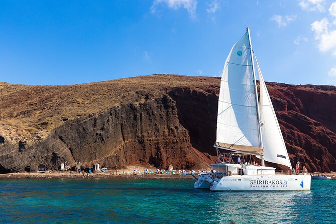
The Santorini catamaran cruise post covers catamaran trips from Santorini, with the route, the stops and the practical details.
Which coasts are sheltered from the meltemi wind?
The meltemi wind meets shelter where mountain ranges and islets screen the coast, as on the south-west Peloponnese and in Navarino Bay. Open island coasts that face north take the wind directly, so aspect decides conditions on each shore.
Near Kardamyli, in the south-west Peloponnese, the Taygetos range blocks much of the northerly wind. That example shows how a single ridge changes conditions on one side of a peninsula.
Navarino Bay on the west coast of Messinia shows shelter of another kind. A long, narrow islet called Sphacteria shields the bay from the open sea and leaves two entrances.
The Climate of Greece article separates the two halves of the country. West of the Pindus range the climate is wetter and has maritime features, while the east is drier and windier in summer.
Island coasts depend on aspect. Kythira has been shaped by prevailing winds into steep cliffs with deep bays, and Lemnos earned the nickname the wind-ridden one for its strong winds.
- Taygetos: This range blocks much of the northerly wind near Kardamyli.
- Navarino Bay: The islet of Sphacteria shields the water from the open sea.
- Pindus divide: The west is wetter and maritime, and the east is drier and windier in summer.
- Exposed isles: Lemnos and Kythira show how wind shapes island shores.
The Mykonos boat tour post covers sea trips from Mykonos, including the coasts and bays that a boat visits.
What do history and myth say about the meltemi wind?
The meltemi wind appears in Greek history and myth through the Anemoi, the wind gods, and through wrecked fleets. The ancient Greeks gave each wind a divine figure with a direction, and they told a creation myth about the Etesian winds.
The Anemoi were wind gods, each ascribed a cardinal direction. According to Hesiod, they were the children of Eos, the goddess of the dawn, and Astraeus, the god of the dusk.
Boreas was the god of the cold north wind and the harshest of the Anemoi. Tradition holds that the Athenians prayed to him when Xerxes threatened Athens, and that he sank 400 Persian ships.
Herodotus recorded a real disaster near Mount Athos. The fleet of the Persian commander Mardonius was wrecked, with losses of 300 ships and 20,000 men, by a strong north wind in 492 BC.
Worship of the winds is very old. Linear B tablets hold a word read as priestess of the winds, and Spartans were reported to sacrifice a horse to the winds on Mount Taygetus.
One creation myth names the Etesian winds directly. Aristaeus, a pupil of the centaur Chiron, is the protagonist of that story, as the account of Chiron records.
- Anemoi: Each wind god had a direction, and the Anemoi were subject to Aeolus.
- Boreas: The north wind god is the harshest of the group.
- Athos: A strong north wind wrecked a Persian fleet off the peninsula.
- Aristaeus: A creation myth links this hero to the Etesian winds.
History and myth show how long the north wind has shaped life at sea in Greece. The modern meltemi wind is the present name for that old pattern.
What do travellers ask about the meltemi wind?
The meltemi wind prompts four questions from travellers: how it differs from the sirocco, how it compares with a monsoon, how it is measured and whether it reaches the Ionian Sea. The answers draw on climate and sea records.
Is the meltemi wind the same as the sirocco?
The meltemi wind and the sirocco are different winds. Records for Chios list the wind direction as northerly, called the meltemi, or southwesterly, called the sirocco, so the two blow from opposite quarters of the compass.
Is the meltemi wind a monsoon?
The meltemi wind is not a monsoon in itself, though it is distantly correlated with the summer monsoons of the Indian subcontinent. Both belong to the warm season, and the Aegean wind is tied to the subtropical ridge of the Mediterranean summer.
How is the meltemi wind measured?
The meltemi wind is measured on the Beaufort scale, which relates wind speed to conditions at sea. The modern scale gives speed in knots as 1.625 times the force number raised to the power of 1.5.
Does the meltemi wind reach the Ionian Sea?
The meltemi wind belongs mainly to the Aegean, and Aegean temperatures run lower than those of the Ionian Sea. West of the Pindus range the climate is wetter and more maritime, a different setting from the Aegean.
Featured photo: giorgoskontaxis, CC BY 3.0, via Wikimedia Commons.