
Greek island groups sort thousands of islands and islets into a handful of chains, from the Cyclades and the Dodecanese in the Aegean to the Ionian Islands in the west. The post is part of the Greece Tours on Greece Ville, listed under the Greek island tours.
This post covers what the Greek island groups are, the Aegean groups one by one, then the Ionian Islands, Crete, Euboea and how the groups are run. Common questions come last.
What are the Greek island groups?
The Greek island groups are the traditional clusters in which Greece sorts its islands: the Saronic Islands, the Cyclades, the North Aegean, the Dodecanese, the Sporades and the Ionian Islands, while Crete and Euboea stand outside the clusters.
Greece has no agreed count of islands. Estimates range from around 1,200 to 6,000, depending on the smallest size that counts. The Greek island groups therefore start from a loose total rather than a fixed number.
The number of inhabited islands is also disputed. Sources cite between 166 and 227 of them. The groups sort that inhabited share into named clusters that travellers and administrators both recognise.
Crete is the largest Greek island by area and by population. Euboea, also called Evia, comes second. Lesbos and Rhodes follow, and every other island is two-thirds the size of Rhodes or smaller.
The Euripus Strait, 60 m wide, separates Euboea from the mainland, and the island belongs to the Central Greece region. The Peloponnese has technically been an island since the Corinth Canal was built in 1893, but it is rarely counted as one.
- Saronic Islands: This cluster lies in the Saronic Gulf near Athens.
- Cyclades: This is a large but dense collection in the central part of the Aegean Sea.
- North Aegean: This is a loose grouping off the west coast of Turkey.
- Dodecanese: This is a loose collection in the southeast, between Crete and Turkey.
The Greek island groups also include the Sporades, a small tight group off the coast of Euboea, and the Ionian Islands west of the mainland. The sections below take the Aegean clusters one at a time.


How do the Aegean Islands divide into Greek island groups?
The Greek island groups of the Aegean number seven when read from north to south: the north-eastern Aegean islands, Euboea, the Sporades, the Cyclades, the Saronic Islands, the Dodecanese and Crete, all set between mainland Greece and Turkey.
The Aegean Islands lie in the Aegean Sea, with Greece to the west and north and Turkey to the east. Crete closes the sea to the south, and Rhodes, Karpathos and Kasos close it to the southeast.
The word archipelago began as the ancient Greek name of the Aegean Sea. Later it passed to the islands inside that sea, and today it describes any island group. The Greek island groups of the Aegean inherit that old name.
The vast majority of the Aegean Islands belong to Greece and are split among nine administrative regions. The only sizable Turkish possessions are Imbros and Tenedos in the northeast, along with smaller islets off the western Turkish coast.
The Aegean Islands have hot summers and mild winters. This is a hot-summer Mediterranean climate, coded Csa in the standard climate classification, and it shapes the seasons across the Greek island groups of the sea.
- North: The north-eastern Aegean islands lie off the Turkish coast.
- Northwest: The Sporades and Euboea lie off the east coast of the mainland.
- South: Crete and the Dodecanese hold the southern edge of the sea.
- West: The Saronic Islands sit in the gulf beside Athens.
Each of the seven groups has its own character. The next sections on the Greek island groups begin with the Cyclades, the cluster set around Delos.
How do the Cyclades fit among the Greek island groups?
The Greek island groups place the Cyclades in the central Aegean Sea, southeast of the mainland, as a ring of about 220 islands around Delos, an island sacred in Ancient Greek religion that gave the group its name.
The name Cyclades comes from the Greek word for a circle. The literal sense is surrounding islands, and the ring is loose rather than geometric, so the name works as a label for a neighbourhood of islands. The Greek island groups use the term for the whole ring.
The major islands include Andros, Tinos, Mykonos, Naxos, Paros, Syros, Milos and Santorini. The Lesser Cyclades add Donousa, Irakleia, Koufonisia and Schoinousa. The smaller islands are mostly uninhabited.
The Cyclades were an administrative prefecture until the Kallikratis reform of 2011 abolished it. Its territory was divided into nine regional units of the South Aegean region, so the group is now a cultural label.
The Sea of Crete bounds the group to the south. The climate is dry and mild, and higher ground records lower temperatures. The Cyclades tours post covers the individual islands and the trips between them.
- Ermoupoli: This town on Syros was the chief town and administrative centre of the former prefecture.
- Delos: The islands around it take their name from the sacred island.
- Lesser Cyclades: Gyaros, Makronisos and Rineia count among the minor islands.
- Prefecture: The old administrative unit disappeared when the nine regional units were created.
Among the Greek island groups, the Cyclades carry the deepest prehistory. The next section turns to that early culture and to the landscape that the farmers and sailors used.
What do the Cyclades add to the Greek island groups in culture and landscape?
The Greek island groups owe an early island culture to the Cyclades, where Cycladic craftsmen carved schematic marble figures centuries before the Minoan civilisation of Crete arose, and where Delos stayed a sanctuary until the rise of Christianity.
Cycladic culture is best known for flat sculptures in pure white marble. It belongs to the Late Neolithic and Early Bronze Age, and it evolved in three phases between about 3300 and 2000 BCE.
A farming and seafaring culture came from Anatolia around 5000 BCE. Settlers grew emmer and barley, kept sheep, goats and pigs, and speared tuna from small boats. Kea and Saliagos are among the excavated sites.
Late Cycladic boat models show a crew of fifty oarsmen drawn from the scattered communities. Copper working left traces at Kephala on Kea, which points to trade as well as farming.
Christos Tsountas investigated burial sites on islands in 1898 and 1899 and coined the term Cycladic civilisation. The British School at Athens followed with systematic work, and the Greek island groups gained a named prehistoric culture. Scholars still debate the meaning of the figures.
- Soil: Naxos is the exception to the poor soil of the group.
- Produce: Wine, fruit, wheat, olive oil and tobacco are the farm products.
- Looting: Collectors competed for the modern-looking figures, and burial sites were looted.
- Strain: Tourism has brought erosion, pollution and water shortages.
Cycladic culture faded as the palace culture of Crete rose, except on Delos. Among the Greek island groups, the Cyclades therefore hold both a prehistoric record and a long religious one.
How do the Dodecanese stand among the Greek island groups?
The Greek island groups place the Dodecanese in the southeastern Aegean Sea, bordered by Turkey to the east, Crete to the southwest and the Cyclades to the west, with Rhodes as the dominant island of the group since antiquity.
The name has a story of its own. In Byzantine sources of the eighth century it named a naval command over the southern Aegean, and it applied to the twelve Cyclades islands clustered around Delos.
That older sense lingered in colloquial and scholarly Greek until the 18th century. Modern historians link the idea to the twelve islands that the geographer Strabo mentions, which suggests a far earlier origin.
The move to the present group has Ottoman roots. After the conquest of the islands held by the Knights Hospitaller in 1522, Rhodes and Kos came under direct rule, while the other islands kept privileges of taxation and self-government.
The islands have been inhabited since prehistoric times. Mycenaean Greeks ruled them from about 1400 BC, and the Dorians arrived around 1100 BC. In the sixth century BC the Dorians founded Lindos, Kameiros and Ialyssos on Rhodes.
- Kos and Patmos: These two rank next to Rhodes as the historically important islands.
- Other main islands: Astypalaia, Halki, Kalymnos, Karpathos, Kasos, Leipsoi, Leros, Nisyros, Symi, Tilos and Agathonisi complete the list.
- Smaller chain: Alimia, Arkoi, Gyali, Kinaros and Levitha belong to the chain.
- Minoan contact: The islands were heavily Minoanized once contact began in the second millennium BC.
The Dodecanese tours post covers the island chain as travellers meet it. The Greek island groups look different here, because the group is loose rather than compact.
How did the Dodecanese join the Greek island groups in the twentieth century?
The Greek island groups gained the Dodecanese in 1947, after the islands passed from Ottoman rule to Italian rule, and the name Dodecanese became firmly fixed for the whole island group through the Italian administration of the 1920s.
Attempts to abolish the Ottoman privileges began after 1869. The last vestiges ended after the Young Turks took power in 1908, and the Greek press then began calling the twelve privileged islands the Dodecanese.
The Greek press began agitating for the cession of the islands to Greece in 1913. Kastellorizo came under Italian rule only in 1921. The Italians used the title Rhodes and the Dodecanese and added Leipsoi to the list of major islands.
By 1920 the name was firmly established for the whole group. Count Carlo Senni became the first civilian governor with the title Viceroy of the Dodecanese. From 1924 the Fascist regime tried to replace the name, but the substitute never took hold.
The islands joined Greece in 1947 as the Governorate-General of the Dodecanese. After 1955 they formed the Dodecanese Prefecture. Greek island groups changed shape through border shifts such as these, and this one is among the latest.
- Climate: The group has a mainly hot-summer Mediterranean climate, while Karpathos, Kasos and Nisyros are hot semi-arid.
- Lindos: It lies in South East Rhodes, which experiences a significantly warmer climate and is the warmest area in Greece.
- Sunshine: South East Rhodes records over 3,100 hours a year, the highest mean annual figure in Greece.
- Winters: Rhodes Port, Kasos, Karpathos and Kastellorizo record among the mildest winters in Europe.
The climate figures explain why the Dodecanese stand apart from the cooler groups to the north. The Greek island groups of the northern Aegean come next.
What makes the North Aegean one of the Greek island groups?
The Greek island groups include the North Aegean as a loose grouping of islands off the Turkish coast, which is also one of the thirteen administrative regions of Greece, set up in the 1987 reform and redefined by the Kallikratis plan.
The region comprises the islands of the north-eastern Aegean Sea. Thasos and Samothrace belong instead to the region of Eastern Macedonia and Thrace, while Imbros and Tenedos belong to Turkey.
The nine islands of the region are Lesbos, Chios, Psara, Oinousses, Ikaria, Fournoi Korseon, Lemnos, Agios Efstratios and Samos. Traditional naming also separates the Thracian Sporades from the Eastern Sporades, so the Greek island groups overlap here.
The Decentralized Administration of the Aegean at Piraeus supervises the region along with the Southern Aegean. The region has the lowest GDP per capita in Greece, and its output was 1.4% of the Greek total in 2018.
Its population shrank by 2.6% between 2011 and 2021. Lemnos lies halfway between Mount Athos and the Turkish coast, and Samos lies across the Mycale Strait, which is 1.6 km wide.
- Thasos: It is the northernmost major Greek island and the twelfth largest by area.
- Lemnos: Strong winds give it a Greek nickname meaning the wind-ridden one.
- Samos: The Principality of Samos lasted from 1835 until the island joined Greece in March 1913.
- Chios: It is the fifth largest Greek island and is known as the Mastic Island.
The North Aegean shows how loose the Greek island groups can be. Its eastern islands face Anatolia more closely than they face Athens, and the next group lies much nearer the mainland.
Which islands form the Sporades among the Greek island groups?
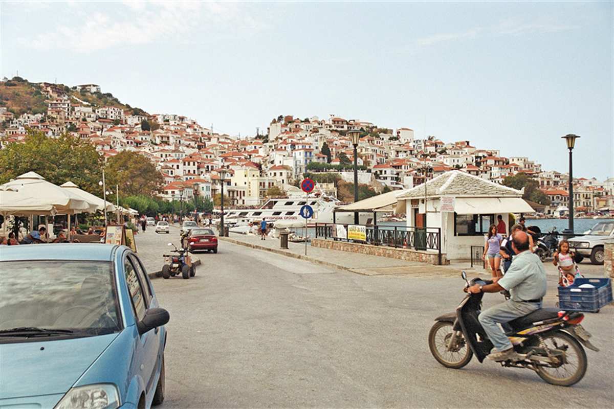
The Greek island groups use the name Sporades, meaning those scattered, and since about 1960 the term refers mainly to the Northern Sporades off the east coast of Greece: Skiathos, Skopelos, Alonnisos and Skyros, with their nearby islets.
From classical antiquity the name Sporades referred to the Aegean island groups outside the central Cyclades. Modern geography recognises five Sporades groups, and only the Thessalian group is meant by the name today.
The Sporades Regional Unit was created in the 2011 Kallikratis reform and has three municipalities: Skiathos, Skopelos and Alonnisos. Skyros belongs to the Euboea regional unit in Central Greece.
Skiathos is the westernmost Northern Sporades island, east of the Pelion peninsula and west of Skopelos. It is about 12 km long and 6 km wide, and its coastline runs for 44 km with over 60 mostly sandy beaches.
Skopelos covers 96 square kilometres, which is larger than Mykonos at 85 and Santorini at 73. Alonnisos lies 3 km east of Skopelos and was renamed in 1838 after an identification that later research judged mistaken.
- Skiathos forests: Aleppo pine covers much of the island, with a small stone pine forest at Koukounaries.
- Bourtzi: The Ghisi brothers built this Venetian-style fortress on an islet after capturing the island in 1207.
- Skopelos legend: Tradition holds that Staphylos, a son of Dionysos and Ariadne, founded the island.
- Alonnisos islets: Gioura, Kyra Panagia, Peristera, Piperi and Skantzoura lie in its municipality.
The Skiathos island tour post covers the westernmost of these islands. Among the Greek island groups, the Sporades form a small tight cluster with a legend-rich past.
Where do the Saronic Islands belong among the Greek island groups?
The Greek island groups place the Saronic Islands in the Saronic Gulf, just off the mainland coast, with Salamis, Aegina, Agistri and Poros as the main inhabited islands and Attica as the administrative home of the whole cluster.
The Saronic Islands are also called the Argo-Saronic Islands. Hydra and Dokos lie off the northeast tip of the Peloponnese, between the Saronic Gulf and the Argolic Gulf, and sources sometimes count them in the group.
Older Greek usage called the cluster the Western Sporades. Athenians keep holiday homes there, and ferries serve the islands regularly from Piraeus and from the Peloponnese. The Greek island groups are rarely so close to a capital.
Salamis is the largest island of the group and lies about 16 km west of central Athens. Its old name Koulouri, used from at least the 13th century, came from its round shape.
Aegina was a powerful city-state in classical antiquity and a rival of Athens. Tradition derives its name from the mother of the hero Aeacus. The town of Aegina is the regional capital.
- Poros: Its ancient name was Pogon, and its southern part, Sphaeria, is of volcanic origin.
- Hydra: The municipality joins Hydra and Dokos, with a total area of 64.443 square kilometres.
- Agistri: It is a small populated island and municipality in the Islands regional unit.
- Spetses: It was part of the Argolis and Corinthia Prefecture until 1948.
The Saronic islands tours post covers the cluster for visitors. Among the Greek island groups, the Saronic Islands stand closest to Athens.
What are the Ionian Islands among the Greek island groups?
The Greek island groups include the Ionian Islands, where Kefalonia is the largest of the principal islands and Paxos the smallest. Corfu is the northernmost, apart from the Diapontian Islands, which mark the westernmost point of all Greece.
Zakynthos, also known as Zante, is the third largest of the Ionian Islands and has a coastline 123 km in length. The Greek island groups of the west include it as a tourist destination with an international airport served by charter flights from northern Europe.
Kefalonia is the largest of the Ionian Islands and the sixth-largest island in Greece. It forms a separate regional unit, and its largest towns are Argostoli and Lixouri.
The regional unit of Corfu extends as far south as the Paxoi, so Paxos falls inside it. The capital and largest city of that regional unit is also named Corfu, and the Diapontian Islands are its satellites.
Paxos is the smallest of the seven main islands, and its main town is Gaios. Its neighbour Antipaxos and the adjoining islets join it under the plural name Paxoi.
Lefkada joins the mainland by a long causeway and floating bridge, so road traffic reaches it without a ferry. The main town and seat of the municipality is Lefkada, in the north of the island.
- Corfu: The northernmost principal island, apart from its Diapontian satellites.
- Paxos: The smallest of the seven main islands, close to Corfu.
- Kefalonia: The largest island of the chain and sixth in Greece.
- Kythira: Its terrain shapes the shore into steep rocky cliffs.
These facts place the Ionian Islands as the western member of the Greek island groups, set apart from the Aegean chains by a different sea and a different past.
How did antiquity and the Middle Ages shape the Ionian Islands among the Greek island groups?
The Greek island groups hold an old Greek history in the Ionian Islands, which Greek settlers reached by the ninth century BC at the latest. Colonists from Corinth displaced an earlier Eretrian settlement at Kerkyra, now Corfu, in 734 BC.
The islands played little part in Greek politics for centuries. The exception came in 434 BC, when a conflict between Kerkyra and its mother-city Corinth drew in Athens and set off the Peloponnesian War.
By the fourth century BC, the islands had passed into the empire of Macedon. A group of islands stayed under the Macedonian Kingdom until 146 BC, when Rome annexed the Greek peninsula.
Under Byzantine rule from the middle of the eighth century, the islands formed the theme of Cephallenia. Saracen raids and later Norman and Italian attacks struck the chain, and William II of Sicily took the larger part in 1185.
Kefalonia and Zakynthos became a county palatine, which lasted until 1357. In that year the entity merged with Lefkada and Ithaki to form the Duchy of Leucadia under French and Italian dukes.
The Ionian Islands tours post covers the organised visits across the chain. Each visit meets the places that this long record left behind, and the Greek island groups of the Ionian Sea share that record.
- Eretria: Settlers from Eretria reached Kerkyra before the Corinthians arrived.
- Macedon: The empire absorbed the islands by the fourth century BC.
- Cephallenia: The Byzantine theme took this name from the middle of the eighth century.
- Leucadia: The duchy formed in 1357 from four islands.
The record shows an Ionian chain that passed between Byzantine, Norman and Italian hands before Venice arrived. That layered past marks it out among the Greek island groups.
Where does Crete stand among the Greek island groups?
The Greek island groups place Crete alone at the southern edge of the Aegean, where it is the largest island in Greece. Two international airports serve it, at Heraklion and Chania, with the Dodecanese to the northeast and the Cyclades to the north.
The Region of Crete takes in the island, its surrounding islands and its islets. Its capital and largest city is Heraklion, which stands on the north shore of the island.
The Sea of Crete separates the island from the Cyclades. The Dodecanese lie to the northeast, so Crete borders two of the Aegean chains without belonging to either of them.
Crete bounds the southern border of the Aegean Sea. The Myrtoan Sea lies in the west and the Carpathian Sea towards the east, so the island meets a different sea at each end.
The island lies about 300 km southwest of Anatolia. Six groups of mountains form a range that crosses the island from west to east, so the interior divides one coast from the other.
The Crete tours post covers the organised visits across the island. It sets out the places on offer from the north shore to the south coast for readers who plan time on the largest island.
- Aegean: The island bounds the southern border of the Aegean Sea.
- Sea of Crete: The sea that separates the island from the Cyclades.
- Myrtoan Sea: The sea in the west of the island.
- Carpathian Sea: The sea towards the east of the island.
Crete therefore counts as a chain of its own rather than a member of the Cyclades or the Dodecanese, and the Greek island groups treat the island and its islets as one region.
Which islets and satellite islands belong to Crete among the Greek island groups?
The Greek island groups count a ring of islets around Crete, among them Gramvousa, Elafonisi, Chrysi, Paximadia, Spinalonga and the Dionysades. Off the south coast, Gavdos lies 26 nautical miles from Hora Sfakion and is the southernmost point of Europe.
Gramvousa is the pirate island opposite the Balo lagoon, and Elafonisi commemorates a shipwreck and an Ottoman massacre. Both lie on the western side of the island.
Paximadia lies off Agia Galini, where tradition holds that the god Apollo and the goddess Artemis were born. The Venetian fort and leper colony of Spinalonga faces the shallow waters of Elounda.
The Dionysades islands sit in an environmentally protected region together with the palm forest of Vai in the municipality of Sitia. Islets in the ring draw visitors, while others see only archaeologists and biologists.
Gavdos belongs to the regional unit of Chania, and the islet of Gavdopoula, whose name means little Gavdos, lies to its northwest. BirdLife International has named both as an Important Bird Area.
Gavdos had 142 residents in 2021, a small number beside the island that governs it. The largest man-made harbour is at Karave, and the island capital is Kastri.
- Elafonisi: An islet in Chania with a shipwreck and a massacre in its record.
- Paximadia: An islet off Agia Galini tied by tradition to Apollo and Artemis.
- Dionysades: Islands protected together with the palm forest of Vai.
- Gavdopoula: The islet to the northwest of Gavdos.
The ring of islets shows why the Greek island groups list Crete with its surroundings. Each islet keeps a history of its own while the Region of Crete governs it.
Where does Euboea stand among the Greek island groups?
The Greek island groups do not hold Euboea as a chain, because Euboea is one long island that ranks second to Crete in both area and population. Its land area is 3,684 square kilometres, and its regional unit also includes Skyros.
The census of 2021 gave the island a population of 204,818. That figure ranks Euboea second among the islands of Greece for population, behind Crete.
Geography divides the island into three parts. The north is fertile and forested, the centre is mountainous and forested, with farming limited to the coastal valleys, and the south is barren.
Two small archipelagos belong to the same unit. The Petalioi archipelago lies to the southwest of the island, while the Monilia islands lie to the west.
The regional unit of Euboea also takes in a small area of the Greek mainland. Skyros, an island municipality, joins the island and the mainland strip in a single prefecture of the past.
The Evia tour post covers the organised visits across the island. It follows the long coast and the mountains, and the Greek island groups gain from it a clear picture of the second island.
- Area: The land area of the island is 3,684 square kilometres.
- Population: The 2021 census counted 204,818 residents.
- Islets: The Petalioi lie to the southwest and the Monilia to the west.
- Skyros: The island municipality sits in the same regional unit.
Euboea stands beside the Greek island groups as a large single island close to the mainland, with its own islets and its own regional unit.
Which islands form the Argolic and Saronic fringe of the Greek island groups?
The Greek island groups reach the Argolic Gulf, about 50 km long and 30 km wide, with Spetses at its entrance. Its main port, Nafplio, lies at the northwestern end, and the regional units of Arcadia and Argolis surround the gulf.
The Saronic Gulf holds Aegina, Salamis and Poros, along with the smaller islands of Patroklos and Fleves. The mountains around the Argolic Gulf protect it from the strong summer Meltemi winds.
Salamis is the largest Greek island in the Saronic Gulf, about two kilometres from the coast beside Piraeus. Its main port, Paloukia, connects it with Perama in the west of the Athens urban area.
Hydra covers 49.6 square kilometres, and its municipality also holds Dokos and a group of uninhabited islets. The municipality is part of the Islands regional unit of the Attica region.
Spetses has a municipality of 27.121 square kilometres that also includes the uninhabited islands of Spetsopoula, Falkonera and Velopoula. Poros lies a channel of 200 m from the Peloponnese.
- Spetses: The island at the entrance to the Argolic Gulf.
- Salamis: The largest island of the Saronic Gulf.
- Hydra: A Saronic island of 49.6 square kilometres.
- Poros: An island pair separated from the mainland by a 200 m channel.
These islands tie the Greek island groups of the Aegean to the Peloponnese and to Athens, and the Saronic members of the fringe sit within one regional unit of Attica.
How are the Greek island groups run by regions?
The Greek island groups are not run as groups, because Greece has thirteen regions and the islands fall into more than one of them. The Kallikratis plan, in effect from 1 January 2011, gave each region an elected governor and a regional council.
The Ionian Islands Region is based at Corfu and is supervised by the Decentralized Administration of the Peloponnese, West Greece and the Ionian Islands, based at Patras. Kythira is the exception, because it belongs to the Attica region.
Crete forms a region of its own, with the surrounding islands and islets inside it. The elected regional council and the regional governor serve five-year terms, and the same rule covers every region of Greece.
The North Aegean Region has five regional units: Chios, Ikaria, Lemnos, Lesbos and Samos. Its capital is Mytilene on Lesbos, and the region holds nine islands in all.
Seven decentralized administrations group from one to three regions under a general secretary appointed by the state. The Decentralized Administration of the Aegean, based at Piraeus, oversees the North Aegean and Southern Aegean regions.
The Chios tour post covers the organised visits to Chios, an island of the North Aegean region. It shows how one regional unit looks on the ground within the Greek island groups.
- Ionian Islands: A region based at Corfu and supervised from Patras.
- Attica: The region that holds Kythira and the Islands regional unit.
- Crete: A region of its own that includes the surrounding islets.
- North Aegean: A region of five units, with its capital at Mytilene.
The regional map explains why a traveller crosses more than one administrative line inside the Greek island groups, even when the sea route between islands seems short.
What do travellers ask about Greek island groups?
Greek island groups draw questions about borders, names and administration, because the traditional chains and the official regions do not match. The answers below cover Kythira, Crete, Euboea and the regions that govern the islands in each chain.
Is Kythira one of the Greek island groups in the Ionian Islands?
Kythira shared the Napoleonic era with the other Ionian Islands and is still regarded as one of them, though it was counted among the Cyclades in antiquity. Administratively it belongs to the Islands regional unit of the Attica region, not to the Ionian Islands Region, which covers the other six principal islands.
Is Crete one of the Greek island groups or a single island?
Crete is a single island, the largest in Greece. The Region of Crete adds the surrounding islands and islets, such as Gavdos, Spinalonga and the Dionysades, so the Greek island groups treat Crete as a chain of its own within one region.
Is Euboea one of the Greek island groups?
Euboea is one island, not a chain. It is the second largest in Greece after Crete, with 204,818 residents in the census of 2021. Its regional unit also includes Skyros and a small area of the mainland, so the island sits beside the island groups rather than inside one.
Which regions govern the Greek island groups?
Greece has thirteen regions in all, and the Greek island groups fall into more than one of them. The Ionian Islands, Crete and the North Aegean form regions, while Kythira and the Saronic islands sit within the Attica region. Each region has an elected governor and council.
Featured photo: Herbert wie, CC BY-SA 4.0, via Wikimedia Commons.