
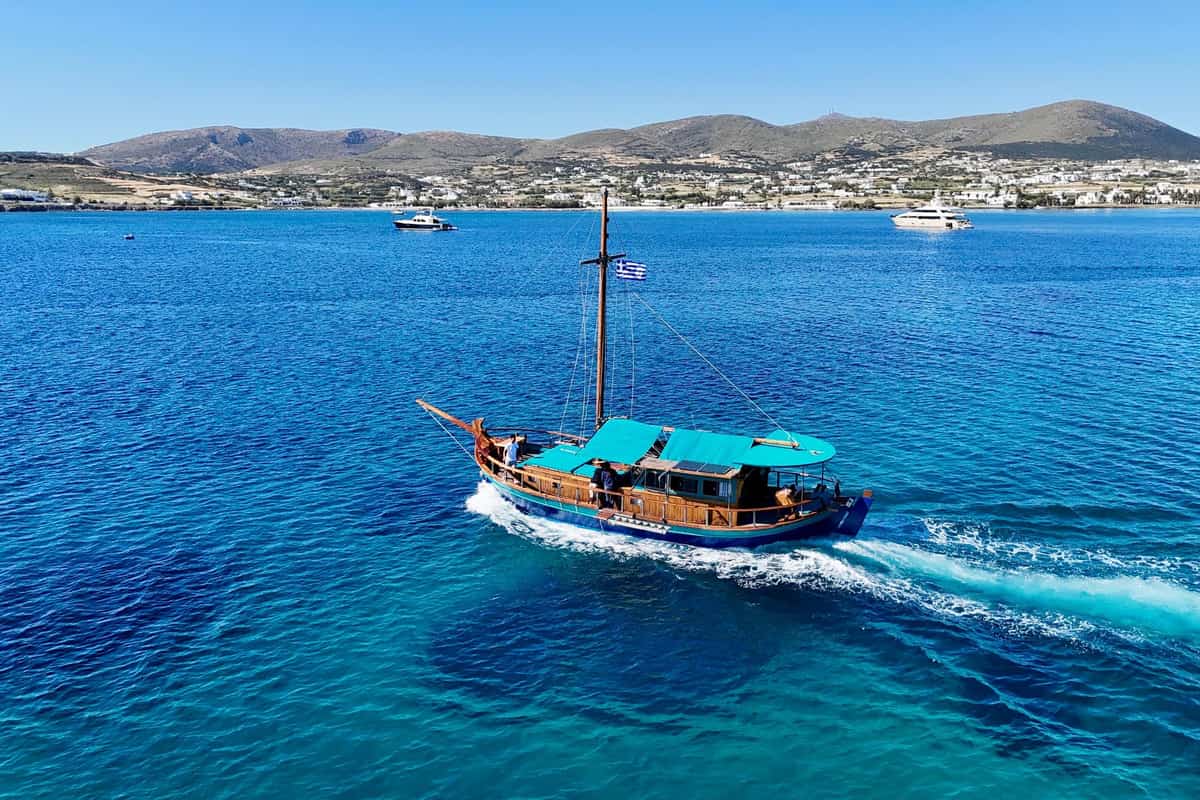
A Paros boat trip takes visitors by sea around Paros and over to Antiparos, Despotiko and the small islets between them. The trip is one of the Greece Tours on Greece Ville, listed with the other Cyclades tours and Greece boat tours.
This post covers what the trip is, the harbours it leaves from, the island’s history at sea, Antiparos, Despotiko and the islets and lagoon around them.
The beaches reached by boat, the best months and common questions come last. The sections include Paros boat trips that can be booked online.
What is a Paros boat trip?
A Paros boat trip sails along a coastline 118.5 km long. A sail right around the island covers 35 miles. Its three big bays are Naoussa in the north, Parikia in the west and Marmara in the east.

Paros sits where sea routes meet between mainland Greece, the Aegean islands, Asia Minor and the Mediterranean. Cape Korakas, the northern tip, carries a stone lighthouse built in 1887.
Cape Agria, the north-east tip, lies directly opposite Naxos. Mavros Kavos is the cape farthest south.
In prehistory, Paros, Antiparos, Despotiko and 10 km² of land now under the sea formed Greater Paros. It ranked third in size in the Cyclades, after Naxos and Andros.
On a Paros boat trip, coastal wetlands line Kolymbithres, Santa Maria, Molos, Golden Beach, Aliki, Kampos and Livadia. They are vital resting places for migrating birds.
Since 2008, a Paros–Antiparos swim has run every 7 July. Swimmers cover 1,453 m, in any stroke they choose.
- Holocene: Greater Paros was once joined to Naxos by a narrow strip of land.
- Birds: Rare birds of Paros include the European shag and Audouin’s gull.
- Swim club: The Antiparos Nautical Club holds the swim.
- More capes: Tourchos, Stafida, Vigla and Pyrgos complete the list.


Which harbours does a Paros boat trip leave from?
A Paros boat trip leaves from busy Parikia, where Eurostat counted 2,170 thousand sea passengers in 2023. Of those, 1,087 thousand arrived and 1,082 thousand left. The port handled 1,237 thousand in 1997. Parikia stands at the eastern head of its bay.
Besides Piraeus, ferries link Parikia with Lavrio, the other Cyclades and Crete.
Portes, a large reef west of the harbour, breaks the surface as two tall rocks. It lies on the usual ferry courses between Paros, Syros and Piraeus.
At night, its flashing light is hard to spot against the town lights. A 1970 plan to blast it away was dropped, because so much rock lies under water.
Naoussa has a small, safe harbour at the eastern head of its bay. It lies between Cape Korakas and Cape Tourchos.
On a Paros boat trip in summer, tourist boats leave Naoussa and Piso Livadi for other Cyclades. Piso Livadi’s little harbour is also a fishing shelter. Its summer boats reach Naxos, Ios, Santorini, Amorgos, Mykonos, Delos, Antiparos and Koufonisia.
- Chart: Greek chart ΧΕΕ-423/2 is the harbour plan for Parikia and the Antiparos strait.
- Lighthouse: Cape Agios Fokas, at Parikia harbour, carries a lighthouse.
- Aliki: It first appeared in the Greek census in 1961, with 116 residents.
- Drios: Caiques and fishing boats tie up in its small harbour at the east end of the beach.
How did the sea shape the history of a Paros boat trip?
A Paros boat trip crosses waters with a long naval past. In 489 BC Miltiades sailed with seventy Athenian ships, and his real target was Paros. In the 1st century BC, pirate raids pushed Parians to borrow from Crete to wall their island.
In the 9th century, the head of the Arab navy of Crete raided Paros. He left the church of Ekatontapiliani in ruins. Parikia, Sarakiniko and Naoussa became Saracen bases. People of the coast moved inland.
In 1537 Barbarossa besieged Cecilia Venier, the last Venetian ruler of Paros, in the castle of Kephalos. Her husband Bernardo Sagredo held out for days, then surrendered for lack of gunpowder.
Barbarossa carried off 6,000 people from Paros, using a large share of them as rowers. One theory makes Nurbanu Sultan, mother of Murad III, a Venetian noblewoman seized on Paros by Barbarossa. Antiparos had to supply 30 rowers for the galleys of the Duchy of the Archipelago.
On a Paros boat trip past Drios, the Ottoman fleet once anchored. Cyclades notables met there to pay taxes and settle court cases.
- 1821: On 24 April, Panagiotis Dimitrakopoulos proclaimed the revolution and shipped Parian fighters to Hydra.
- 1833: The French 74-gun warship Superbe ran aground in a storm at the entrance of Parikia harbour.
- 1944: On 14 January, Allied planes bombed Parikia port to destroy boats the Germans had seized.
- Marble: Under Frankish rule, Parian marble was shipped across Europe, above all to Venice.
What does a Paros boat trip see on Antiparos?
A Paros boat trip reaches Antiparos and its cave. The main hall lies 50 m down and is 40 m high. Its biggest stalagmite, the Holy Table, is 6 m tall and 18 m around. Two chapels stand before the arched cave mouth.
In 1673 the Marquis de Nointel came looking for a giant statue. It proved to be a stone formation. For his Christmas mass, he lit the cave with 100 candles and 400 oil lamps.
His party of 500 stayed in the cave for 3 days. Latin words on the Holy Table, HIC IPSE CHRISTUS ADFUIT, recall that midnight mass.
An ancient inscription listing visitors’ names survived on the entrance stalagmite until the 19th century.
On a Paros boat trip, the Antiparos strait was once called the Strait of 14 feet. In the 15th century, pirates hid in its bays. In 1794 pirates from Kefalonia and Mani plundered Antiparos.
The coat of arms of the Loredan family once decorated the castle gate.
- Film: A house in the castle district was a set for the 1960 film Madalena, starring Aliki Vougiouklaki.
- Saliagos: This islet covers less than 500 square metres.
- Bones: Saliagos animal bones are 83.5% sheep and goats, 12.1% pigs and 3.5% cattle.
- Obsidian: Saliagos tools used obsidian from Gyali, a trade link of almost 200 km.
What lies on Despotiko on a Paros boat trip?
A Paros boat trip reaches Despotiko, an uninhabited island west of Antiparos. Nikos Zafiropoulos began digging at Zoumparia and Mantra in 1959. He found building pieces of a Doric temple dated to about 500 BC.
Later work at Mantra uncovered a long building of five rooms in a row. Its southern room held Archaic goods from the East Aegean, Rhodes and Cyprus.
Part of an Archaic ritual water basin carries the dedication Marda anethiken. Small finds include clay figurines, seal stones and little vessels called alabastra, kotyles and aryballoi. Excavators think the sanctuary honoured Artemis as well as Apollo.
On a Paros boat trip to Despotiko, the finds come from Zoumparia, Mantra and Livadi. Traces of a prehistoric settlement were found at Cheiromyloi.
French pirates once raided Despotiko and killed its people. The island has stayed uninhabited since. Engravings from the 15th and 17th centuries show a castle at Mantra.
A 1965 ministerial decision first listed the north-west coast as an archaeological site.
- Hill: The highest hill on Despotiko is called Chondro Vouno.
- Scrub: Phrygana and garrigue, two kinds of low scrub, cover large parts of the island.
- Rock: The north is grey gneiss cut by pegmatite veins.
- Tsimintiri: This islet between Antiparos and Despotiko is also called Koimitiri, for the graves found on it.
Which islets and lagoons line a Paros boat trip?
A Paros boat trip passes Panteronisi, an islet of 0.484 square km. It rises to 53 m at its southern end. The census has listed it as a settlement since 1991, but nobody lived there in 2021.
Gaidouronisi covers 0.148 square km and is about 650 m long and 350 m wide. Sailors call the reef-filled water between it and north-east Paros the psalidia of Paros.
A rock islet named Tourlos lies at the north-east tip of Paros, near Gaidouronisi. Agios Spyridon islet faces Parikia, rises to 26 m and takes its name from its small church.
On a Paros boat trip along the north-east, Filidi lies opposite Santa Maria beach. It covers 0.187 square km and rises to 22 m. Dryonisi, in the bay of Drios, covers 0.371 square km.
Revmatonisi belongs to the Goulandris shipping family and has holiday homes. Its guests included Konstantinos Karamanlis and Sean Connery. Early Cycladic figurines were found on Kavouras, an islet of 0.294 square km.
Strongylo covers 1.638 square km and has no beaches or facilities. It splits loosely into Agios Nikolaos in the north and Vigla in the south.
- Glaromputa: Also called Glarobi or Glarovida, it covers 0.209 square km and rises to 17 m.
- Diplo: This islet off Antiparos covers 0.492 square km.
- Strongylo status: It became a Place of Special Natural Beauty in 2000 but lost that status in 2002.
- Tigani: This islet is also known as Tigana.
Which beaches does a Paros boat trip reach?
A Paros boat trip reaches Kolymbithres, inside the open Plastira bay, which is 3,600 m long. The beach can take about 1,000 bathers at once. A 30 m jetty for small boats stands at its eastern end.
The seaside settlement of Kolymbithres had 28 residents in 2021. Monastiri became an official bathing beach in 2018. Beside it, Paros Park has an open stone theatre for summer events.
On a Paros boat trip south, Aliki beach is 200 m long, 15 m wide and faces south-west. Tourist boats reach it as well as roads. Piers at both ends moor small fishing and leisure boats.
Pounta Marpissa is 20 m wide, faces south-east and reaches 5 m deep about 180 m out. It has a lifeguard and room for about 2,000 bathers.
Tserdakia, or New Golden Beach, is 30 m wide. Its water reaches 5 m deep about 130 m out.
- Blue Flag: Tserdakia received the Blue Flag award for 2014.
- Golden Beach: It sits in an open bay 1,400 m long and holds about 1,500 bathers.
- Psaralykes: These three Antiparos beaches south of the waterfront are shaded by tamarisks.
- Kitesurf: At Pounta, instructors certified by IKO and VDWS teach kitesurfing at all levels.
Which months suit a Paros boat trip?
A Paros boat trip in August meets the island’s feasts. On 15 August, faithful from all over Paros join a procession of the icon of Panagia Ekatontapiliani. On 23 August, caiques of pirates stage a night raid on Naoussa.
Since 2009, Paros Park has run its Festival in the Park every summer from June to September. The largest Antiparos festival falls in July, for Agia Marina.
In the 1991-2020 normals, Naxos logs 233.6 hours of sunshine in April and 207.3 in March. April’s gust record there is 120.4 km/h, set in 2015.
August has the lowest gust record of any month at Naxos, 85.2 km/h. The strongest July gust on record reached 100.8 km/h in 2000.
- October gust: The October record at Naxos is 125.9 km/h, set in 2006.
- Record gust: The strongest gust in the Naxos record, 148.2 km/h, struck on 22 January 2004.
- August rain: The wettest August day on record brought only 6.0 mm of rain.
- September rain: The wettest September day on record brought 38.0 mm.
What do visitors ask about a Paros boat trip?
A Paros boat trip raises questions about pets, wind, rip currents, sea colour, stinging eyes and drinking water. Greek ship rules count a pet of 5 to 15 kg as medium-sized. A pet over 15 kg counts as large.
How do Greek ships carry pets on a Paros boat trip?
Cages for large pets must measure at least 100 by 100 by 100 cm. Each ship that must carry cages needs at least 2. On voyages over 8 hours, a muzzled, leashed pet can be walked on the open deck.
How strong is the wind at each Beaufort force on a Paros boat trip?
At force 1, light air of 1 to 3 knots forms scale-like ripples up to 0.3 m. At force 2, a light breeze of 4 to 6 knots raises waves of 0.3 to 0.6 m. At force 9, a strong gale of 41 to 47 knots raises waves of 7 to 10 m.
How do swimmers escape a rip current on a Paros boat trip?
A rip runs fastest in its narrow neck and fades in its head, just beyond the breaking waves. It is strongest near the surface, because friction slows water near the seabed. Once it weakens, swim back diagonally, away from the rip and towards the shore.
Why is the sea turquoise on a Paros boat trip?
Red light rarely reaches below 50 m in the sea, while blue light can reach 200 m. Pure water looks blue even in a white-bottomed pool. Fine particles scatter blue light toward green, giving the sea its cyan shade.
Why does seawater sting the eyes on a Paros boat trip?
The body keeps the salt in blood near 0.9%, far below the salt level of open seawater. In a saltier liquid, osmosis pulls water out of cells. Pain receptors in the cornea are 300 to 600 times denser than in skin.
How much water does a Paros boat trip call for?
EFSA advises 2.0 L of total water a day for women and 2.5 L for men. Active people in hot climates can need 6.0 L or more. A United States Army study advised no more than 1 to 1.5 L per hour of heavy sweating.