
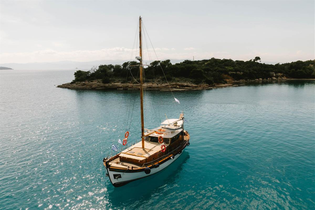
An Ermioni boat trip starts from the waters around Ermioni, the harbour town in the south-east of Argolis in the Peloponnese, and reaches Spetses, Dokos and the coast of Porto Cheli. The trip is one of the Greece Tours on Greece Ville.
This post covers the formats on sale, where Ermioni sits, ancient Hermione and its sanctuaries, the Ermioni headland, Spetses town, Bouboulina, the Armata, Spetsopoula, the Spetses shores, Dokos and its shipwreck, Porto Cheli, sunken Halieis, the Franchthi Cave, Kranidi and the questions that come up before booking.
What is an Ermioni boat trip?
An Ermioni boat trip centres on a small port town in Argolis, on the Argolid Peninsula of the Peloponnese. The town sits on the Aegean coast, and its ancient name, Hermione, once gave a name to the sea off southern Argolis.
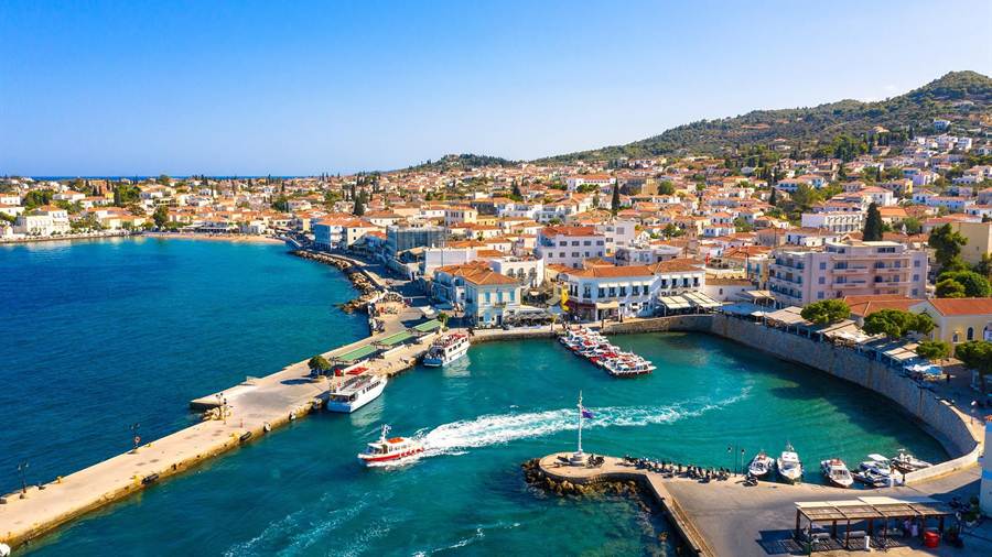
Ermioni is a former municipality as well as a port. Since the 2011 local government reform, it has formed a municipal unit of Ermionida, whose seat is Kranidi. The unit covers 168.18 square kilometres.
The town counts as a popular tourist resort, and a ferry connects its port with Piraeus. The community of Iliokastro, 7 km north of the town, belongs to the same municipal unit of Ermioni.
The water of an Ermioni boat trip belongs to a wider basin. The Argolic Gulf and its islands are sometimes grouped with the Saronic Gulf and its islands as the Argo-Saronic Gulf and the Argo-Saronic Islands.
The main inhabited Saronic Islands are Salamis, Aegina, Agistri and Poros. Ferries from Piraeus and from the Peloponnese serve them on a regular basis, and the group falls under the Greek administration of Attica.
- Ancient name: Ancient Greek names for the town are Hermione and Hermion, and its territory bore the name Hermionis.
- Region: Argolis forms a regional unit inside the Peloponnese region of Greece.
- Dolphins: The Saronic Gulf is one of the gathering areas for short-beaked common dolphins in the Aegean Sea.
- Whales: Fin whales have also been sighted in the Saronic Gulf as conditions in its water have improved.
An Ermioni boat trip shares these waters with other island routes, and the Hydra boat trip page covers a neighbouring island route in the same stretch of sea.


Which Ermioni boat trip formats are on sale?
An Ermioni boat trip on sale today does not leave from Ermioni harbour. The listed formats start from Porto Cheli, Spetses, Nafplio and Athens, and each one centres on Spetses or other Argo-Saronic islands, with swim stops, cruising or a walk ashore.
No format in the listings names Ermioni harbour as its point of departure. The nearest formats leave from Porto Cheli, Spetses, Nafplio and Athens, so an Ermioni boat trip begins at one of those points.
From Porto Cheli, one private cruise runs to Spetses each day and builds swim stops into the route. A private format keeps the boat for a single booking party rather than a shared group of strangers.
On Spetses itself, one format explores the island by sea aboard an electric kaiki. A second Spetses format stays on land as a night walk on local history and faith at Armata Grove.
From Nafplio, 44 km north-west of Ermioni, two formats reach Spetses. One is a day trip with swimming, listed on two sales platforms, and the other is a RIB cruise to the island.
From Athens, one format is a Spetses day trip with time to swim. A second Athens format is an island-hopping tour, and buyers choose between a Hydra and Poros pairing or Spetses on its own.
- Porto Cheli: A private daily cruise sails to Spetses with swim stops.
- Spetses: An electric kaiki outing and a night walk at Armata Grove both start on the island.
- Nafplio: A Spetses day trip with swimming and a RIB cruise to Spetses both depart from this port.
- Athens: A Spetses day trip and an island-hopping tour both begin in the capital.
The tour cards and availability boxes on this page list live dates for each Ermioni boat trip format, from the private Porto Cheli cruise to the Athens island-hopping tour.
Where is Ermioni on an Ermioni boat trip?
An Ermioni boat trip starts in south-eastern Argolis, on the Aegean coast of the Argolid Peninsula. Ancient Hermione stood at the southern extremity of Argolis, beside a gulf that counted as separate from both the Argolic and Saronic Gulfs.
Argolis is a regional unit of Greece within the Peloponnese region, in the east of the peninsula. Much of its territory lies on the Argolid Peninsula, where an Ermioni boat trip follows the south-eastern shore.
Argolis has two coastlines. The Saronic Gulf meets it in the north-east, while the Argolic Gulf meets it in the south and south-east. The sea off its southern coast bore a third name, the Hermionitic Gulf.
The Argolic Gulf runs about 50 km long and 30 km wide, and its main port is Nafplio, at the north-western end. Mountains around the gulf shelter it from the strong summer Meltemi winds.
Strabo placed the promontory of Scyllaeum in Hermionis. In that account, the Hermionitic Gulf ran along the coast of Troezen as far as that cape, so the name covered a long stretch of shore.
- Neighbours: Ermioni lies 10 km east of Kranidi and 22 km southwest of Galatas.
- Landscape: Low hills with olive groves and small forests cover the area around Kranidi.
- Mountains: The Arachnaio and Didymo ranges rise in the east of Argolis.
- Open sea: The Myrtoan Sea is the part of the Aegean south of Euboea, Attica and Argolis.
An Ermioni boat trip covers the south-eastern end of Argolis, while the Nafplio day trip page covers the main port at the north-western end of the Argolic Gulf.
What ancient history does an Ermioni boat trip pass?
An Ermioni boat trip passes the site of ancient Hermione, a city that Greek myth credits to the Dryopes. It outlasted its kindred towns as an independent state, fought in the Greco-Persian Wars and later joined the Achaean League.
In Greek myth, Heracles drove the Dryopes out of Mount Oeta and its valleys. They resettled in the Peloponnese, where their three chief towns were Hermione, Asine and Eion, with Hermione apparently the leading one.
Homer’s Iliad names Hermione beside its kindred city Asine in the Catalogue of Ships. The Dorians took Asine and Eion early, yet the city of Hermione endured as an independent Dryopian state.
During the Greco-Persian Wars, the Hermionians were still counted as Dryopes. Their city sent three ships to the Battle of Salamis and 300 men to fight at the Battle of Plataea.
The Argives later took the town and planted an Argive colony there, possibly around 464 BCE, when they also subdued Mycenae and Tiryns. Hermione turned into a Doric city yet kept Dryopian customs.
Around 230 BC, a tyrant named Xenon ruled the city. Once Aratus of Sicyon took the Acrocorinthus and freed Argos, Xenon stepped down in 228 BC, and Hermione then joined the Achaean League.
- Shipyards: Classical Hermione was known for its shipbuilders and for porphyra, an important red dye.
- Uniforms: Armies including that of Alexander the Great wore uniforms coloured with this dye.
- Poet: Lasus of Hermione, a lyric poet of the 6th century BC, worked at Athens under the Peisistratids.
- Last tyrant: Xenon was the last tyrant of the Peloponnese to surrender his power.
An Ermioni boat trip also passes a later chapter, since the town kept its shipbuilding and naval skills under Ottoman rule, and those skills played a significant role in the Greek revolution of 1821.
Which temples and myths belong to an Ermioni boat trip?
An Ermioni boat trip passes a town where Pausanias recorded a long list of temples. Its chief cult honoured Demeter Chthonia on Mount Pron, and nearby fenced precincts of Clymenus and Hades marked what locals held to be the shortest road to Hades.
On an Ermioni boat trip, the cult of Demeter Chthonia comes first, since she appears to have been the principal deity of the Dryopians. Hermione stayed the chief seat of her worship after the Argive takeover.
Tradition holds that Chthonia, a daughter of Phoroneus, founded the sanctuary with her brother Clymenus. In another version, Demeter burned Colontas alive for ill-treating her, but saved Chthonia and carried her to Hermione.
The sanctuary stood on a height of Mount Pron and counted as inviolable, yet Cilician pirates still plundered it. A temple of Clymenus stood opposite, and the stoa of Echo stood to its right.
That stoa repeated a voice three times. Close by lay three sacred places enclosed by stone fences, one for Clymenus, one for Hades and a third for the Acherusian lake.
Inside the precinct of Clymenus, an opening in the earth served, in local belief, as the shortest road to Hades. So the Hermionians put no coin in the mouths of their dead for the ferryman.
- Hestia: In the sanctuary of Hestia, Pausanias saw only an altar and no image of the goddess.
- Rarity: Hestia normally lacked temples of her own, and Pausanias names only one other sanctuary, in Sparta.
- Offerings: An inscription shows that the Asinaeans, resettled in Messenia, kept sending offerings to Demeter Chthonia at Hermione.
- Hymn: Lasus of Hermione wrote a hymn to Demeter of Hermione that avoided the letter sigma.
An Ermioni boat trip thus touches Clymenus, a name also used as a title of Hades, and the festivals and sport games that Pausanias described in the town.
What is the Ermioni headland on an Ermioni boat trip?
An Ermioni boat trip rounds the promontory where the old city of Hermione stood. Pausanias gave it a length of seven stadia and a width of three at its broadest, with a harbour on either side and a temple of Poseidon.
By the 2nd century, when Pausanias described the town, nobody lived on the promontory any longer. Temples still stood on the headland, and the one sacred to Poseidon stood out among them.
The later town lay four stadia from the temple of Poseidon, on the slopes of a hill called Pron. Walls ringed it completely, and in earlier times it had served as the acropolis.
The lower city appears to have emptied during the Argive takeover, when part of the old population was expelled. The ruins of the ancient town now lie around the modern village of Ermioni.
Strabo traced a coastwise voyage along the Hermionic Gulf, an early form of an Ermioni boat trip. It began at Asine, passed Hermione and Troezen, and reached Calauria, four stadia off the mainland.
Calauria held a temple of Poseidon and a league of seven cities that shared in its sacrifice. Hermione heads the list of members, and it has been inferred from this that Hermione held the presidency.
- Research: Greek and Swedish archaeologists have studied ancient Hermione since 2015.
- Projects: The work began as A Greek cityscape and its people and continued under the title Hermione: A model city.
- Themes: The teams study the built environment, landscape, family structures, religious practice and funerary rituals.
- Results: First findings appeared in the journal Opuscula and in Archaeological Prospection.
An Ermioni boat trip passes ground that scholars still map, from a 1968 temple study in Hesperia to a topology of Hermion and Ermioni between Pausanias and digital maps.
How does an Ermioni boat trip reach Spetses?
An Ermioni boat trip reaches Spetses by sailing out from a small port town on the Argolid Peninsula towards the entrance of the Argolic Gulf. Spetses sits at that entrance, and a strait divides it from Kosta, a point on the Argolis mainland.
Ermioni stands in the southeastern part of Argolis, on the Aegean coast of the Argolid Peninsula. Ferries link the small port town with Piraeus, while Spetses lies just off the same Argolida mainland.
In the Mesolithic Age, around 8000 BC, an isthmus joined Spetses to the Argolida mainland at the point now called Kosta. Today open water separates the island from Kosta.
The Argolic Gulf measures about 50 km by 30 km, with Nafplio as its main port and Spetses at its entrance. The surrounding mountains shield the gulf from the strong summer Meltemi winds.
Around 2300 BC, at the height of the State of Lerna, three natural harbours on Spetses, Saint Marina, Saint Paraskevi and Zogeria, sheltered cargo ships bound to and from the Argolis Gulf.
Beyond the strait, Spetses keeps its own link with Athens. Ferries and high-speed hydrofoils arrive regularly from Piraeus, while an Ermioni boat trip reaches the island from the Peloponnese side of the water.
- Region: Spetses counts among the Saronic Islands and belongs to the region of Attica.
- Grouping: The Argolic Gulf and its islands are sometimes joined with the Saronic Gulf as the Argo-Saronic Gulf.
- Municipality: The island forms its own municipality of 27.121 km2, with no internal boundaries.
- Regatta: Each June, the Spetses Classic Yacht Regatta starts and finishes in the strait facing Kosta.
An Ermioni boat trip stays at the Argolic end of this island chain. The main inhabited Saronic Islands include Aegina and Poros, which a Hydra, Poros and Aegina cruise visits.
What is Spetses town on an Ermioni boat trip?
An Ermioni boat trip lands at the town of Spetses, the only large settlement on the island. The town spread out from the old village at Kastelli, and no private cars are allowed within its limits, so people walk, cycle or ride carriages.
An unusual rule shapes the town, since private automobiles are not allowed inside its limits. Walking, horse-drawn carriages, bicycles, mopeds and motorcycles move people around, and only taxis and delivery vehicles enter the downtown area.
In the 18th century, Arvanites fleeing Ottoman persecution founded the old village of Spetses at Kastelli, where a wall added to the natural defence of the ground. An Arvanite community still lives on the island.
Turkish forces destroyed that village in 1770, after the Orlov Revolt, and the island stood empty for a time. New settlers from the facing Peloponnese coast arrived in 1774, and the town then spread beyond Kastelli.
The Spetses Museum fills the mansion of Hatzigiannis Mexis, the first governor of Spetses, built between 1795 and 1798. Its displays span 4000 years of island history, and the house also holds the historical archive.
On an Ermioni boat trip, the Old Port tells an older story. Refugees fleeing a raid by the Goths gathered there, and the settlement grew into one of the three largest cities of Argolis.
- Villages: Ligoneri, Kouzounos, Moni Ayion Panton and Ayioi Anargyroi are the other settlements on the island.
- Mansion: Heirs of Hatzigiannis Mexis gave his house to the Greek state in 1938.
- School: John Fowles taught English at the Anargyrios and Korgialenios School between 1951 and 1953.
- Novel: Spetses became the model for the island of Phraxos in his 1965 novel The Magus.
Mexis also served as a delegate to the First National Assembly of Epidaurus, a name that ties the revolutionary story of an Ermioni boat trip to an Epidaurus tour.
Who was Bouboulina on an Ermioni boat trip?
An Ermioni boat trip meets the memory of Laskarina Bouboulina, a naval commander of the Greek War of Independence. Born in Constantinople in 1771, she grew up on Spetses and is considered one of the first women to reach the rank of admiral.
Born Laskarina Pinotsi, she moved to Spetses with her family at the age of four. Her mother later married the Spetsiot Dimitrios Lazarou-Orlov, who encouraged her love of sailing beyond the norms of the time.
She was widowed twice. Her second husband, the shipowner Dimitrios Bouboulis, drowned in an 1811 fight with Algerian pirates off Lampedusa, and she took over his fortune and trade, later buying shares in other Spetsiot ships.
On Spetses, she ordered a ship larger than Ottoman rules allowed, and a bribed Ottoman admiral passed it as a trader. Armed with 18 cannons, it became the first warship of modern Greece.
When the war broke out, she sailed to Nafplion and blockaded it by sea on 4 April 1821. Spetsiots sent seven more ships at her appeal, and the rebels named her Kapetanissa, or Captain.
She then blockaded Monemvasia, whose garrison surrendered on 25 July 1821. Her end came in 1825, in a family feud, when she faced armed men from her balcony and one of them shot her.
- Statue: An Ermioni boat trip finds her life-sized statue on the main dock of Spetses.
- Rear Admiral: The Hellenic Navy granted her the honorary title of Rear Admiral in 2018.
- Banknote: Her image appeared on the reverse of the Greek 50-drachma note of 1978.
- Film: Irene Papas played her in the Greek drama film Bouboulina, released in 1959.
Her statue and the museum kept by her descendants give an Ermioni boat trip two direct links to the woman the rebels called Kyra, or Lady.
What is the Armata on an Ermioni boat trip?
An Ermioni boat trip reaches the home of the Armata, the festival that recalls the sea battle of 8 September 1822 off Spetses. Each year, on the second weekend of September, events end in a staged re-enactment in the harbour.
The Ottoman fleet, sailing from Monemvasia, tried to supply Nafplion, under Greek siege since the spring of 1821. Between Trikeri and Spetsopoula it met the joined fleets of three seafaring islands, Spetses among them.
Andreas Miaoulis commanded the Greeks. Modelling his plan on Themistocles at Salamis, he split sixteen fireships and fifty-six vessels into three squadrons, one of them set to guard the coast between Spetses and the Peloponnese.
The Ottoman fleet counted eighty-four vessels under Kara Mehmet Pasha. Engagements ran from 8 to 13 September, and after three failed attempts to break through, the Ottomans withdrew, so the battle counts as a Greek victory.
The Spetsiot historian Anastasios Orlandos credits Kosmas Barbatsis, who steered his fireship at the Ottoman flagship and forced it to flee. No relief reached the besieged castles of Nafplion, and the garrison surrendered in December.
The festival joins the battle anniversary with the feast of the chapel of Panagia Armata, the Madonna-in-arms, near the lighthouse. Its finale burns a mock Turkish flagship in the harbour, a scene absent from historical accounts.
- Fireship captain: Kosmas Barbatsis, credited with the charge at the flagship, lived from 1792 to 1887.
- Brig: An Algerian brig caught fire after boarding a Greek fireship by mistake.
- Network: Spetses, the goal of an Ermioni boat trip, is one of nine European cities in the European Network of Historical Reconstructions.
- Premiere: A documentary on Bouboulina, The Brave Stepped Back, debuted at the Armata Festival in 2005.
An Ermioni boat trip on the second weekend of September lands in the middle of the festival, when the town replays its naval role in the War of Independence.
What is Spetsopoula on an Ermioni boat trip?
An Ermioni boat trip sights Spetsopoula, a small private island lying to the southeast of Spetses. Its name means small Spetses, it covers about 2 square kilometres, and the 2011 census found it uninhabited, down from 8 residents in 2001.
Spetsopoula lies 90 kilometres from Athens. Pausanias, the ancient Greek traveller and geographer, recorded its old name as Aristera, while the modern name comes from its larger neighbour, Spetses.
In 1962 the Greek shipping magnate Stavros Niarchos bought the island. His descendants still own Spetsopoula, and friends of the Niarchos family from high society call there as guests.
The island is also linked to the death of Eugenia Livanos, a former wife of Niarchos, who was found dead there in 1970. She was 44 years old.
Spetsopoula belongs to the Municipality of Spetses, together with Falkonera and Velopoula, and all three islands are uninhabited. Velopoula also lies southeast of Spetses and carries a lighthouse.
Falkonera lies further out, between Milos and the Peloponnese. A lighthouse stands on its eastern cape, and with Velopoula and Ananes it forms part of the Natura 2000 network.
- Novel: Richard H. White’s 2013 novel Miro’s Knot uses Spetsopoula as one of its settings.
- Period: The book portrays Spetsopoula as the island stood in 1967.
- Falcons: The name Falkonera comes from a Venetian word meaning place of falcons.
- Wildlife: Falkonera supports a population of the Milos wall lizard, Podarcis milensis.
On an Ermioni boat trip, Spetsopoula stands as the private neighbour of Spetses, an island still held by the descendants of Stavros Niarchos.
Which Spetses shores does an Ermioni boat trip reach?
An Ermioni boat trip reaches shores ringed by pine woods and beaches. Ayios Mamas lies in the town centre, Kaiki and Ayia Marina sit close by, and public buses run to Zogeria, Ayioi Anargyroi and Ayia Paraskevi further out.
Ayios Mamas beach sits in the town centre. Kaiki beach, once called College, lies 1 kilometre to the northwest, while Ayia Marina sits 2 kilometres to the south, and both offer water sports.
Finds at Ayia Marina mark the first Hellenic settlement known on the island, from the 3rd millennium BC. Late Mycenaean artefacts turn up there and at Ayioi Anargyroi, dated to the 12th to 13th century BC.
Zogeria, one of the old natural harbours, yielded pieces of Mesolithic flint near a water source. A stone observatory rose there during the Peloponnesian War, with another at Prophet Elias.
On an Ermioni boat trip, the pine slopes recall the ancient name Pityussa, meaning abounding in pine trees. Sotirios Anargyros, a tobacco tycoon back from the United States in 1899, had seedlings planted in the hills.
In the early 21st century, Spetses ranks among the best-wooded islands of the southern Aegean. Walking trails encircle the island and add up to about 25 to 30 km.
- Villa Bourani: The house from The Magus stands on the south side, above a public beach.
- Free-diving: World record free-diving attempts frequently take place around the island.
- Mini Marathon: Its main race covers 26 km around the island, with swimming races of 2.5 km and 5 km.
- Migration: Turtledoves and quail migrating between Africa and Europe once drew Athenian hunters from August to October.
From the water, an Ermioni boat trip traces this green, beach-lined coast, from Ayios Mamas in town to the beaches served by the island buses.
What is Dokos on an Ermioni boat trip?
An Ermioni boat trip looks out on Dokos, a small island of the Argo-Saronic Gulf that carried the name Aperopia in ancient times. A narrow strait separates it from the Peloponnese, and Byzantine and Venetian castle ruins stand on its east side.
The port town of Ermioni stands on the Argolid Peninsula and faces two islands, Hydra and Dokos. Dokos is the small island of the pair, and its name in Greek script is Δοκός.
Dokos belongs to the Islands regional unit. The account of the Dokos shipwreck places the island in the Aegean Sea off southern Greece, about 100 kilometres east of Sparta in the Peloponnese.
Dokos has counted as a strategic location since ancient times. On its east side stand the ruins of a large castle that dates from the Byzantine and Venetian periods of rule.
During the Middle Ages, Dokos served as a refuge for the animals of Albanian settlers. On the Ermionida shore opposite, the port of Ermioni was known for its shipbuilders in classical and Ottoman times.
In 1975, Peter Throckmorton discovered a wreck near the island, dated to about 2150 BC. Divers and archaeologists returned to the site in later decades for a full excavation of the cargo.
- Ancient name: Aperopia, written Ἀπεροπία in ancient Greek.
- First settlers: Archaeological studies show people living on Dokos from the early Bronze Age.
- Marine research: The Hellenic Institute of Marine Archaeology excavated the wreck site off the island.
- Strait: A narrow channel of sea divides Dokos from the Peloponnese coast.
On an Ermioni boat trip, Dokos brings together castle ruins on land, early Bronze Age traces and a Bronze Age wreck site on the sea floor nearby.
What is the Dokos shipwreck on an Ermioni boat trip?
An Ermioni boat trip crosses the waters of the Dokos shipwreck, a Bronze Age cargo site 15 to 30 metres down. Archaeologists date it to the second Proto-Helladic period and rank it as the second-oldest known shipwreck in the world.
The American archaeologist Peter Throckmorton found the site on August 23, 1975. Throckmorton, born in New York City, worked as a photojournalist and was a pioneer of underwater archaeology.
One account of the find places the cargo at 20 metres depth and describes pottery of the Cycladic type. Hundreds of clay vases and other ceramic items marked the spot on the seabed.
The Hellenic Institute of Marine Archaeology, known as HIMA, excavated the site between 1989 and 1992. Its president, Dr. George Papathanasopoulos, led the first full-scale excavation of an ancient shipwreck in Greece.
The seabed at Dokos is irregular. To plot and map the underwater finds, the HIMA team used a new system, the Sonic High Accuracy Ranging and Positioning System, known as SHARPS.
The clay pots appear to be goods from an ancient Argolida workshop. They were presumably meant for trade with small coastal villages around the Gulf of Argos and the Myrtoan Sea.
- Vases: Divers uncovered more than 500 clay vases from the Early Helladic period.
- Sherds: The HIMA seasons produced more than 15,000 pottery sherds and artefacts.
- Anchors: Two large boulders with bored holes lay 40 metres from the wreck.
- Parallels: The sauceboats resemble finds from Askitario in Attica, from Lerna and from the Cyclades.
The wreck on an Ermioni boat trip appears to sit on an old trade route from South Euboea to the Saronic and Argolid gulfs. Travellers heading further south along the Peloponnese add a Monemvasia tour.
What is Porto Cheli on an Ermioni boat trip?
An Ermioni boat trip in practice starts near Porto Cheli, a summer resort town of Ermionida on a bay of the Argolic Gulf. No format on sale names Ermioni harbour as its departure point, while one private cruise leaves from Porto Cheli.
Porto Cheli lies in the southeastern part of Argolis, 7 km south of Kranidi and 40 km southeast of Nafplio. The name also appears in print as Portocheli and as Porto Heli.
Ferry connections run from Porto Cheli to the islands of Spetses, Hydra and Poros. Further routes reach Ermioni and Piraeus, so the bay acts as a sea junction for the southern Argolid coast.
A yacht marina sits within the bay of Porto Cheli. It has become a popular wintering port for pleasure vessels, which spend the cold season moored at its quays rather than at sea.
A small private airport, Porto Cheli Airport, once operated south of the town. It has been closed since 2004, and the land on which it stood has since been sold.
The former King Constantine II of Greece lived in Porto Cheli with his wife, Queen Anne-Marie. The couple owned a villa there, sold it in 2022 and moved to Athens.
- Coast villages: Koilada, Portocheli and the beach settlement of Doroufi lie on the coast of the Kranidi unit.
- Ancient neighbour: The ancient city of Halieis, called Halike by Pausanias, lies near the town.
- Gulf size: The Argolic Gulf measures about 50 km in length and 30 km in width.
- Tour formats: One private cruise with swim stops sets out from Porto Cheli.
For an Ermioni boat trip, Porto Cheli works as the practical harbour, with ferry links, a marina and the ruins of Halieis close to its bay.
What lies under the water at Halieis on an Ermioni boat trip?
An Ermioni boat trip near Porto Cheli reaches the site of Halieis, an ancient port town of Hermionis at the mouth of the Argolic Gulf. Part of the town now lies under the sea, and Michael H. Jameson began excavating it in 1962.
Ancient writers gave the town a string of names: Halice, Halike, Halia, Alycus and Haliai. Thucydides called its district Halias, and the townsfolk took their name from their fisheries.
Halieis also served as a place of refuge for its neighbours. The Tirynthians and the Hermionians both fled there after the Argives drove them out of their own cities.
Around 460 BCE, Aneristus, the son of Sperthias, took the town and made it subject to Sparta. Athenian forces later ravaged the district more than once. After the Peloponnesian War, Xenophon describes Halieis as autonomous.
By the time of Pausanias, nobody lived in the town. He noted that the road to Halice split from the road to Mases seven stadia from Hermione and ran between the mountains Pron and Coccygius.
Michael H. Jameson, a classicist and later Crossett Professor Emeritus at Stanford University, studied the partly drowned port city. He worked at the University of Pennsylvania from 1954 to 1976 and wrote about sixty articles.
- Drowned temple: Jameson wrote “The Excavation of a Drowned Greek Temple” for Scientific American in October 1972.
- Wider study: From 1979 to 1983 he drove a broad ecological study of the Argolid, the first look at the paleoecology of ancient Greece.
- Book: A Greek Countryside, written with Tjeerd van Andel and C. N. Runnels, appeared in 1994.
- Modern site: The ruins lie near the modern town of Porto Cheli, south of Kranidi.
On an Ermioni boat trip, Halieis is the drowned harbour of a classical town, with its story kept in Thucydides, Xenophon and Pausanias and in the excavations of Jameson.
What is the Franchthi Cave on an Ermioni boat trip?
An Ermioni boat trip into Kiladha Bay passes below the Franchthi Cave, an archaeological site opposite the village of Kiladha. People used the cave as a shelter for around 35,000 years, from the Upper Paleolithic until its last occupation around 3,000 BC.
Franchthi ranks among the comprehensively studied Stone Age sites in Southeast Europe. Its layers cover the Upper Paleolithic, Mesolithic and Neolithic periods, with a break during the Younger Dryas cooling event.
T. W. Jacobsen of Indiana University began the first excavations in 1967. The dig started as a side project, grew into the focus of his work and ended in 1976 after nearly a decade.
Sea levels have risen around 120 metres since the cave’s early use. Its first inhabitants looked out over a large coastal plain, and that plain now lies under the water of Kiladha Bay.
In the Upper Paleolithic, a group of about 25 to 30 people used the cave by season. They hunted wild ass and red deer and carried a stone kit of flint bladelets and scrapers.
Between around 7,900 and 7,500 BC, tuna became a major food, which points to deep sea fishing. Around 7,000 BC, domesticated plants and animals appear in the cave layers alongside wild species.
- Paralia: Neolithic people built terrace walls for crops outside the entrance, and a village below now lies under the sea.
- Bay of Kiladha Project: The University of Geneva and the Greek Ephorate of Underwater Antiquities began the survey in 2012.
- Lambayanna: In 2015, divers found an Early Bronze Age city of 1.2 ha under 1 to 3 m of water.
- Defences: The Lambayanna remains include a fortification wall with three large towers.
An Ermioni boat trip across Kiladha Bay runs over a drowned prehistoric landscape, with the cave above the shore and the old plain beneath the water.
What is Kranidi on an Ermioni boat trip?
An Ermioni boat trip follows the coast below Kranidi, the seat of the Ermionida municipality on the easternmost finger of the Peloponnese. The town lies about 4 km from the sea, 8 km west of Ermioni, among low hills with olive groves.
Kranidi appears in Katharevousa as Κρανίδιον and in Latin as Cranidium. Since the 2011 local government reform, it has been the seat and a municipal unit of Ermionida, formed by merging Kranidi and Ermioni.
Two explanations exist for the name. One links it to Koronida, a nearby islet, and the other to the ancient word Kranaos, which means rocky trough. The name later shifted to Kranida, then Kranidi.
In the Homeric era, two cities stood in the area: Hermion, at modern Ermioni, and Masis, at modern Koilada. Kranidi first appears in the 16th century under the Turkish name Kato Nahagie, meaning low province.
After a failed uprising against Ottoman rule, a large number of locals left for Europe, Russia and Cyprus. Kranidi residents took part in the Greek War of Independence, among them the priest Arsenios Krestas.
In 1823, Kranidi became the seat of the legislative part of the Greek government. During the civil war that followed, a second executive formed at Kranidi with Kountouriotis as president.
- Province seat: After independence, Kranidi became the seat of Ermionida province, which was abolished in 2006.
- Distances: The town lies 28 km south of Epidaurus and 38 km southeast of Nafplio.
- Second homes: Sean Connery, King Willem-Alexander and Queen Máxima have had second homes in Kranidi.
- Language: Arvanitika, a language with heavy Greek influence, now has only elders as speakers.
An Ermioni boat trip ends close to roads that lead north from Kranidi to the sites covered on a Mycenae and Epidaurus day trip.
What do travellers ask about an Ermioni boat trip?
An Ermioni boat trip raises four common questions among travellers: where the formats depart, which islands lie close, whether the day includes swimming and what to pack. The answers below draw on the formats on sale and on mapped facts about the area.
Where does an Ermioni boat trip depart from?
No format on sale names Ermioni harbour as its departure point. The nearest formats leave from Porto Cheli, Spetses, Nafplio and Athens. Ermioni itself has a ferry link to Piraeus, and ferries from Porto Cheli serve Spetses, Hydra, Poros, Ermioni and Piraeus.
Which islands lie close to an Ermioni boat trip route?
Ermioni faces the islands of Hydra and Dokos, and the waters off Dokos hold the Bronze Age wreck site. Inside the Argolic Gulf, the main islands are Psili, Plateia and Bourtzi. Bourtzi carries a Venetian fortress that protects the port of Nafplio.
Can travellers swim on an Ermioni boat trip?
Yes. The private cruise from Porto Cheli lists swim stops, and the day trips to Spetses from Nafplio and from Athens include swimming. The mountains around the Argolic Gulf shelter its waters from the strong summer Meltemi winds. Swimmers bring their own towels and check the sea state with the crew before each stop.
What do travellers bring on an Ermioni boat trip?
Travellers on an Ermioni boat trip pack swimwear, a towel, a sun hat, sun cream and drinking water. A light jacket helps on deck when the wind rises. A mask and snorkel suit the shallow bays, and a dry bag keeps phones and cameras safe from spray.