
Athens tours are walks, rides and visits through the Greek capital, from the Acropolis and the museums to the old quarters, the food markets, the coast of Attica and the port of Piraeus. The page is part of the Greece Tours on Greece Ville.
This page covers what Athens tours are, the Acropolis, the museums and the stadium, tours on foot, by bike and by bus, food, the coast, the port and the airport, and trips beyond the city. Common questions come last, and each section links to the Greece Ville posts on single tours.
What are Athens tours and how big is the city they cover?
Athens tours cover a capital with 643,452 residents in 2021 inside 38.96 square kilometres of municipal land, set within a metropolitan area of 3,638,281 people, so every single itinerary chooses one slice of a much larger and older city.
The municipality is only the administrative core. The Athens urban area consists of 40 municipalities, with 35 of them in four regional units and the other five forming the regional unit of Piraeus.
Geography frames every route. The city sprawls across the central plain of Attica, known as the Athens Basin, which four mountains bound: Aigaleo to the west, Parnitha to the north, Pentelicus to the northeast and Hymettus to the east.
The city is also built around a large number of hills. Lycabettus is one of the tallest within the city proper, and its summit gives a view of the entire Attica Basin.
Recorded history spans over 3,400 years. The Cave of Schist holds the oldest known human presence in Athens, dated to between the 11th and 7th millennia BC, so Athens tours cross a very deep layer of time.
- Municipal core: Seven municipal communities divide the municipality into 53 municipal districts.
- Metropolitan area: It covers 2,928.717 square kilometres and holds 58 municipalities in seven regional units.
- Length: The urban area spreads over 50 kilometres from Agios Stefanos in the north to Varkiza in the south.
- Tallest rim: Mount Parnitha reaches 1,413 metres and is the tallest of the four basin mountains.
Athens tours work best when each route names its district first, because the municipality, the urban area and the metropolitan area carry different boundaries and different counts.



Why does the Acropolis anchor Athens tours?
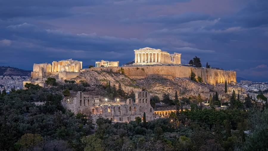
Athens tours reach the Acropolis, the rock where a Mycenaean fortress stood by 1400 BC and where a building programme under Pericles later raised the Parthenon, so the hill gives every route its place on the long timeline of the city.
By 1400 BC the settlement had become an important centre of the Mycenaean civilisation. Sections of the characteristic Cyclopean walls still mark the line of the old fortress on the rock.
The decades after the Persian wars became the Golden Age of the Athenian democracy. Pericles promoted the arts and fostered democracy, and he launched the ambitious building programme that produced the Acropolis monuments.
The playwrights Aeschylus, Sophocles and Euripides flourished in the same period. Athens tours that start at the rock therefore meet the theatre, the philosophy and the politics of one generation.
The Acropolis tour post covers a visit to the rock and its monuments. The Acropolis tickets post covers entry to the site.
The Acropolis Museum tickets post covers the museum that holds finds from the rock and sits beside it.
- Fortress: A major Mycenaean fortress stood on the Acropolis by 1400 BC.
- Builder: Pericles led the programme that raised the Parthenon and the other Acropolis buildings.
- Playwrights: Aeschylus, Sophocles and Euripides all worked in Athens during the Golden Age.
- Heritage: Athens holds two UNESCO World Heritage Sites, the Acropolis and the medieval Daphni Monastery.
Athens tours that begin on the Acropolis give the later stops a clear order, from fortress to Golden Age to the modern capital below the rock.
Which museums and which stadium belong on Athens tours?
Athens tours include the National Archaeological Museum, which holds the world’s largest collection of ancient Greek antiquities, and the Panathenaic Stadium, which hosted the 1906 Intercalated Games, so one indoor stop and one open-air stop balance each route.
The first national archaeological museum in Greece was set up on Aigina in 1829 by Ioannis Kapodistrias. The current building in Athens was finished in 1889, and the museum took its present name in 1881.
During World War II the museum closed. The antiquities were sealed in special protective boxes and buried, and exhibits returned to display in 1945.
The National Archaeological Museum tickets post covers entry to the collection and the layout of its halls.
The German-born architect Ernst Ziller led a thorough excavation of the stadium in 1869 and 1870. A throne from its front row is now kept in the British Museum. The Panathenaic Stadium tickets post covers entry to the track.
- Inscriptions: The south wing houses the Epigraphical Museum, with the richest collection of inscriptions in the world.
- Reopening: The museum reopened in July 2004 after a refurbishment that kept it fully closed for more than a year and a half.
- Basketball: The 1968 FIBA European Cup Winners’ Cup final was played in the stadium.
- Archery: The stadium hosted the archery competition at the 2004 Summer Olympics.
Athens tours pair the two sites because the museum shows what the ancient city made and the stadium shows how the city later hosted sport.
How do Athens tours work on foot, by bike and by bus?
Athens tours on foot, by bike or by bus follow the old quarters at the foot of the Acropolis, where Plaka, Monastiraki and the squares around them sit close together, so the street plan shapes every route more than distance does.
Plaka is the old historical neighbourhood, clustered around the northern and eastern slopes of the Acropolis. It is nicknamed the Neighborhood of the Gods and has been inhabited from the Neolithic to the present day.
Adrianou Street divides Plaka into Ano Plaka, directly under the Acropolis, and Kato Plaka, which lies between Syntagma and Monastiraki. Streets such as Adrianou and Tripodon trace back to the ancient era.
Monastiraki takes its name, “little monastery”, from the Church of the Pantanassa on its square. The metro station there serves Line 1 and Line 3 of the Athens Metro.
The Athens walking tour post covers the old quarters on foot. The Athens bike tour post covers the same streets by bicycle, and the Athens hop on hop off post covers the bus loop.
- Pedestrian route: Dionysiou Areopagitou Street runs from the Temple of Olympian Zeus to Thiseio under the Acropolis slopes.
- Green space: The National Garden was completed in 1840 and covers 15.5 hectares in the centre.
- Street plan: Stamatios Kleanthis and Eduard Schaubert drew the modern city plan for King Otto.
- Public transport: Transport for Athens operates a large bus and trolleybus fleet beside the metro and tram.
Athens tours in the centre stay compact because the oldest streets, the squares and the metro stations all lie within one small area.
What food belongs on Athens tours?
Athens tours meet Greek cooking through a short list of staples: grilled meat on a skewer, wheat, olive oil and wine, small shared plates and a farmer’s salad, all sold in the market streets around Monastiraki and the central squares.
Greek cuisine is founded on the triad of wheat, olive oil and wine. It also uses vegetables, grains, fish and meat, with cheeses, herbs, lemon juice and olives as other important ingredients.
In Athens and southern Greece, skewered meat is commonly called kalamaki, meaning small reed. Gyros is meat cooked on a vertical rotisserie and wrapped in pita bread, and in Greece it is traditionally made with pork.
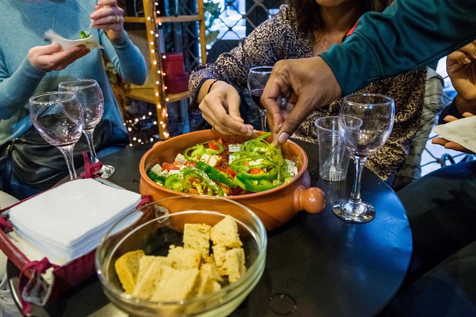
Meze is a selection of small dishes served as appetisers, together with spirits at an ouzeria. A Greek salad, choriatiki, is made with tomatoes, cucumbers, onion, feta and olives, and the original dish has no lettuce.
Monastiraki is a flea market neighbourhood and one of the main shopping districts, so market stalls and street food share the same lanes. The Athens food tour post covers tasting stops, and the Athens cooking class post covers cooking the dishes.
- Salad: Choriatiki is dressed with salt, Greek oregano and olive oil, and is served unmixed.
- Moussaka: The modern Greek version was created in the 1920s by Nikolaos Tselementes.
- Cookbook: The first Greek cookbook was printed on the island of Syros in 1828.
- Desserts: Nuts, honey, fruits, sesame and filo pastries are common dessert ingredients.
Athens tours that include food let the street plan work for the visitor, because each market lane groups a small set of dishes close together.
Where does the coast fit into Athens tours?
Athens tours reach the coast along the Athens Riviera, the southern strip that runs from Piraeus to Sounio and Lavrio, about 16 kilometres from downtown, and that ends at a temple of Poseidon built between 444 and 440 BC.
Plans to regenerate the Riviera date from the 1920s but political instability delayed them. In 1957 the development began with the creation of Asteria in Glyfada, and Greek cinema helped make the area popular.
Cape Sounion is the southernmost tip of the Attica peninsula, 69.5 kilometres southeast of Athens. It lies 8 kilometres south of the town of Lavrio.
The Temple of Poseidon stands almost 60 metres above the sea, and the headland is surrounded on three sides by the Aegean. Homer’s Odyssey gives the earliest literary mention of Sounion.
An American airbase stood at nearby Elliniko until the early 1990s, and Glyfada now holds nightclubs, upscale restaurants and shops along the shore, which gives Athens tours on the Riviera an urban side.
The Athens Riviera tour post covers the coastal road and its bays. The Cape Sounion tour post covers the cape and the temple.
- Vouliagmeni: Ruins of the Temple of Apollo Zoster have been excavated in Vouliagmeni.
- Kouros: The Sounion Kouros was found in 1906 in a pit east of the temple.
- Festival: Herodotus records a four-yearly festival at Sounion with a sacred boat from Athens.
- Water quality: A waste plant on the island of Psytalia improved the Saronic Gulf, and swimmers can use the coastal waters again.
Athens tours that head south trade the dense centre for open water, so a coastal day fits well beside a day of museums.
How do the port and the airport shape Athens tours?
Athens tours begin and end at two gateways: Piraeus, the second-busiest passenger port in Europe, and Athens International Airport, which lies about 20 kilometres east of the centre, so the arrival and departure points influence every plan made for a trip.
Until the third millennium BC, Piraeus was a rocky island. Silt later joined it to the mainland of Attica and shaped the harbours, and Themistocles began to fortify it in 493 BC.
The port is the largest in Greece. It is owned by the Greek state and run by the Piraeus Port Authority, and it ranks as the thirteenth-largest container port in the world.
The Piraeus shore excursion post covers visits from the cruise berths into the city.
In 2002 the government leased the port lands and facilities to the Piraeus Port Authority for 40 years. In 2008 the term changed to 50 years, so the lease ends in 2052.
The airport stands between Markopoulo, Koropi, Spata and Loutsa, and it is 30 kilometres by road because hills lie in between. The Athens airport transfer post covers the road and rail links into the city.
- Runways: The airport has parallel runways of 4 kilometres and 3.8 kilometres.
- Ownership: The Greek state holds 55 per cent and private investors hold 45 per cent.
- Name: It is named after Elefthérios Venizélos.
- Old airport: It replaced the Ellinikon airport, which had no space to grow.
Athens tours that start at either gateway save time in the city, because the transfer is planned before the first stop.
Which trips beyond the city start from Athens tours?
Athens tours lead outward to the Saronic islands, Crete and Santorini, because Aegina lies only 27 kilometres from the city while Crete and Santorini need a longer sea or air journey, so each trip sits at a different distance.
Aegina covers 87.41 square kilometres and is roughly triangular. Poros lies about 58 kilometres south of Piraeus and is two islands joined by a bridge, with 3,261 inhabitants in 2021. The Saronic Gulf also holds Salamis, Patroklos and Fleves.
Hydra covers 49.6 square kilometres and has a main town with a crescent-shaped harbour. Wheeled vehicles are not permitted on the island. The Hydra Poros Aegina cruise post covers the three islands in one trip.
The Day trips from Athens post covers journeys by land to sites and towns beyond the basin.
Crete is the largest island of Greece, with an area of 8,450 square kilometres, and Santorini lies about 200 kilometres southeast of the mainland. The Crete tours post and the Santorini tours post cover those islands.
- Crete: The region had a population of 624,408 in 2021, and Heraklion is its capital.
- Minoans: Crete was the centre of Europe’s first advanced civilisation from 2700 to 1420 BCE.
- Santorini: The island had 15,480 residents at the 2021 census.
- Eruption: One of the largest eruptions in recorded history struck Santorini about 3,600 years ago.
Athens tours work as a base for these trips, because the capital holds the ports and the airport that connect every island, and each return leg brings the traveller back to the same city centre.
What do travellers ask about Athens tours?
Athens tours raise four common questions about the best months, moving around the centre, which sites sit close together and how to combine city and island trips, and the answers below rely on climate, transport and map facts.
When are the best months for Athens tours?
Athens has a hot-summer Mediterranean climate, with a mean annual temperature of 19.2 degrees Celsius at the central station. Summer is warmer than in Seoul, Melbourne, Buenos Aires or Cape Town, and air pollution remains an issue during the hottest summer days, which affects Athens tours in July and August.
How do travellers get around the centre on Athens tours?
The metro and tram link the centre with the suburbs. The tram network is 27 kilometres long and runs from Syntagma Square to Palaio Faliro, where the line splits towards Voula and Piraeus, so Athens tours can reach the coast without a car.
Which sites sit close together on Athens tours?
The Acropolis, Plaka and Monastiraki lie within one old quarter, and the pedestrian route of Dionysiou Areopagitou Street links the Temple of Olympian Zeus to Thiseio. The National Archaeological Museum lies further north in Exarcheia, so Athens tours treat it separately.
How can Athens tours combine city and island trips?
The port of Piraeus and the airport connect the city with the Saronic islands, Crete and Santorini. Athens tours keep the city days first, then add an island day, since Aegina lies 27 kilometres away and the others need longer travel.