
Greece walking tours cover city streets, walled towns and mountain gorges on foot, from Athens, Thessaloniki, Nafplio, Chania and Rhodes to the gorges of Crete, the caldera path of Santorini and the Lousios Gorge. The page is part of the Greece Tours on Greece Ville.
This page covers what Greece walking tours are, the streets of Athens, Thessaloniki and its White Tower, the walled towns, the gorges of Crete, the Santorini caldera path, Zagori and Lousios. Common questions come last. Each section links to the Greece Ville posts on single tours.
What are Greece walking tours?
Greece walking tours are on-foot visits that link city streets, village paths and gorge trails into one route with a local expert, taking in ancient squares, Venetian walls, stone bridges and mountain canyons in towns and regions across the country.
Travel on foot is older than the tourism trade. Wordsworth began an extended tour of France, Switzerland and Germany in 1790, and Stevenson published Travels with a Donkey in 1879. Greece walking tours continue that habit.
The Grand Tour of Europe ran from the seventeenth to the nineteenth century as part of a wealthy young man’s education. It joined cities and sites, and Greece walking tours apply that idea to one town.
Words for walking differ by country. In the United Kingdom and Ireland, walking covers every kind of walk, from a park stroll to backpacking in the Alps. In the United States, walking means shorter urban outings.
The Greece hiking tours post covers the high mountain routes of the country. This hub keeps to walks that stay close to towns, gorges and village paths, and it follows the posts that cover them.
- City walks: Athens, Thessaloniki, Nafplio, Chania and Rhodes each have an old centre that works on foot.
- Village paths: Zagori links 46 villages that were joined by mountain roads and arched stone bridges.
- Gorge trails: The Samaria Gorge became a national park in 1962 on the island of Crete.
- Day hikes: A day hike is one that a walker can finish within a single day.
The sections below follow the routes in order, from Athens to the Pindus, and each one names the posts that cover the place in full.
Which streets and squares of Athens do Greece walking tours cover?
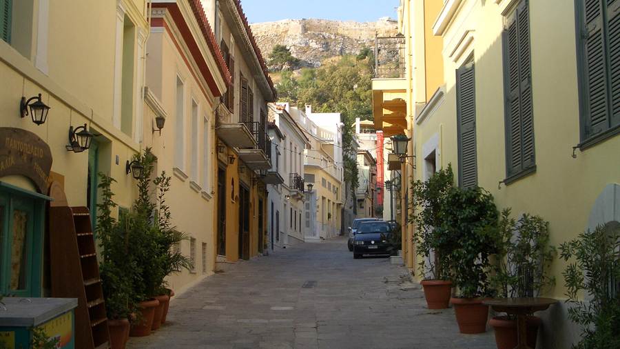
Greece walking tours in Athens cover Plaka, the old district on the northern and eastern slopes of the Acropolis, and the Ancient Agora below the hill, where citizens once traded, gathered in assembly and lived beside the public buildings of the classical city.
Plaka holds small museums close together, so Greece walking tours can pause at each. The Museum of Greek Folk Musical Instruments and the Museum of Pavlos and Alexandra Kanellopoulou both stand in the district.
The Ancient Agora lies northwest of the Acropolis. The Areopagus bounds it on the south, and Agoraios Kolonos, also called Market Hill, bounds it on the west. Its first uses were trade, assembly and housing.
On the west side stood the Monument of the Eponymous Heroes, which honoured the ten heroes of the Athenian tribes. Citizens also read notices of new laws, public events and military conscription on it. The Greek phrases for tourists post covers greetings, numbers and words on direction signs.
Marble-workers made the Agora a centre of sculpture. The Library of Pantainos rented rooms to them, and they moved into the ruined South Square after the Roman general Sulla sacked Athens in 86 BC.
The Athens walking tour post covers the town plan, Byzantine churches, Ottoman traces, neoclassical mansions, street names, writers, open-air cinemas, festivals and the old trades of the streets in the city.
- Bryaxis: A marble statue signed and possibly carved by Bryaxis came to light behind the Royal Stoa.
- The Mint: The Mint struck bronze coinage in the second and third centuries BC, but nothing shows it struck Athenian silver.
- Middle Stoa: The Middle Stoa was the largest monument built in the Agora during the second century BC.
- Temple of Ares: The Temple of Ares stood in the north half of the Agora, just south of the Altar of the Twelve Gods.
Greece walking tours in Athens therefore pair a living district with a working ancient market. Plaka and the Agora both lie around the Acropolis hill, so the route links them on foot.
How do Greece walking tours treat the White Tower and the Roman monuments of Thessaloniki?
Greece walking tours in Thessaloniki start on the waterfront at the White Tower, a monument and museum, and then turn inland to the Arch of Galerius and the Rotunda, two neighbouring Roman works of the early fourth century.
Archbishop Eustathius mentioned an older Byzantine tower during the sack of Thessaloniki in 1185. The tower seen today stands on the waterfront and once guarded the eastern end of the sea walls.
For years writers credited the tower to Venice, to which the Byzantines ceded the city in 1423. Research now shows that Ottoman builders raised it after Sultan Murad II captured Thessaloniki in 1430.
An Ottoman verse inscription above the door gave the date 1535 to 1536 under Suleiman. Historian Franz Babinger suggested the architect Mimar Sinan, though Michel Kiel states that his part cannot be confirmed.
A low wall called a chemise stood at the foot of the tower until its demolition in 1917. It carried heavy guns and enclosed an area at least three times the diameter of the main tower.
The Arch of Galerius stands where Egnatia Street meets Dimitriou Gounari Street, and a minaret survives beside the Rotunda. The Thessaloniki walking tour post covers the Roman layer, churches, walls and museums.
- Turret: A turret 12 m wide and 6 m high rises on top of the main drum.
- Platform: The turret holds a platform 10 m in diameter.
- Embrasures: A spiral ramp reaches the openings in the outer wall, and a central room on each floor serves the others.
- Roof: Early illustrations show a conical roof, like the towers at Yedikule and Rumelihisari.
Greece walking tours in Thessaloniki therefore read the city in layers. Byzantine, Ottoman and Roman works stand within one stretch of waterfront and avenue.
Which walled towns do Greece walking tours reach in Nafplio, Chania and Rhodes?
Greece walking tours reach three walled towns: Nafplio, whose old town fills a peninsula in the Argolic Gulf of the Peloponnese, Chania on the north coast of Crete, and Rhodes, where Hospitaller walls enclose the medieval city beside its harbour.
The old town of Nafplio stands largely on a peninsula that forms a protected bay, improved by human-made moles. Marshes once isolated the city, and landfill since the 1970s has nearly doubled its land area.
The Chania Lighthouse guards the entrance to the port. It has been a listed archaeological site since 1962, and in 1915 a fixed white light made it an official lighthouse of the Greek network.
Rhodes was already walled in the Hellenistic period. The Knights Hospitaller took the island in 1309 after a three-year struggle and built on the Byzantine walls, which form a defensive crescent around the medieval town.
The Nafplio walking tour post covers Nafplio, the Chania walking tour post covers Chania and the Rhodes Old Town tour post covers Rhodes, so the three posts split the walled towns between them.
- Nafplio: The city served as the first official capital of the modern Greek state from 1827 to 1834.
- Chania: The inner walls were first built in antiquity and rebuilt by the Byzantine Empire.
- Rhodes: The Turkish coast lies only 18 km from Rhodes and can be seen from the island.
- Rhodes harbour: The harbour front has a crenellated wall instead of the stone-cased embankment of the landward walls.
Greece walking tours in these three towns share one feature: a circuit of walls that shaped the streets inside. Each town adds its own layer of Venetian, Byzantine or Hospitaller work. The Kavala walking tour post covers the old town, the Kamares aqueduct and the harbour.
Which gorges of Crete do Greece walking tours cover?
Greece walking tours in Crete cover the Samaria Gorge, the Imbros Gorge and the trails of the White Mountains, a limestone range in the Chania region of western Crete, whose high peaks, plateaus and canyons form the main feature of the area.
The Samaria Gorge lies in southwest Crete and is a national park. A small river between the White Mountains and Mount Volakias carved it, and the whole gorge is 16 km long.
The Gates are the best-known stretch of Samaria. There the walls close in to only four metres and rise to almost 300 metres. The last inhabitants of Samaria village left in 1962.
The Imbros Gorge runs parallel to Samaria and is 11 km long, with a narrowest point of 1.60 m. It ends at the village of Kommitades, and its upper end lies near the plain of Askyfou.
The White Mountains take their name from the pale colour of the limestone, which gives way to snow on the peaks until late in spring. The rock ranges from light grey to bluish or black.
The Samaria Gorge tour post covers the crossing to the sea, the Imbros Gorge hike post the canyon near Hora Sfakion, and the Chania hiking tour post the mountain trails.
- Samaria length: The walk through the national park measures 13 km, and two more kilometres lead to Agia Roumeli.
- Samaria start: The northern entrance lies at an altitude of 1,250 m.
- Range: In West Crete, the White Mountains cover a large part of the central area.
- Plateaus: Plateaus at Askifou, Omalos, Anopolis and other places lie between 500 and 1,100 m.
Greece walking tours in Crete therefore range from a gorge that closes to four metres to high plateaus ringed by peaks. The what to wear in Greece post covers footwear for ancient sites, trails and gorges.
How do Greece walking tours follow the caldera path on Santorini?
Greece walking tours on Santorini take the caldera path linking Fira with Oia. The route runs along the rim of a flooded volcanic crater where whitewashed settlements stand on the cliff edge above the Aegean Sea and the Kameni islands.
Greece walking tours begin in Fira, the modern capital of the island, which stands on the western edge of Thera. Its name comes from a variant pronunciation of Thira, which served as the ancient name for the island.
Oia lies at the northwest end of Santorini and covers the whole island of Therasia. Ancient Thera had two harbours, and the ancient Oia was one of them. It stood in the southeast, near where Kamari now lies.
Therasia covers 9.3 km2. Non-volcanic rock shows at Pirgos, Monolithos, the Gavrillos ridge, Mesa Vouno and Mikro Profititis Ilias, while the Kameni islands at the centre are built of lava.
The Fira to Oia hike post covers the start in Fira, the cliff churches, the villages on the ridge, the volcanic islets and the end of the path in Oia.
- Old eruption: Researchers found an eruption about 520,000 years ago whose deposits covered three nearby islands.
- Seafloor: Pyroclastic deposits from that eruption lie up to 150 metres thick on the seafloor.
- Kameni: The last eruption on the Kameni islands took place in 1950.
- Emporeio: The village lies 12 km from Fira, near the Profitis Ilias Mountains.
Greece walking tours on Santorini therefore combine a built route with a geological one. The path follows the rim, and the rock under each step records the volcano.
Where do Greece walking tours go in the Lousios Gorge and Zagori?
Greece walking tours in the Peloponnese and Epirus follow the Lousios Gorge in Arcadia, where monasteries and old mills line a river canyon, and the stone-bridge villages of Zagori in the Pindus mountains of north-western Greece.
The Lousios Gorge is a deep, narrow valley about 2 km wide. Heavy forest and steep cliffs cover its sides, and old water-mills for tabac and gunpowder production stand along the river.
Tradition holds that the river took its name from Zeus, who washed at its sources after his birth. The Lousios Gorge hike post covers the monasteries, ancient Gortys and the villages of Dimitsana and Stemnitsa.
Zagori covers about 1,000 square kilometres in the Pindus. The villages of Eastern Zagori, home to Aromanians, joined the treaty with the Ottomans in 1480, while the rest had done so in 1431.
Orthodox Albanian families settled in at least 12 Zagori villages, and Roma families settled in low numbers as musicians and blacksmiths. A 1986 study of local place names found about 70 percent came through Greek.
The Zagori tours post covers the villages, stone bridges, Vikos Gorge and the national park, and Greece walking tours here are read alongside it. The post gives the wider setting for the paths named above.
- Lousios length: The gorge runs about 15 km from north to south.
- Lousios ends: Dimitsana lies at the north end and ancient Gortys at the south end.
- Zagori area: The municipality has an area of 989.796 km2.
- Zagori status: Zagori is a designated UNESCO World Heritage Site.
Greece walking tours in these two regions follow water and stone. One valley holds monasteries and mills, and the other holds bridges and villages built with the wealth of merchants.
What do travellers ask about Greece walking tours?
Greece walking tours differ from hiking tours because they stay close to towns, villages and short gorge paths, with stops at sites along the way, so this part answers the questions travellers ask before a route is chosen.
What distinguishes Greece walking tours from Greece hiking tours?
Greece walking tours stay near settlements and sites, and they cover city centres, village lanes and short gorge paths. Greece hiking tours cover longer mountain routes. In British usage, walking covers every kind of walk, so the two terms overlap.
Which cities are best for Greece walking tours?
Athens, Thessaloniki, Nafplio, Chania and Rhodes all hold old centres with walls, squares and museums within reach on foot. Each has a linked post in this hub. Plaka in Athens is built over the residential areas of the ancient town.
Do Greece walking tours include gorges?
Greece walking tours include gorges in Crete, the Peloponnese and Epirus. The Samaria Gorge is 16 km long, the Imbros Gorge is 11 km long and the Lousios Gorge runs about 15 km. The Vikos Gorge in Zagori is about 32 km long.
Which area do Greece walking tours reach on Santorini?
Greece walking tours on Santorini follow the caldera rim from Fira to Oia. The caldera is about 12 by 7 km across, and its cliffs are steep on three sides. The two Kameni islands, Nea Kameni and Palea Kameni, stand near its centre.