
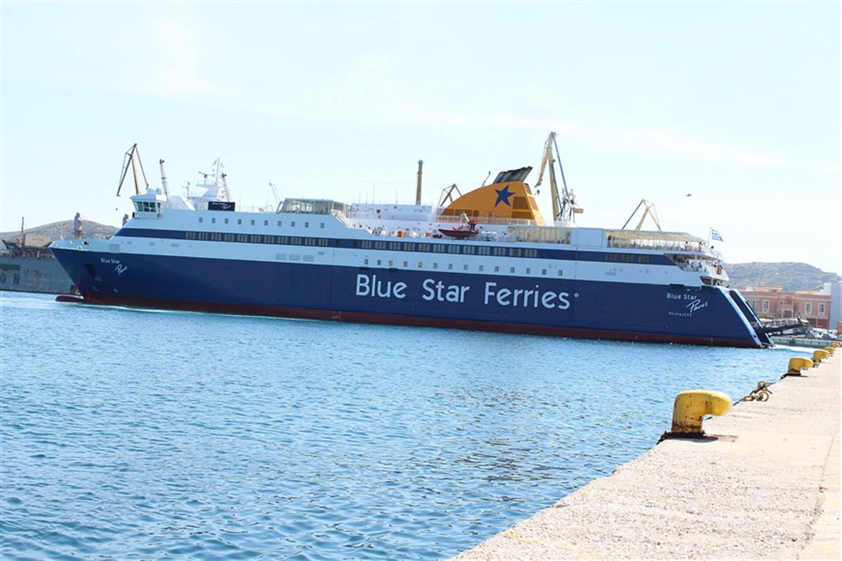
Greek ferries link the mainland ports with the Cyclades, the Dodecanese, the Saronic islands and the North Aegean, from the hub of Piraeus, on conventional ferries, hydrofoils and catamarans. The post is one of the Greece Tours on Greece Ville, listed with the other Greek island tours and Greece boat tours.
This post covers what Greek ferries are, the history of coastal shipping, the ship types, high-speed craft, Piraeus, the other ports and the map of routes to the island groups. Common questions come last.
What are Greek ferries?
Greek ferries are the passenger and vehicle ships that link the Greek mainland and the islands across the Aegean and Ionian seas. A ferry carries passengers, and sometimes vehicles and cargo, over water, and ferry transport remains the prominent link between the islands.
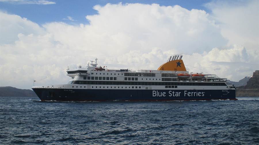
A ferry is a boat or ship that carries passengers across a body of water, and sometimes vehicles and cargo too. Greek ferries follow that definition on routes between mainland ports, island harbours and Italy.
Direct transit between two points is what a ferry offers, with a capital cost well below that of bridges or tunnels. That low cost helps explain why Greek ferries serve as the sea road across the islands.
Shipping counts as arguably the oldest occupation of the Greeks, and a key element of Greek economic activity since ancient times. Modern Greek ferries carry that maritime tradition into the present day.
Upgrades to roads, rail, urban transport and airports have changed travel in Greece over the past two decades. Even so, ferry transport remains the prominent method of moving between the islands of the nation.
- Definition: A ferry is a boat or ship that transports passengers across a body of water.
- Cost: A ferry link needs much less capital than bridges or tunnels do.
- Tradition: Greece is a maritime nation by tradition, and shipping is arguably its oldest occupation.
- Role: Ferries stay the prominent link between the islands, beside the new roads, rail and airports.
The sections below follow Greek ferries through history, ship types, ports and island groups. Each section keeps to geography and background, and none lists a timetable or a fare.
How did Greek coastal shipping and Greek ferries grow from the steamship era?
Greek ferries grew out of the steamship era of the nineteenth century, when Syros changed from a quiet island into a vigorous centre of crafts, industry and production. Patras then rivalled Syros as a port, while iron steamers showed engines moving passengers.
Engine power on water has an old pedigree. Horses turning a capstan or a treadmill drove paddlewheel boats, and that design came before the steam engine. Greek ferries descend from that line of boats.
The iron steamship Suhulet, built for the Bosphorus, weighed 157 tons and reached 6 knots. A steam engine turned its side wheel, and its symmetrical entry and exit let horse carriages drive aboard and ashore.
Syros held an important place as a maritime way-point because of its crucial geographical position. The Syros day trip post covers the town, the port and the island that grew from that role.
Patras developed quickly into the second-largest urban centre of Greece in the late nineteenth century. The city gained from its role as the main export port for the farm produce of the Peloponnese.
- Team boats: Horses turning a capstan or a treadmill were a precursor to steam for driving paddlewheel boats.
- Suhulet: The iron steamship weighed 157 tons and ran at up to 6 knots on its side wheel.
- Syros: The island became a maritime way-point and, almost overnight, a vigorous centre of industry.
- Patras: The port exported the farm produce of the Peloponnese and rose as the second-largest urban centre.
Companies owned in Greece now operate passenger ferries on Aegean and Adriatic routes, so the steamship story continues in the ship types and ports of the sections below.
Which ship types sail as Greek ferries (conventional ferries and roll-on roll-off ships)?
Greek ferries sail as conventional passenger ferries and as roll-on roll-off ships, the ro-ro design that moves freight in great quantities with minimal labour. Both types cross a body of water, and larger ships carry vehicles beside passengers.
The word ferry covers a wide range of craft. A small passenger ferry with multiple stops, like those of Venice, is sometimes called a water taxi or water bus. Greek ferries include such boats.
The ro-ro design moves freight in great quantities with minimal labour. It turned the ro-ro ferry from an experimental and marginal ship type into one of central importance for goods and passengers.
Lines from Greece to Italy cross the Adriatic Sea. Their routes join the Italian ports of Ancona and Bari with Igoumenitsa and Patras, and Bari with Corfu. Another line runs mainly from Piraeus to Crete.
The Corinth Canal crosses the Isthmus of Corinth and links the Gulf of Corinth with the Saronic Gulf. It shortens the sea voyage from the Adriatic to Piraeus by 325 km.
- Passenger ferry: The smallest passenger ferries make multiple stops and carry the names water taxi or water bus.
- Ro-ro ship: Vehicles and freight move with minimal labour, which made the design central to goods transport.
- Adriatic line: Routes join Ancona and Bari with Igoumenitsa and Patras, and Bari with Corfu.
- Crete line: One Greek operator runs passenger ferries mainly on the Piraeus to Crete route.
Greek ferries therefore divide into passenger ferries and ro-ro ships by design, and into Aegean and Adriatic services by route. Faster craft form a separate class, described in the next section.
How do hydrofoils, catamarans and other high-speed craft work among the Greek ferries?
Greek ferries include high-speed craft such as hydrofoils and catamarans, which serve the Saronic islands from Piraeus. A hydrofoil lifts its hull out of the water as it gains speed, which cuts drag, while a catamaran rides on two parallel hulls.
A hydrofoil is a lifting surface that works in water, much like the aerofoil of an aeroplane. As a craft gains speed, the foils lift the hull out of the water and the drag falls.
Wider use of hydrofoils is held back by the cost of building and maintaining them. Above a certain size they cost far more than conventional craft, so they stay small and serve as high-speed passenger ferries.
Early hydrofoils used V-shaped foils that pierce the surface. Fully submerged inverted T-shaped foils are more stable at sea, and sensors and a computer adjust the angle of attack.
High-speed hydrofoils and catamarans from Piraeus serve Hydra, stopping first at Poros before going on to Spetses. The Hydra Poros Aegina cruise post covers a sea trip among those islands.
- Lift: The foils raise the hull clear of the water, so wave resistance and drag on the hull disappear.
- First patent: The first evidence of a hydrofoil on a vessel is a British patent granted to Emmanuel Denis Farcot in 1869.
- First service: The first commercial hydrofoil, the PT10, launched in 1952 on Lake Maggiore and carried 32 passengers.
- Speed limit: Cavitation disturbs the lift of the foils above a speed of 60 knots.
Greek ferries thus mix slow ships that carry vehicles with fast craft that lift or skim over the water. The ports in the next sections handle both kinds.
How does the port of Piraeus serve the Greek ferries?
Greek ferries reach almost every island of eastern Greece from the central port of Piraeus, which serves routes to Crete, the Cyclades, the Dodecanese and much of the northern and eastern Aegean Sea. The western part of the port handles cargo services.
Piraeus counted 8.1 million passengers by 2015. That figure made it the sixth-largest port in the EU in terms of passenger transportation, and the passenger trade sits at the centre of the port.
Piraeus lies in the south-west of the central plain of Attica. Mount Aigaleo bounds it to the north-west, and the Saronic Gulf bounds it to the south and west, where the Greek ferries sail.
Piraeus station covers two railway stations, one for the Metro and one for the Suburban Railway, and both stand next to the seaport. Buses, trolleybuses and the Athens Tram also serve the city.
The Piraeus shore excursion post covers a visit built around the port and the coast of Athens, for readers who start from the harbour and want a plan for the day ashore.
- Passengers: The port reached 8.1 million passengers by 2015 and ranked sixth in the EU for passenger transport.
- Routes: Ferry routes run to Crete, the Cyclades, the Dodecanese and the northern and eastern Aegean Sea.
- Cargo: The western part of the port serves cargo, apart from the central passenger port.
- Stations: The Metro and Suburban Railway stations of Piraeus stand next to the seaport.
Piraeus is therefore both a gateway to the islands and a junction of Athens transport. The Greek ferries of the eastern Aegean and Crete begin in that one port.
Which other ports of Attica, the Peloponnese and the mainland handle Greek ferries?
Greek ferries also use ports in Attica, the Peloponnese and the mainland, among them Rafina, Lavrio, Patras, Igoumenitsa, Volos and Kavala. Each port sits on a different coast, so the sea routes start from separate places around the country.
The national transport survey lists three ports and harbours for Attica: Piraeus, Rafina and Lavrio. Lavrio stands on a bay that overlooks Makronisos, the ancient Helena, in the south-east of the region.
Dubbed the Gate to the West, Patras is a commercial hub of the northern Peloponnese. In 419 BC the town was joined to its harbour by long walls, on the advice of Alcibiades.
Igoumenitsa lies at the end of the Gulf of Igoumenitsa in the Ionian Sea. The A2 motorway ends there, so the port starts tourists from Europe and ends trucks from Turkey.
Among Greek port cities, Volos is the newest, with modern buildings raised after the earthquakes of 1955. It links to Lemnos, Lesbos, Chios and Skyros. Kavala is a historic northern port.
- Attica: Piraeus, Rafina and Lavrio appear together in the list of ports and harbours of the region.
- Patras: The city is dubbed the Gate to the West of Greece and is a commercial hub.
- Igoumenitsa: The port stands in the Ionian Sea and is the western end of the great northern motorway.
- Volos: The port links to Lemnos, Lesbos, Chios and Skyros in the Aegean Sea.
These ports show how Greek ferries serve the west, the east and the north from separate coasts, each beside a road or a city of its own.
How do the Greek ferries link the Cyclades, the Dodecanese, the Saronic islands and the North Aegean as a map of routes?
Greek ferries link the Cyclades, the Dodecanese, the Saronic islands and the North Aegean as a map of routes that fans out from Piraeus and the northern ports. Each island group sits in a different part of the Aegean Sea.
The Cyclades form an island group in the Aegean Sea, lying south-east of mainland Greece. Naxos is the largest island of the group, and Syros has the largest population. Ermoupoli on Syros is the chief town.
The Cyclades also hold minor islands, known as the Lesser Cyclades, among them Donousa, Irakleia, Koufonisia and Schoinousa. Small ferry stops therefore reach beyond the major islands of the chain.
The Saronic Islands take their name from the Saronic Gulf, just off the mainland coast. Hydra and Dokos lie off the north-east tip of the Peloponnese, and mainland Greeks keep holiday homes on the group.
Tradition holds that farmers and herders reached Hydra by sea from the mainland port of Ermioni. The Ermioni boat trip post covers that port town and the islands that face it.
- Cyclades: The archipelago lies south-east of the mainland, with Naxos as its largest island.
- Dodecanese: Piraeus sends ferry routes to the group in the south-east of the Aegean Sea.
- Saronic islands: The group takes its name from the Saronic Gulf and includes Hydra and Dokos.
- North Aegean: The region covers the islands of the north-eastern Aegean Sea and dates from the 1987 reform.
The North Aegean region before the reform of 2010 consisted of the prefectures of Samos, Chios and Lesbos. Greek ferries still tie those islands to the mainland ports.
What do travellers ask about Greek ferries?
Greek ferries raise questions about ship types, ports and island groups. The answers below stay with geography and history, so they name no timetable, journey time or fare, and they point back to the sections above for the ships and ports.
What kinds of ships sail as Greek ferries?
Greek ferries sail as conventional passenger ferries, as ro-ro ships that move freight with minimal labour, and as high-speed hydrofoils and catamarans. Larger ships carry vehicles and cargo beside the passengers, while the smallest craft serve short stops between nearby harbours and islands.
Why do hydrofoils work among Greek ferries?
A hydrofoil lifts its hull out of the water as it gains speed, which decreases drag. Hydrofoils cost more to build and maintain than conventional craft, so they stay small and serve as high-speed passenger ferries on island routes.
Which ports handle Greek ferries on the mainland?
Piraeus is the central port, with routes to Crete and the island groups. Rafina and Lavrio serve Attica, Patras serves the Peloponnese, and Igoumenitsa, Volos and Kavala serve the west and the north, each with its own sea links and its own neighbouring road or city.
Which island groups do Greek ferries connect?
Greek ferries connect the Cyclades, the Dodecanese, the Saronic islands and the North Aegean with the mainland. The Cyclades lie south-east of the mainland, the Saronic islands lie just off its coast, and the North Aegean covers the north-eastern Aegean Sea, with Samos, Chios and Lesbos among its islands.
Featured photo: Zacharias Mitzelos, CC0, via Wikimedia Commons.