
Central Greece tours run through the mainland north and west of Athens, from Delphi and Arachova to Galaxidi, Nafpaktos, Thermopylae, Evia, Lake Plastira, Mount Pelion and the rock monasteries of Meteora. The page is part of the Greece Tours on Greece Ville.
This page covers what Central Greece tours are, Delphi, Arachova and the Gulf of Corinth coast, Thermopylae and Evia, Karpenisi, Lake Plastira, Meteora, Mount Pelion and Mount Oeta. Common questions come last. Each section links to the Greece Ville posts on single tours.
What are Central Greece tours?
Central Greece tours cover Sterea Ellada, the mainland region that Greeks also call Roumeli, together with Thessaly to the north. The region holds more people than any other traditional region of Greece, and it reaches from the Aegean to the Ionian Sea.
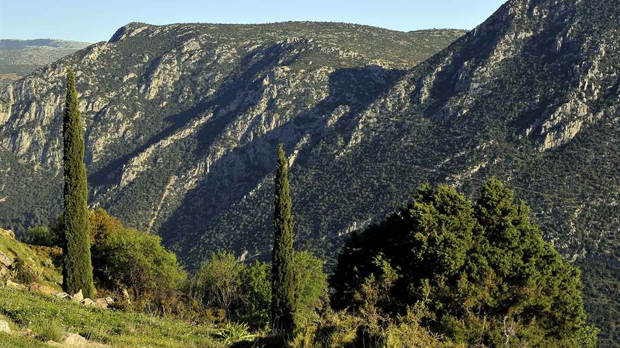
The traditional region has a population of 4,591,568 people and covers 24,818.3 km2. That makes it the second-largest region of the country in area, after Greek Macedonia. Athens, the capital, counts as its largest city.
The name Roumeli comes from a Turkish word meaning land of the Romans. The official Greek name, Sterea Ellada, means mainland Greece and contrasts the region with the Peloponnese across the Corinthian Gulf.
Since 1987 the old territory has been split among Attica, Aetolia-Acarnania in Western Greece and the administrative region of Central Greece. Central Greece tours centre on the last, which holds Phthiotis, Boeotia, Phocis, Evrytania and Euboea.
Thessaly borders Epirus to the west and Macedonia to the north, and its capital is Larissa. Before the Greek Dark Ages it was known as Aeolia, a name that appears in Homer’s Odyssey.
- Borders: The Aegean Sea lies to the east, the Ionian Sea to the west and the Corinthian Gulf to the south.
- Climate: Coasts are temperate and the interior is dry.
- Chalkida: The census of 2001 counted 53,584 people in the town.
- Amfissa: The same census counted 7,761 people in the town of Phocis.
Central Greece tours therefore join two traditional regions, the mainland south of the mountains and the Thessaly plain. The sections below take the main stops in turn, from Delphi to Karpenisi.
What do Central Greece tours show at Delphi?
Central Greece tours reach Delphi, the sanctuary of Apollo on the southwestern slope of Mount Parnassus, where the Pythia once gave oracles. The site lies inside Parnassos National Park, and UNESCO lists it as a World Heritage Site.
The Delphi day trip from Athens post covers the sanctuary, its treasuries and its museum. The rest of this section follows the working of the oracle and the Pythian Games.
Visitors consulted the Pythia on only one day of the month. On the seventh day she was led out with her face veiled in purple, then bathed in the Castalian Spring and drank from the Cassotis.
Up to three women served as the Pythia in the busiest period. Two took turns and the third waited in reserve. The Pythian priestess became pre-eminent by the end of the seventh century BC. The Delphi tickets post covers the sanctuary, the theatre, the stadium and the museum.
Central Greece tours meet the Pythian Games, which ran every four years, two years after the Olympics, and ranked second in importance. Nine Delphian envoys announced each festival to the Greek cities six months ahead.
- Stadium: Up to 20 athletes ran together on the track, until the lanes were cut to 17.
- Dating: One dating places the stadium in the mid-third century BC, after the victory over the Galatians.
- Maxims: A further 147 sayings, recorded by Stobaeus, stood near the temple.
- Poems: Pindar wrote 45 poems for Panhellenic winners, and 12 honour Pythian winners.
Central Greece tours then continue east along the same national road, which links Amfissa, Delphi and Livadeia. The next stop on that road is Arachova, a mountain town above the Pleistos valley.
How do Central Greece tours treat Arachova and Mount Parnassus?
Central Greece tours use Arachova as a base for Mount Parnassus, and the town also marks the site of a Greek victory of November 1826. Karaiskakis blockaded an Ottoman force of 2,000 men there, and only 300 of them escaped.
The Arachova day trip post covers the town, the Corycian Cave, the ski centre and Hosios Loukas, a monastery near the town. This section adds the battle of 1826 and the history of the mountain.
Mustafa Bey marched from Livadeia towards Amfissa to relieve its garrison. Karaiskakis learned of the march and readied a force of 500 men at the church of Agios Georgios and the houses of Arachova.
An 800-man force under Abdullah Agha tried to relieve the trapped army, but an ambush at a narrow pass stopped it. Mustafa Bey was mortally wounded on 22 November, and a snowstorm followed.
The Ottomans broke out on 24 November. Only 300 of the 2,000 men escaped, and the Greeks lost 12 killed and 20 injured. Central Greece tours note that the victory bought time before the Great Powers helped.
- Park: The national park of Parnassus covers about 150 km2.
- Birds: The park became a protected area for birds under the Birds Directive.
- Garrison: Amfissa held an Ottoman garrison, and the battle was fought to relieve it.
- Spoils: The Greeks took 23 flags and large amounts of weaponry and ammunition.
Central Greece tours then turn from the mountain to the sea. The next stop lies on the northern shore of the Gulf of Corinth, where Galaxidi sits on a double harbour.
What do Central Greece tours see at Galaxidi and on the Gulf of Corinth coast?
Central Greece tours follow the Gulf of Corinth coast from Galaxidi towards Nafpaktos, a shore where a tectonic rift, deep water and seismic activity made bridge building hard. Galaxidi sits at the eastern end of that stretch, on a double harbour.
The Galaxidi day trip post covers the harbours, the museums, the ships and the plain around Itea. This section turns to the bay of Antikyra and the Rio-Antirrio Bridge.
Antikyra lies on a bay of the same name on the north coast of the gulf. It took its name from its position opposite Cirrha, the port of Delphi, on the far side of a peninsula.
Central Greece tours pass the bay on the coast road. Black and white hellebore grew there and was the main product of the port, and the municipal unit held 1,346 people in 2015.
Jacks and dampers join the deck of the Rio-Antirrio Bridge to its pylons and absorb movement. A rigid link risks failure in an earthquake. The bridge is among the longest of the fully suspended type.
- Monitoring: A system of more than 100 sensors watches the bridge at all hours.
- Sensors: Accelerometers on the deck, pylons, cables and ground record wind and tremors.
- Bays: The gulf also holds the Alkyonides Gulf, the Crissaean Gulf, the Bay of Antikyra and Dombraina.
- Anchorage: Only small boats anchor at the village beach, and a deep-water harbour lies on the Kephali Peninsula.
Central Greece tours reach Nafpaktos next, on the same coast and west of Galaxidi. The town stands inside the entrance to the gulf, near the Rio-Antirrio Bridge.
Why do Central Greece tours stop at Nafpaktos?
Central Greece tours stop at Nafpaktos, a port town on the Gulf of Corinth that Venice held in the fifteenth century. The harbour and castle stand near the waters where the Holy League fleet defeated the Ottoman navy in 1571.
The Nafpaktos tour post covers the harbour, the castle, the Battle of Lepanto and ancient Naupactus. This section adds the arms and tactics of the battle of 1571.
By one estimate the Christian fleet carried 1,815 guns against 750 on the Ottoman side. The Christians relied on arquebusiers and musketeers, while the Ottomans trusted composite bowmen.
Shortly before contact the wind shifted to favour the Christians. Central Greece tours note the four galleasses at the front, which opened fire at close quarters and confused the Ottoman galleys.
On the Christian right, Doria sailed south and left a wide gap with the centre. His captains read the move as treachery, and Uluc Ali swung round to attack Colonna’s southern squadron.
- Plan: Garcia de Toledo advised John of Austria to copy the battle plan that the Ottomans used at Preveza.
- Scouts: An exploration party warned that 150 Ottoman ships were plundering the coast of Corfu.
- Rowers: Oarsmen were mainly drawn from local Greek populations, particularly from Kefalonia.
- Chains: Before the clash the galley slaves were freed from their chains.
Central Greece tours treat Nafpaktos as the western end of the gulf coast. The next stop lies north-east, at the narrow pass of Thermopylae.
What do Central Greece tours show at Thermopylae?
Central Greece tours stop at Thermopylae, the narrow pass between the mountains and the Malian Gulf where Leonidas made his last stand in 480 BC. Hot sulphur springs gave the pass its name, which means the hot gates.
The Thermopylae tour post covers the pass, the Amphictyony, the Greek cities and the Persian army. This section adds Leonidas himself and two later battles at the pass.
Leonidas was the seventeenth king of the Agiad dynasty, a Spartan house that claimed descent from Heracles. He came to the throne around 489 BC, after his half-brother Cleomenes.
In 191 BC a later battle at the pass pitted the Roman consul Glabrio against Antiochus III. A small force under Cato outflanked the defenders through the fort of Callidromus, and they broke ranks.
A Gaulish army under Brennus later tried to force the pass. The Malian Gulf was so shallow that the Greek fleet struggled to get close enough to bombard the Gauls.
- Terrain: Torrential rain falls for four months of the year, and the summer heat cracks the ground.
- Scrub: Vegetation is scarce, low and thorny, with thick brush on the hillsides.
- Persians: Modern scholars estimate the Persian army at 120,000 to 300,000 soldiers.
- Track: Central Greece tours follow the old track at the foot of the hills, beside a modern road.
Central Greece tours also reach the hot springs, which still flow close to the foot of the hill. In Greek myth the waters turned hot when Heracles tried to wash off the Hydra’s poison.
How do Central Greece tours cross to Evia?
Central Greece tours cross to Evia, the second-largest Greek island, by one of two bridges at Chalkida. The first bridge over the Euripus Strait, which separates the island from Boeotia, dates to 410 BC, in the twenty-first year of the Peloponnesian War.
The Evia tour post covers Chalkida, the Euripus Strait, Eretria, Karystos, Kymi and Mount Dirfys. This section adds the ancient wars, the bridges and the league of the island.
The Euripus Bridge, built in 1992, was the first cable-stayed road bridge in Greece. It is 395 metres long and its concrete deck is only 45 centimetres thick.
The older bridge in midtown began in 1858 as a retractable bridge, and a rotating bridge replaced it in 1896. The present bridge, originally wooden, dates from 1962 and was refurbished in 1998.
In the reign of Justinian I there were two channels in the Euripus, and a single plank of wood spanned the narrower cleft. Central Greece tours see the widened channel today.
- Settlers: In 506 BC Athens invaded Chalcis and settled 4,000 Attic Greeks on its lands.
- Revolt: Pericles led the Athenians against a revolt in 446 BC and took Histiaea in the north.
- Grave: In 1980 excavators at Lefkandi found a mound with two shaft graves, one holding four horses.
- League: The Euboean League united the island cities until Diocletian dissolved it in 297 AD.
Central Greece tours return to the mainland by the same bridges. From there the road runs west and north to the mountains of Evrytania, where Karpenisi is the main town.
What do Central Greece tours find at Karpenisi and in Evrytania?
Central Greece tours reach Karpenisi, the capital of Evrytania, a regional unit formed almost entirely of mountains. The Acheloos, which flows on to the Ionian Sea, runs along its western edge, and the remote Agrafa region spans Evrytania and Karditsa.
The Karpenisi tour post covers the town, the Velouchi ski area, the villages of Megalo and Mikro Chorio and the monastery of Proussos. This section looks at the river and the Agrafa.
On leaving the Kremasta reservoir the Acheloos flows southwest into Aetolia-Acarnania. It feeds the Kastraki reservoir and then the Stratos reservoir, and it empties into the Ionian Sea west of Missolonghi.
Herodotus compared the Acheloos to the Nile for its power to reshape the shoreline. He wrote that it had already turned half the Echinades islands into mainland. Five dams now stand on the river.
Central Greece tours cross a region where the central valley of the Agrafiotis River is ringed on three sides by a steep wall of mountains 2,000 metres high.
- Forests: The villagers bought forest land from the monasteries, and timber sales still benefit the whole community.
- Work: Before modernisation, people in Agrafa harvested nuts and fruit, farmed, kept sheep and made textiles.
- Dams: The Kremasta dam dates from 1965, Kastraki from 1969 and Stratos from 1989.
- Viniani: Twelve British saboteurs met 150 ELAS men and 60 to 65 EDES men there.
Central Greece tours also meet a myth of archery. In Greek myth King Eurytus of Oechalia promised his daughter Iole to whoever beat him in an archery contest, and Heracles won but was refused. The Greece in winter post covers snow, ski centres and mountain villages in the cold months.
Why do Central Greece tours include Lake Plastira?
Central Greece tours include Lake Plastira because the reservoir shows how a flood-prone river valley in the Agrafa hills became a mountain lake, a power source and a water supply for the Karditsa plain, with a concrete arch dam at its centre.
The hills around the lake belong to the Agrafa, a mountainous region of small villages in Evrytania and Karditsa. The region kept a form of self-governance, with its own militias and dispute arbitration systems.
The Agrafa served as a refuge for Greeks fleeing Ottoman rule. It was also a centre of Greek literacy and culture, and in the 19th century it played a prominent role in the War of Independence.
Before modernisation, people of the Agrafa worked orchards for nuts and fruit, farmed, kept sheep and made textiles. Timber sales from forests bought from the monasteries still benefit the whole community.
Colonel Nikolaos Plastiras drove that modernisation. His vision of a hydroelectric dam aimed to supply electricity to nearly all of mainland Greece except the Peloponnese, and Central Greece tours reach the lake it created.
The project also irrigated the Thessaly plains and raised the yields of cash crops such as cotton. Plastiras also championed the extension of voting rights to women in politics.
- Crops: The produce is mainly cold weather crops or crops that survive in poor soil.
- Migration: People began leaving in the 1920s, and the flow nearly stopped after the junta fell.
- Tourism: The lake has met increasing tourist development.
- Power: The Power Corporation adopted the dam as part of its effort to electrify the country.
The Lake Plastira post covers the reservoir, its dam and the shore villages. Central Greece tours use that post for the lake itself.
What do Central Greece tours see at Meteora?
Central Greece tours reach Meteora, a cluster of sandstone and conglomerate pillars in the Pineios Valley near Kalambaka, where monks built twenty-four monasteries between the fourteenth and fifteenth centuries and six still stand as a World Heritage Site.
The Varlaam monastery takes its name from a monk who scaled the rock in 1350. After his death it stood abandoned for two hundred years, until two brothers hoisted materials to rebuild it.
Varlaam was reputed to house the finger of Saint John and the shoulder blade of Saint Andrew. A museum there holds a wide array of relics and ecclesiastical treasures.
The Great Meteoron thrived in the sixteenth century on imperial and royal donations. Its founder’s successor, Saint Joasaph, added cells and a hospital and renovated the churches of the monastery.
At Holy Trinity, supplies once rose in baskets drawn up by rope-ladders. Today Central Greece tours reach the monastery by tunnels and 130 stone steps, and a garden of 0.8 hectares fills the summit.
Saint Stephen became a nunnery in 1961 and sits at the top of a precipice below the Kukulas peak. Together with Holy Trinity it stands apart from the main group of monasteries to the north.
- Rousanou: The name is thought to derive from the earliest monks on the rock, who arrived from Russia.
- Anapausas: Saint Nicholas Anapausas occupies a narrow rock of about eighty metres in height.
- Vegetation: Plants grow thickly from the rock walls, fed by water in the cracks.
- Architecture: Much of the architecture of the monasteries is Athonite in origin.
The Meteora day trip from Athens post covers the journey and the monasteries, and the monastery dress code post covers what the visits ask of clothing. Central Greece tours join both. The Meteora tours page covers the rock pillars and the monasteries of Meteora.
How do Central Greece tours join Delphi and Meteora on one route?
Central Greece tours join Delphi and Meteora on one route because the two sites sit at either end of the region, one on a slope of Mount Parnassus and the other in the Pineios Valley, and each holds UNESCO World Heritage status.
Thessaly lies to the north of Central Greece and was once called Aeolia in Homer’s Odyssey. Since 1987 it has formed one of thirteen regions, and Central Greece tours cross it to reach Meteora.
Homer places the Hellenes, then a small tribe, in Thessalian Phthia, where they served with the Myrmidons under Achilles. The Parian Chronicle names Phthia as the homeland of the Hellenes.
Delphi lies on the southwestern slope of Mount Parnassus. The modern town beside it was created after buildings were removed from the sacred precinct to allow excavation of the ancient site.
Thessaly borders Macedonia to the north, Epirus to the west, Central Greece to the south and the Aegean Sea to the east. It is divided into five regional units and 25 municipalities.
Legend says the Amphictyonic League was founded after the Trojan War to protect the temples of Apollo at Delphi and of Demeter near Thermopylae. The league was an association of Greek tribes with twelve founders.
- Name: Thessaly is named after the Thessaloi, an ancient Greek tribe.
- Capital: Larissa is the capital of the Thessaly region.
- Islands: The Thessaly region also includes the Sporades islands.
- Delphi: The Delphi precinct stands in Phocis.
The Delphi Meteora tour post covers the two sites as one trip, and the classical tour of Greece post sets them inside a longer circuit.
Why do Central Greece tours cross Mount Pelion?
Central Greece tours cross Mount Pelion because the forested peninsula between the Pagasetic Gulf and the Aegean Sea joins Greek myth, fruit orchards and a narrow gauge railway, and the Centaurs of legend were said to live in the mountains of Magnesia.
Beech, oak, maple and chestnut trees cover the slopes, with olive, apple and pear trees and plane tree groves near water. Water reaches the villages and their orchards through streams that run in carved-stone beds.
The line was run by the private Thessaly Railways company until 1955 and then by the Hellenic State Railways. In 1971 the national railway organisation suspended the service as a cost-saving measure.
The Friends of Pelion Railway ran Volos to Agria as a heritage line from 1987 to 1994. Central Greece tours use the stretch from Ano Lechonia to Milies, which the state railway reopened in 1996.
Diesel traction replaced steam in 1999. The stations at Ano Lechonia and Agria, damaged by earthquakes, were restored to their original designs, and a larger turntable at Milies took the diesel locomotives.
The municipality of South Pelion has its seat in Argalasti and covers the south of the mountain. It was formed in 2011 from five former municipalities: Afetes, Argalasti, Milies, Sipiada and Trikeri.
- Sheds: Engine sheds were built at Volos, Agria and Milies.
- Towers: Water towers were built at Agria, Ano Lechonia and Milies.
- Opening: King George I inaugurated the Volos to Larissa line of Thessaly Railways on 22 April 1884.
- Network: Thessaly Railways ran the metre gauge network and the Pelion railway from 1884 to 1955.
The Pelion tour post covers the villages, the coast and the little train in full. Central Greece tours use that post for the mountain itself. The Volos tour post covers the Pagasetic Gulf, Iolcos, the Argonauts, Dimini and Sesklo.
Where do Central Greece tours reach Elati and Pertouli?
Central Greece tours reach Elati and Pertouli in the south of the Pindos chain, where villages in the Trikala regional unit stand among forests, with a church, an arched bridge and a small ski centre along the road from Trikala.
Pyli is a municipality of the Trikala regional unit made up of seven municipal units. It had always been the main trade centre for the surrounding settlements of the area.
Alexander the Great is recorded as passing through Pyli to win the support of Thessaly, and King Philip V of Macedon visited later. A temple of Aphaia Athena also stood in the area.
Gardiki is a village of the Trikala regional unit within the Aithikes municipal unit. The 2021 census recorded 134 residents, and the community has two settlements, Gardiki and Palaiochori.
The Pertouli ski resort is relatively small and has suffered from unreliable snow in recent years because of its low altitude. It is known among snow sports fans in central Greece.
The Trikala regional unit forms the northwestern part of Thessaly, with the city of Trikala as its capital. Its towns include Kalampaka, Pyli and Farkadona, and Central Greece tours add the mountain villages.
- Farming: The unit produces fruit and vegetables, cotton, olives and cattle.
- Roads: The A3 motorway, the EO6 and the EO30 pass through the unit.
- Bishops: Manuscript lists name later bishops of Gardiki, among them Sophronius in the seventeenth century and Meletius in 1743.
- Church: A ruined three-aisled basilica of Saint Paraskevi from the fourteenth century survives at Gardiki.
The Elati Pertouli post covers the villages, the forests and the monasteries of the area. Central Greece tours use that post for the Trikala mountains.
What do Central Greece tours find on Mount Oeta and the Lamia plain?
Central Greece tours find Mount Oeta, a national park with fir forests and flowers above the Spercheios valley, and Lamia, a city on the slopes of Mount Othrys and the capital of both Phthiotis and the Central Greece region.
Mount Oeta rises to 2,152 metres at Pyrgos, and the second summit, Greveno, stands at 2,117 metres. A southeastern offshoot of the Pindus range, its core became a national park in 1966.
The mountain holds 1,149 identified plant species and two endemic species. Meadows cover slightly over a tenth of it, with lilies, croci, orchids and irises, so it is known as the mountain of flowers.
The Balkan chamois lives on the mountain and is the symbol of the national park. Brown bears, wolves and wildcats are its big predators, and golden eagles number among its birds of prey.
In Greek myth, Heracles died on Mount Oeta, where he built a funeral pyre and gave his bow and arrows to Philoctetes. The remains of a Doric temple of Heracles survive near Pavliani.
The Spercheios is 80 km long and drains a basin of 1,830 square kilometres. It crosses former wetlands reclaimed for farming and reaches the Malian Gulf 13 kilometres southeast of Lamia.
- Viaduct: Resistance forces and British saboteurs destroyed the Gorgopotamos viaduct on 25 November 1942.
- Waterfall: The Kremastos waterfall is considered the highest in Central Greece.
- Fortress: Sultan Bayezid I razed the fortress of Lamia in 1394.
- River god: Ancient Greeks worshipped the Spercheios as a god.
Lamia stands on the slopes of Mount Othrys and served as a border city until Thessaly joined Greece in 1881. Central Greece tours link it to Oeta.
What do travellers ask about Central Greece tours?
Central Greece tours cover the mountains and plains between Parnassus and Pelion, with Meteora, Lake Plastira, Elati Pertouli, Mount Oeta and the Lamia plain among the stops, and travellers ask mainly about the season, the roads and the monasteries.
What season suits Central Greece tours?
Lamia has a hot-summer Mediterranean climate, with a cold and wet period from late October to mid April and a warm, moderately dry period from mid April to late October. Central Greece tours in the mountains meet snow in winter, because Pertouli runs a ski resort.
How do travellers reach Lamia for Central Greece tours?
The A1 motorway bypasses Lamia to the south east, and the A3 motorway branches off the A1 near Anthili. Lamta station serves regional trains to Leianokladi and Stylida, and an intercity bus station serves routes to and from the city. Central Greece tours use these links.
Are the monasteries on Central Greece tours still active?
Meteora held twenty-four monasteries, and six survive. Four of them are occupied, managed by monks and open to visitors, while Rousanou and Saint Nicholas Anapausas are no longer in active use. Saint Stephen became a convent in 1961. Central Greece tours reach the four that stay active.
Why do myths shape Central Greece tours?
In Greek myth, Heracles died on Mount Oeta and the Centaur Chiron lived on Mount Pelion. Phthiotis takes its name from Phthia, the Homeric home of Achilles. Tradition holds these places in Thessaly and Phthiotis, so Central Greece tours meet legend at each of them.