
Crete tours are trips across the largest Greek island, from the Minoan palaces and the old towns of the north coast to the gorges, lagoons and islets of the south and west. The page is part of the Greece Tours on Greece Ville.
This page covers what Crete tours are, the ancient sites and the areas around Heraklion, Chania and Rethymno. Lasithi and the south coast, the gorge hikes, the lagoons and islets, sea tours, food, wine, active tours and common questions follow. Each section links to the Greece Ville posts on single tours.
What are Crete tours and what does the island cover?
Crete tours are organised visits to the largest island in Greece, which covers 8,450 square kilometres, stretches 260 kilometres from west to east and forms a region of 624,408 residents, counted in 2021, with Heraklion as its capital.
The island ranks fifth in size among the islands of the Mediterranean Sea, behind Sicily, Sardinia, Cyprus and Corsica. Its coastline runs for 1,046 kilometres, so Crete tours follow a long shoreline.
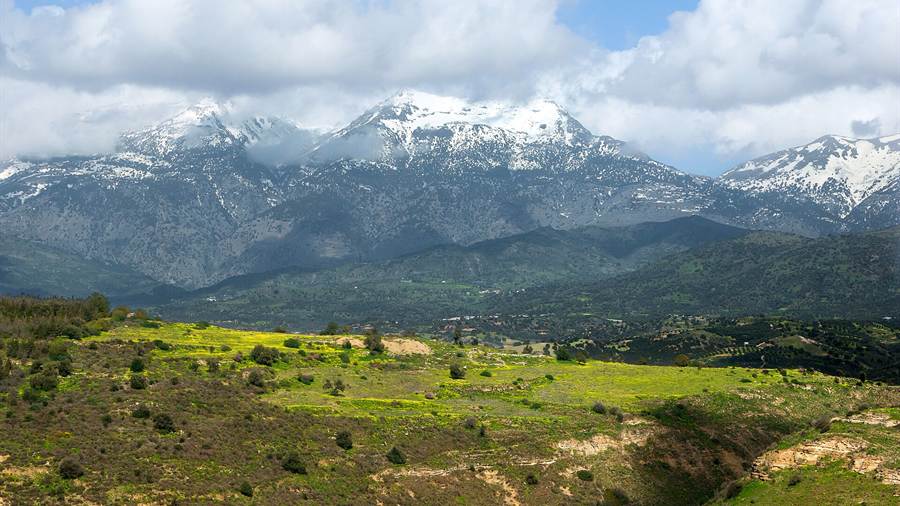
A mountain range crosses the island from west to east. Mount Ida, the highest point, lies in a natural park that belongs to the UNESCO Global Geoparks Network, and that high ground sets the scene for inland Crete tours.
The Region of Crete is the southernmost of the 13 top-level administrative units of Greece. It takes in the island and its surrounding islets and holds four regional units.
Chania covers the westernmost quarter of the island and borders only Rethymno, which lies to the east. Heraklion stands on the north shore as the capital.
- Size: Crete is the largest island of Greece, and no other Greek island has a larger population.
- Position: The island lies 100 kilometres south of the Peloponnese and 300 kilometres south-west of Anatolia.
- Past: The Minoans, Europe’s first advanced civilisation, lived on the island from 2700 to 1420 BCE.
- Rulers: Rome, the Byzantine Empire, Andalusian Arabs, Venice and the Ottoman Empire held the island in turn.
Together these facts explain why Crete tours are grouped by area and by period. The sections below begin with the ancient sites and then move through Heraklion, Chania and Rethymno.


Which ancient sites do Crete tours visit?
Crete tours visit the Minoan palaces, such as Knossos, Phaistos, Malia and Zakros, and later cities such as Gortyn, which together cover the Bronze Age culture of the island and the Greek and Roman rule that followed it.
Archaeologists doubt that the palaces were royal residences. They held shrines, workshops and storage magazines, and tablets in Linear A and Linear B point to administration, so Crete tours cover working centres.
The Knossos tickets post covers entry to the palace site. The Heraklion Archaeological Museum tickets post covers the museum in the city. The museum moved into a dedicated building built from 1904 to 1912, at the instigation of the archaeologists Iosif Hatzidakis and Stefanos Xanthoudidis.
The Phaistos tour post covers the palace at Phaistos. Gortyn lies in the Messara valley, 45 kilometres from Heraklion, and was the Roman capital of Creta et Cyrenaica.
The Arkadi Monastery tour post covers the monastery near Rethymno. In November 1866 a large Ottoman force besieged it, where 259 defenders and more than 700 women and children had taken refuge.
- Hellenistic: Gortyn was the strongest and wealthiest city of Crete in the Hellenistic era.
- Cathedral: The cathedral of St Titus, the first bishop of Crete, was built at Gortyn in the sixth century AD.
- Alignment: The palace at Phaistos is aligned with Mount Ida, and the palace at Knossos with Mount Juktas.
- Term: Arthur Evans introduced the word palace, after reading Knossos as the home of a Priest-King.
These ancient sites give Crete tours a thread that runs from the Bronze Age through Hellenistic and Roman times to the early Christian church.
What do Crete tours around Heraklion cover?
Crete tours around Heraklion cover the fourth largest city in Greece and the largest in the Greek islands, with a municipal population of 179,302 in 2021, where the Minoan palace of Knossos stands on the southern edge of the city.
The name comes from Heracleium, an ancient port that served as the harbour for Knossos and was named for the hero Heracles. The site lies within the modern city, near today’s port area.
The greater area of Heraklion has been inhabited since at least 7000 BCE. In 824 CE, Arab exiles from al-Andalus moved the island’s capital there from Gortyna, so Crete tours around Heraklion start in a very old settled area.
The Heraklion tour post covers the city and its sights. Venice rebuilt the walls and bastions that stand around the historic centre.
The Heraklion boat trip post and the Heraklion sailing tour post cover the sea side of the city. The Agios Minas Cathedral was built between 1862 and 1895.
The Cretaquarium tickets post covers the aquarium. The Heraklion area drew 3.4 million visitors in 2018 and ranked 19th in Europe.
- Cathedral: St Titus Cathedral was built in 1869 as the Yeni Cami, or New Mosque.
- Church: The Dominican church of St Peter was built between 1248 and 1253.
- Museum: The Heraklion Archaeological Museum building went up between 1937 and 1940.
- Names: The Arabic name of the city became Chandax and was Latinised as Candia.
Heraklion therefore links Minoan, Arab, Venetian and Ottoman layers in one place, and Crete tours around Heraklion move between those layers within a single city.
What do Crete tours around Chania cover?
Crete tours around Chania cover the old Venetian walls and harbour, the museum collections and the western coast, in a regional unit whose towns include Kissamos, Georgioupolis and Kalives and whose coast ends in three headlands that reach into the sea.
The inner walls of Chania were first built in antiquity and rebuilt by the Byzantines. In 1336 Venice decided to wall the outer districts and completed the fortifications within 20 years.
The Chania walking tour post covers the old town and its walls. The Ottomans besieged the Venetian city in 1645 and took it after 56 days.
The Chania food tour post covers eating in the city, and the Chania wine tour post covers tasting in the region. The Archaeological Museum of Chania was founded in 1962 in a former Venetian monastery.
The Chania boat trip, Chania catamaran cruise and Chania sunset cruise posts cover the water side of Chania. Crete tours by sea pass three headlands known as the three heads of Crete.
The museum reopened in 2022 on Skra Street in Halepa. Its collection holds Minoan and Roman artefacts from Kydonia, Aptera, Polyrinia and Kissamos.
- Gramvousa: The Gramvousa peninsula has a peak of 725 metres.
- Rodopos: The Rodopos peninsula has a peak of 730 metres.
- Akrotiri: The Akrotiri headland has a peak of 505 metres.
- Rivers: Rivers from the White Mountains reach the north coast, including the Tavronitis, Keritis and Kladissos.
Chania therefore offers walls, museum rooms, a long coast and mountain rivers, and Crete tours around Chania can be built on any of them.
What do Crete tours around Rethymno cover?
Crete tours around Rethymno cover a city of more than 35,000 inhabitants whose old town the Venetians built almost entirely, together with the mountains of the regional unit and the freshwater lake near the border with Chania.
Rethymno began to grow when the Venetians set up a commercial station there between Heraklion and Chania. The old town is one of the best-preserved in Crete, with buildings from the 16th century.
The Rethymno tour post covers the city and its sights. Its monuments include the Neradje Mosque, the Great Gate, the Piazza Rimondi and the Loggia.
The Rethymno boat trip post covers the coast from the water. On land, the city holds the Archaeological Museum of Rethymno and the Historical and Folklore Museum of Rethymno.
The Lake Kournas tour post covers the lake near the regional border. The lake used to be called Koresia, after ancient Korion, a city thought to have had a temple to Athena.
The regional unit has five municipalities: Agios Vasileios, Amari, Anogeia, Mylopotamos and Rethymno. Crete tours in this unit therefore reach both the coast and the uplands.
- Municipality: The Rethymno municipality was formed in 2011 by merging four former municipalities.
- Peaks: Mount Kedros reaches 1,777 metres and Mount Kouloukonas 1,084 metres.
- Economy: Tourism is the main source of income in the city.
- Diocese: From about 1250 the city was the seat of the Latin Diocese of Retimo.
Rethymno sits between its two larger neighbours and keeps a Venetian core, so Crete tours around Rethymno combine old streets, a lake and the mountains behind them.
Which Crete tours cover Lasithi, the east and the south coast?
Crete tours in Lasithi, the east and the south coast cover the easternmost regional unit, whose capital is Agios Nikolaos, and the Libyan Sea shore beyond it. The routes join a plateau, a Venetian fortress, a south-coast stop and an island.
The Lasithi plateau stretches 11 km from east to west and 6 km from north to south, at an average altitude of 840 m. The Lasithi Plateau tour post covers the basin.
Venetian rulers dug drainage ditches between 1514 and 1560, and they still carry floodwater to a sinkhole at the plateau’s western edge. Crete tours here follow that old farming landscape.
Spinalonga covers 85,000 square metres, and around 750 m of water separates it from Plaka on the mainland. The Spinalonga tour post covers the island’s fortress and its leper colony.
The Selena range in the north reaches 1,556 metres, and the Thrypti range in the east reaches 1,476 metres. The Matala tour post covers a stop on the south coast.
Chrysi lies about 15 km south of Crete, near Ierapetra, and the island of Mikronisi lies about 700 metres to its east. The Chrissi Island boat trip post covers the crossing.
- Villages: Xerokambos, Koutsouras and Makrigialos are villages on the south coast.
- Sunshine: South Crete records more than 3,257 hours of sunshine a year.
- Palms: Vai is known for a forest of date palms.
- Waist: The island narrows to as little as 12 km close to Ierapetra.
Crete tours in this part of the island pair a mountain plateau with sea crossings, because the fortress island and Chrysi each sit on a different side of the region.
Which gorge hikes are among Crete tours?
Crete tours on foot through gorges descend from the White Mountains of Chania towards the Libyan Sea. The Samaria Gorge is a national park, the Imbros Gorge runs parallel to it, and the range holds more than 30 summits above 2,000 metres.
The Samaria Gorge has been a national park since 1962, set up as a refuge for the rare kri-kri. The Samaria Gorge tour post covers the walk from Omalos to the coast.
The gorge is 16 km long, starting at 1,250 m at the northern entrance and ending on the Libyan Sea shore at Agia Roumeli. At the Gates the walls close in to four metres.
The Imbros Gorge narrows to 1.60 m at its tightest point, and Imbros village stands at 780 m. The Imbros Gorge hike post covers the route to Hora Sfakion.
The Kallergi Refuge, built in 1970 at 1,650 m, stands 5 km from Omalos and takes 45 people. The Chania hiking tour post covers the trails of the wider range.
- Village: Samaria village, inside the gorge, was left by its last inhabitants in 1962.
- Plateaus: Askifou, Impros, Kallikratis, Anopolis and Omalos are plateaus at 500 to 1,100 metres.
- Desert: Above 1,800 m the central White Mountains form a high desert.
- Name: Lefka Ori means White Mountains, after the pale limestone peaks.
Crete tours through these gorges drop from high plateaus towards the Libyan Sea, so the Lefka Ori and the south coast belong in the same plan.
Which lagoon and island trips are among Crete tours?
Crete tours by lagoon and island reach the north-west and south-west corners of Crete, then the southernmost Greek island and the Cyclades. The Gramvousa islands and Elafonisi belong to Chania, while Gavdos and Santorini lie offshore.
Imeri Gramvousa and Agria Gramvousa are two small uninhabited islands off the Gramvousa Peninsula. The Venetian fort on Imeri Gramvousa was built between 1579 and 1584. The Balos Lagoon cruise post covers the lagoon route.
Elafonisi means Deer Island and lies close to the south-western corner of Crete. In fine weather it is possible to walk to the island through shallow water. The Elafonisi day trip post covers the visit.
Gavdos lies south of Crete, and its municipality covers 32.424 square kilometres with the islet Gavdopoula. Mount Vardia, at 345 m, is the highest point. The Gavdos boat trip post covers the crossing.
Santorini lies about 200 km south-east of the mainland, around a caldera left by an eruption about 3,600 years ago. The Santorini day trip from Crete post covers the sea crossing to the island.
Santorini is the southernmost member of the Cyclades and covers about 73 km2. The Santorini tours post covers routes on the island itself, beyond the Crete tours that sail to it.
- Names: Imeri means Tame and Agria means Wild in the island names.
- Memorial: On 18 April 1824 Ottoman soldiers killed hundreds of Greeks on Elafonisi.
- Heat: Gavdos reaches around 33 degrees Celsius in July and August.
- Census: Santorini had 15,480 residents at the 2021 census.
Crete tours by lagoon and island depend on the sea, so the Gramvousa islands, Elafonisi, Gavdos and Santorini each need their own plan.
How do Crete tours by sea follow the whole coast?
Crete tours by sea follow a coastline of 1,046 km, with the Sea of Crete to the north and the Libyan Sea to the south. Islands, islets and rocks hug that shore, so boat routes link beaches, reserves and dive sites.
Crete spans 260 km from east to west but is only 60 km across at its widest point. The Crete boat trip post covers the general sea routes.
The Sea of Crete forms the southern part of the Aegean Sea, while the Libyan Sea, also called the South Cretan Sea, borders the southern shore. The Crete catamaran cruise post covers catamaran sailings.
Thodorou, Dia and Agioi Pantes are islets off the north coast, and the kri-kri, the Cretan wild goat, can be seen on them. The Crete sunset cruise post covers evening sailings.
Not counting Crete, the other islands in the Libyan Sea are Gavdos, Gavdopoula, Koufonisi and Chrysi. Crete tours by sea therefore reach both the north and the south shore of the island.
The endangered Mediterranean monk seal lives along almost all coasts of Greece, and sea turtles and hammerhead sharks pass the shores of Crete. The Crete scuba diving post covers the dive sites.
- Abyss: The area south of Crete is known as the Greek Abyss.
- Dodecanese: The Dodecanese lie to the north-east of Crete.
- Distance: Crete lies about 100 km south of the Peloponnese.
- South coast: The shore along the Libyan Sea includes the Mesara Plain.
Crete tours by sea suit the long coastline, because each boat route covers a different stretch of shore. The posts above sort the options by vessel and by activity.
Which food, wine and active trips count as Crete tours?
Crete tours built around food, wine and action draw on a plant-based cuisine, an old wine tradition and a mountainous interior. Cooking, olive oil and wine suit the table, while jeep, quad and horse routes cover tracks and plateaus.
The core of Cretan cuisine consists of food from plants, and olive oil is the main source of fat, used in salads and in cooking. The Crete cooking class post covers the dishes.
Pulses, wild herbs and rough cereals formed the base of the diet until the 1960s, when meals shifted towards meat. The Crete olive oil tour post covers the groves.
Wine was made by the Minoans in the Bronze Age. In the second century Crete was known for a sweet wine, protropos, which was exported to Italy, and late medieval Europe valued vino di Candia.
The vines grow in limestone soils, from denser clay to sandy loam, with hot African winds and cooling Aegean breezes. The Crete wine tour post covers the island’s wine.
A small number of main roads lead into the White Mountains. The Crete jeep safari, Crete quad safari and Crete horse riding posts cover routes beyond them by wheel and on horseback.
- Dittany: Dittany of Crete grows wild only on the mountainsides and gorges of Crete.
- Dakos: Dakos is a salad listed among the appetizers of Cretan cuisine.
- Fish: Rofos me bamies is grouper cooked in the oven with okra.
- Drinks: Tsikoudia, rakomelo and Cretan wine are the drinks listed for the island.
Crete tours for food and wine suit a visit to the table, while the active routes suit the mountains and the coast.
What do travellers ask about Crete tours?
Crete tours raise the same questions about season, access, regions and format. The answers below draw on climate records and geography, and they point back to the sections above for detail on each route, each region and each island.
When are the best months for Crete tours?
Snow covers the mountains between November and April, so gorge and plateau routes suit the warmer months. Crete tours on the coast meet mild winters. On Gavdos, daily temperatures reach around 33 degrees Celsius in July and August, and the sea is at 26 degrees or more in summer.
How do travellers reach the start of Crete tours?
Crete lies about 100 km south of the Peloponnese and about 300 km south-west of Anatolia, so travellers cross water or fly. In 2023 the island welcomed 6.3 million visitors. A north-coast highway, the A90, links the four major cities, which gives Crete tours a base in each.
How do the regions differ on Crete tours?
Lasithi in the east has the Dikti, Selena and Thrypti ranges, while the south coast, including the Mesara Plain and Asterousia Mountains, has significantly more sunny days. The west holds the White Mountains, with more than 30 summits above 2,000 metres. Crete tours in each region differ in terrain.
How can travellers choose between sea and land Crete tours?
Land routes follow a small number of roads into the White Mountains, and snow covers the peaks until late in spring. Sea routes reach islands such as Chrysi, Gavdos and Elafonisi. Travellers who want mountains pick land Crete tours, and those who want islands pick sea Crete tours.